Southern Cascades | Mount Rainier Area
Mount Rainier National Park | Mount Rainier Wilderness
Location: 46.9342703,-121.6768165
Summit Elevation: 7,181′
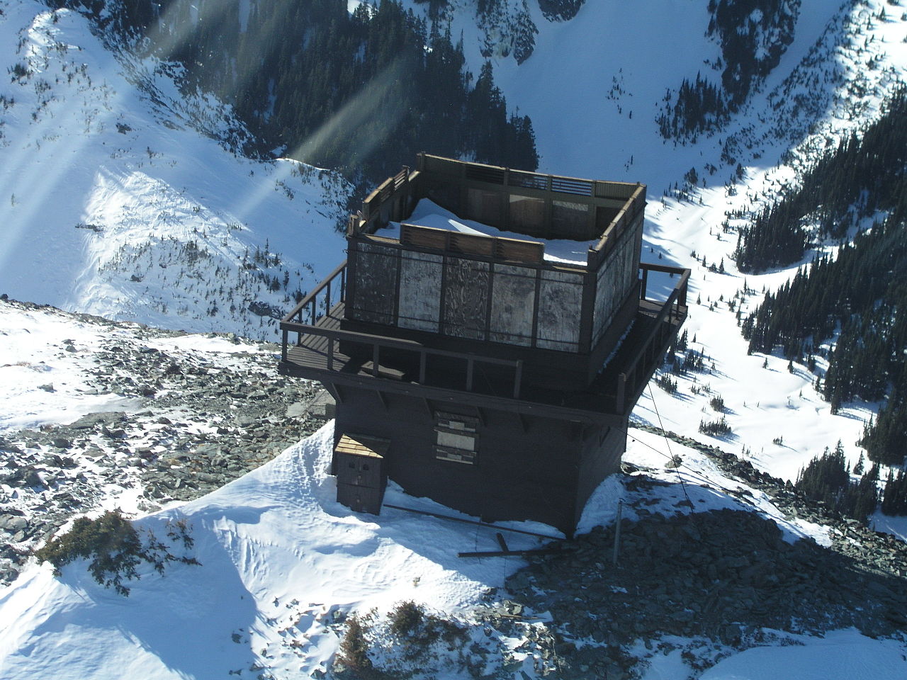
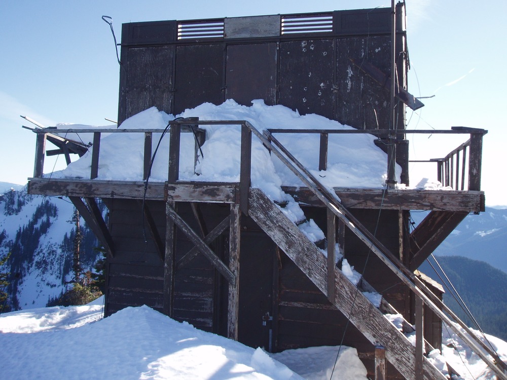
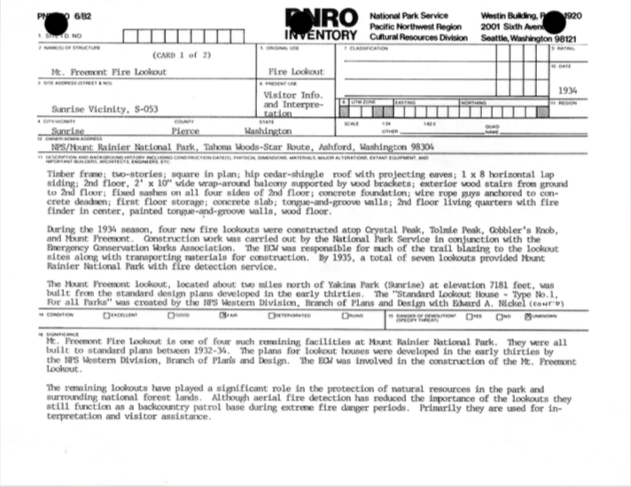
Lookout Type: 14’x14′ National Park Service style cab
Site Established: 1934
Current Structure Built: 1934
Date Visited: 7/22/17
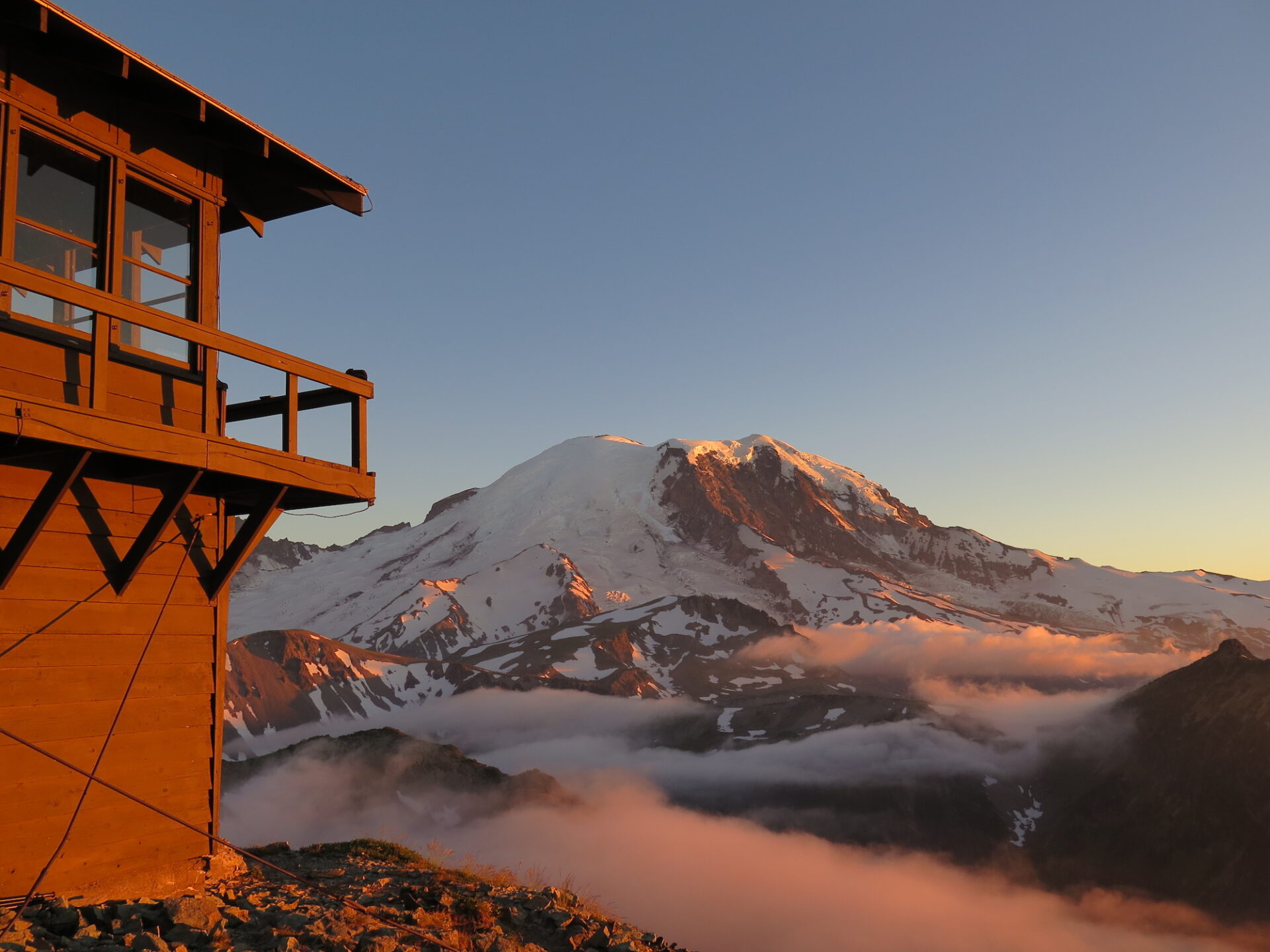
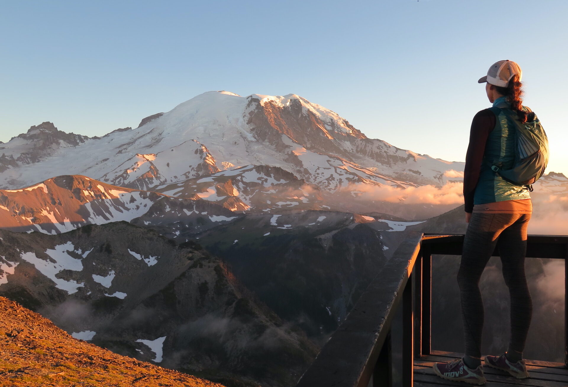
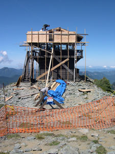
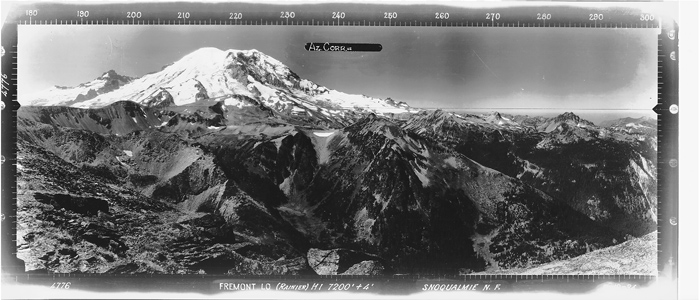
At 7,181′, the Mount Fremont Lookout is the highest of four fire lookouts inside Mount Rainier National Park and boasts incredible views of Mount Rainier’s Willis Wall and Emmons Glacier. Its relatively easy approach from Sunrise makes it a destination for just about anyone.
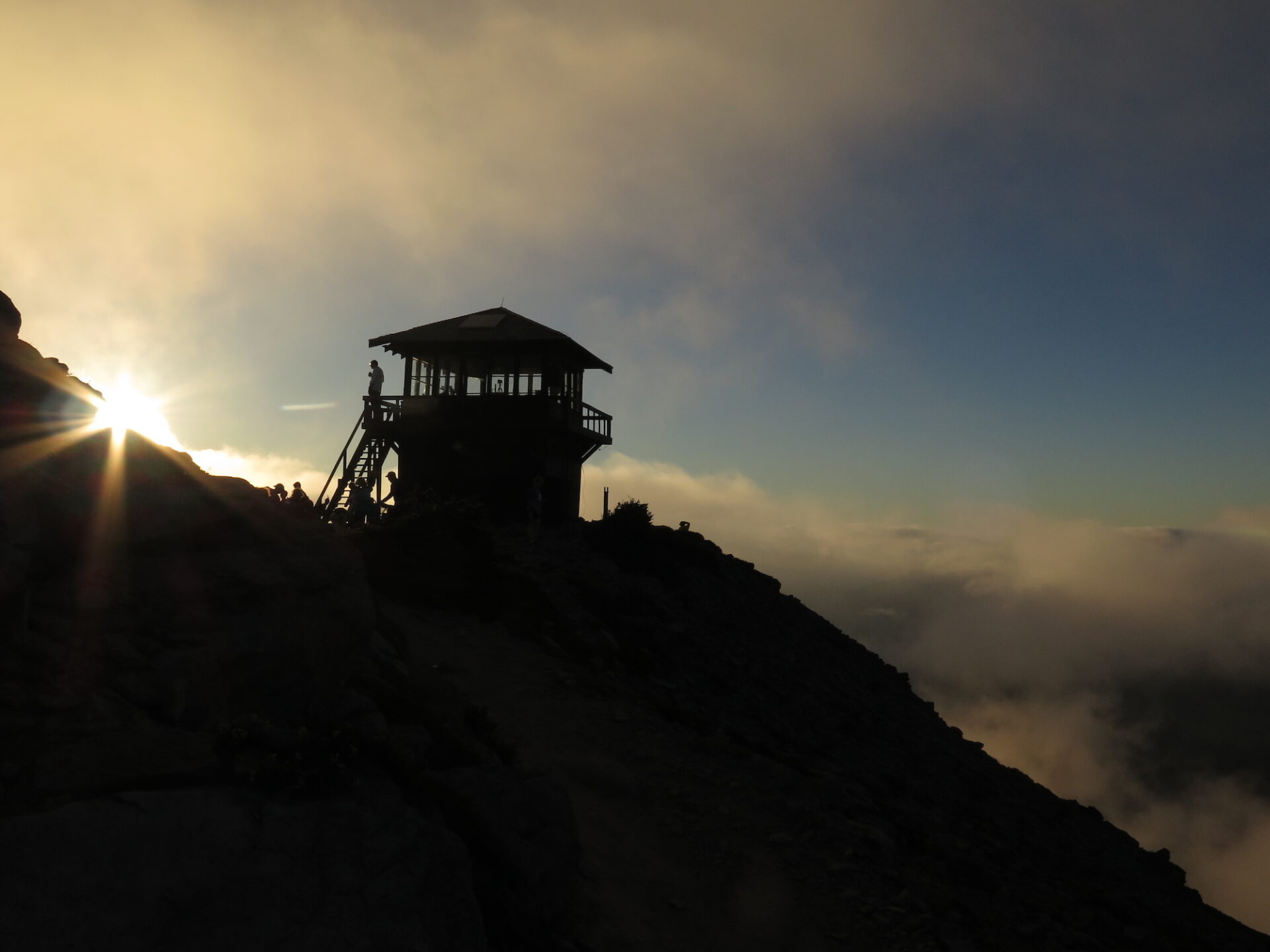
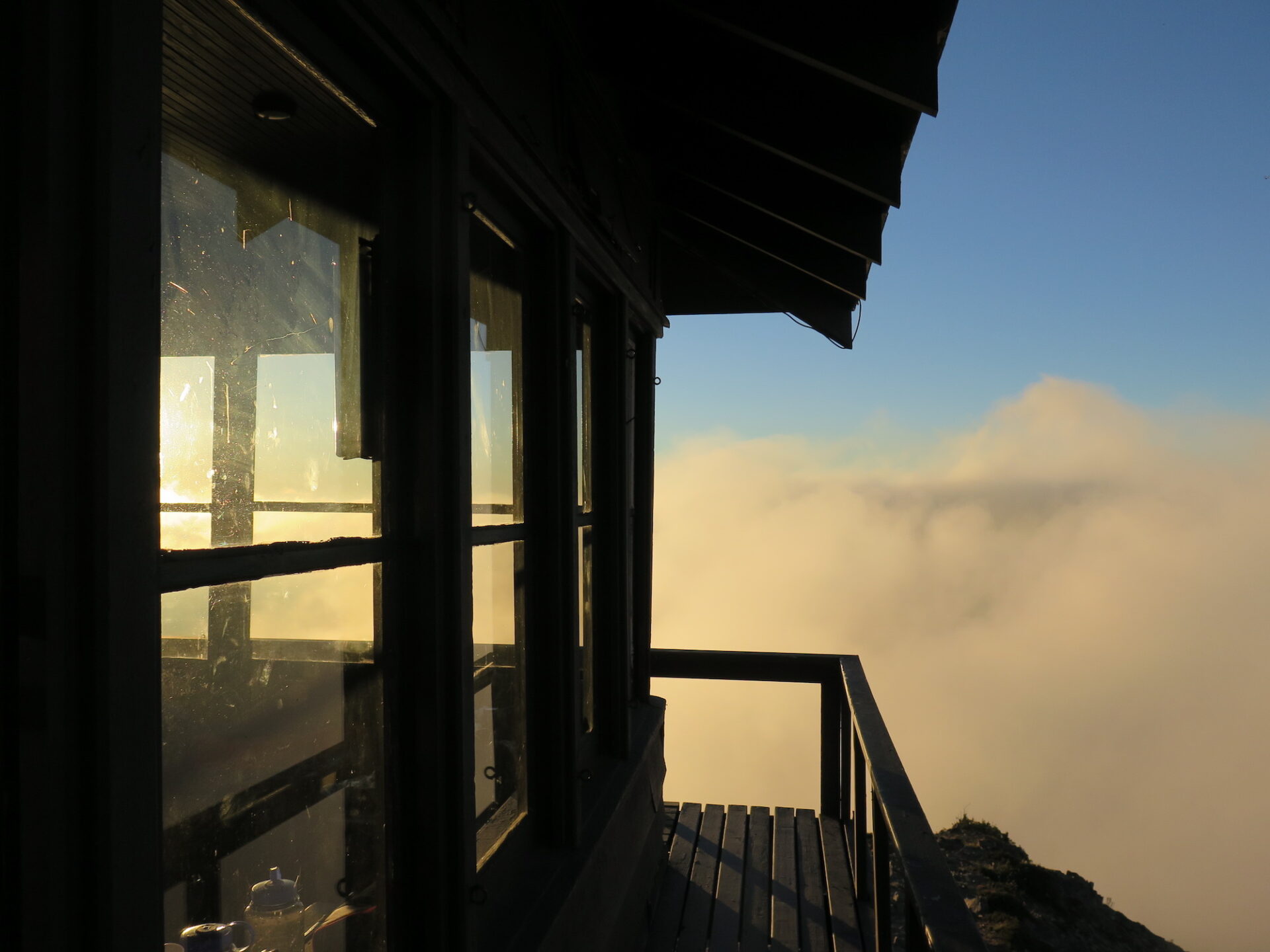
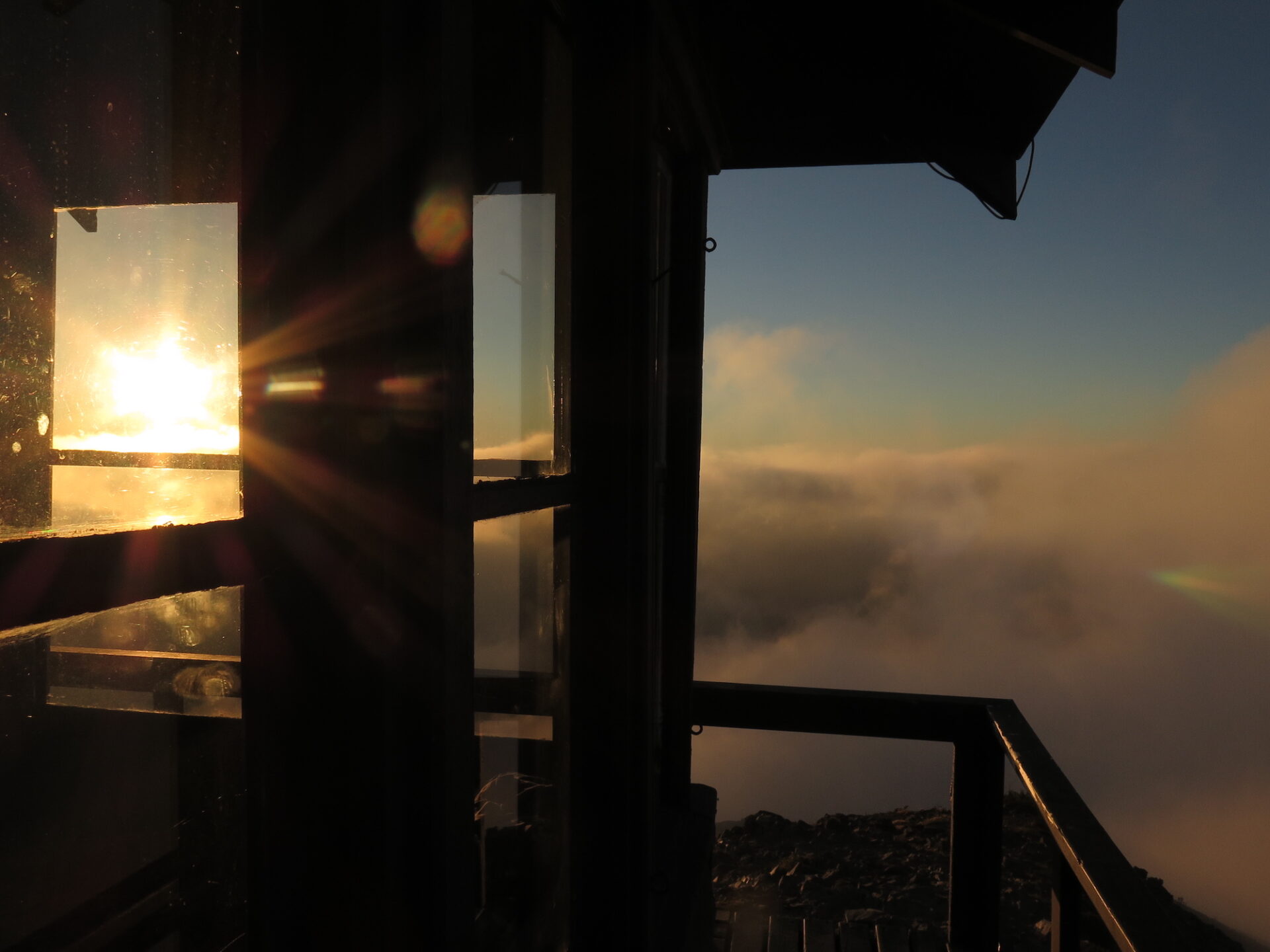

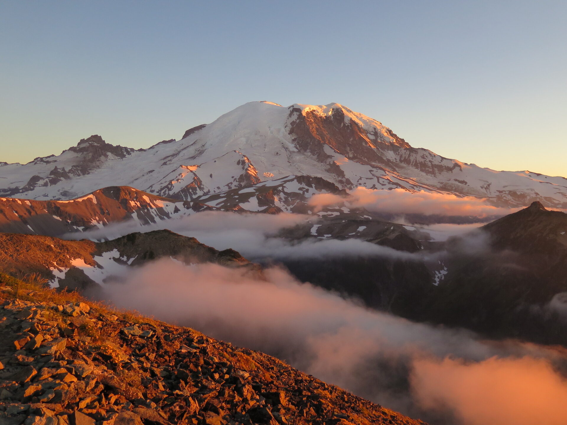
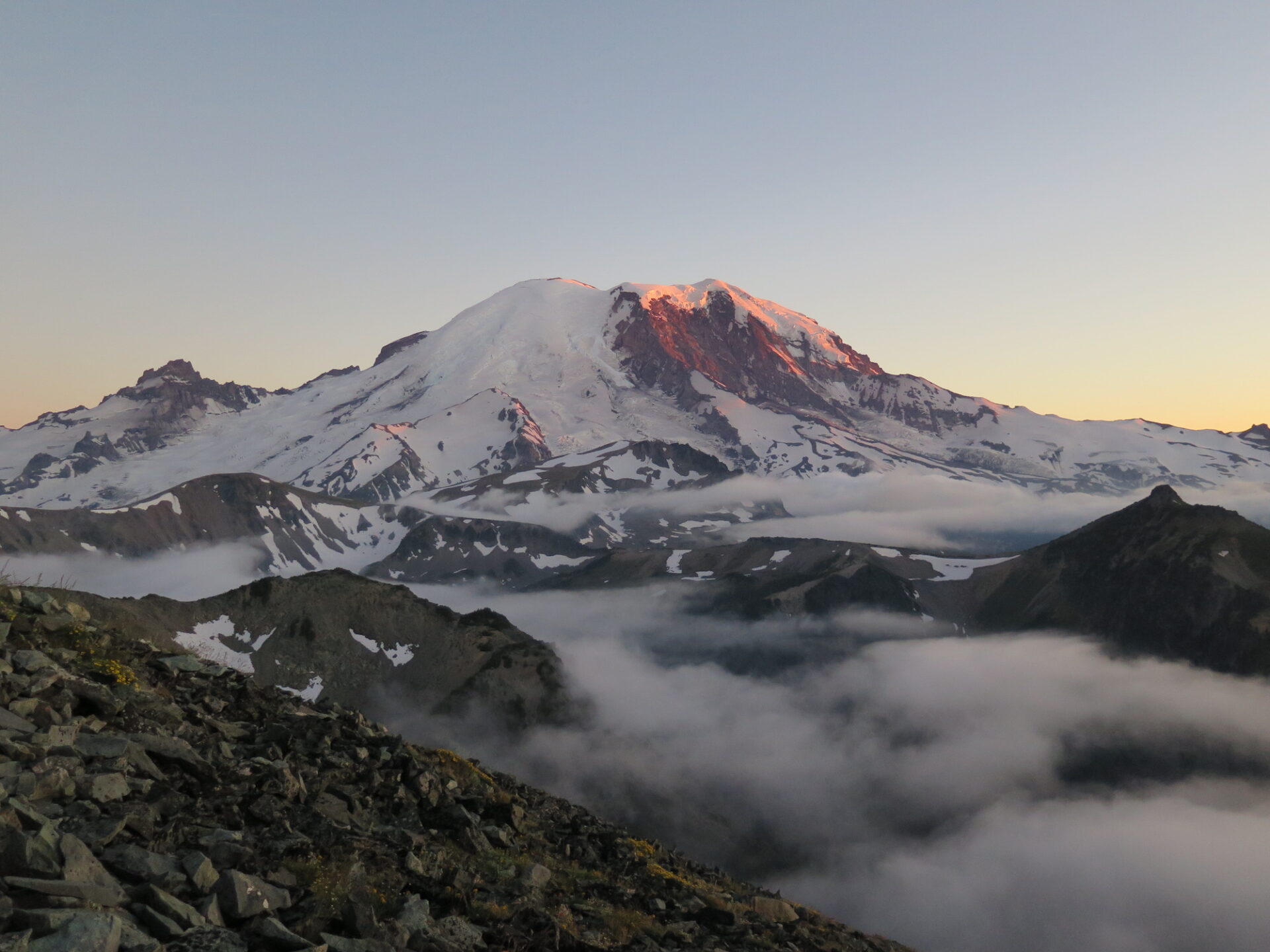
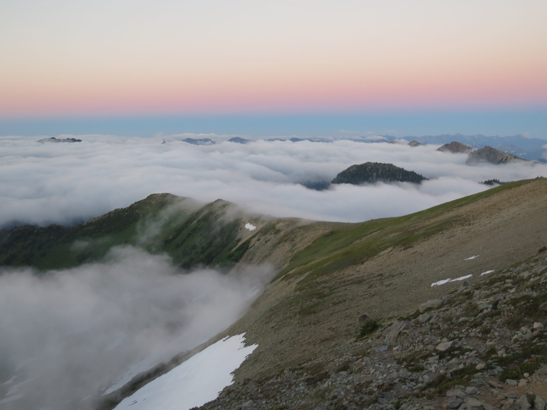
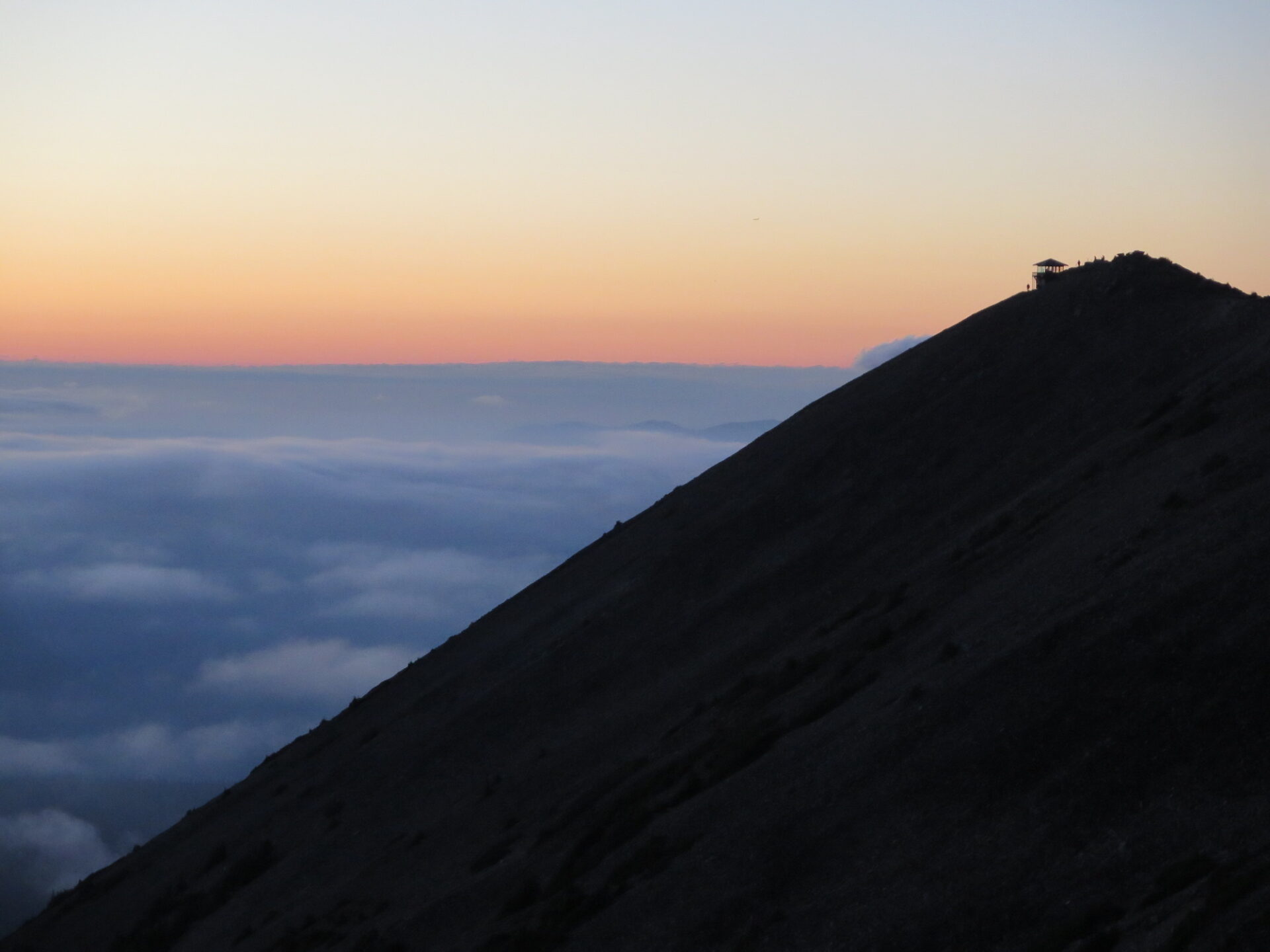
Photos from a 2017 visit where I was treated to the most spectacular sunset cloud display I’ve ever seen in my 20+ years in Washington!
History.
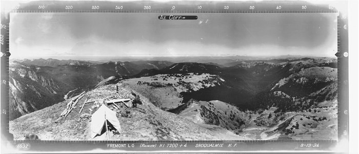
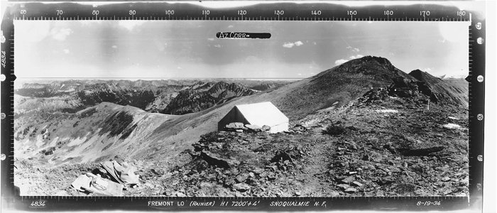
At 7,181′, the Mount Fremont lookout is the highest of Mount Rainier National Park’s 4 remaining lookouts. Built in 1934 with assistance from the Emergency Conservation Works Association (ECW), it follows the standard design of the National Park Service Branch of Plans and Designs. The ECW was responsible for much of the trail blazing to the lookout sites as well as transporting building materials.
The Fremont lookout has had a rough history with storms. Shortly after its completion, the its hip roof was destroyed by a windstorm and immediately repaired. Again in 2006 it suffered damage from a windstorm and was repaired with park donations.
The route.
Distance (RT): 5.6 miles
Elevation Gain: 800′
Don’t let Fremont’s high elevation fool you. Since the hike starts at 6,400′ at Sunrise, you only need to climb about 800′ over 2.8 miles to reach the lookout. It’s an easy hike that can be done by the entire family.
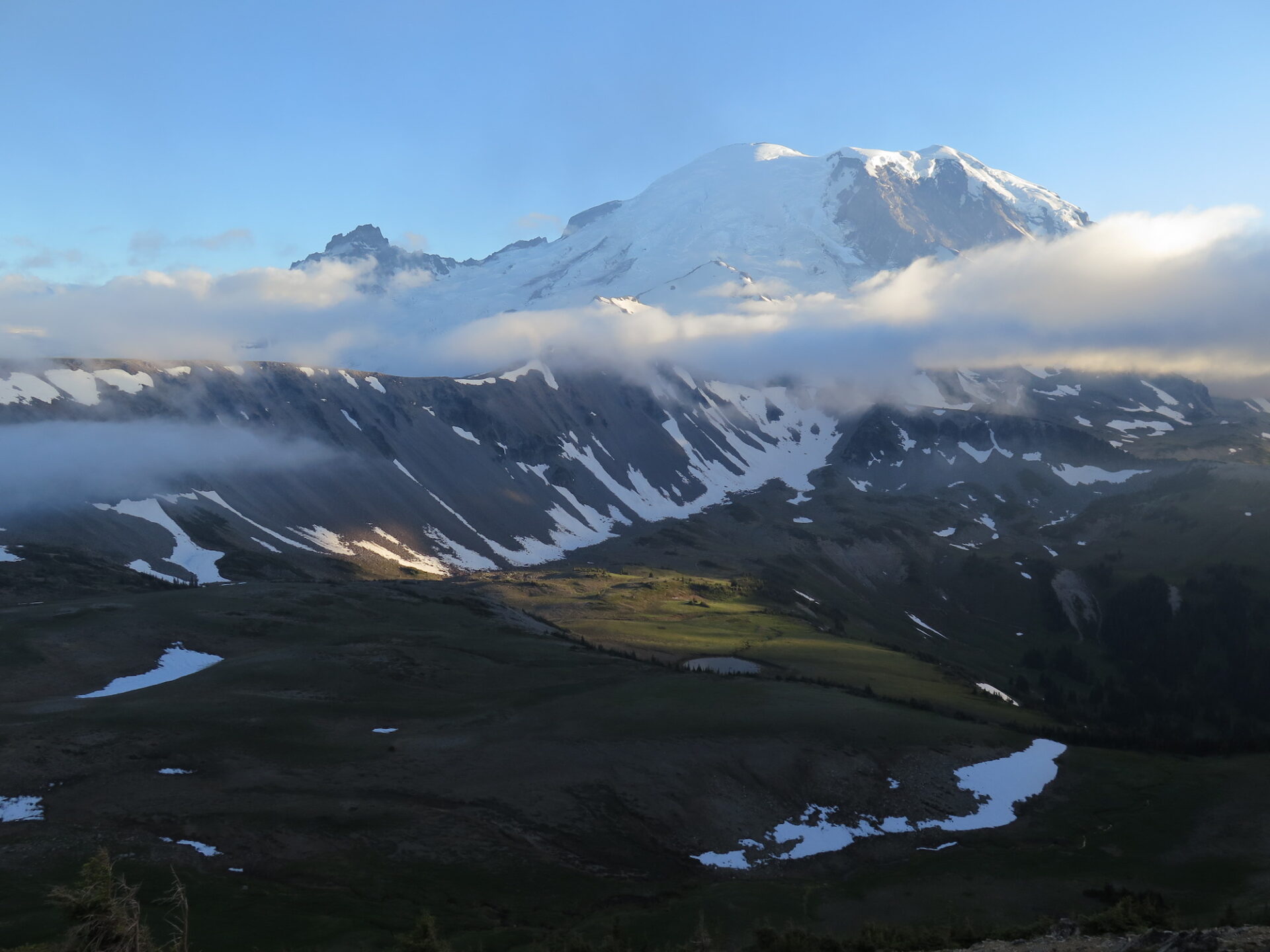
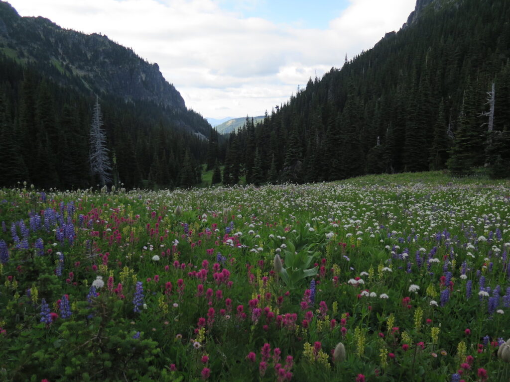
From the Sunrise parking area, head west on the Sourdough Ridge Trail to Frozen Lake and enjoy vast views of Rainier and three Burroughs. At a large junction, you can turn right and head uphill to the Fremont lookout or, if it’s wildflower season, consider detouring straight ahead to visit Berkeley Park while you’re at it. The flowers are incredible! If you do head to Berkeley Park, the trail will turn downward, so you’ll have to hike back up, but it’s well worth the extra effort!
Past the Frozen Lake junction, views of Rainier’s Willis Wall and Emmons Glacier are immense. The hike is exposed most of the way and although recent trail work in 2017 added steps to aid with erosion, it can be a little rocky in places. As you continue on, you’ll soon see the lookout at the very end of the ridge.
This is a popular hike and a short effort from Sunrise, so don’t expect too much solitude here, but there’s plenty of room on the summit to spread out. Check out Seattle’s skyline and the Olympics to the northeast and try to spot the Space Needle with binoculars.
Definitely consider hiking up early for the sunrise or staying late for the sunset to avoid the crowds. When I made my visit in July 2017 for sunset, everyone was on their way down and I had no trouble with traffic or parking. I was also treated to one of the most incredible sunset cloud displays I’ve ever seen in my 20 years here in the PNW.
The lookout is occasionally staffed by volunteers and when I visited it was open and the friendly hosts invited me in.
Fremont has an incredibly large reward for such a small effort. Don’t miss it!
*Note: I first continued past Mount Fremont to Berkeley Park to enjoy the wildflower display, so this GPS track is not direct to Mount Fremont.
Directions.
From the White River entrance of Mount Rainier National Park off Highway 410, drive to the Sunrise Visitor Center. The trail begins on the north side of the parking area.