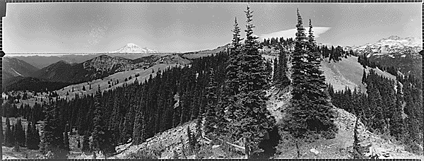
Back in July 2017 I set out to trail run/hike a 16 mile loop in the beautiful Goat Rocks Wilderness to visit two former fire lookout locations and bask in the high alpine flower show. I’m a huge fan of loop routes and this one still remains one of my favorites!
The Goat Rocks Wilderness, located between Klickitat (aka Mount Adams) and Tahoma (aka Mount Rainier) spans 108,096 acres across both the Okanagan–Wenatchee National Forest and Gifford Pinchot National Forest in southwestern Washington State. It’s a long drive from most anywhere but absolutely worth the effort.
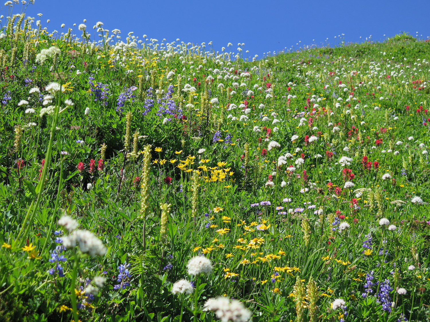
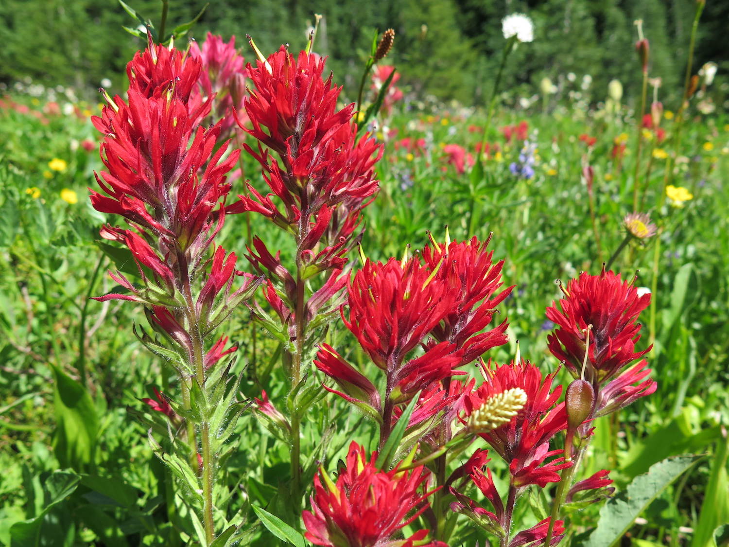
During the peak flower season in July/August, the area can be quite busy and is considered the most popular area in the Goat Rocks Wilderness. That being said, I did this route on a Sunday and the trail seemed far from crowded. Of course that was also four years ago and a lot has changed since then.
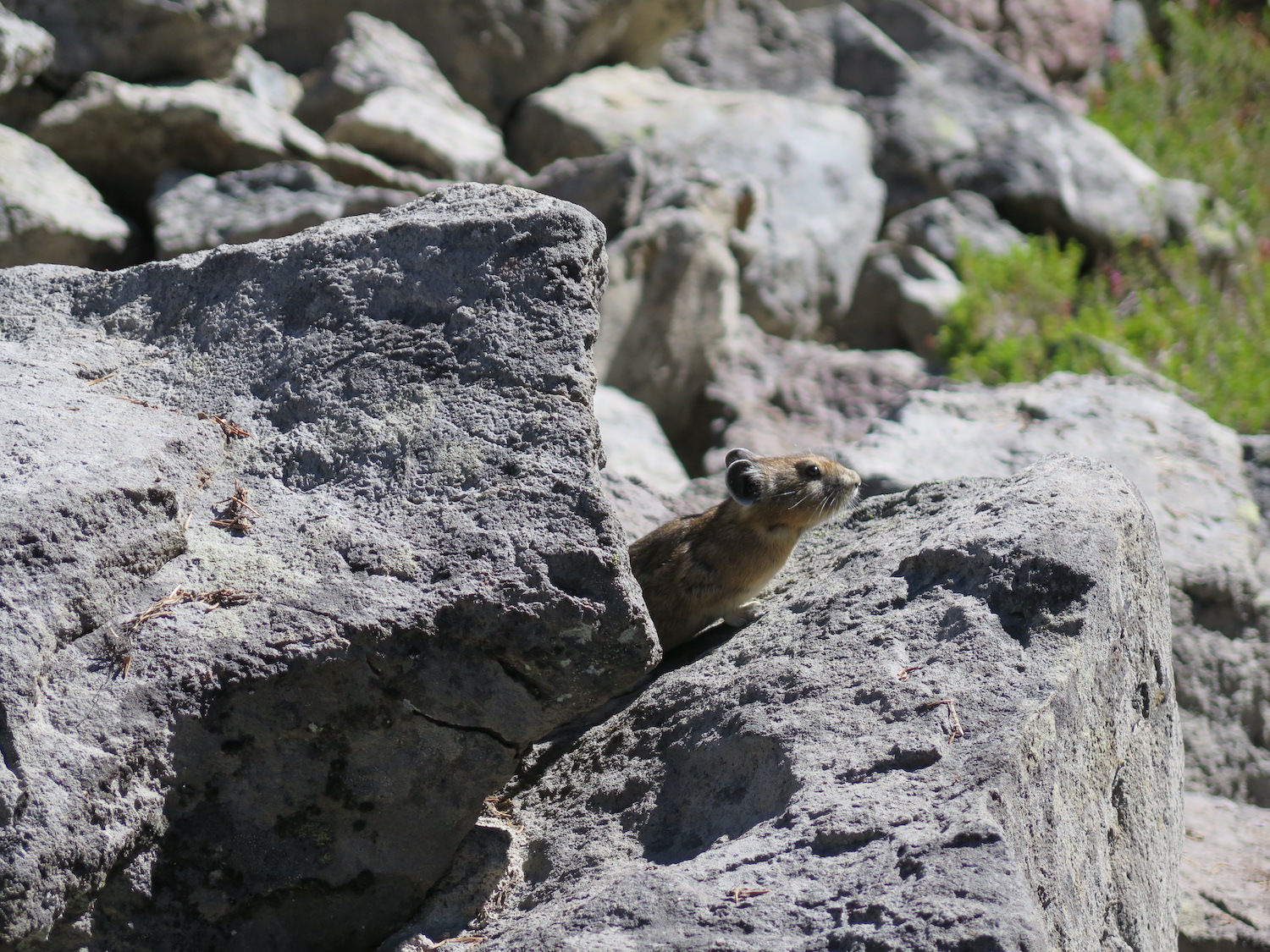
Please remember that high alpine areas such as Goat Rocks are extremely fragile. Please stay on the trail and practice impeccable leave no trace principles.
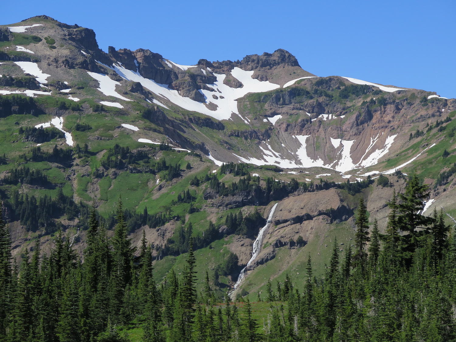
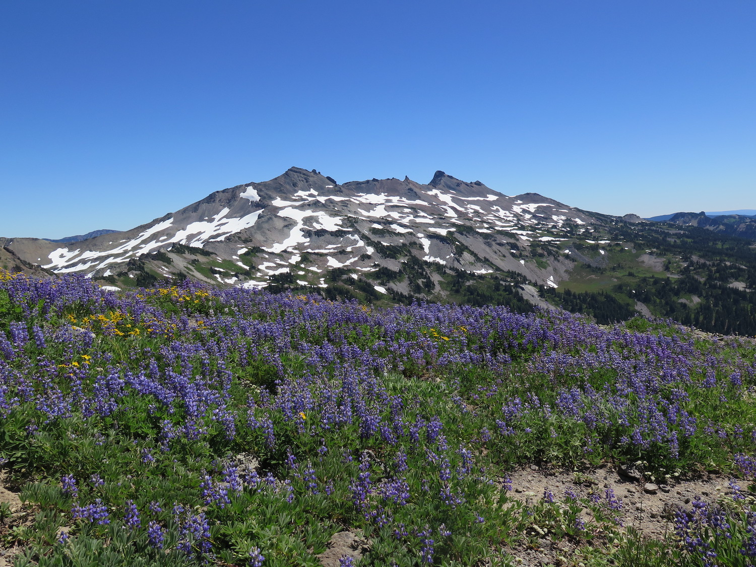
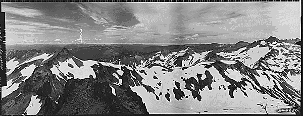
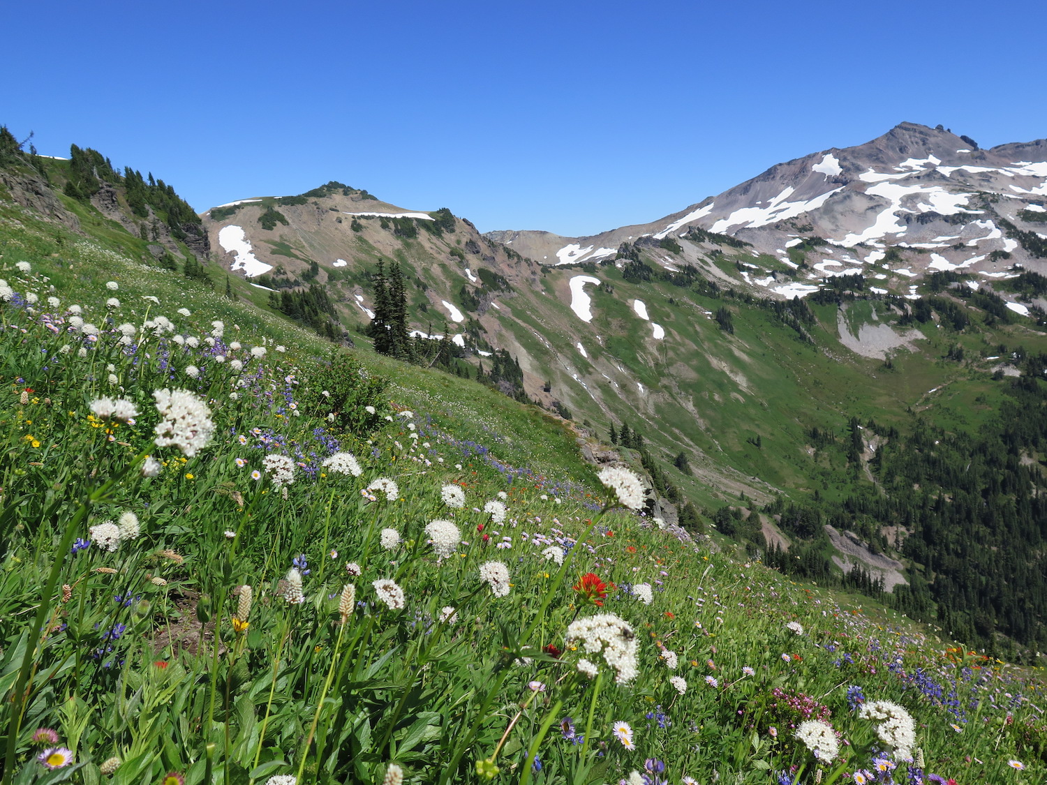
Goat Ridge lookout site.
I started my loop clockwise from the popular Berry Patch trailhead for Snowgrass Flats near Chambers Lake. Berry Patch was once home to a guard station built in 1916 that eventually became a Ranger Station until approximately 1930.
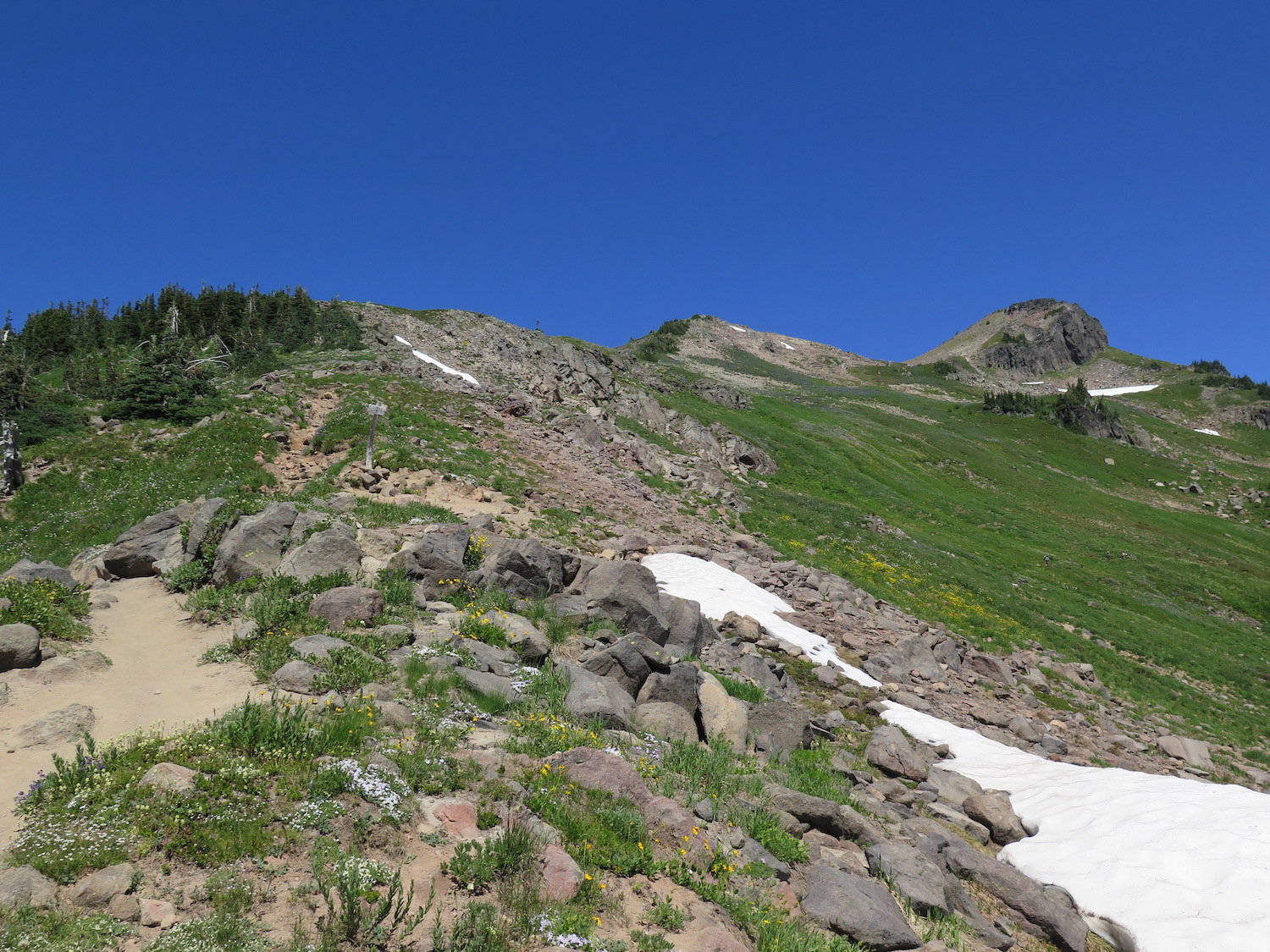
The first 2.5 miles of trail climb fairly steadily through forest from about 4,500′ in elevation to the location of a former lookout site atop Goat Ridge at 6,000′. The Goat Ridge Lookout Trail #95A is a loop off the main Goat Ridge Trail #95 and makes a circuit around Goat Ridge before descending north and reconnecting with the main trail.
The old lookout site has some scattered artifacts and a fantastic view of Adams. There is also a well defined trail that continues northwest of the lookout site to a big strategic view point of the surrounding valley. It’s possible it may have been a past patrol point.
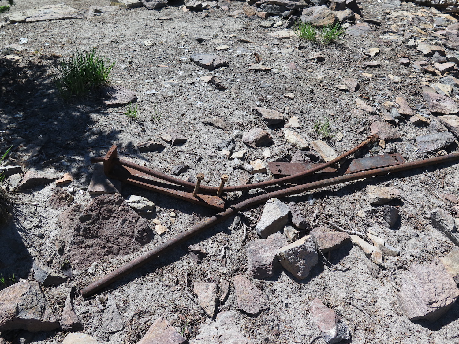
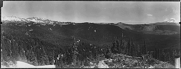
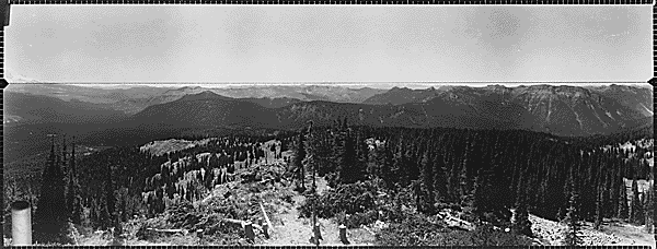
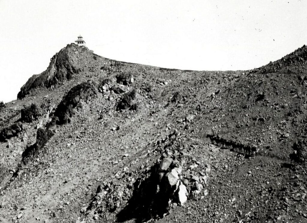
The original lookout at Goat Ridge was an L-4 cab built in 1933. The lookout was used for 30 years before it was decommissioned and removed sometime after 1963. It’s one of the few lookout sites left where the old 1934 panoramas of the surrounding forest actually look similar to today.
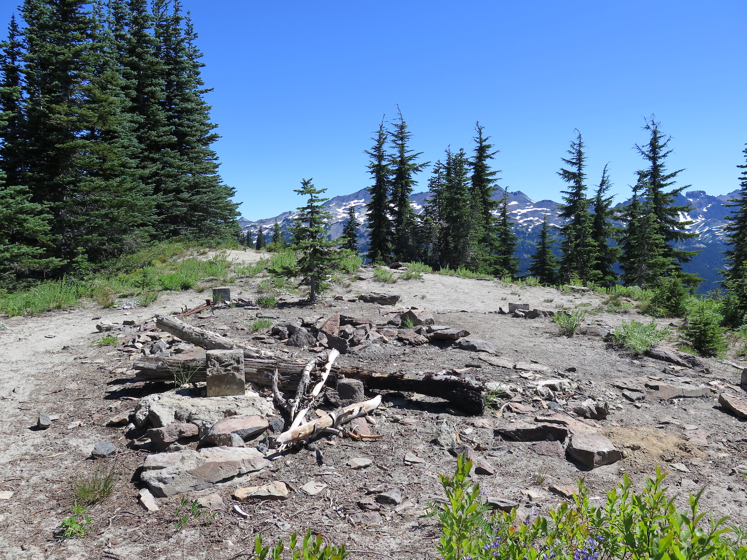
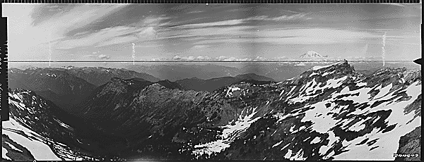
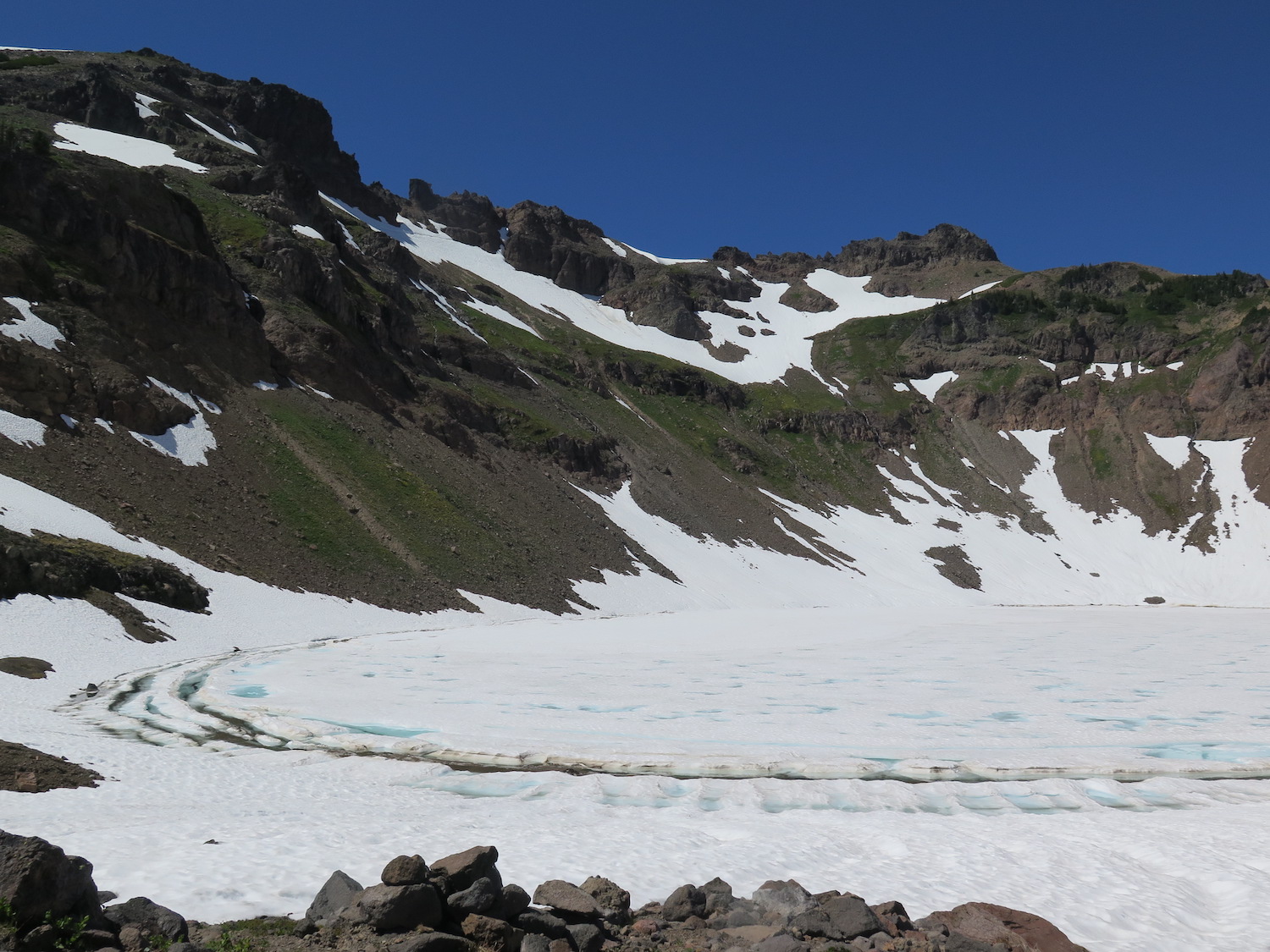
Hawkeye lookout site.
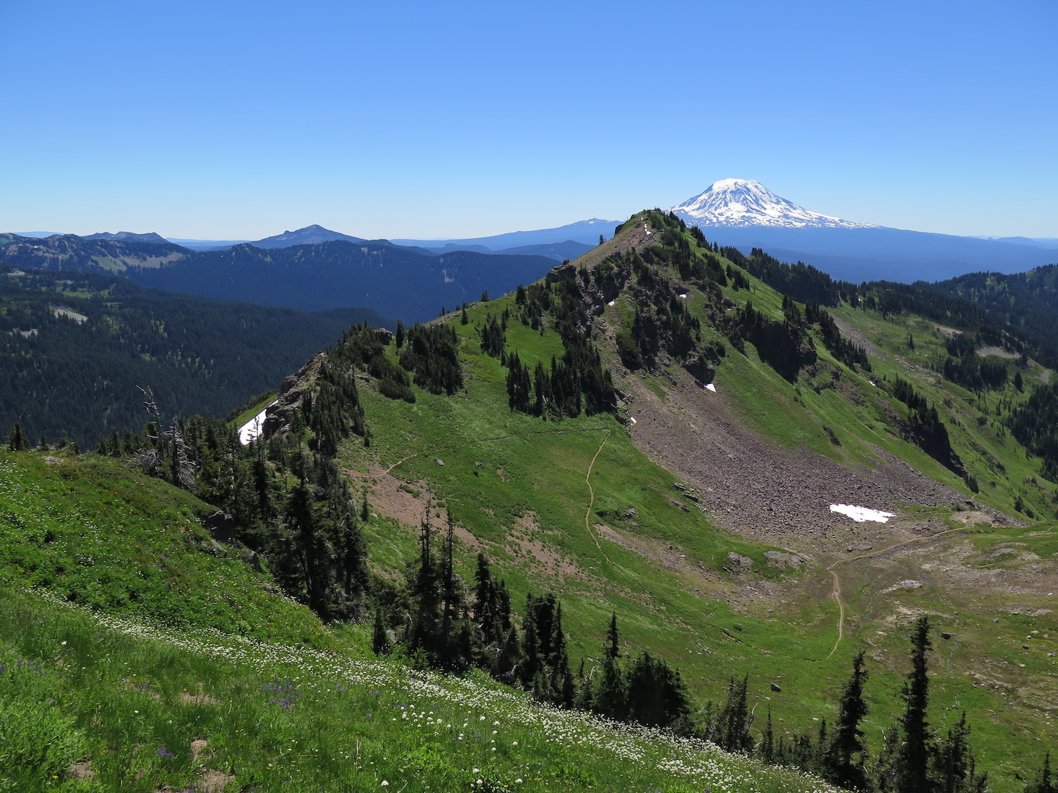
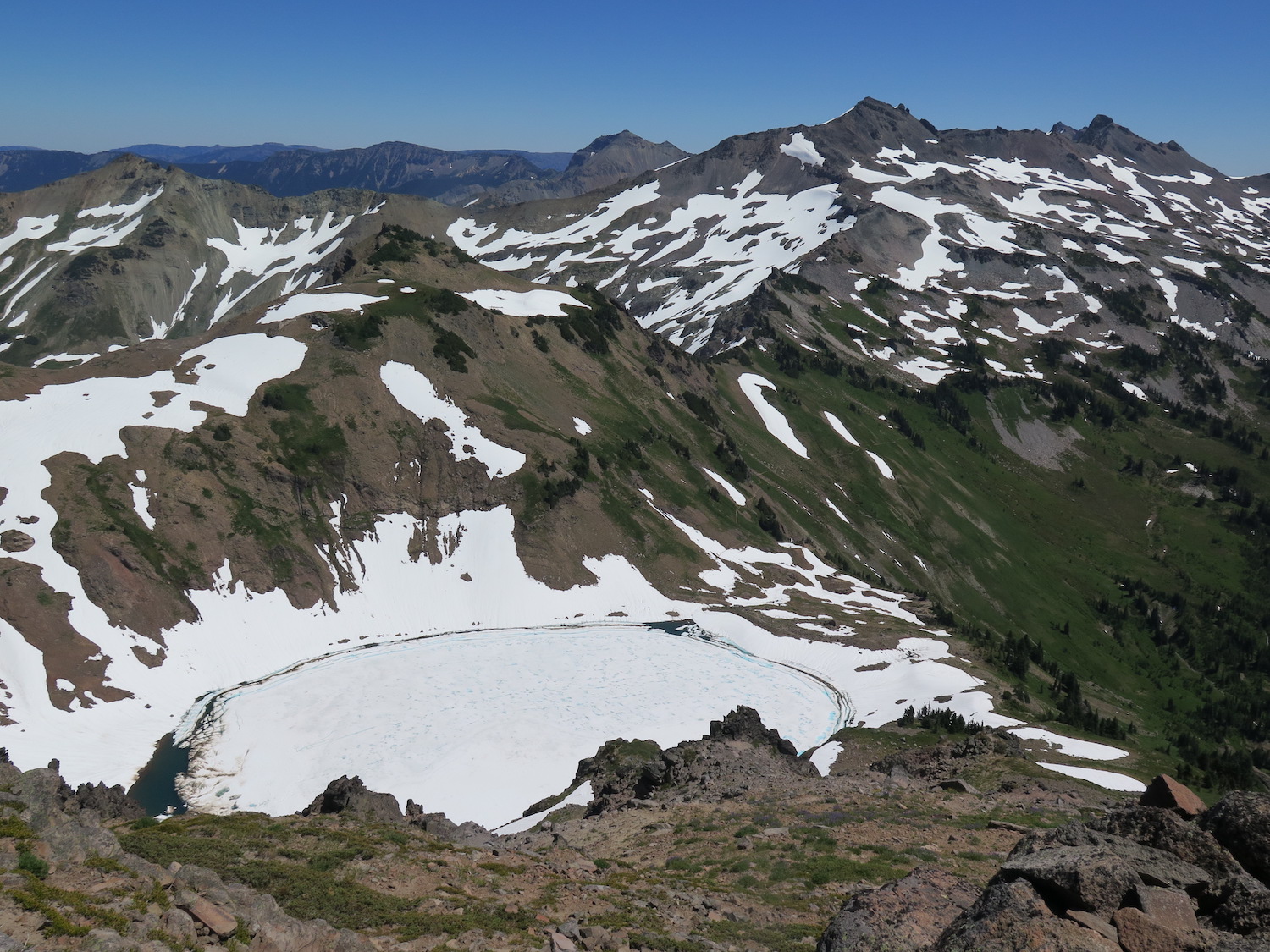
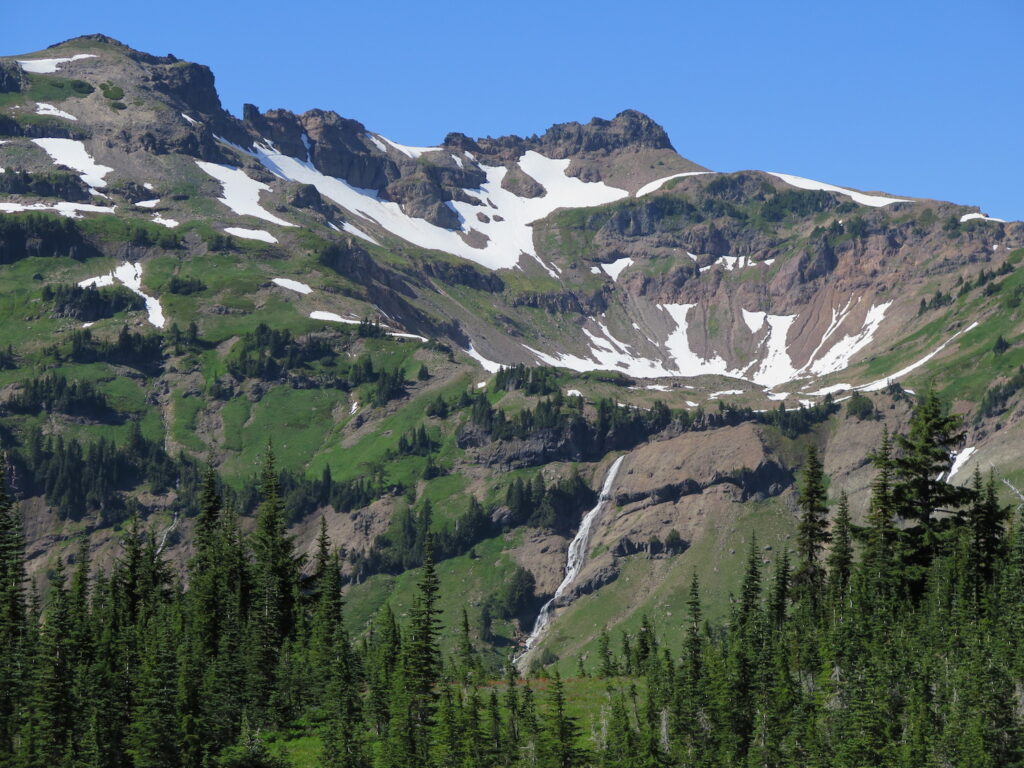
From Goat Ridge, the trail continues a gradual climb along the west side of Goat Ridge high above Jordan Basin, full of big waterfalls and even bigger terrain. At the 6 mile mark the trail climbs the west shoulder of the beautiful Goat Lake cirque and reaches a junction with the Lily Basin trail. Just to the north past the junction, a steep boot path heads up the ridge to Hawkeye, climbing roughly 800′ over 0.75 miles to the lookout site.

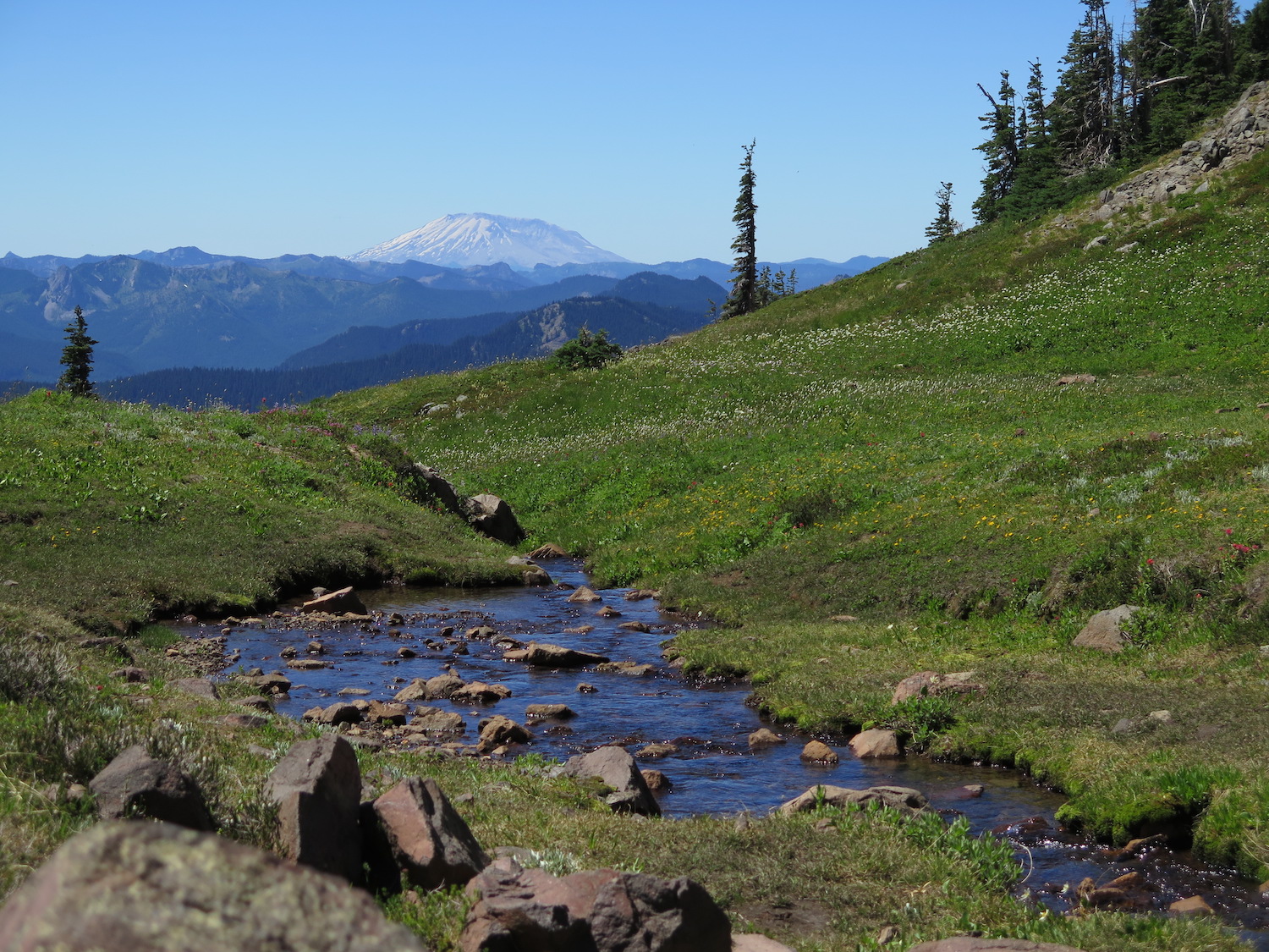
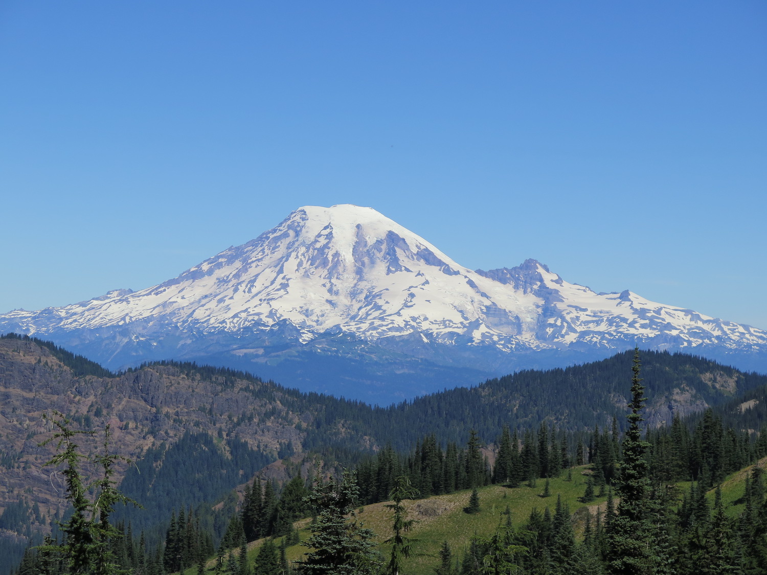
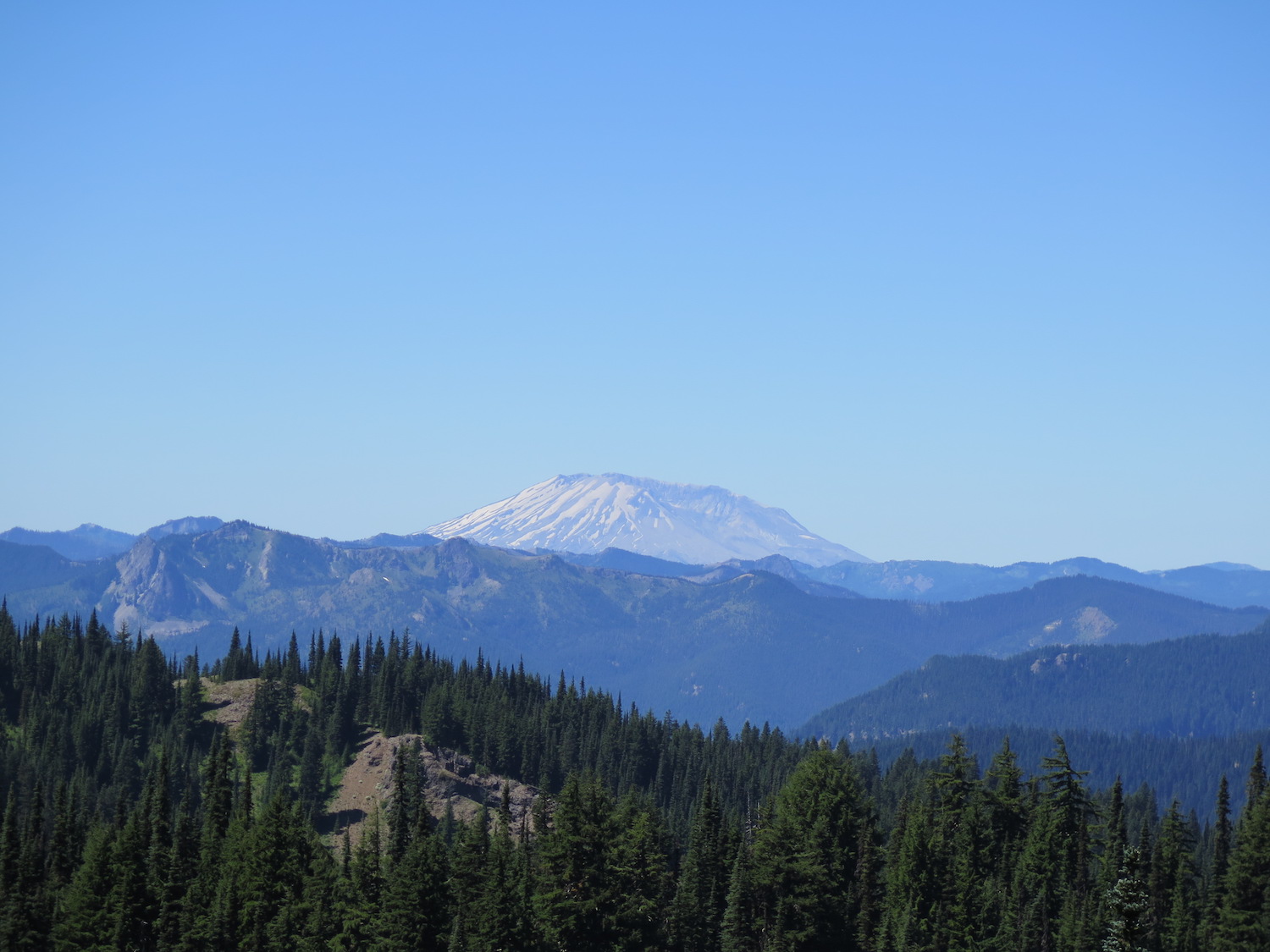
At 7,431′, Hawkeye Point is the 2nd highest peak along Goat Ridge and 6th highest in the Goat Rocks wilderness area. The views include the sparking turquoise waters of Goat Lake far below and the towering profiles of Old Snowy (7,930′) and Ives Peak (7,920′) to the east-southeast along the PCT. The broad summit allows for a nice picnic spot.
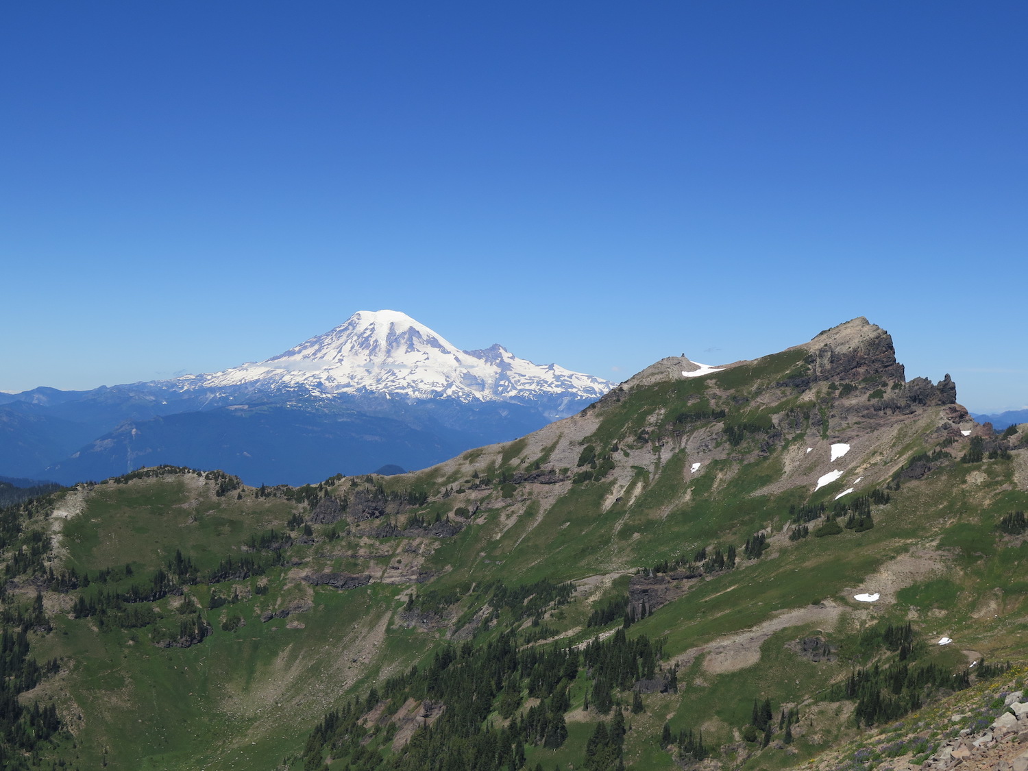
A cupola lookout was constructed at Hawkeye Point in 1927, the first lookout built in the Packwood District. Reportedly, heavy fog forced the decommissioning of the site and the lookout at Goat Ridge was built to replace it. The Hawkeye lookout survived for many decades but was eventually destroyed sometime in the mid-60s.
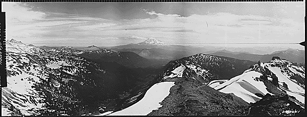
Completing the loop.
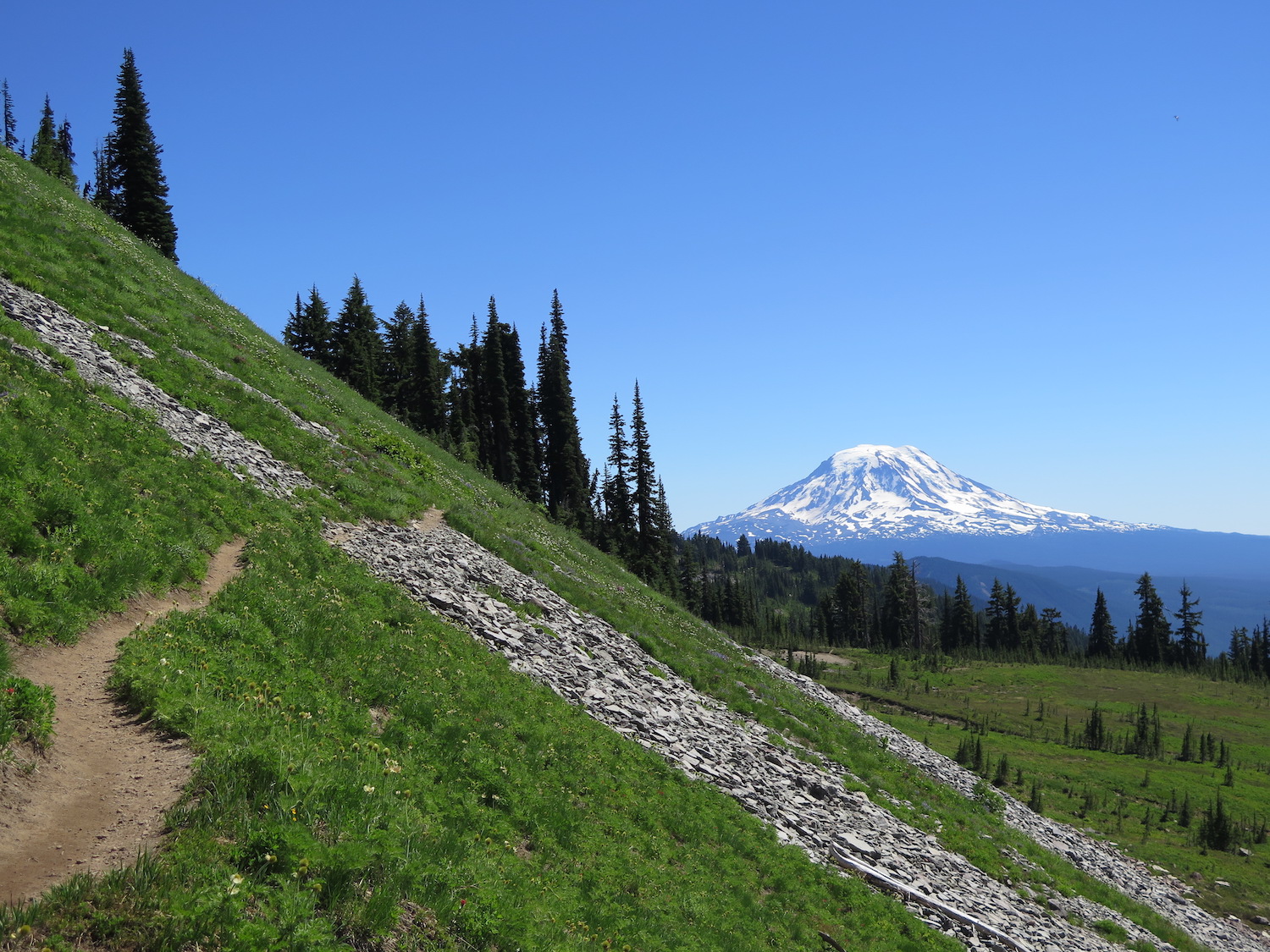
From Hawkeye, it’s nearly the same mileage to go back the same way as it is to complete the loop around through Snowgrass Flats. In my mind, there’s no question that the loop is worth it. In fact, it’s also possible to take a side trip over to the PCT to Old Snowy. Unfortunately I didn’t make it work on this trip so I’m definitely due for a return.
From Goat Lake, Snowgrass Flats is about 2.5 miles away and a fairly easy downhill run. The flower show continues all the way. Snowgrass Flats makes a great place to take a stop and enjoy the awesome views back to Hawkeye and the surrounding country before descending into the forest and completing the loop.
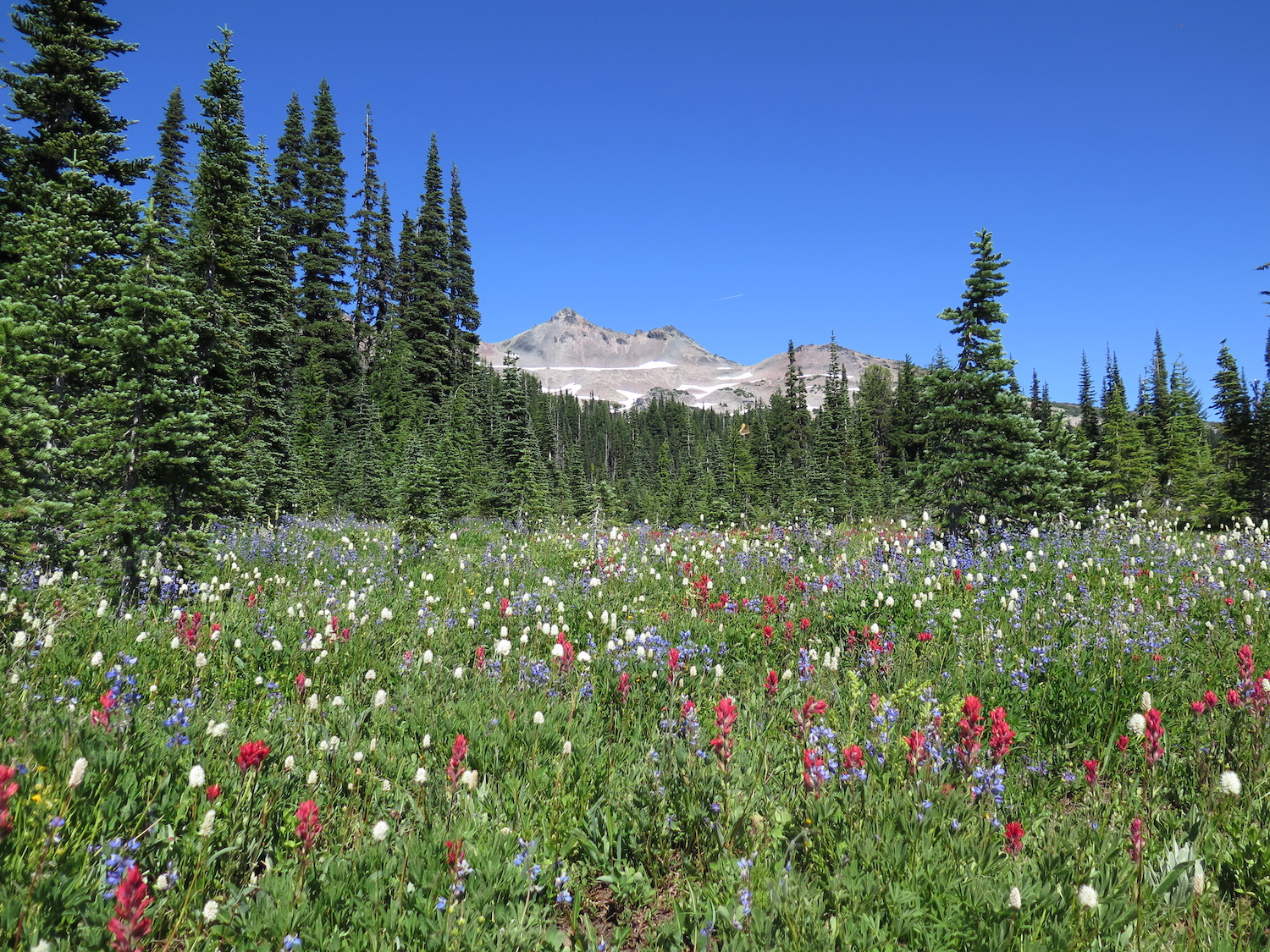
It’s nearly impossible to document in photos how big the Goat Rocks landscape truly is. Every photo I took doesn’t come close to doing it justice. There really isn’t much that gets better than this one! Loop? Check. Alpine wildflowers? Check. Lookout site locations? Check. Incredible awe-inspiring big landscape? Absolutely. The Goat Rocks wilderness must be seen in person to be truly appreciated, that’s for sure! Happy trails!
Did I mention earlier that if you visit this fragile alpine area to please, please stay on trail and practice leave no trace principles? Goat Rocks is a gem and deserves our utmost care and respect.
Date Completed: 7/30/17
Distance (RT): 15.8 miles
Elevation Gain: 3,973′
High Point: 7,431′
