
Southern Cascades | Mount Rainier Area
Mount Rainier National Park | Mount Rainier Wilderness
Location: 46.9575357,-121.883024
Summit Elevation: 5,920′
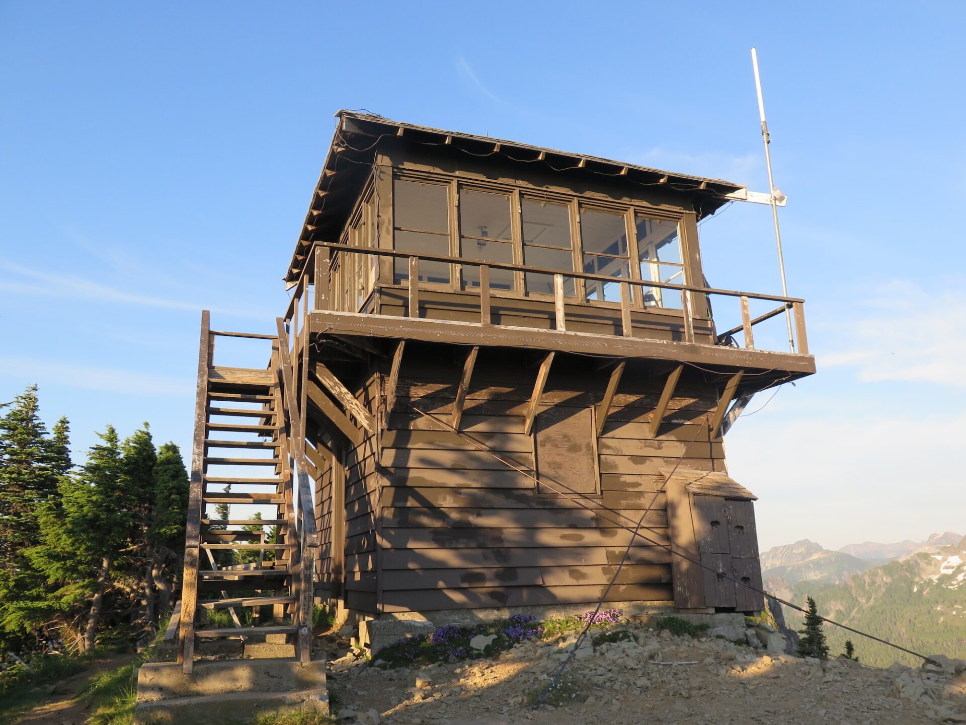
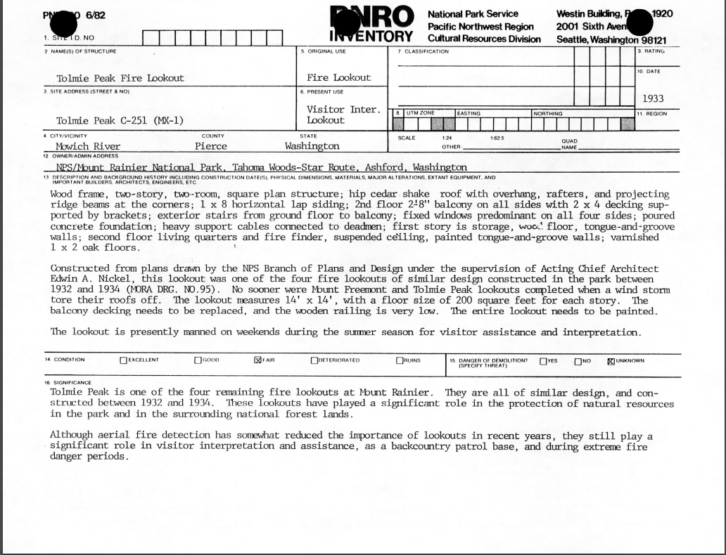
Lookout Type: 14’x14′ National Park Service style cab
Site Established: 1933
Current Structure Built: 1933
Date Visited: 07/16/18
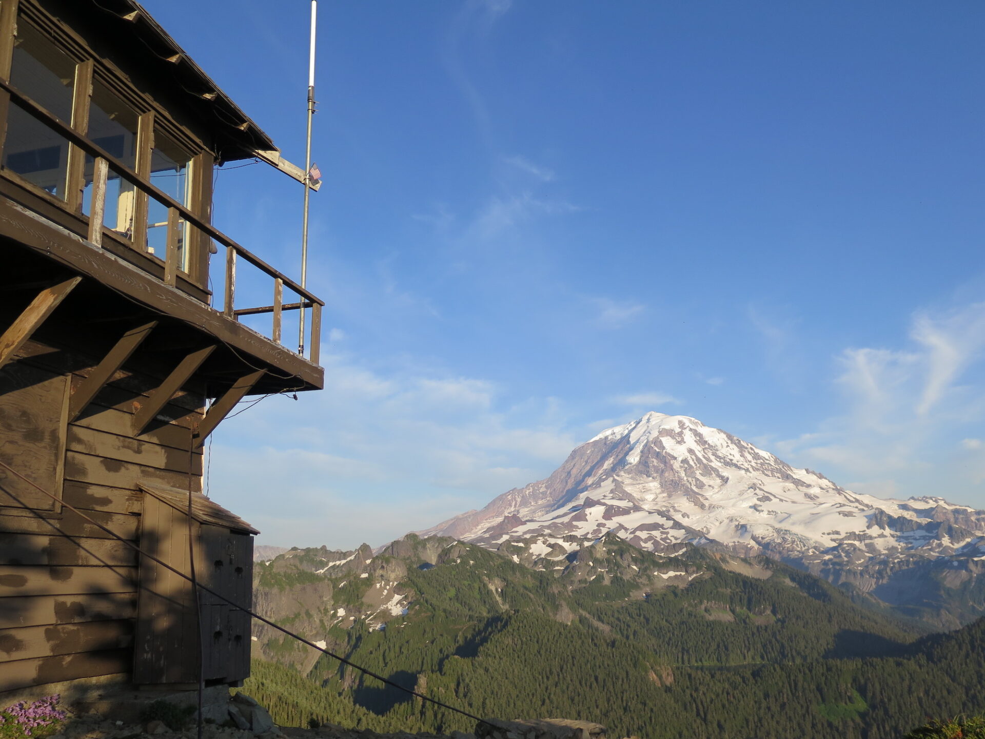
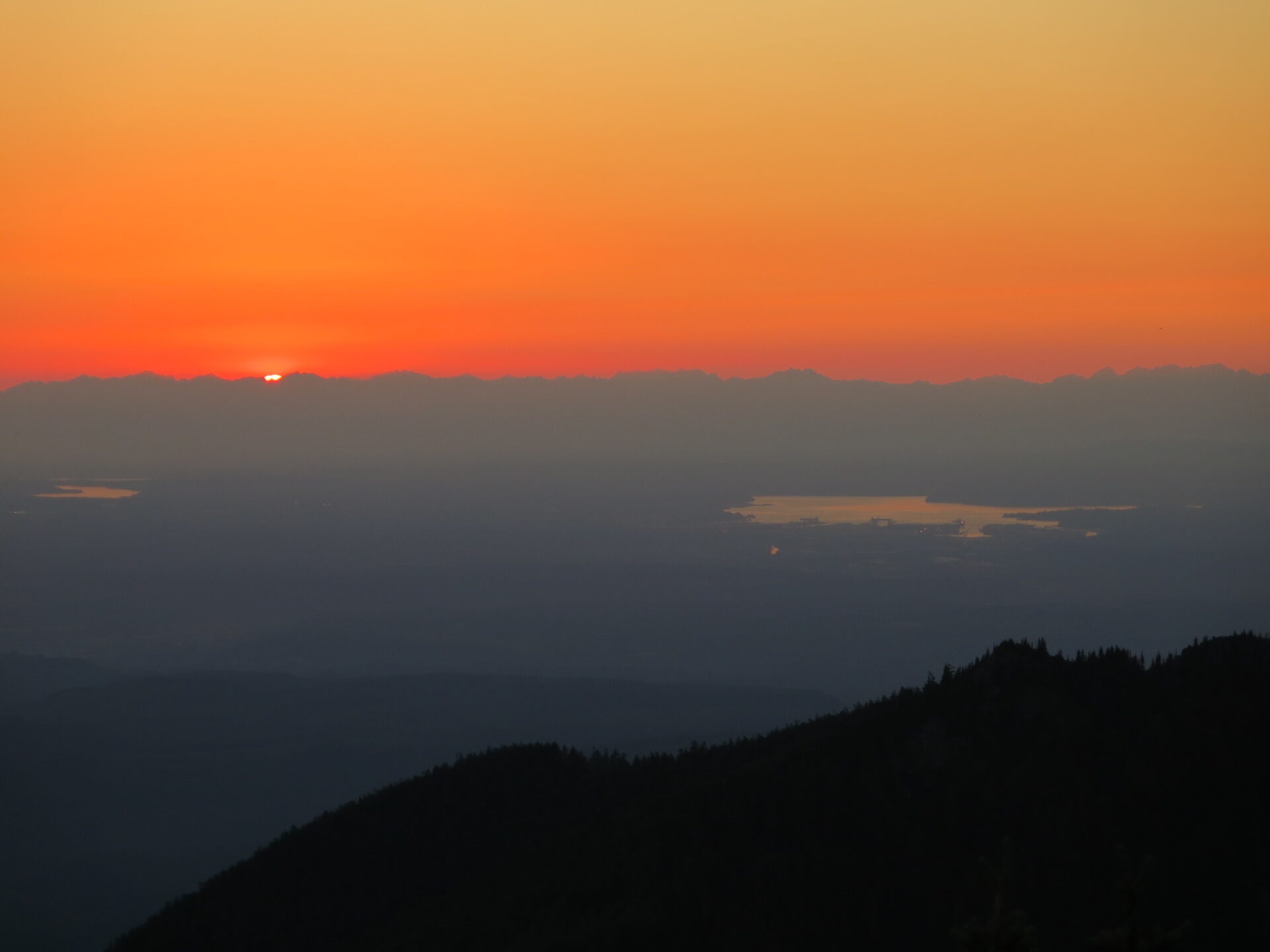
In the 1930s, seven fire lookouts stood inside the Mount Rainier National Park Boundary. Now only four remain in each corner of the park. Tolmie Peak inside Mount Rainier National Park is a wonderful family-friendly excursion and provides spectacular views of Rainier with sparkling Eunice Lake below. On a clear day, enjoy views of Mount St. Helens, the Olympics, Seattle skyline, as well as Baker and Glacier.
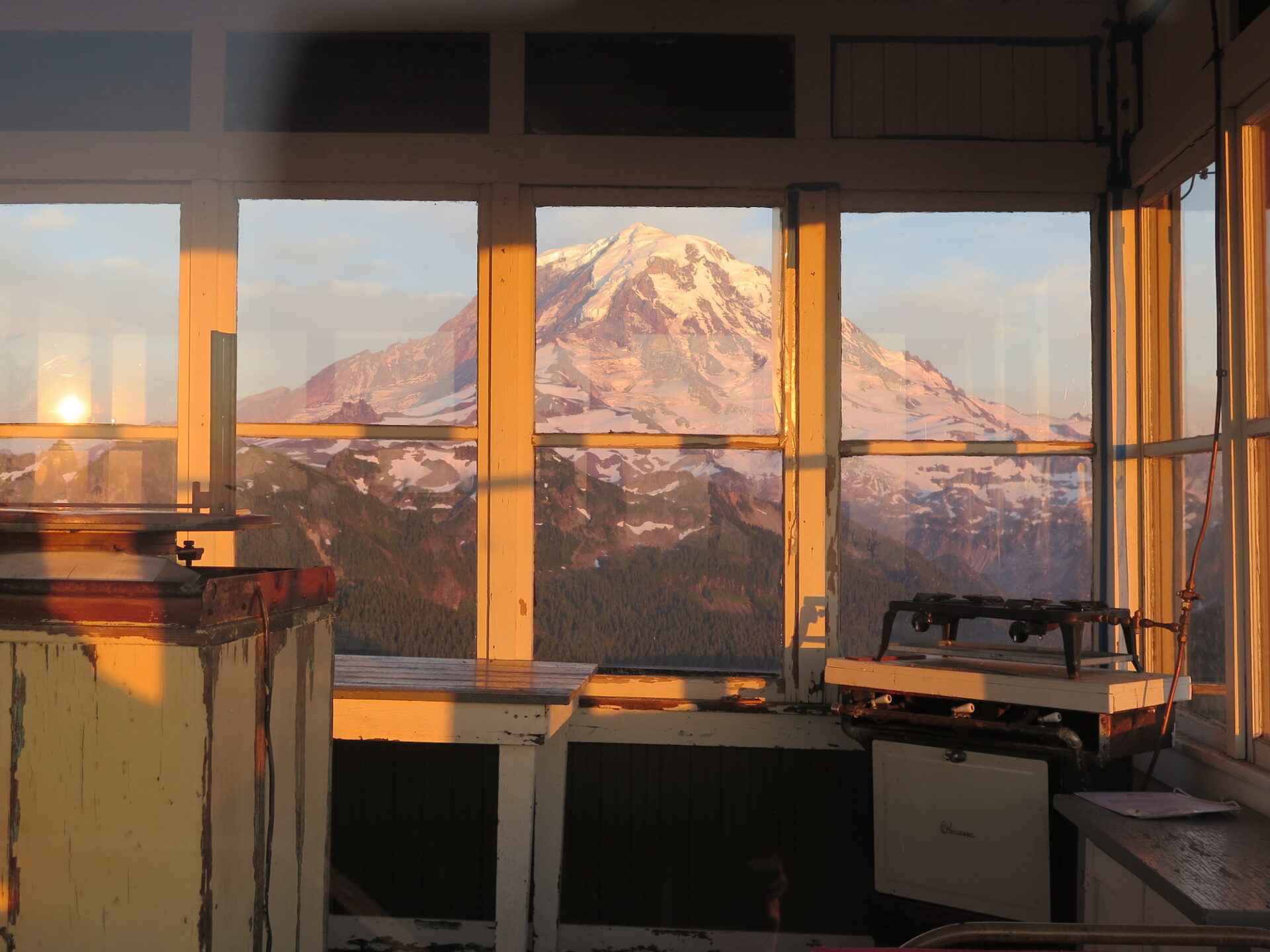
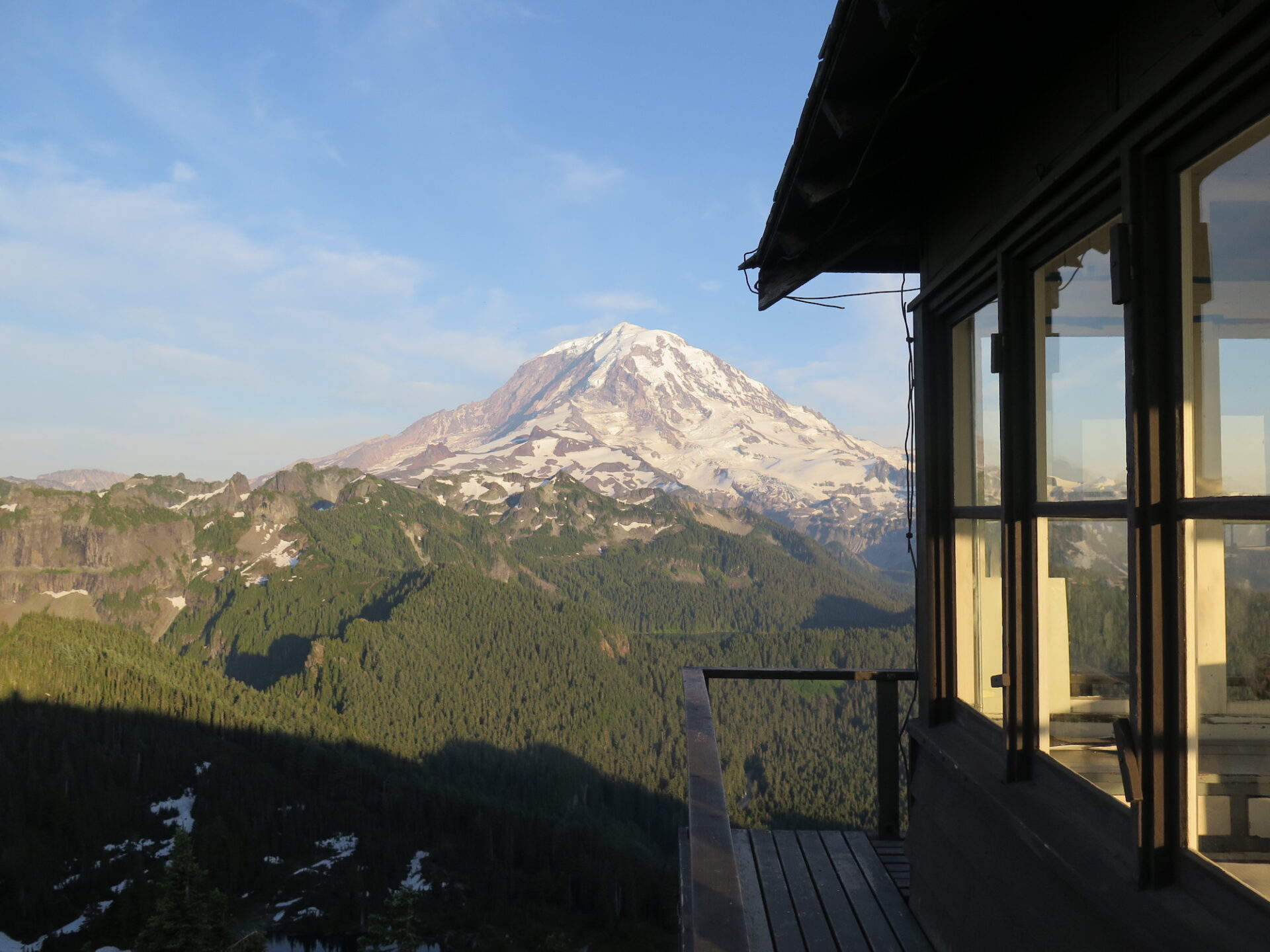
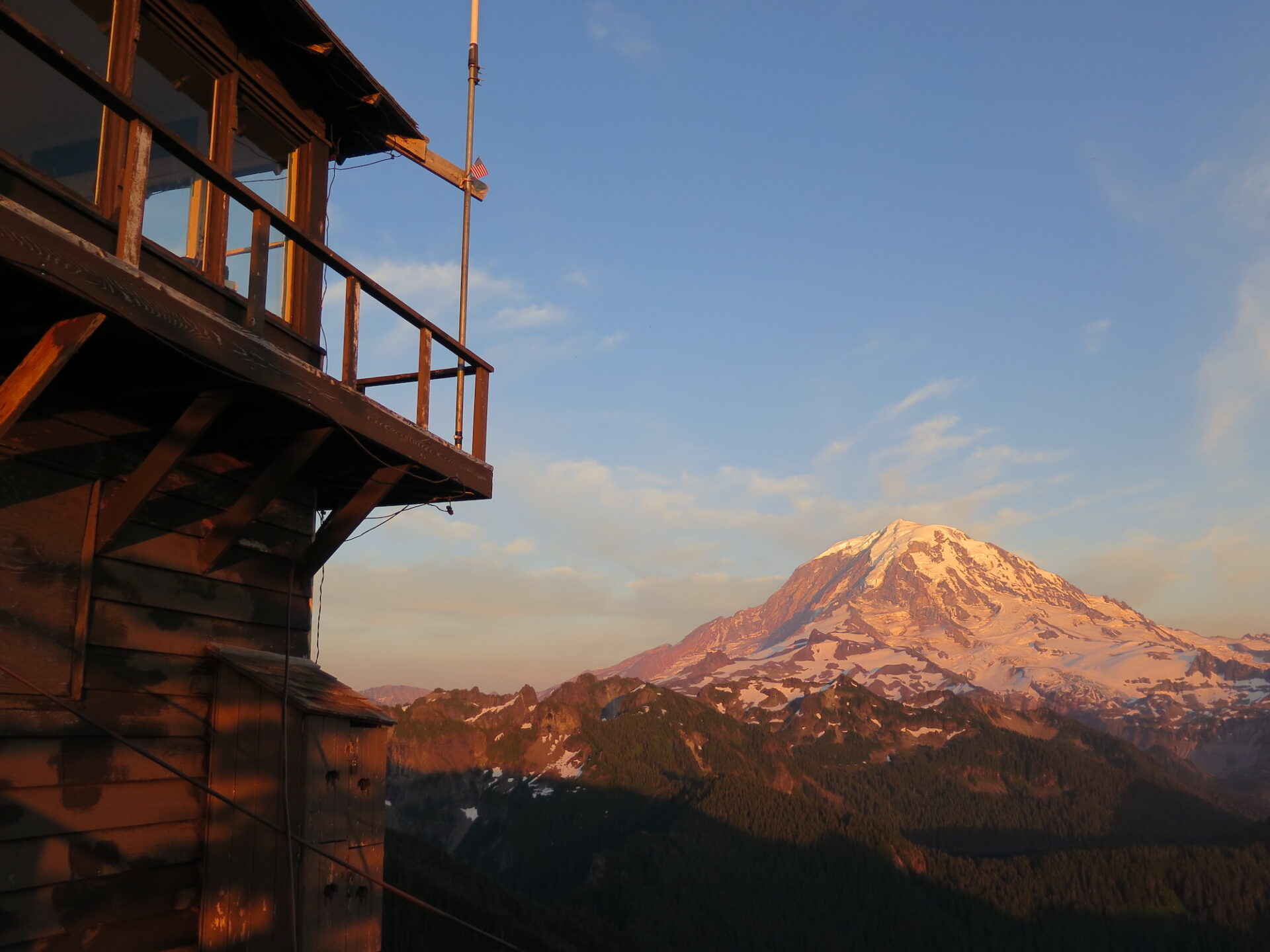
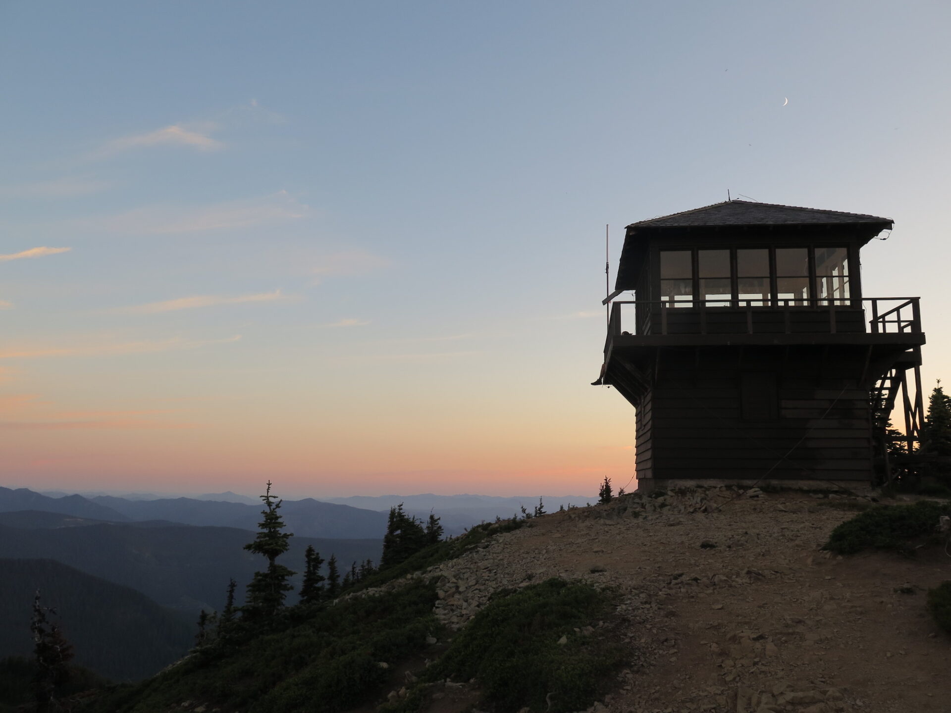
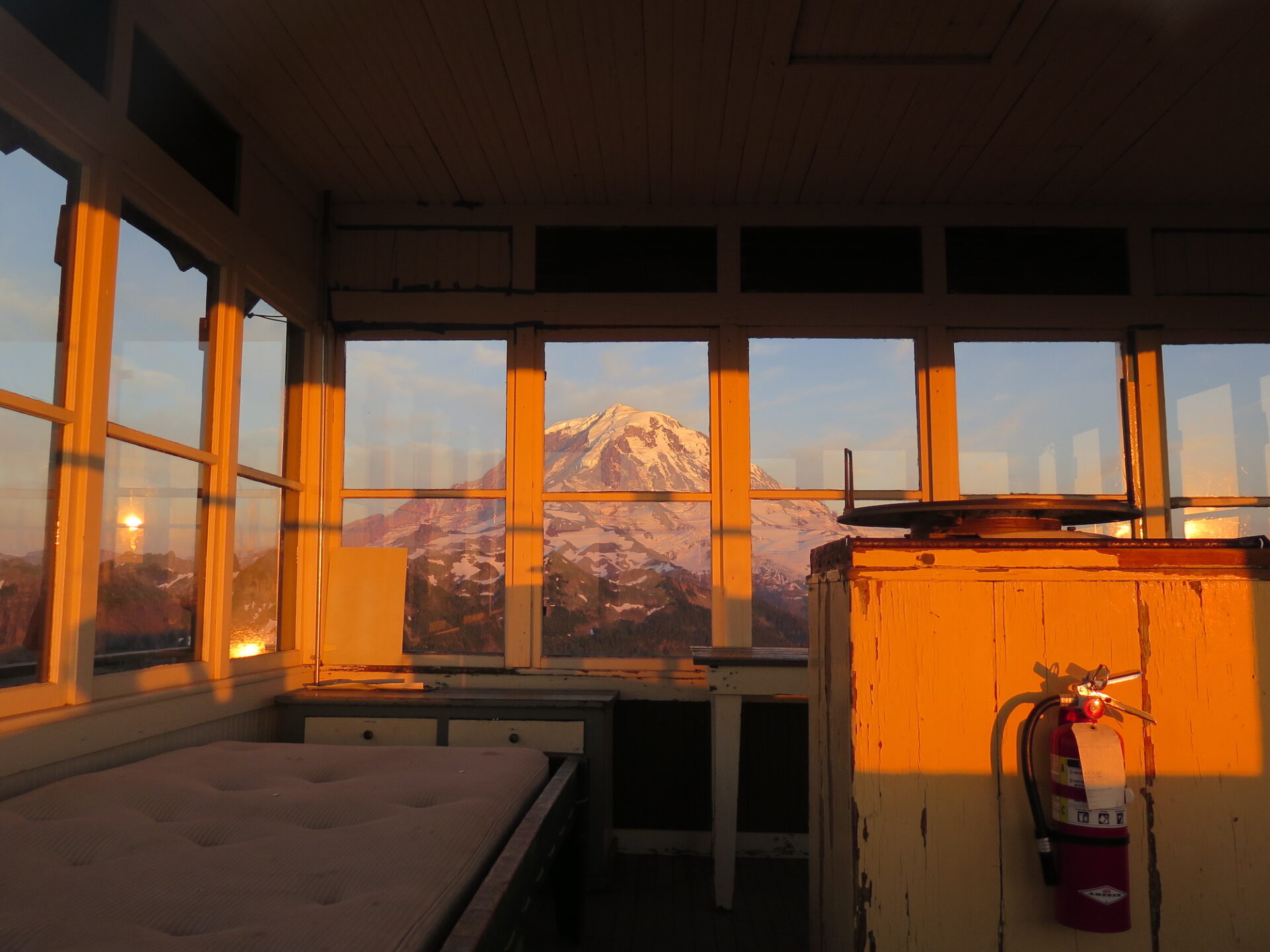
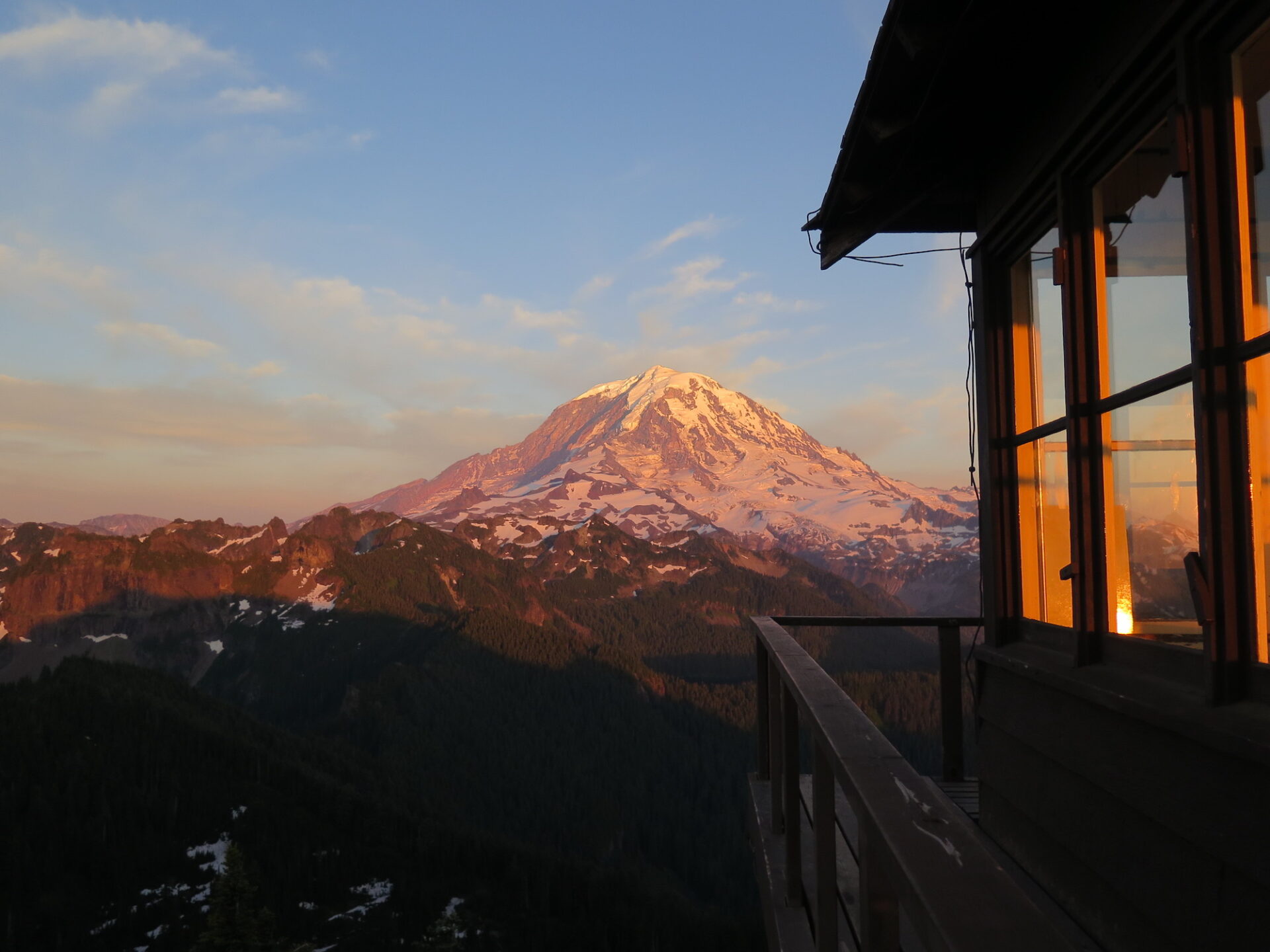
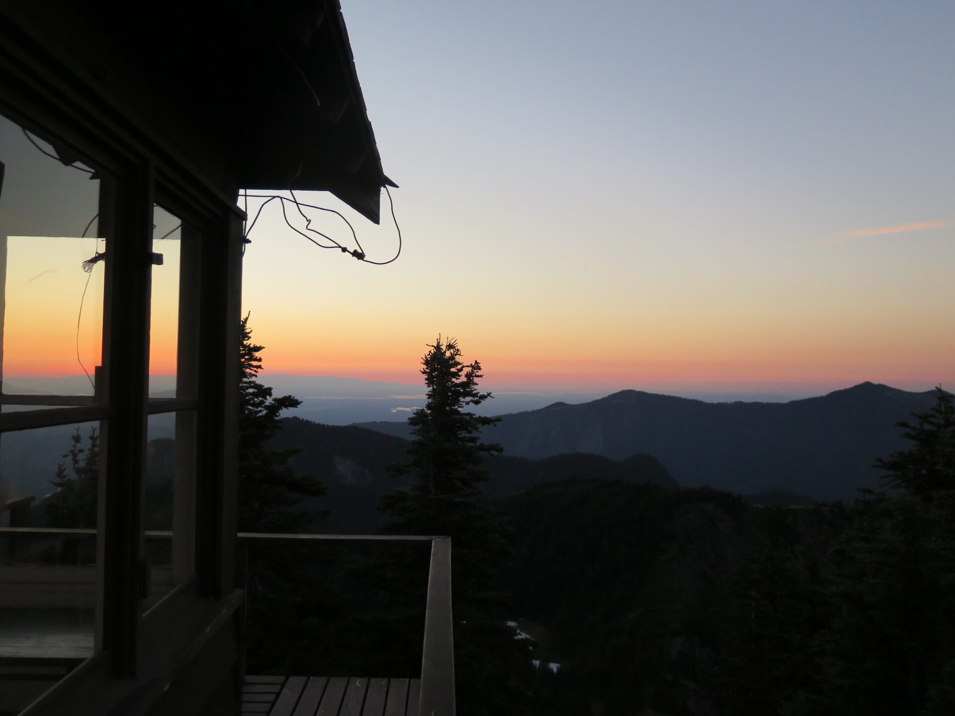
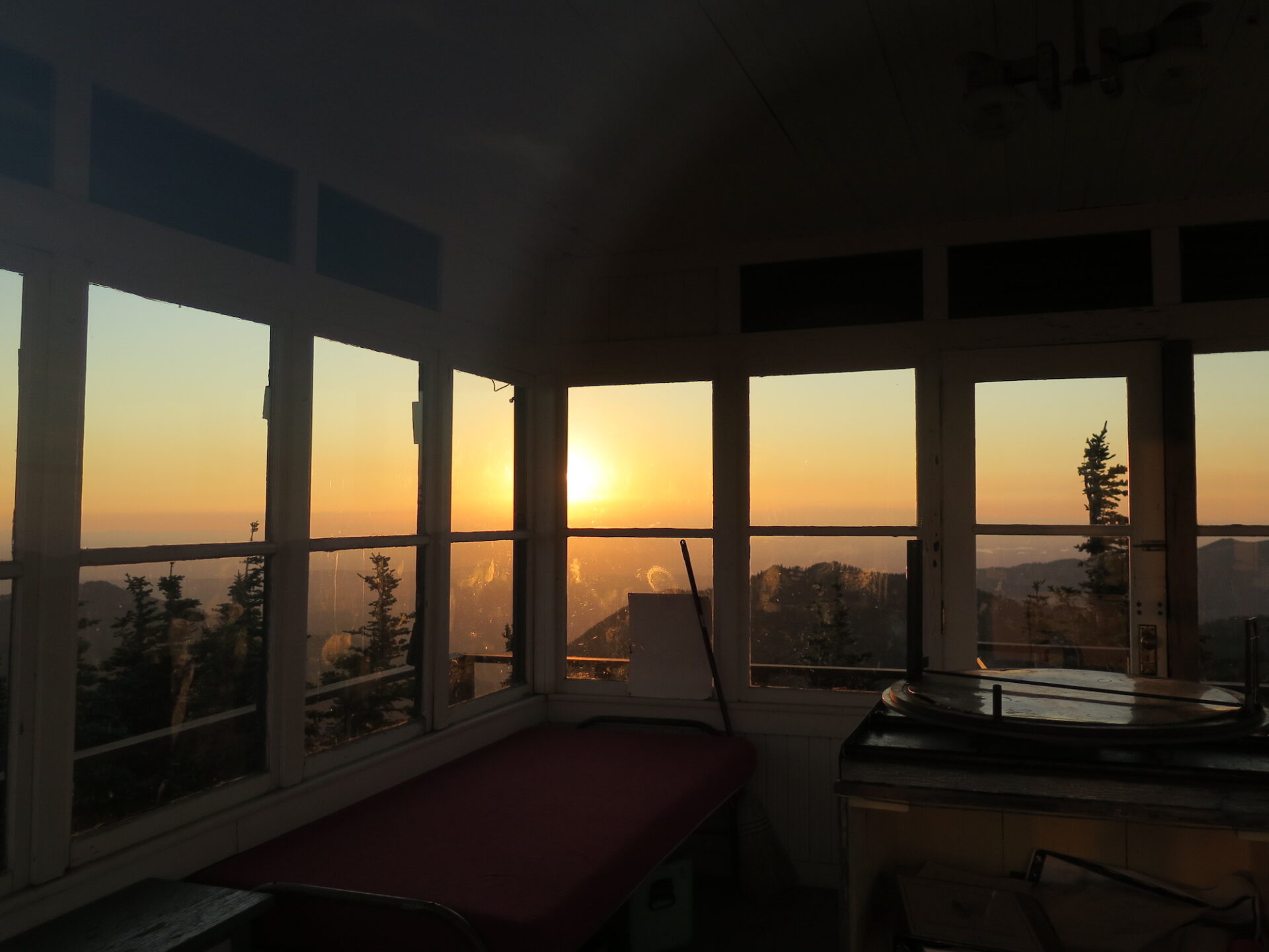
Photos from 2018 visit.
History.
The Tolmie Peak fire lookout was built in 1933 according to the typical National Park style two-story structure. The upper level houses a lookout station with storage at the ground level. The design was prepared under the supervision of Edwin A. Nickel of the NPS Branch of Plans and Designs.
Tolmie was named after William Fraser Tolmie, a member of Hudson’s Bay Company who spent several months living at Fort Nisqually in the early 1800s. Tolmie set out on a botany excursion up the Puyallup River Valley with Native American guides, subsequently becoming the first non-native to set foot inside the present day boundaries of Mount Rainier National Park. Tolmie was known for building strong relationships with indigenous peoples.
The Tolmie fire lookout was placed on the National Register of Historic Places in March 1991 and is sometimes volunteer staffed in the summer.
The route.
Distance (RT): 5.5 miles
Elevation Gain: 1,200′
Summit Elevation: 5,920′
The trailhead to Tolmie is near Mowich Lake and the area is oftentimes very busy, especially during peak summer months. Parking can be a challenge, so you may need to add a half mile or mile round trip to the hike. With a relatively low elevation gain, this is a pretty family-friendly outing for most. The few steep sections are relatively short and the low mileage make this a great sunrise or sunset hike.
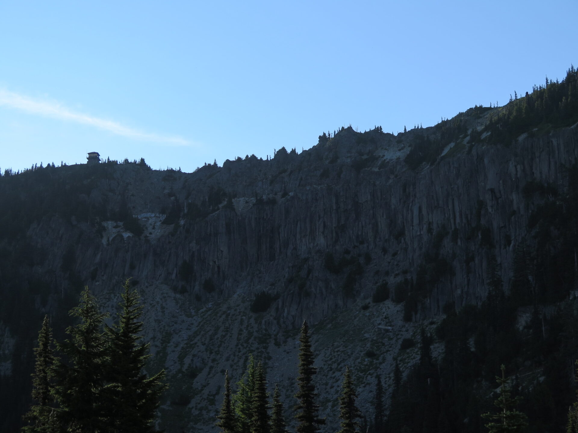
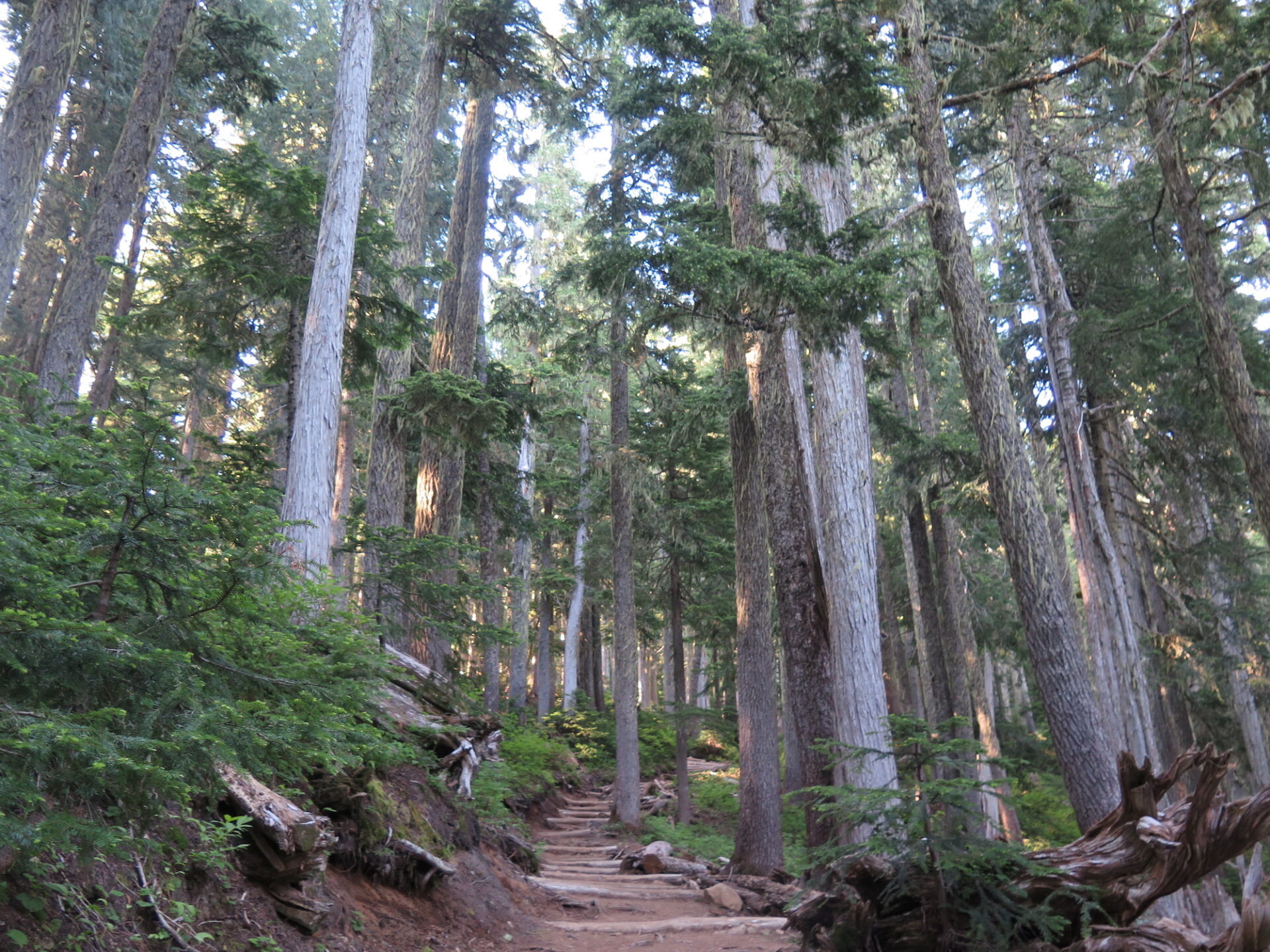
The first bit of trail is flat and easy, skirting around Mowich Lake through beautiful old growth forest and steep columns of basalt. Mowich Lake, by the way, is the largest lake inside Mount Rainier National Park.
In about a mile, the trail reaches a junction with Ipsut Pass, which is a nice detour and allows views of the valley. To continue to Tolmie, turn left and descend a few hundred feet. Don’t be surprised, it’s the right way!
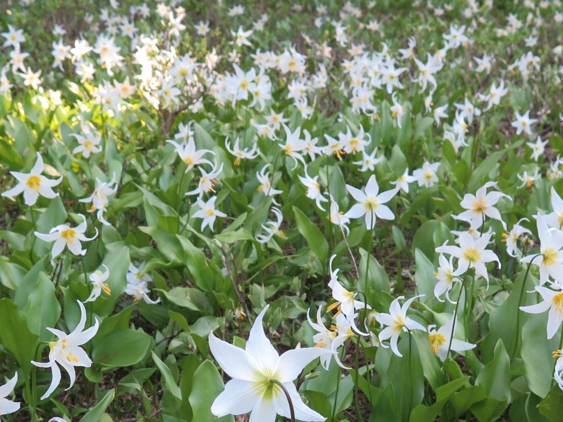
Once the trail stops descending, you’ll have to climb back what you just lost, but the trail flattens out as it enters the beautiful Eunice Lake basin. Avalanche lilies are often bursting in the basin in the summer months. Please remember to stay on trail, these alpine meadows are incredibly fragile.
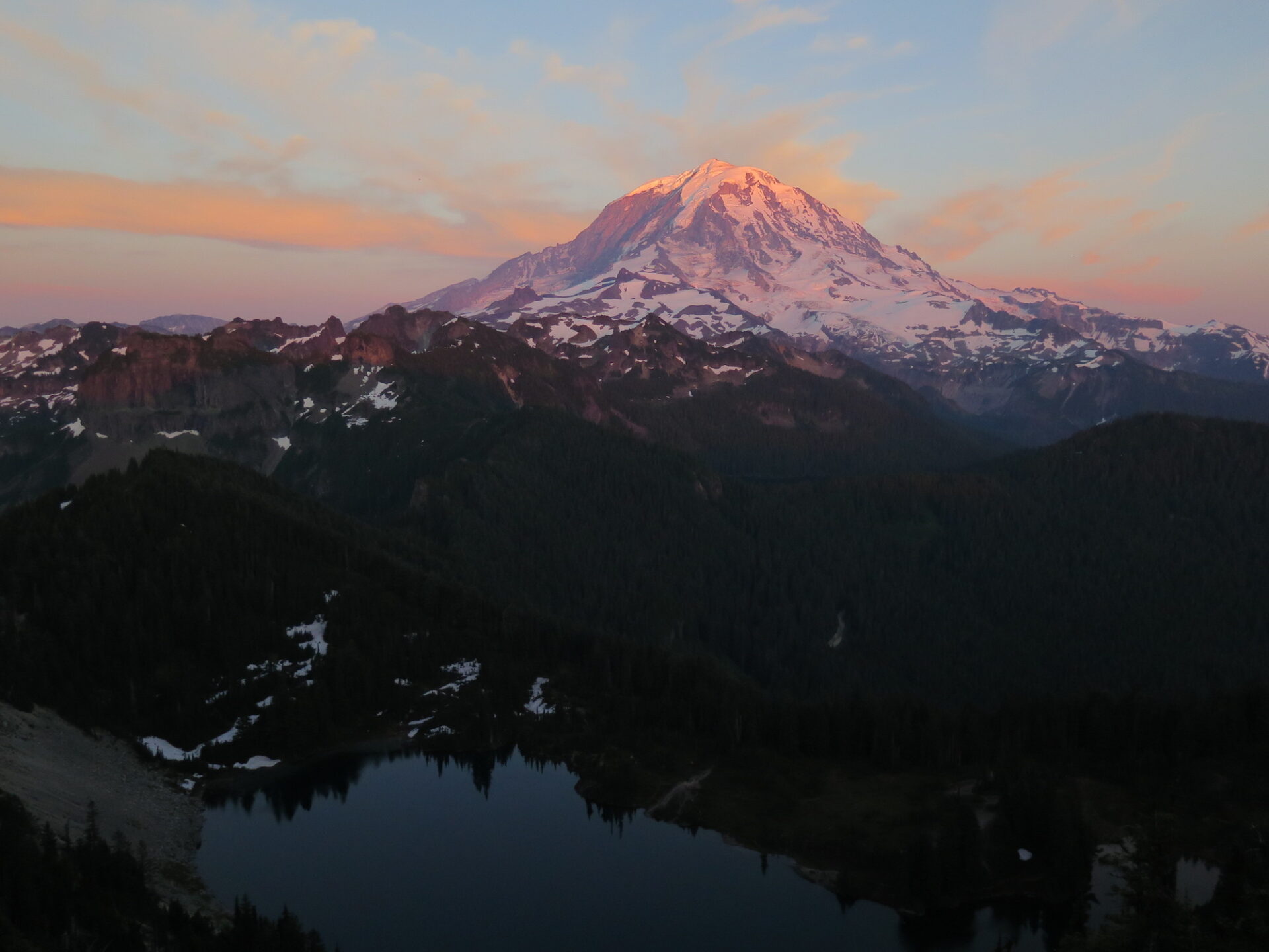
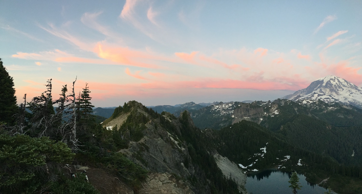
From Eunice Lake, the lookout towers high on the basalt cliffs above. The trail winds around the lake, then makes a final climb to the summit.
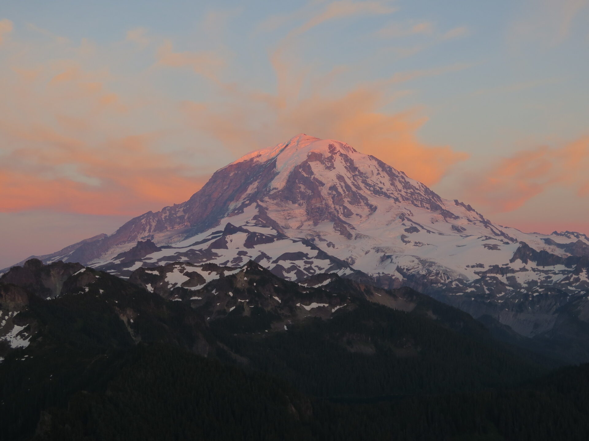
Once at the summit, enjoy impressive views of Mount Rainier and the sparkling water of Eunice below, along with the Olympics in the distance as well as Mount St. Helens, the Seattle skyline, and on a clear day, Baker and Glacier as well.
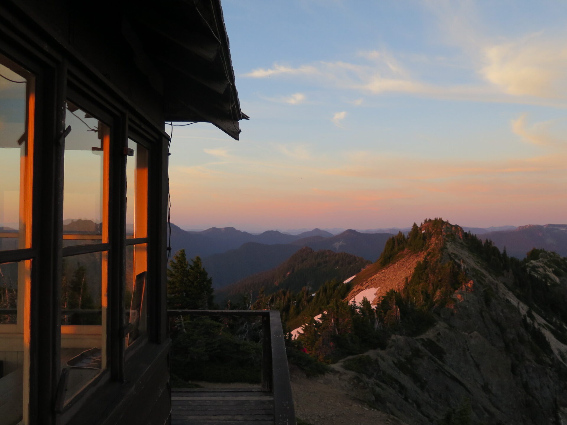
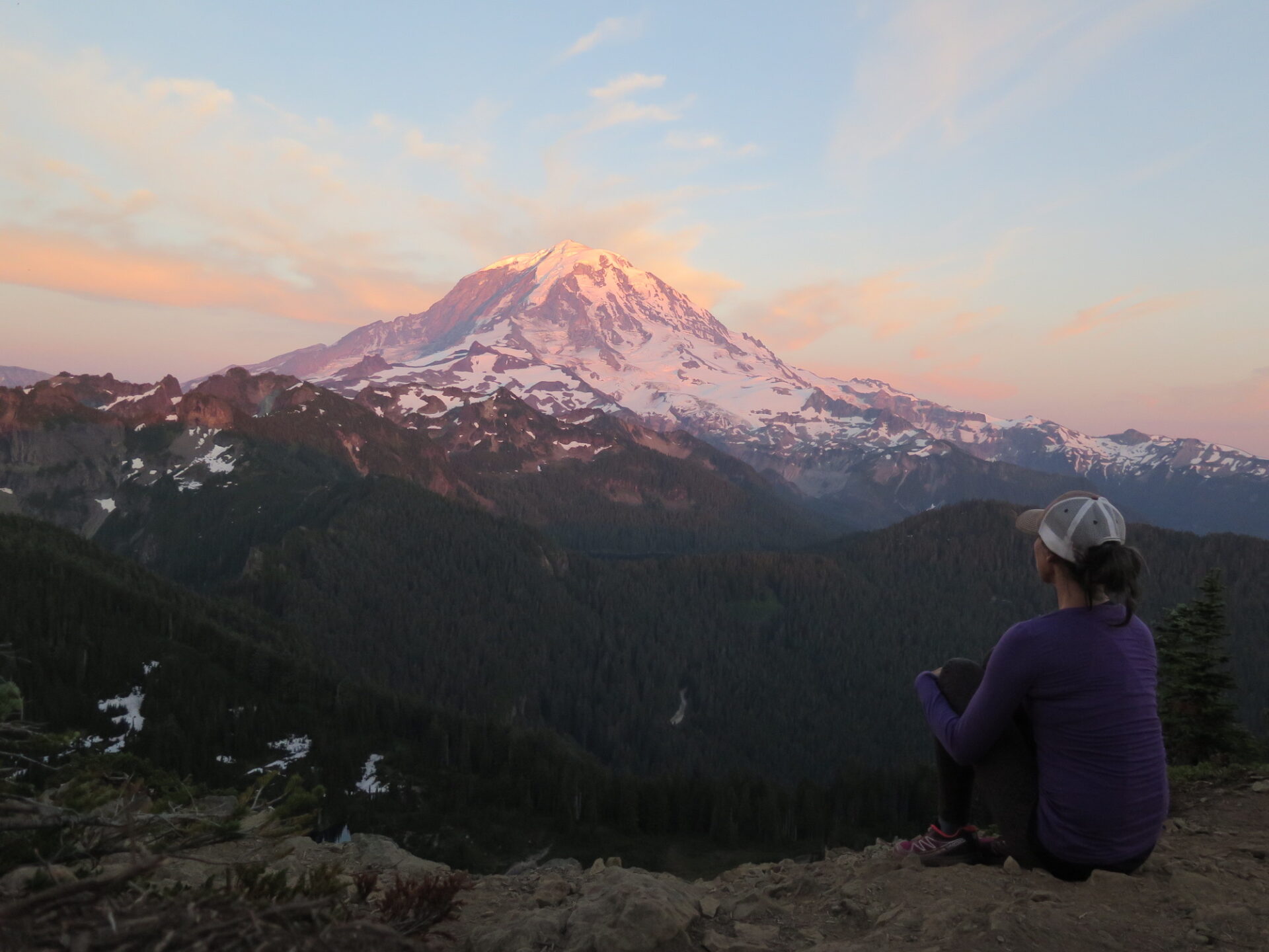
There is no backcountry camping allowed in the area, so if it’s sunrise and sunset shots you’re after, you’ll have to do it as a day trip. The trail is well established and easy to hike in the pre-dawn or post-sunset hours. When I visited in July 2018 I was treated to a spectacular sunset show that turned the Mountain pink. It was absolutely stunning!
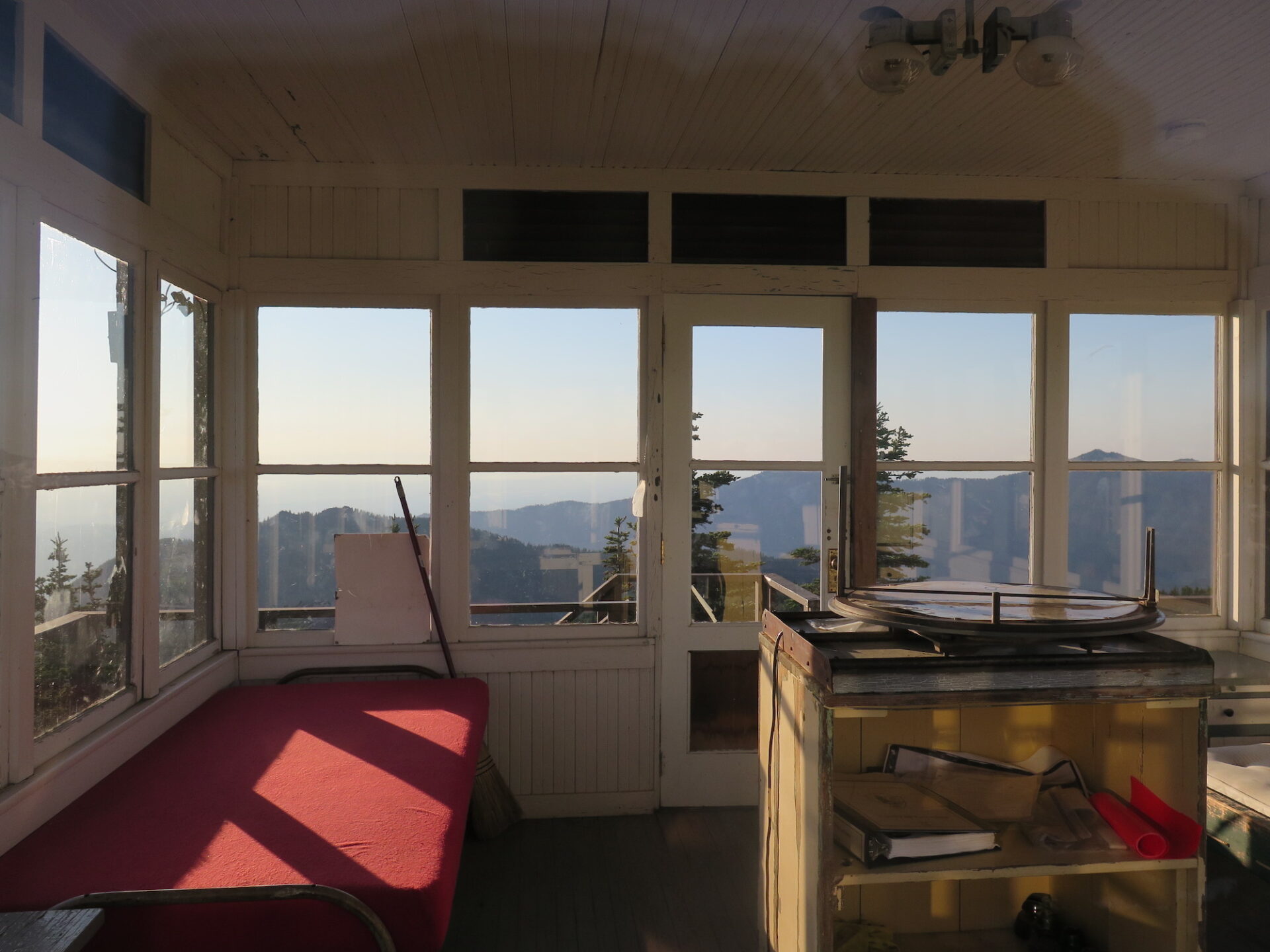
The lookout is closed to the public unless a volunteer is on staff.
[sgpx gpx=”/wp-content/uploads/gpx/tolmiePeakLO.gpx”]
Directions.
From Puyallup, drive east for 13 miles on Highway 410 to the small town of Buckley. Turn right onto Highway 165 and continue through Carbonado. Just past the Carbon River Gorge Bridge, turn right onto Mowich Lake Road and drive 17 miles to the end. This road can be rough, washboarded, and potholed, but most cars should be able to make it. The trailhead for Tolmie is on the left side of the road.