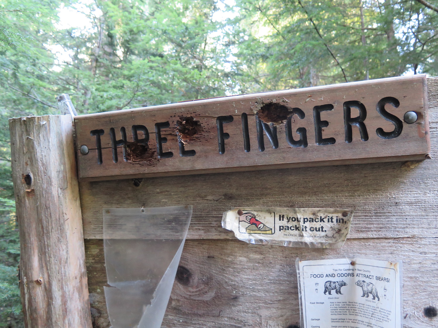
North Cascades | Mountain Loop Area
Mount Baker-Snoqualmie National Forest | Boulder River Wilderness
Location: 48.169874, -121.687848
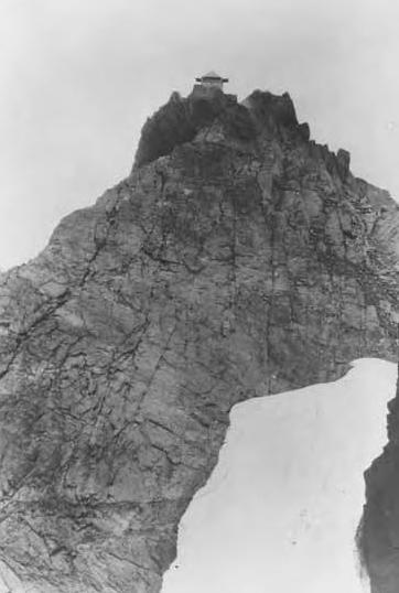
Summit Elevation: 6,850′
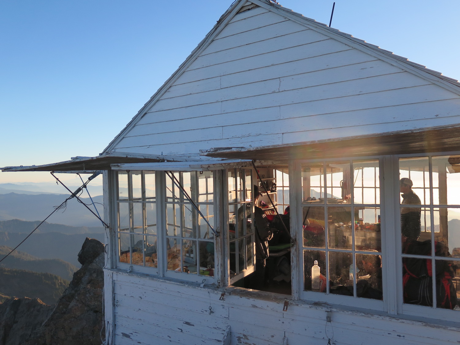
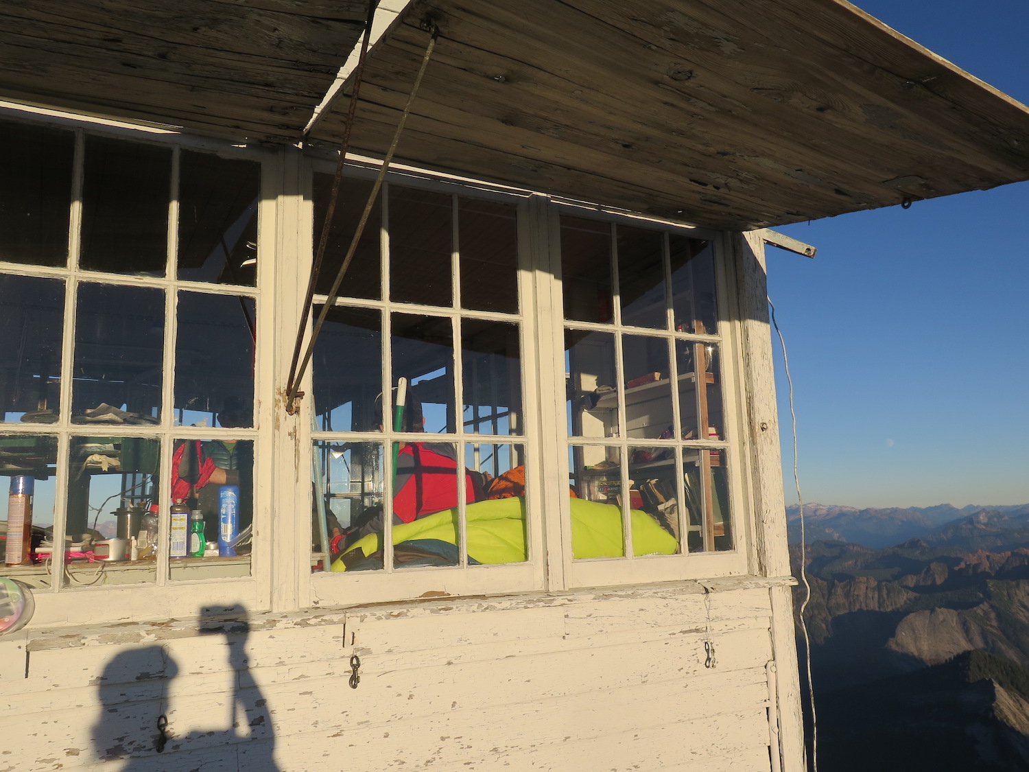
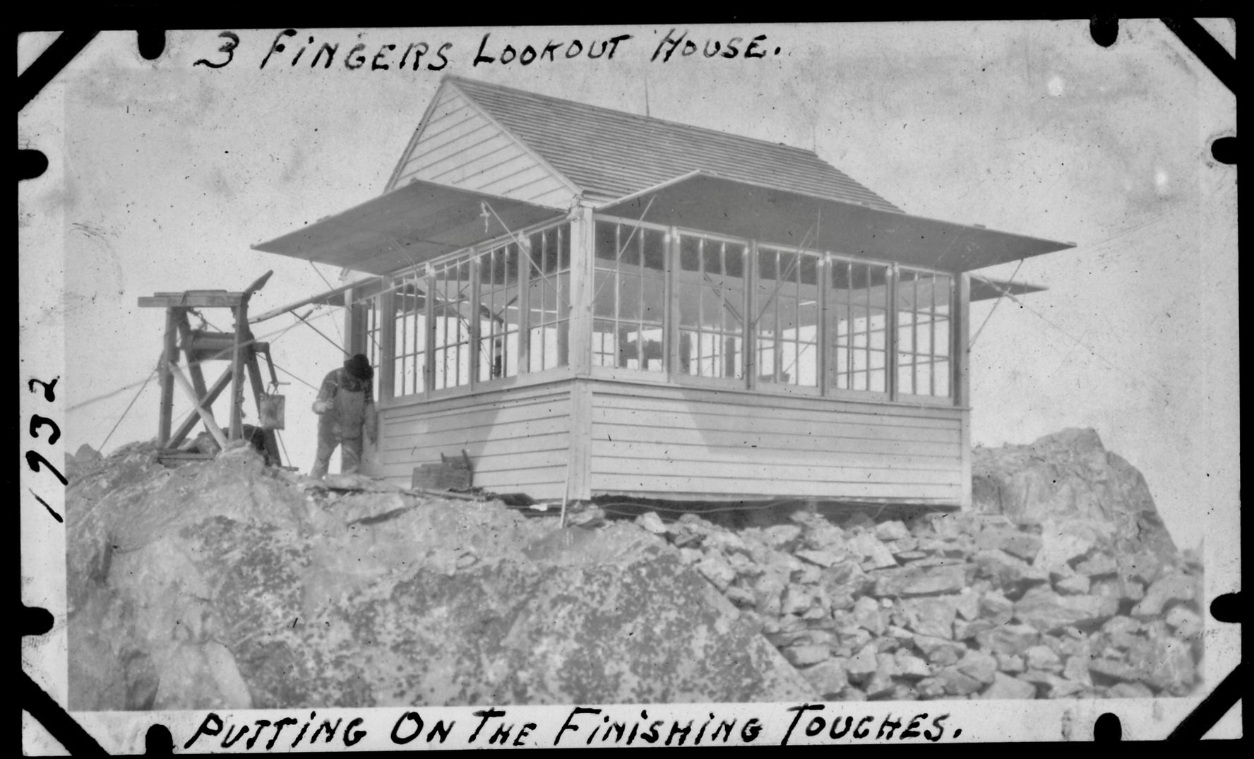
Lookout Type: L-4 gable ground house
Site Established: 1931
Current Structure Built: 1931
Date Visited: 10/20/18
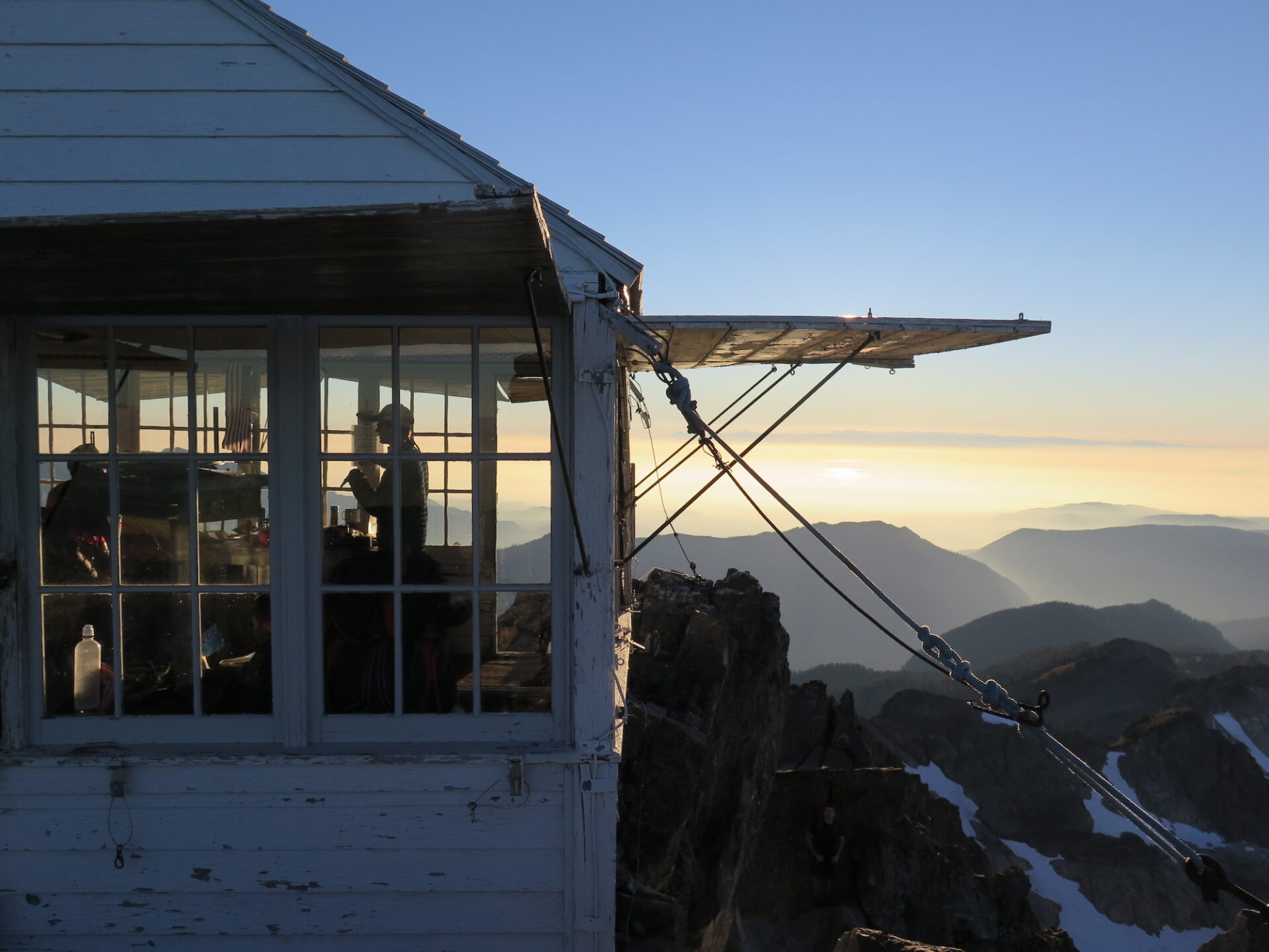
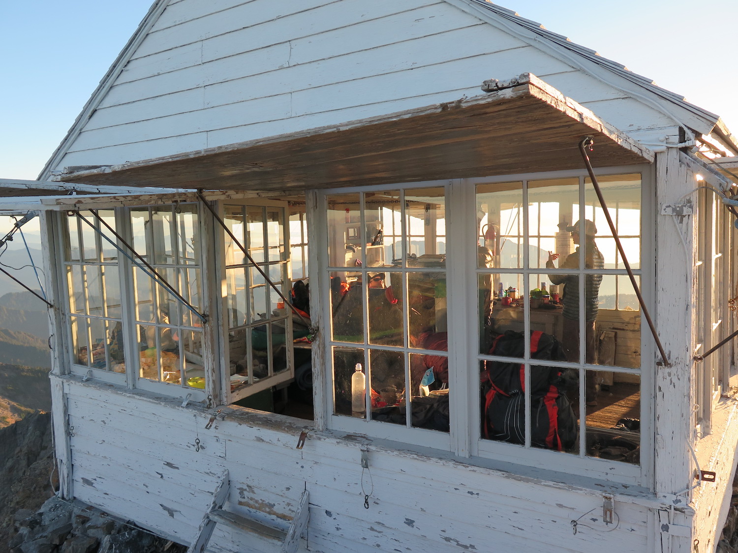
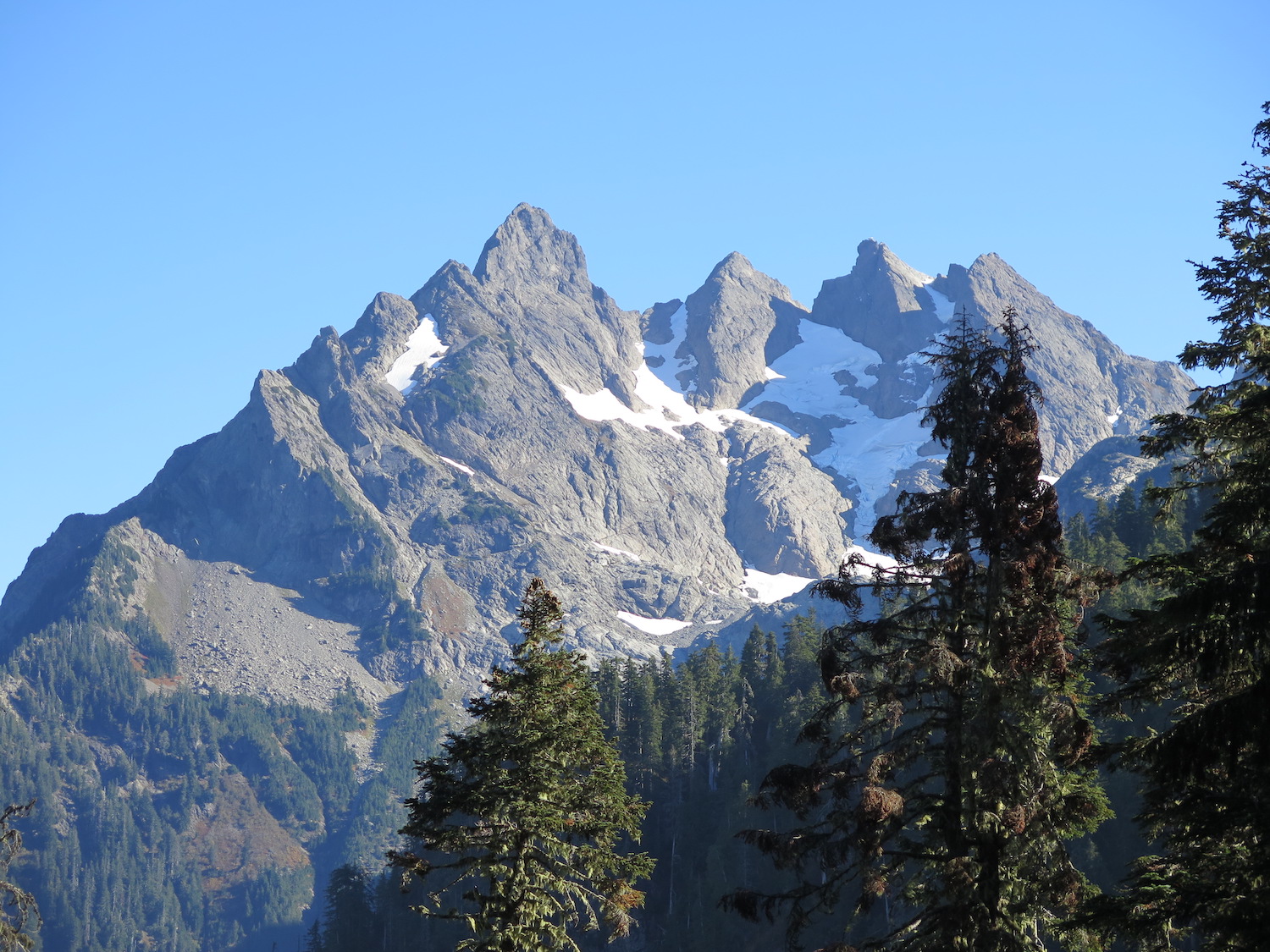
Three Fingers is no doubt one of the most intimidating fire lookouts in Washington to reach thanks to its infamous ladders and long, potentially technical approach. When it comes to dramatic perches though, it most certainly can’t be beat! The lookout sits atop a spectacular pinnacle of basalt that is also the 12th most prominent peak in Washington State. Three Fingers is one of only two gable roof lookouts, known as Grange Halls, remaining on the Mount Baker-Snoqualmie National Forest.

Photos from 2018.
History.
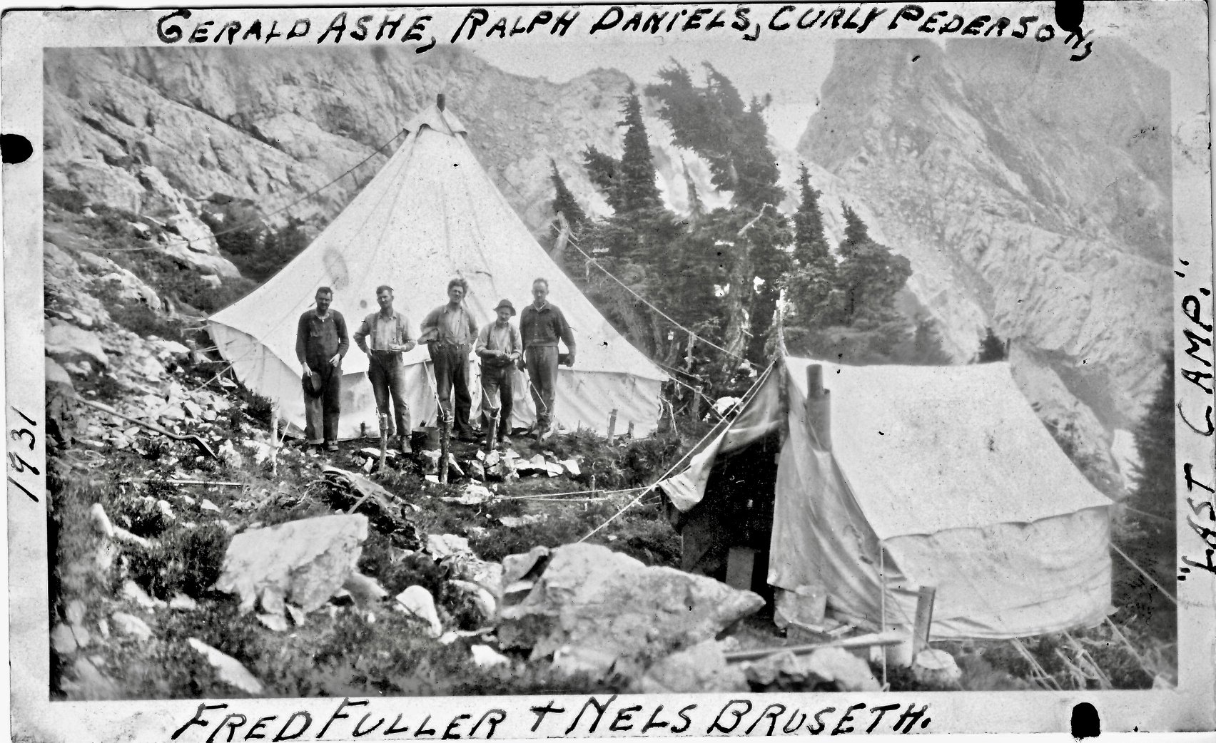
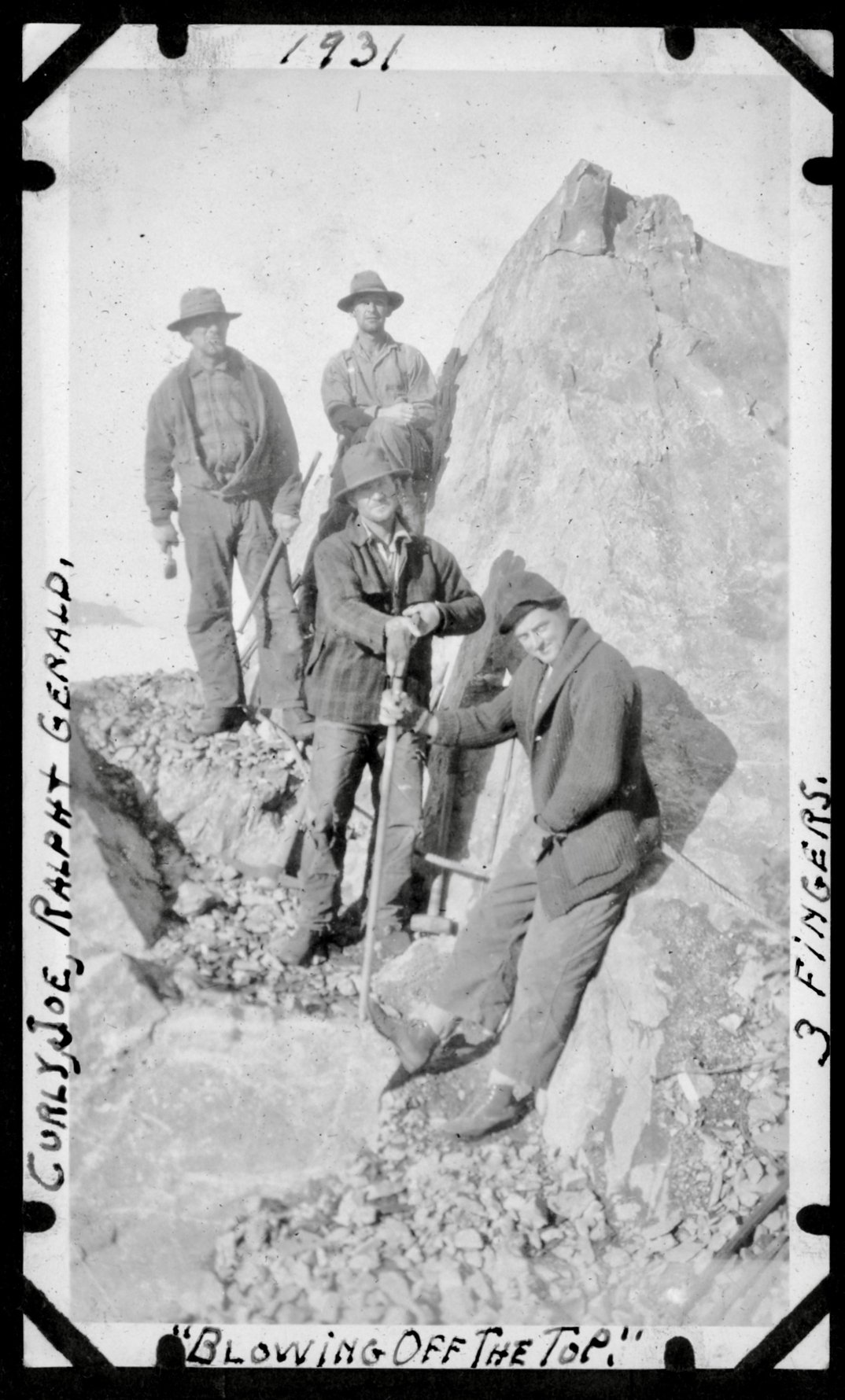
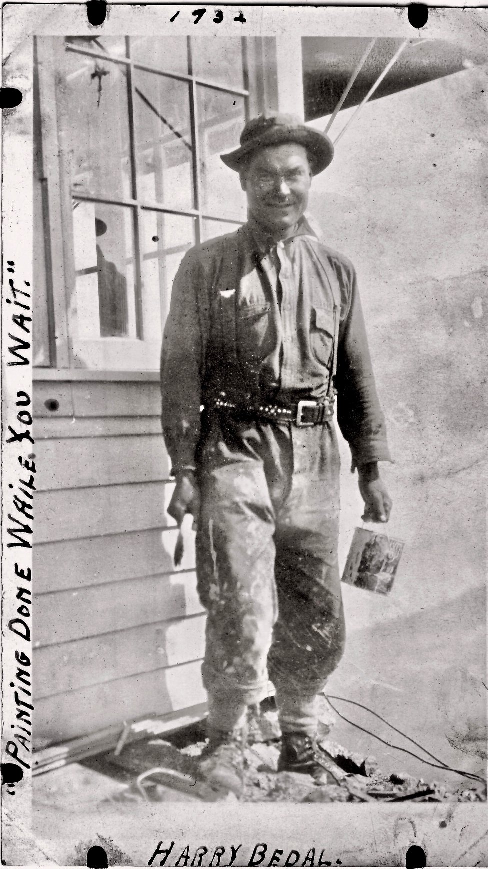
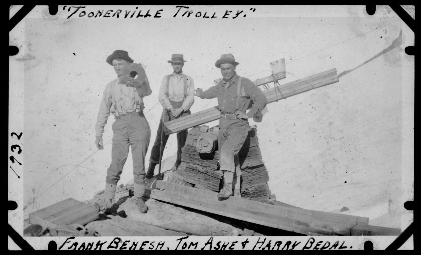
The first ascent of Three Fingers was in 1929 by Harry Bedal and Darrington District Ranger Harold Engles. In 1930, Bedal, Engels, Frank Benesh and crew began construction of the Three Fingers fire lookout, overlooking thousands of acres of old-growth timber on the Snoqualmie National Forest. The effort was an amazing feat and took nearly three years to complete. The top 15′ of the summit was blasted off to make room for the lookout, a trail was built, and telephone line was strung up from the Boulder River valley below.
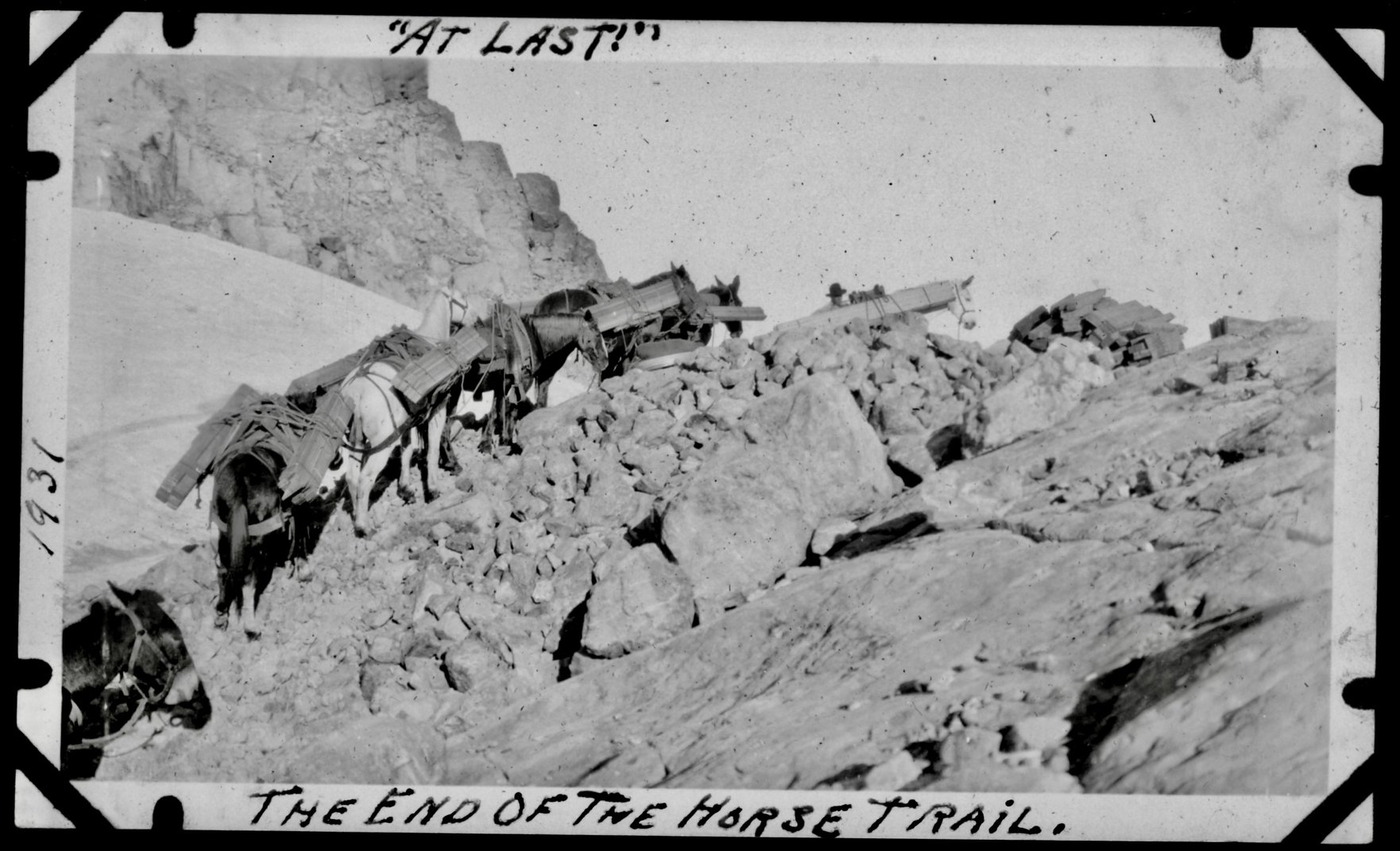
The original intent was to build a 12′ x 12′ D-5 but instead a standard 14′ x 14′ L-4 lookout was provided for the District. The larger footprint barely fit on the summit and did not allow for the construction of a catwalk. Horses and mules carried materials to within 600′ of the summit, then they were lifted the remaining distance by a windlass made from telephone wire.
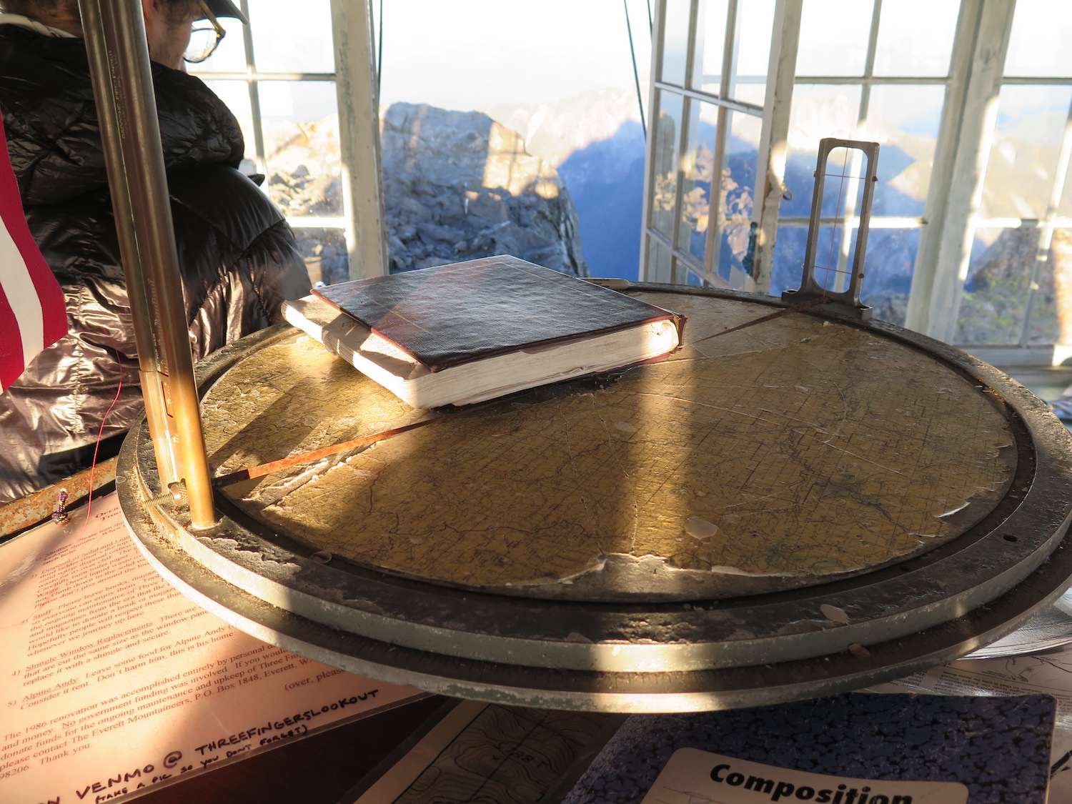
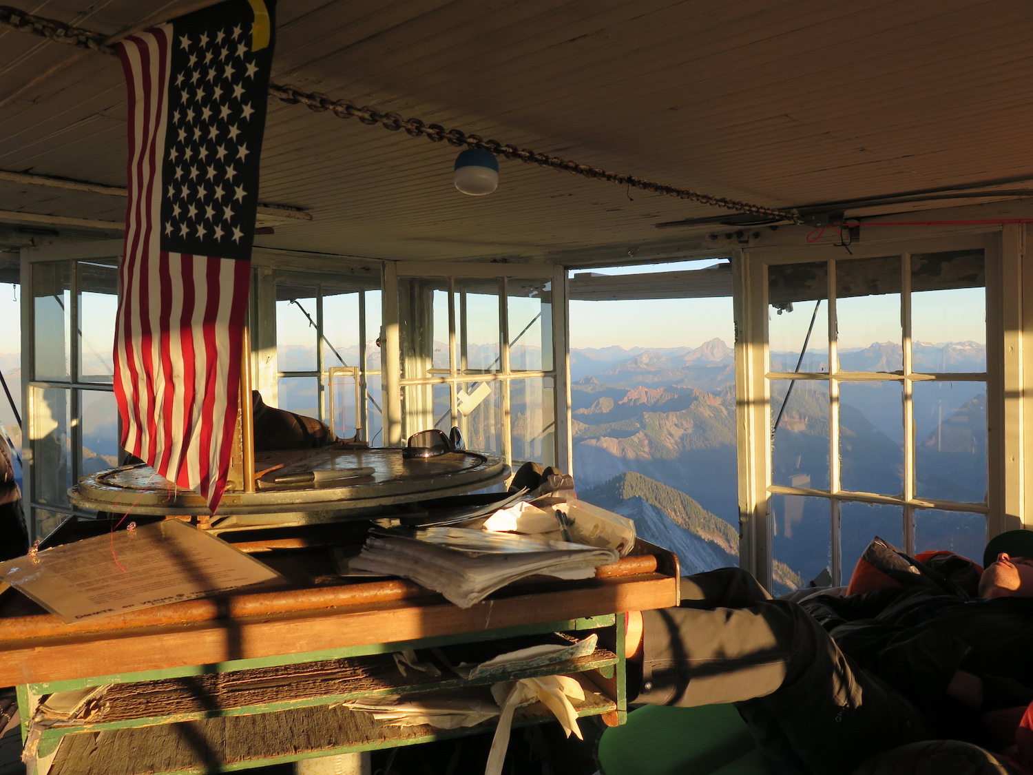
Three Fingers was seasonally staffed from 1933 until 1942. An Adirondack canvas chair, built by Harold Weiss, one of the original lookouts, still remains at the summit today.
The Everett Mountaineers maintained the lookout from the mid-1960s and in 1986, they replaced the cedar shingles, repaired windows, and made small structural updates. Retired Ranger Engles lived to see the project completed before his passing in August 1993.
In 2015, a volunteer team lead by Arthur Wright replaced the roof with assistance from the Snohomish County Sheriff’s helicopter for supply drops. In 2021, the Friends of Three Fingers organized work parties to complete significant work on the lookout which included painting, structural repairs, and replacement and repair of shutters.
Three Fingers is one of only two gable roof lookouts, also known as Grange Halls, remaining on the Mount Baker-Snoqualmie National Forest.
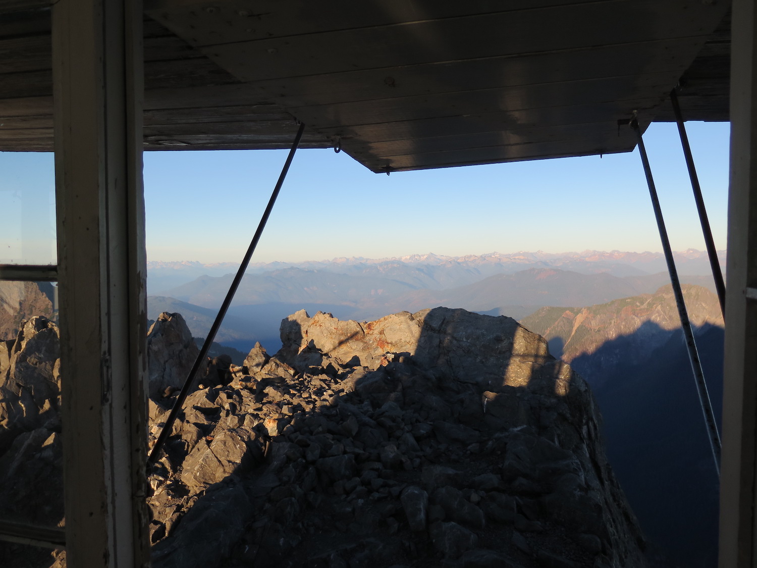
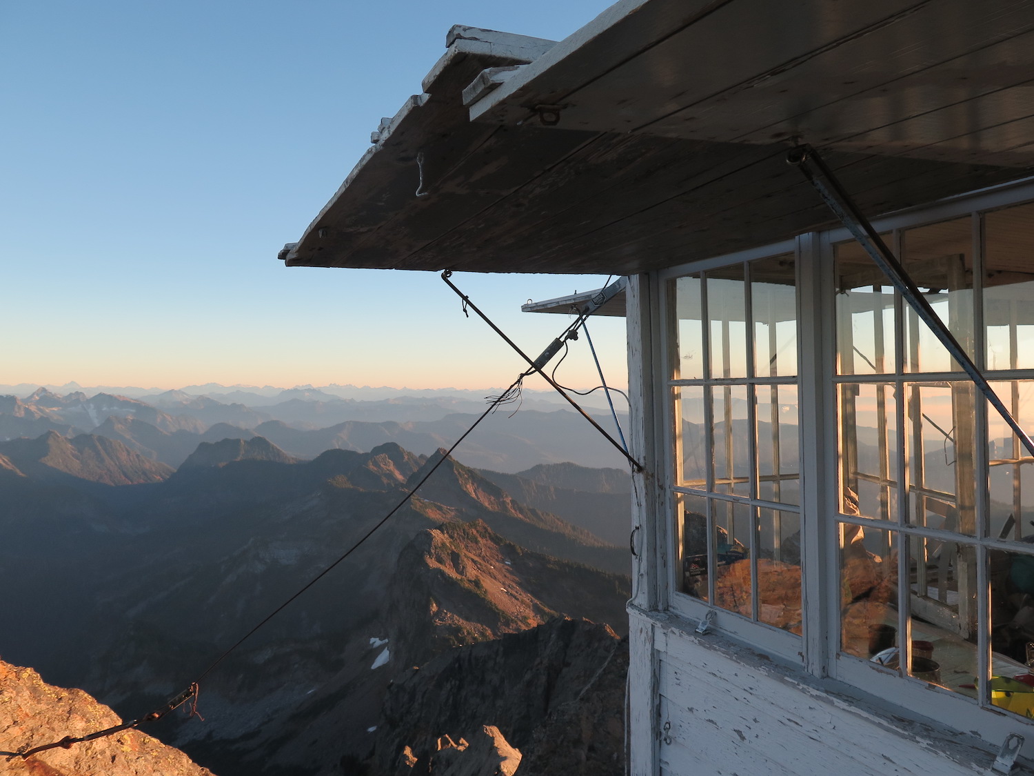
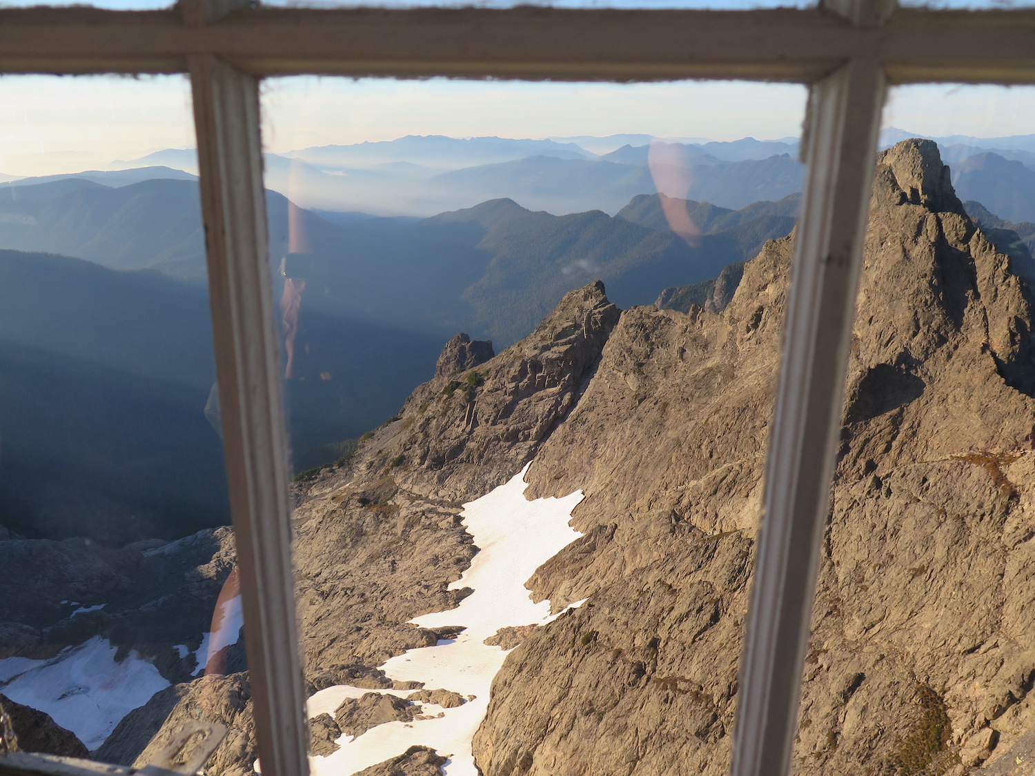
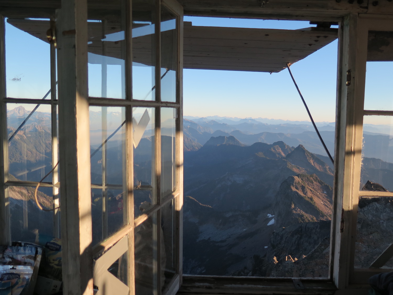
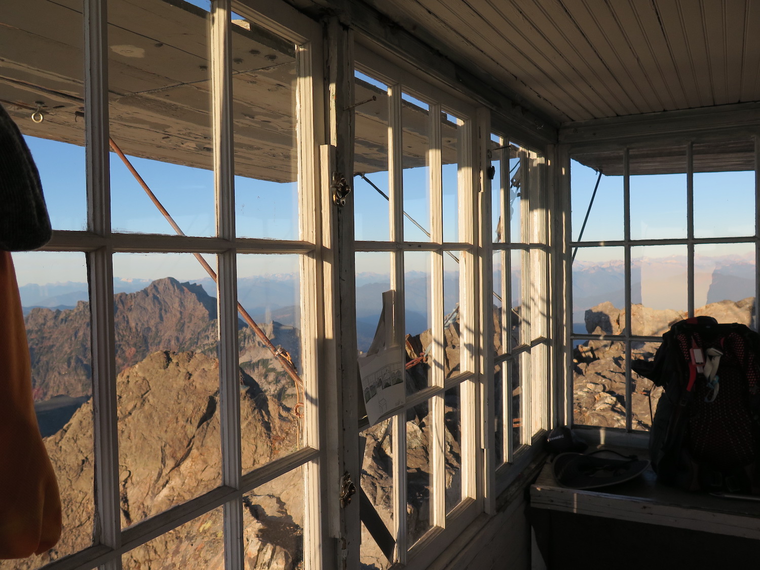
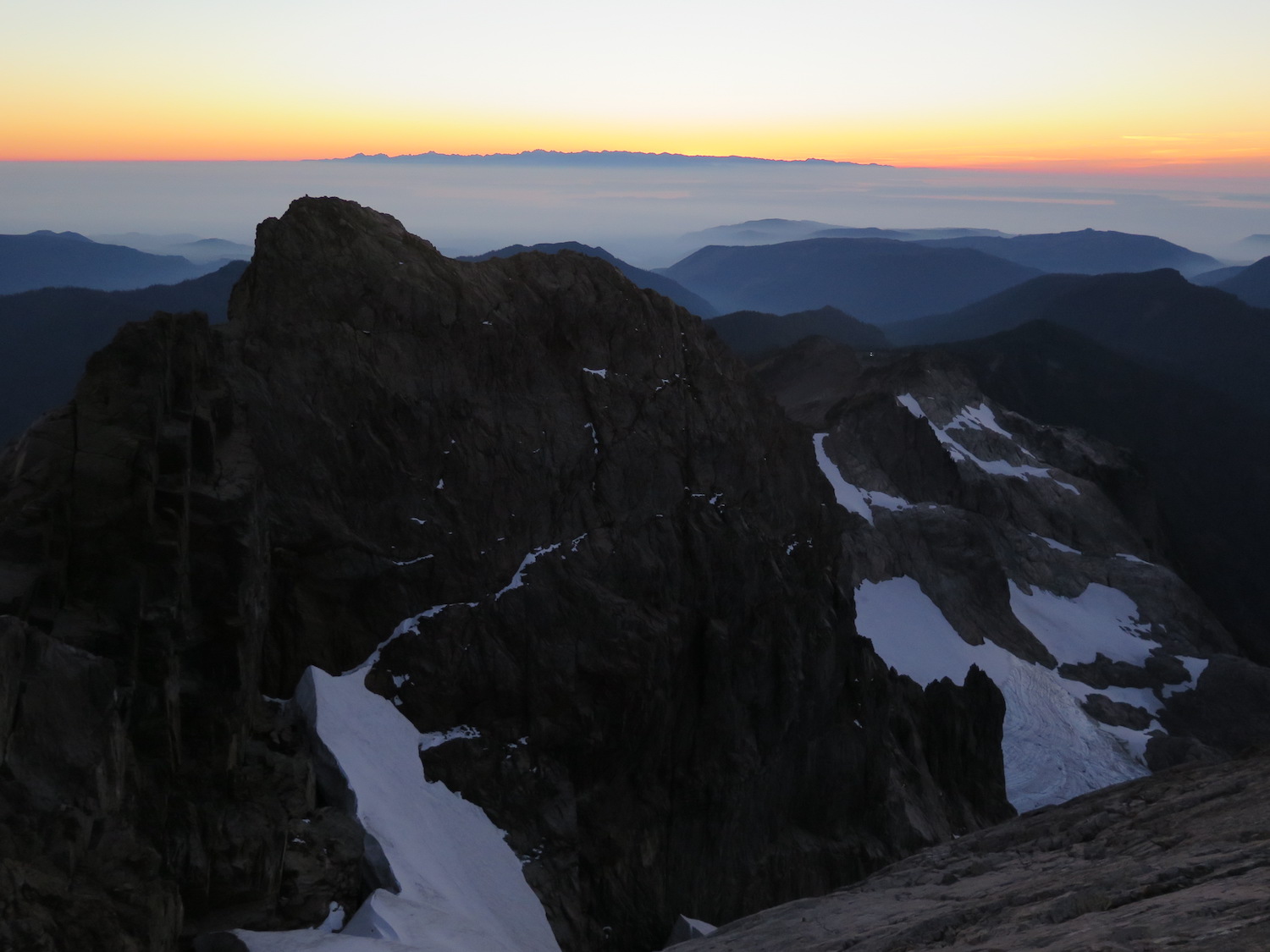
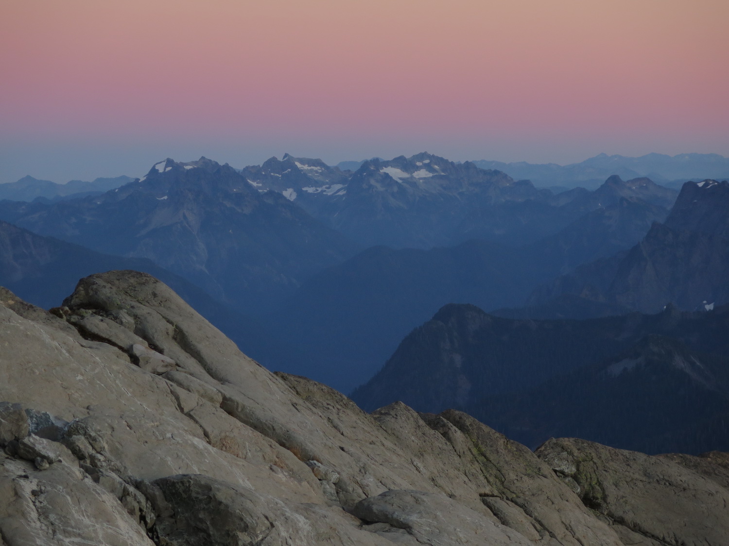
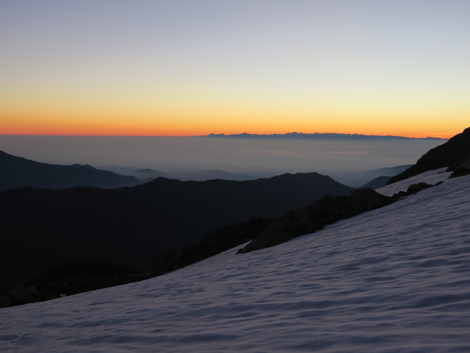
The views.
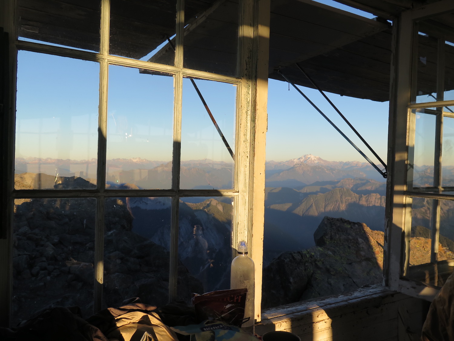
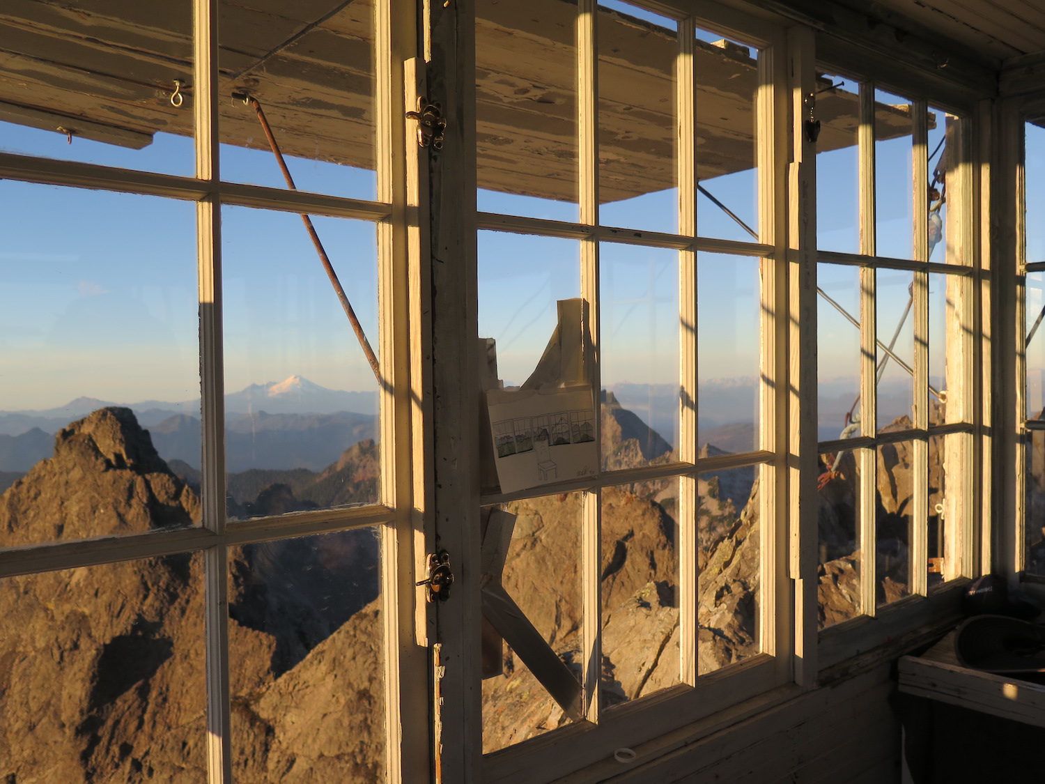
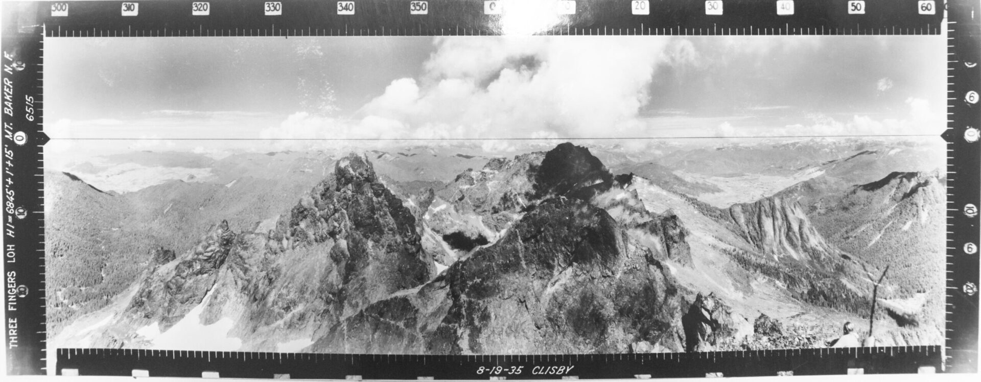
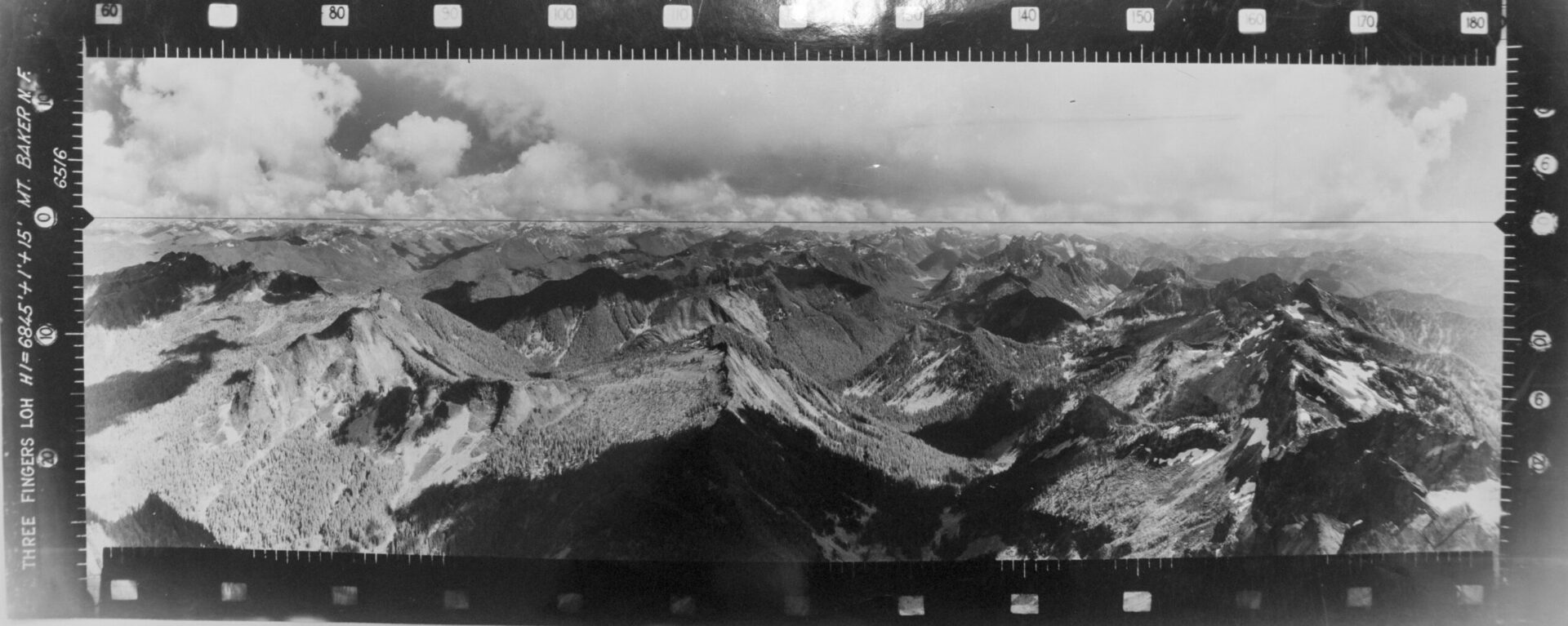
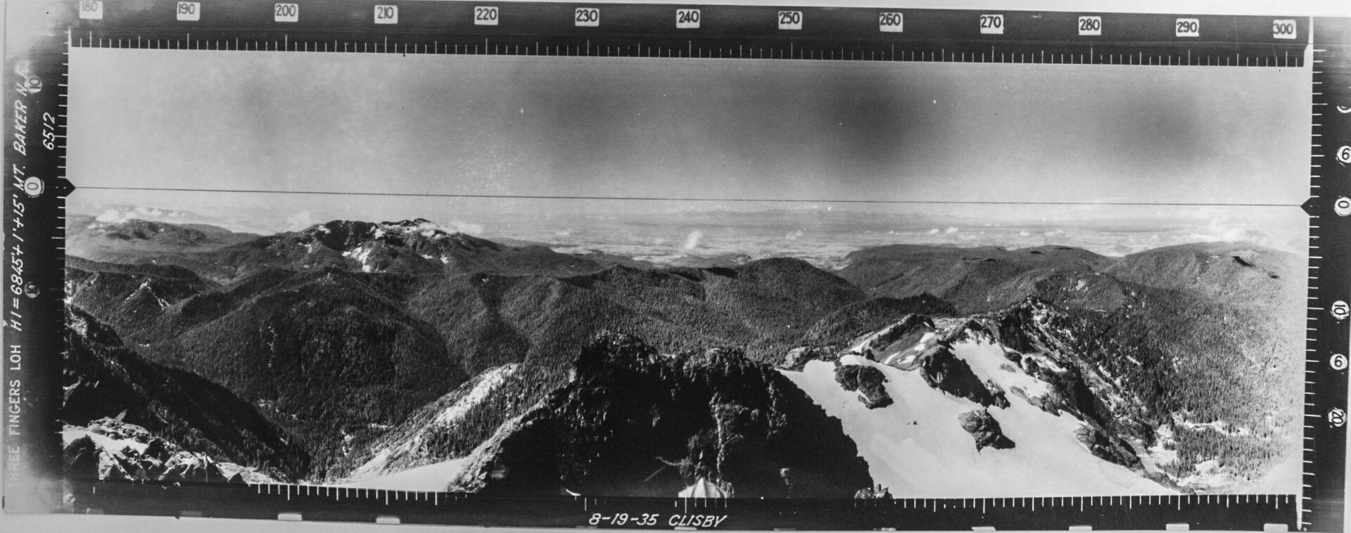
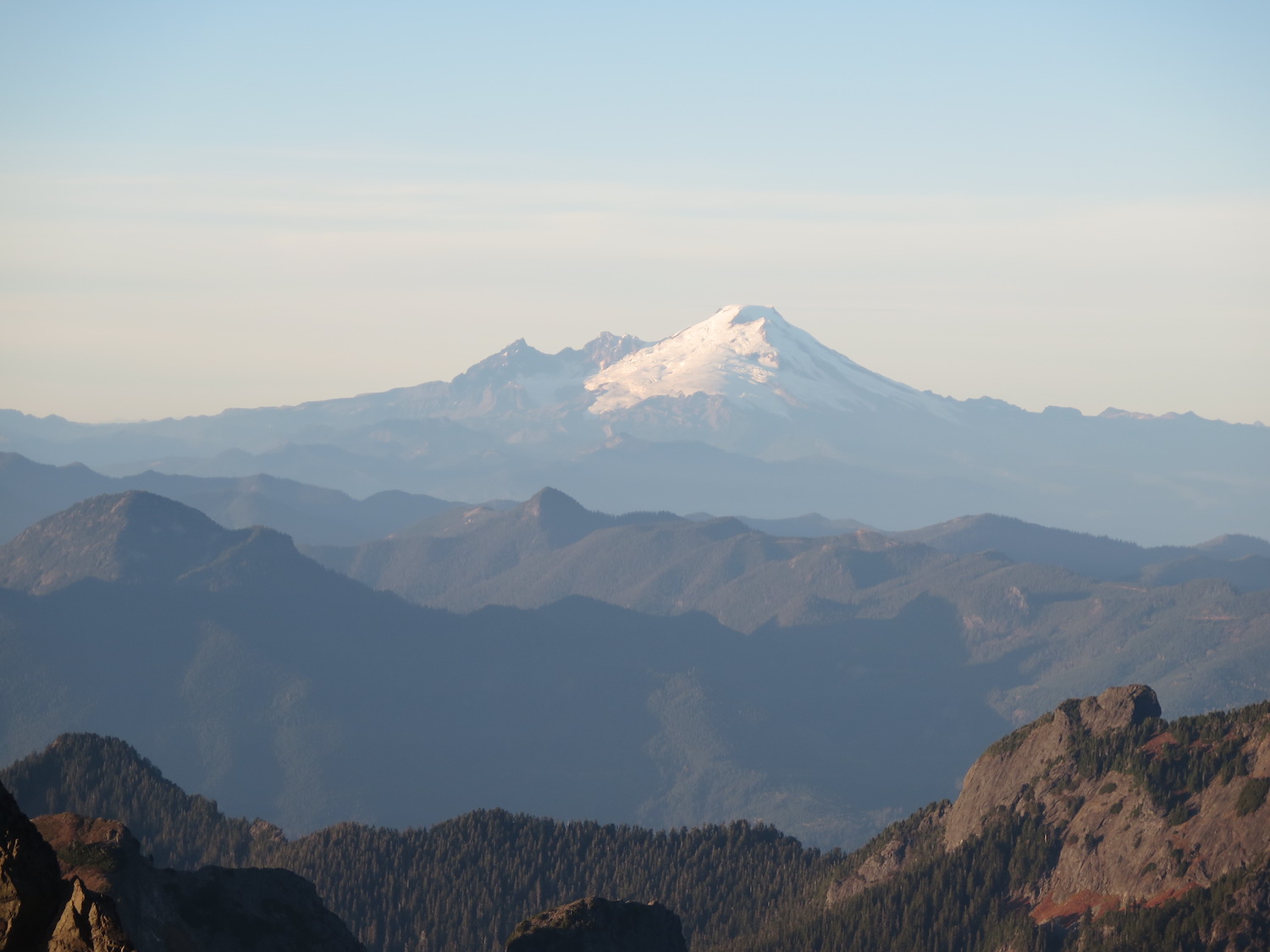
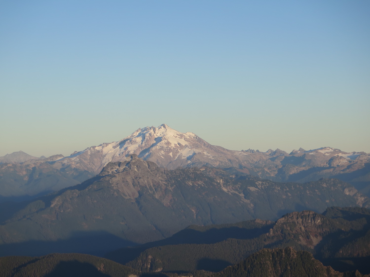
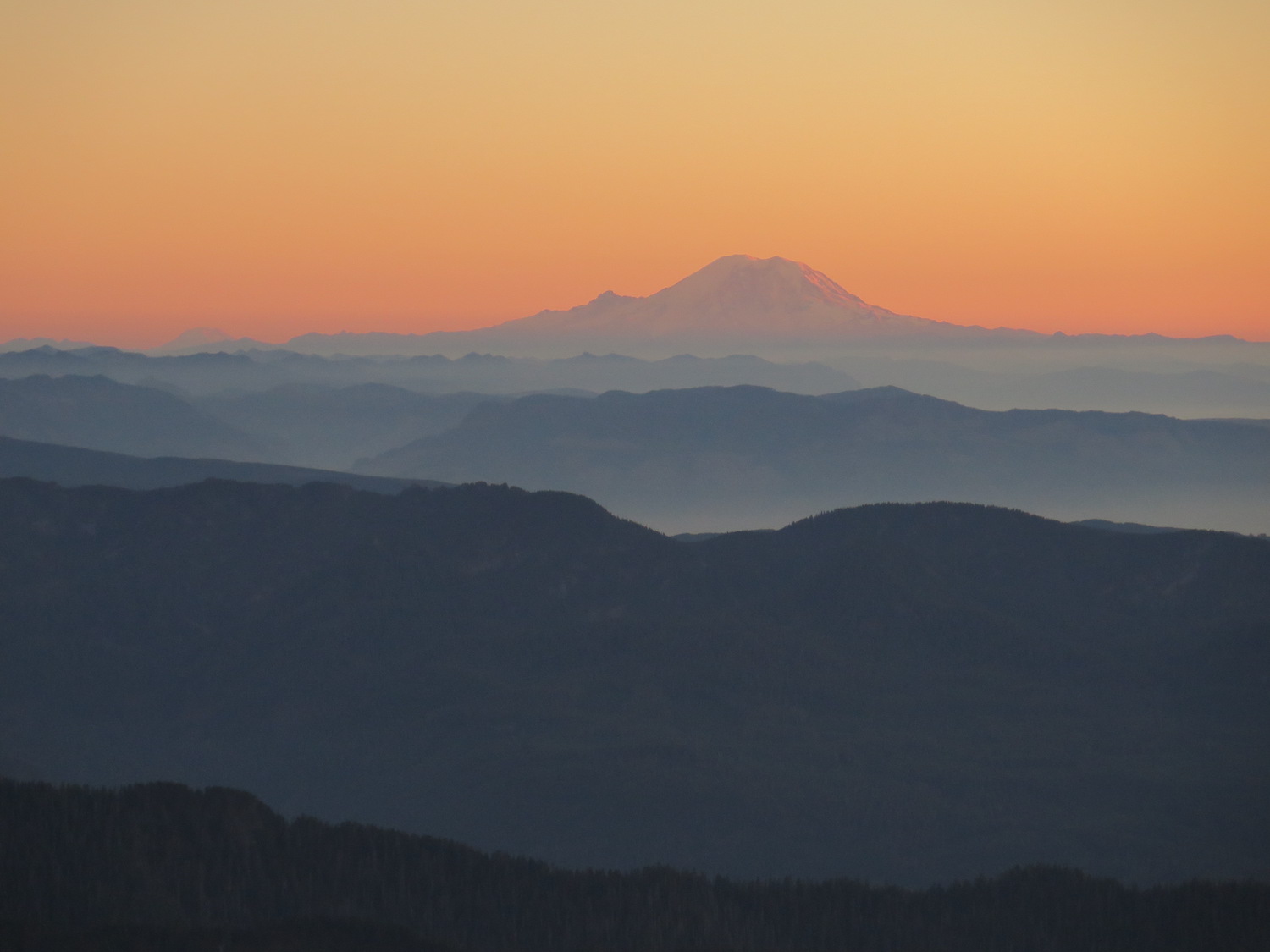
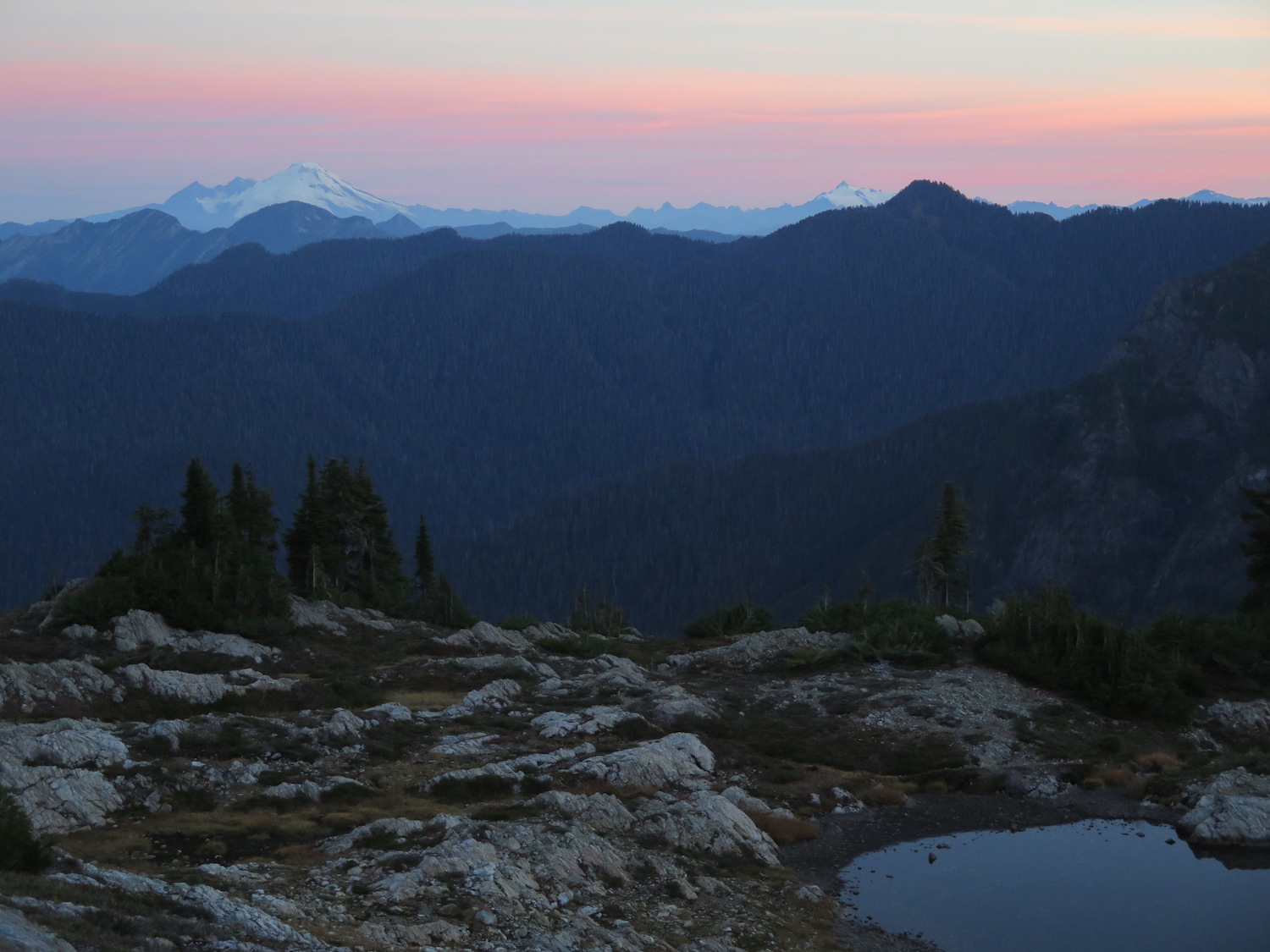
Three Finger’s spectacular views include Mount Baker, Mount Rainier, the surrounding Cascades, and even the twinkling of city lights from nearby Everett and the I-5 corridor beyond.

The route.
Distance (RT): 31 miles
Elevation Gain: 5,750′
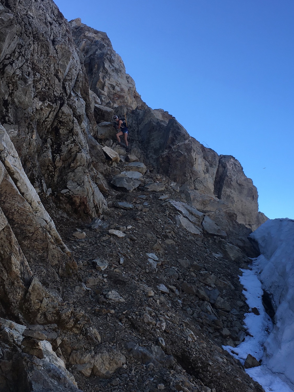
Three Fingers is one of the tougher lookouts in Washington State to reach due to the long distance and possibility for technical route challenges. There have been several search and rescue missions here so don’t underestimate it and be sure to check the weather forecast before going. Three Fingers can be a very challenging place to get stuck in bad conditions.
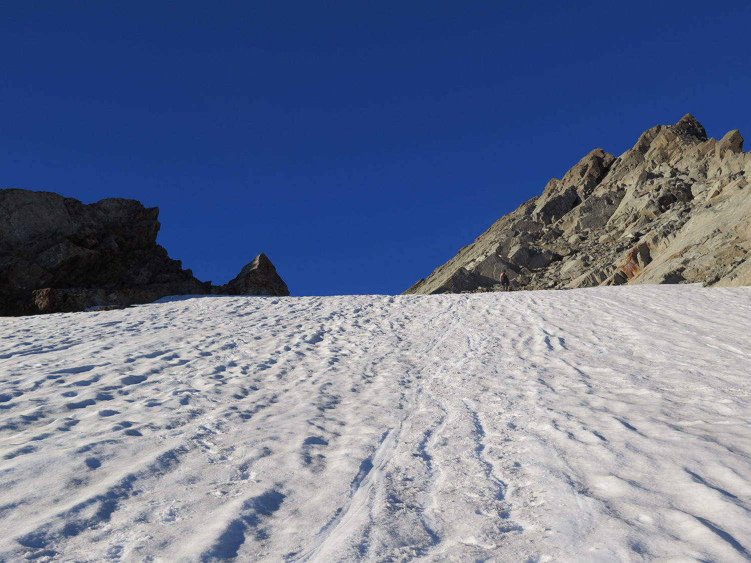
Without technical climbing or mountaineering skills, the best time to visit Three Fingers is late summer, September and October preferable, when most of the approach is melted out. Even then, a steep snow slope lingers below the summit that may or may not require traction devices. Earlier in the season the route has steep snow slopes and moats that require technical equipment and route finding skills.
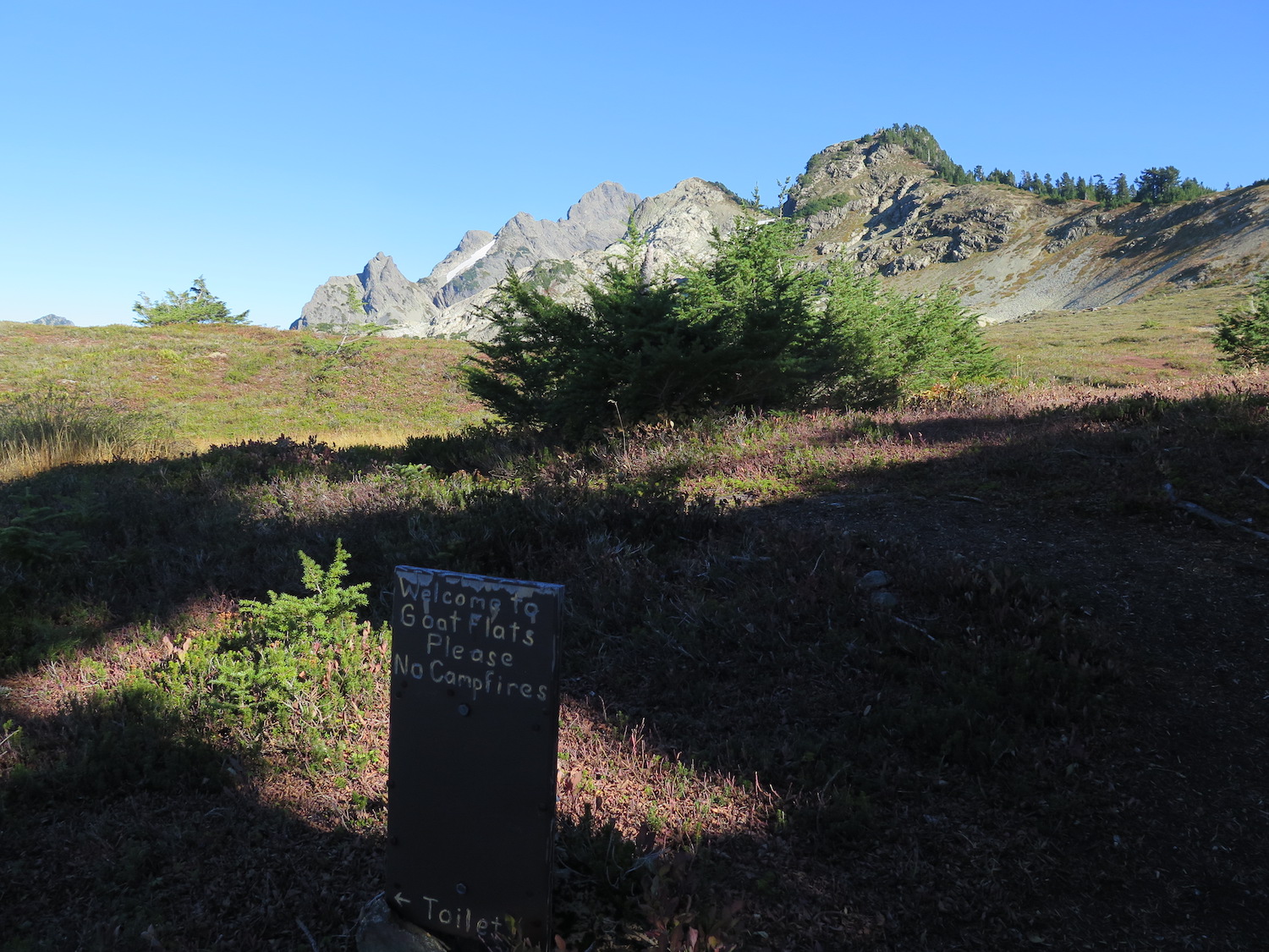
If planning to overnight at Three Fingers, know that it can often be busy and there is no guarantee of a securing space to sleep. Bring camping gear in case the lookout is full it’s precarious perch also means there is no room at the summit for camping. There are a few camping spots at the bottom of the snow slope below and on Tin Can Gap a mile away but the best place for camping is at Goat Flats, 2.5 miles from the lookout.
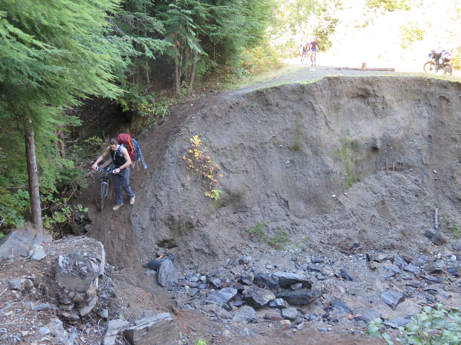
Due to a road washout, getting to the trailhead requires a 9-mile bike ride or walk road. Using a bicycle makes the approach much easier and far faster on the way back down. Starting at the washout, the road climbs consistently but not steeply to the trailhead, gaining about 1,600′ in just under 9 miles. I used a mountain bike on my approach in 2018 though a gravel bike could easily make the trip. The biggest challenge is simply biking up with an overnight pack!
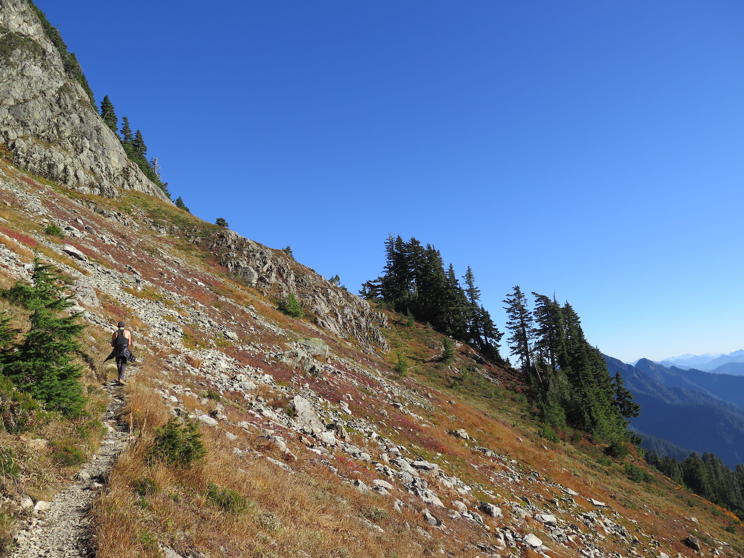
At the trailhead, there are ample places to lock up bicycles out of sight. The first 2.5 miles of trail to Saddle Lake can be a little soggy and during 2018, were littered with blow down. From Saddle Lake, the trail begins to climb slowly above treeline the next two miles to Goat Flats, which makes an excellent lunch break or overnight camp spot. If you camp at Goat Flats, bring bear canisters as bears are known to frequent the area.
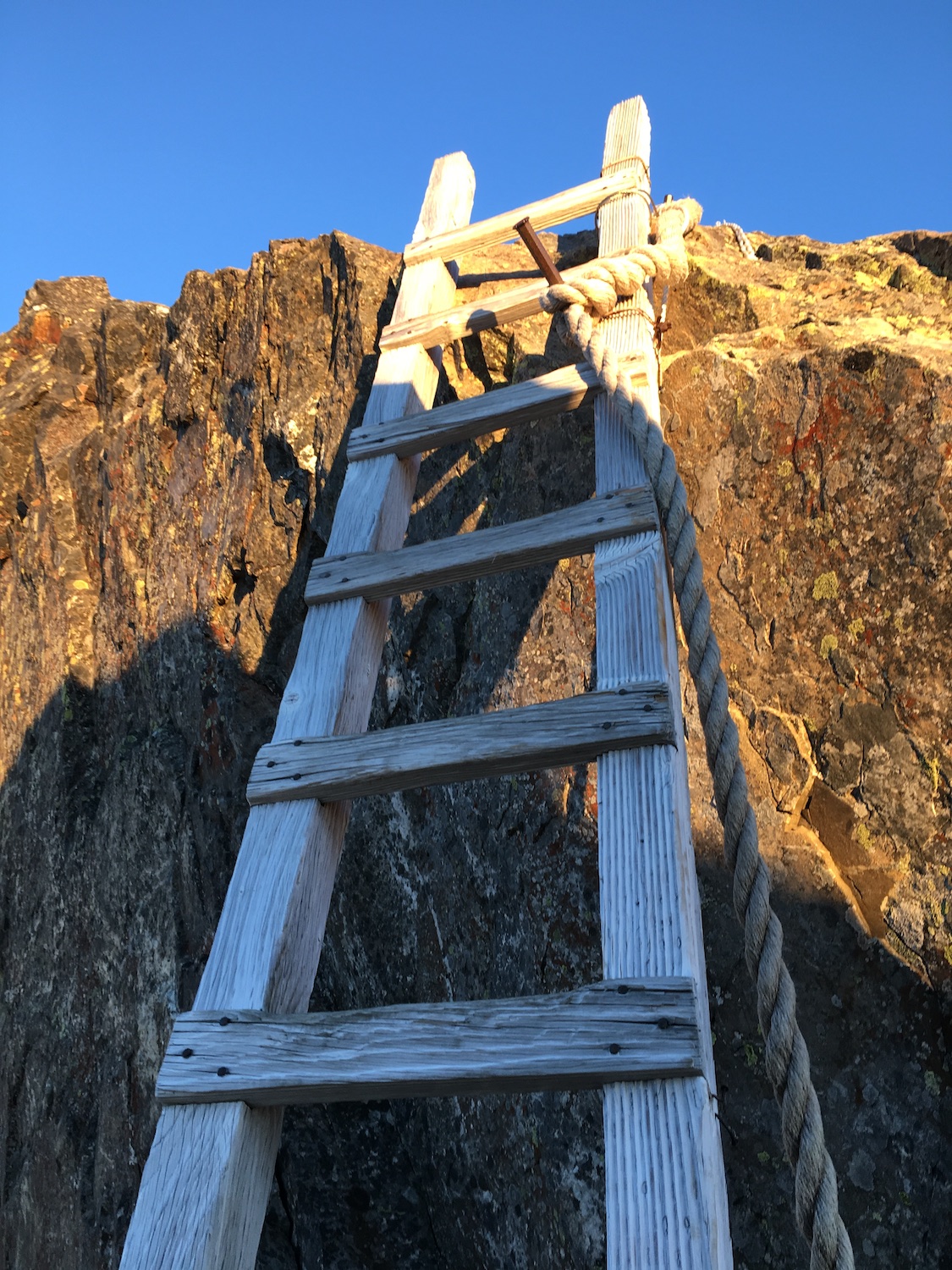
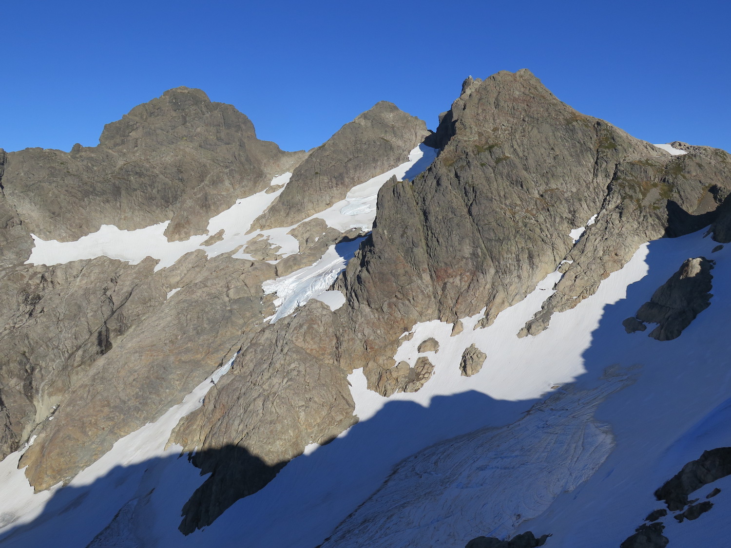
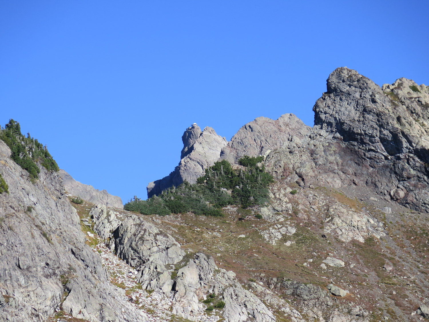
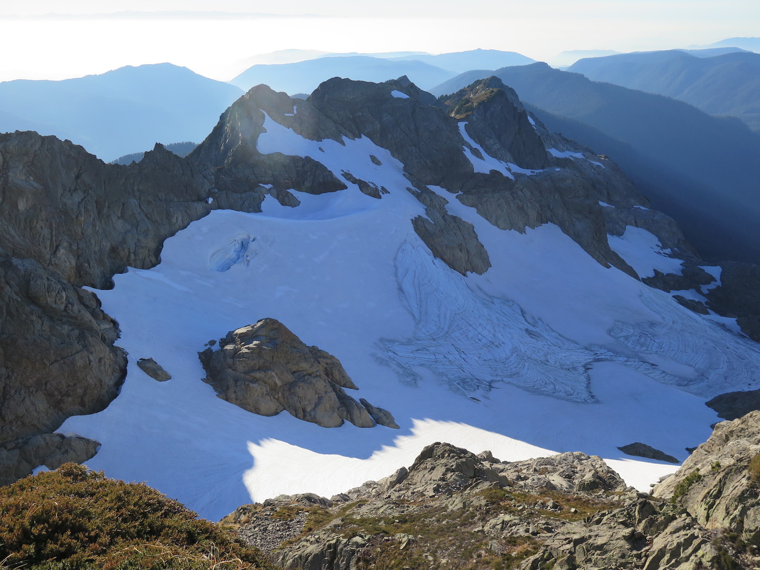
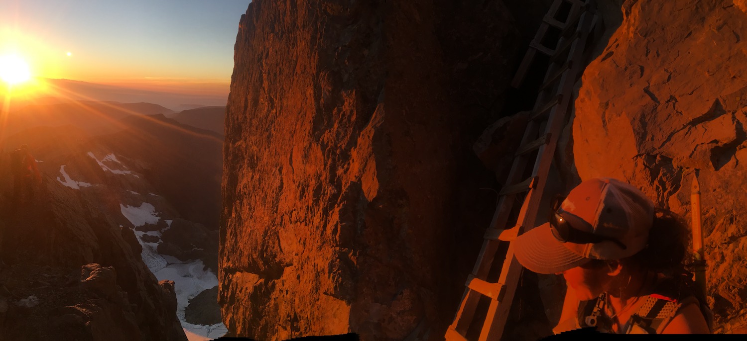
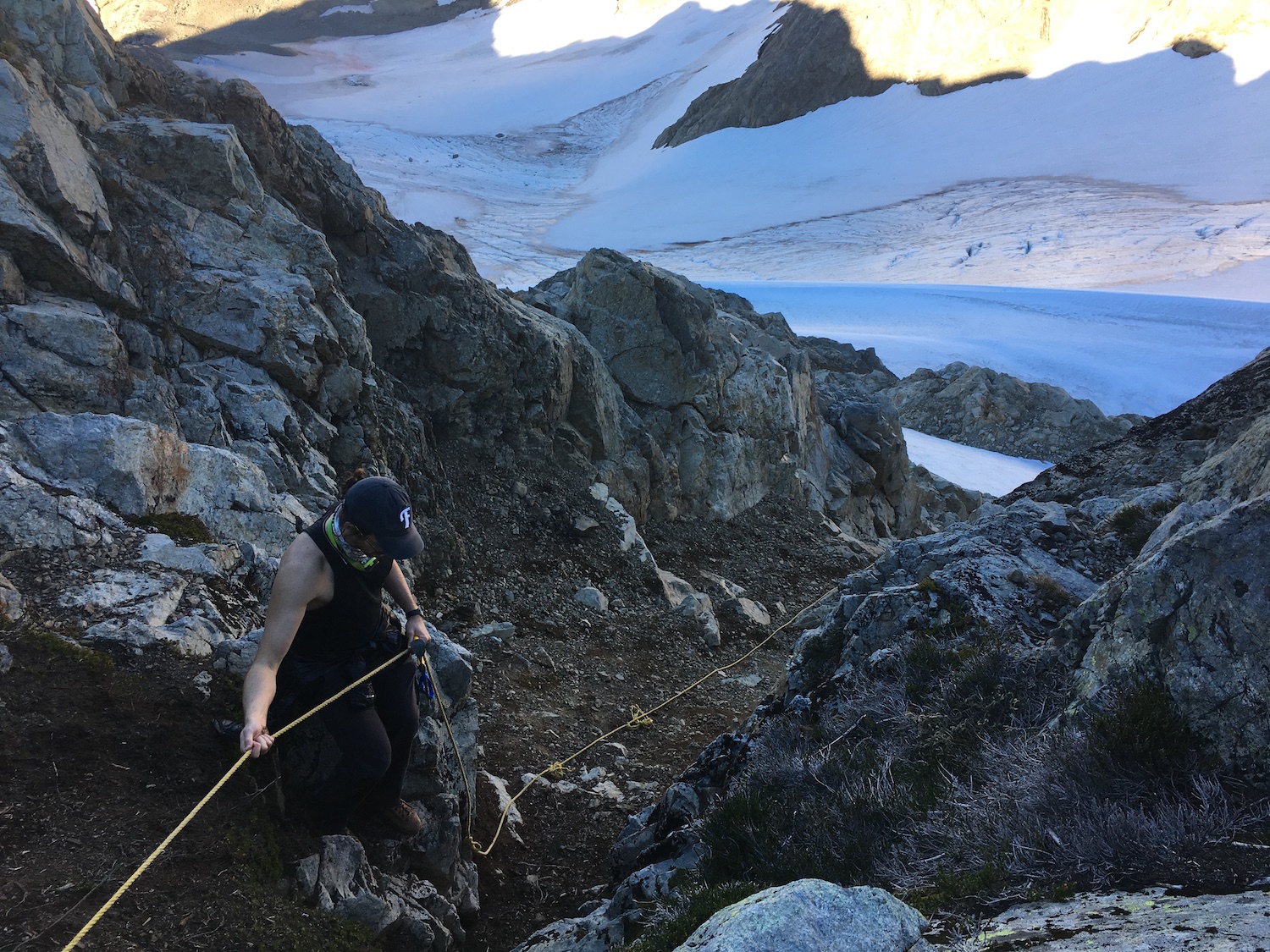
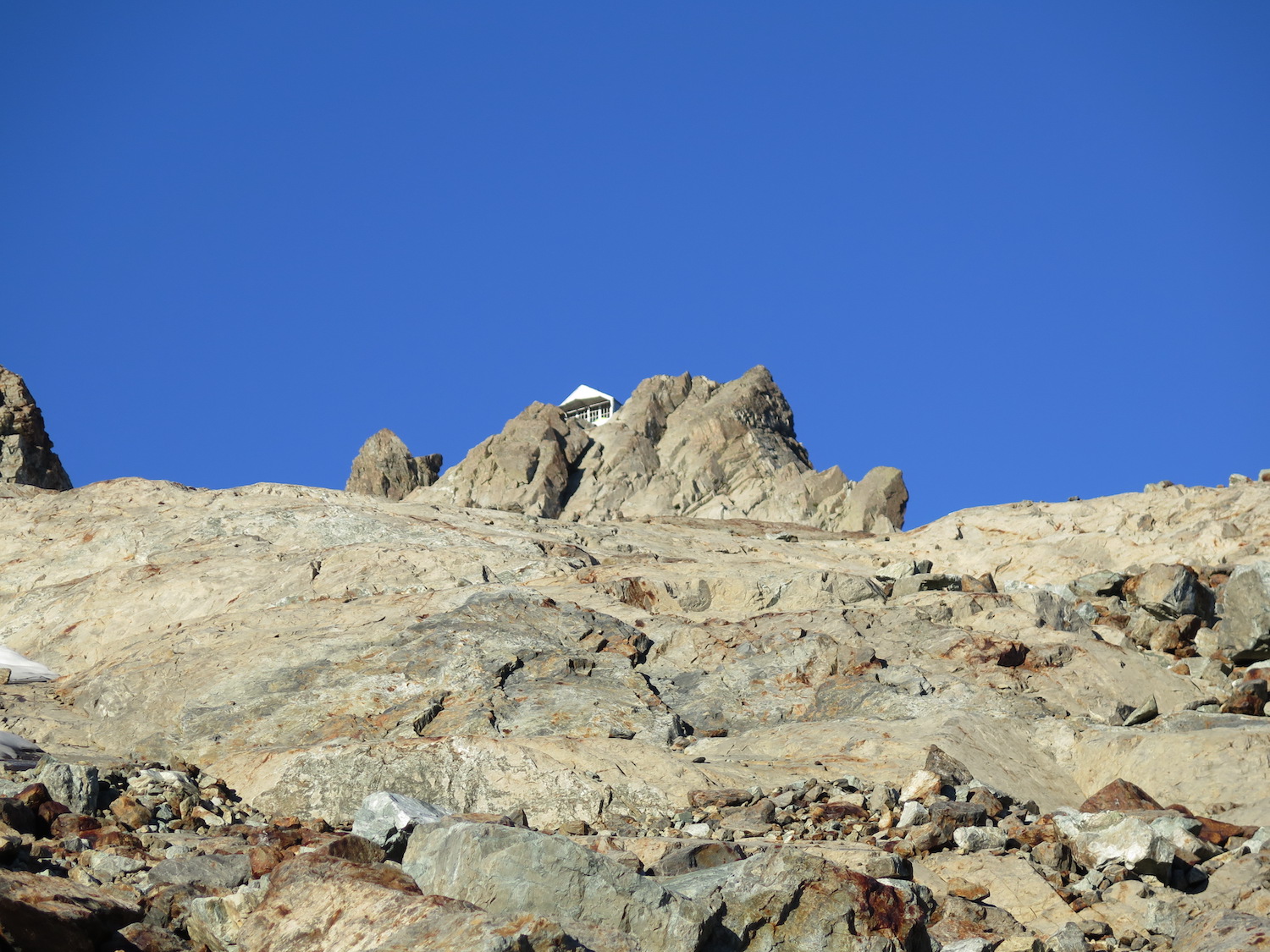
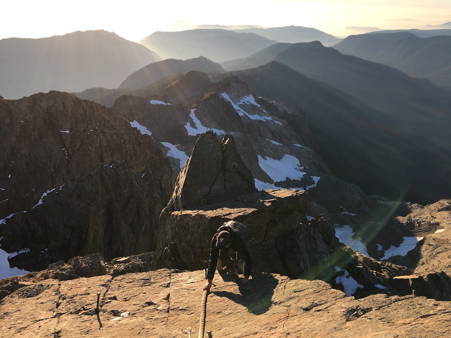
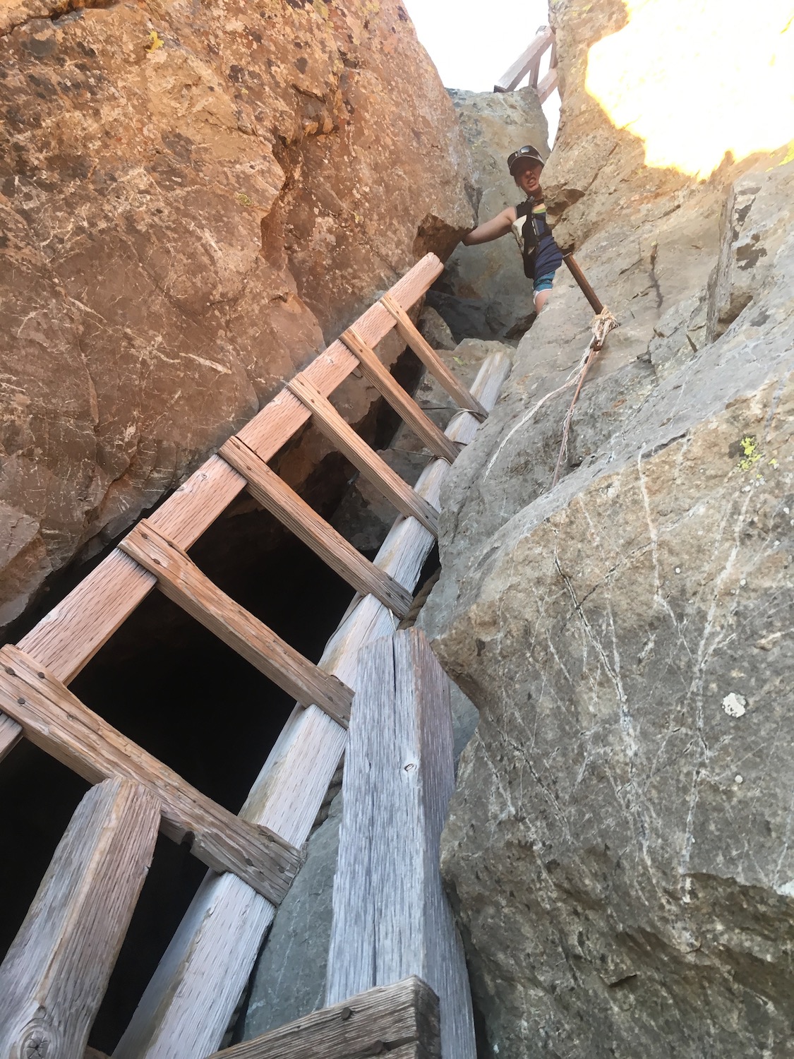
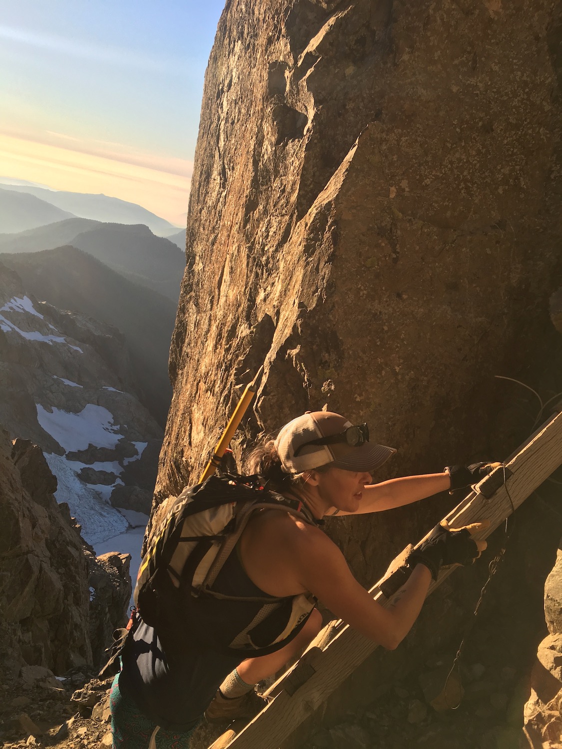
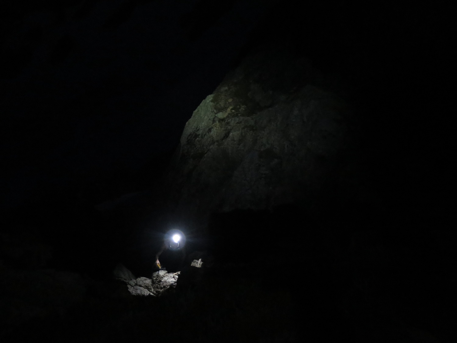
From Goat Flats, the remaining route to Three Fingers can be challenging depending on current conditions. There are places where the trail may cross the Queest-Alb glacier, which can be icy and steep snow fields can linger on the south ridge. Late in the season it’s usually possible to drop into a moat between the glacier and rock, which offers the safest travel. Towards the top of the glacier, the trail traverses back to the south and to the bottom of a snow field that lingers year-round. At the top of the snowfield, the route becomes a rock scramble up to the infamous three ladders, which offer the last technical challenge to reach the summit. The ladders are sturdy enough but the transition between the 2nd and 3rd ladder is tricky and can be difficult to negotiate with a backpack. The top of the 3rd ladder bring you to the summit rock and the unbelievable vertical perch of Three Fingers.
Note: there is an alternative Meadow Mountain trail that cuts off some of the road approach. The trail is unmaintained but recent reports say the route is relatively straight-forward.
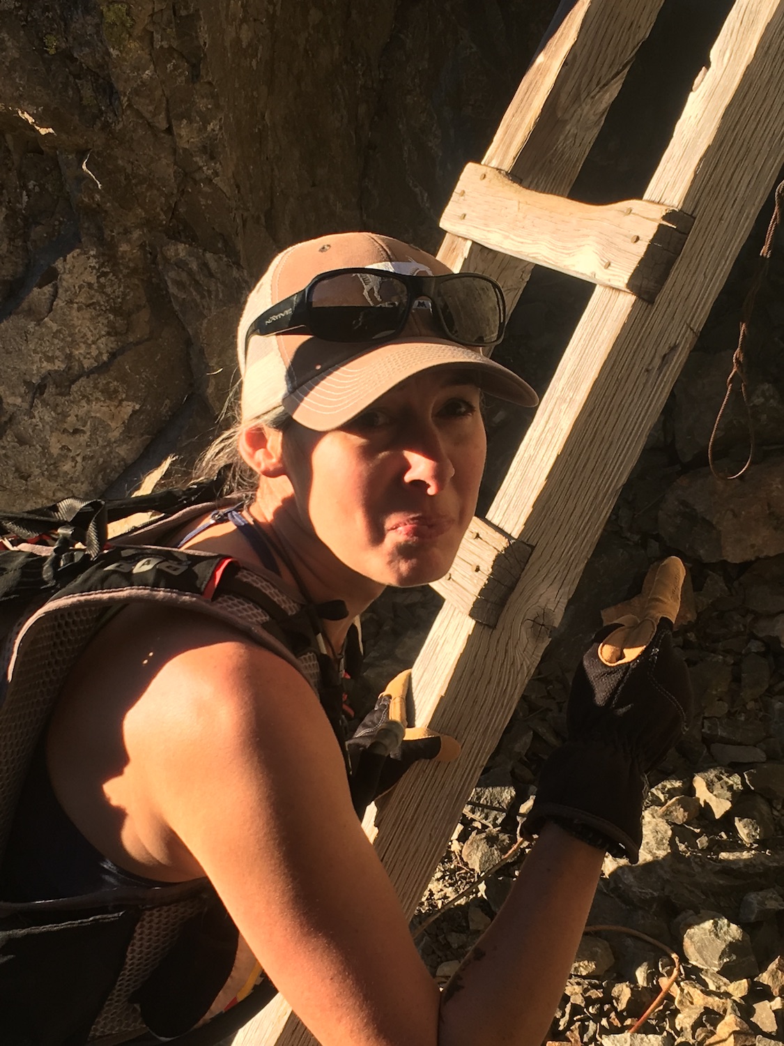
Visiting Three Fingers. And oh, the ladders.
A friend joined me on this outing back in 2018 and we chose to camp below at Goat Flats so we could make the summit an easy up and down day hike with small day packs. I have a notoriously laughable ladderphobia, ironic for a fire lookout geek, which is an endless source of entertainment for my friends. I was absolutely terrified of the thought of climbing the Three Fingers ladders and wasn’t sure I’d make it.
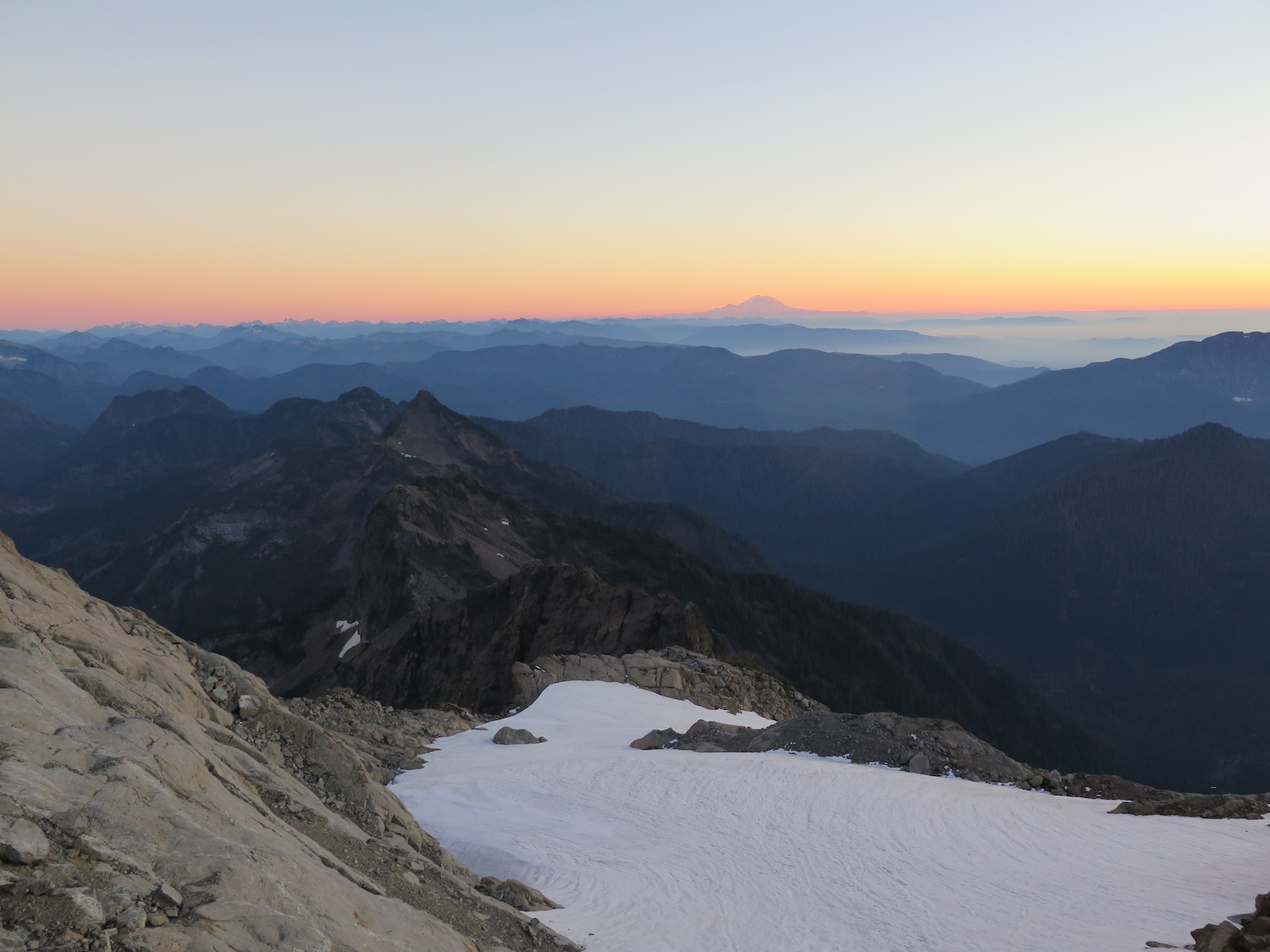
My friend and I kept waiting for a good weather window late in the season to hit the summit and our patience was rewarded in late October 2018. The route was melted out and conditions past Tin Can Gap were about as non-technical and easy as they get! We still carried crampons and an ice axe for safety but the snow field below the lookout was soft with ideal traction.
As far as the ladders? Well, they were certainly sturdier and less exposed than I had feared but the transition from the 2nd to 3rd ladder was quite challenging, at least for me. I’m pretty sure I aged about 10 years getting up the ladders to the summit and I’m so thankful my friend was very patient! Somehow I did it and I laugh now looking at the photos that I had no idea my friend was taking at the time.
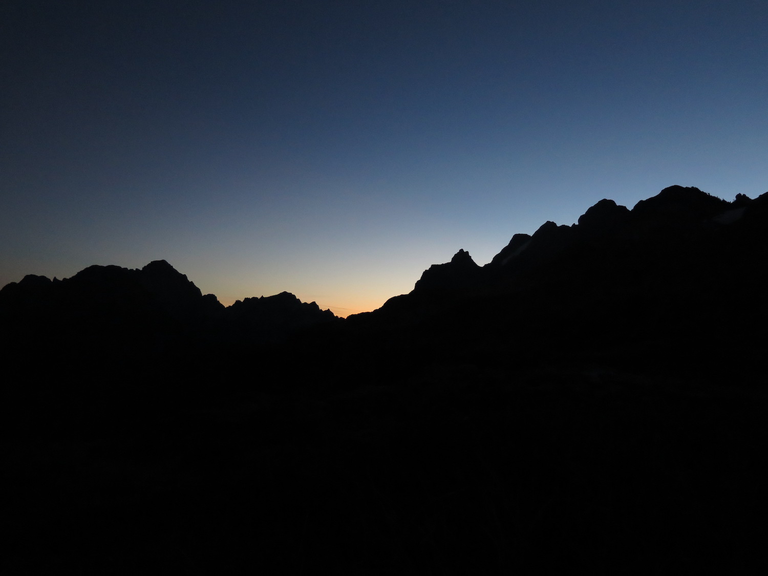
We stayed at the lookout for sunset with a handful of other folks, enjoying the gorgeous views, then descended from the summit block just before dark. Normally we wouldn’t have hiked down a technical route in the dark but the conditions were very favorable. A weather inversion at the time had the lower valleys solidly fogged in and temperatures up high were in the 60s. Hiking back to Goat Flats in the dark, wearing t-shirts and donning headlamps, was a pretty memorable moment.
There really isn’t a spot in Washington more dramatic than Three Fingers! I really hope to return to this one again.
Directions.
Drive the Mountain Loop Highway east about 7 miles from Granite Falls and turn left onto Green Mountain Road/NF-41. Follow the road 8.5 miles to a washout at South Fork Canyon Creek.