
North Cascades | Okanogan Range
Okanogan-Wenatchee National Forest
Location: 48.247253, -119.999132
Summit Elevation: 5,000′
Lookout Type: Crows nest
Site Established: 1918
Current Structure Built: 1918
First Visit: 7/29/18
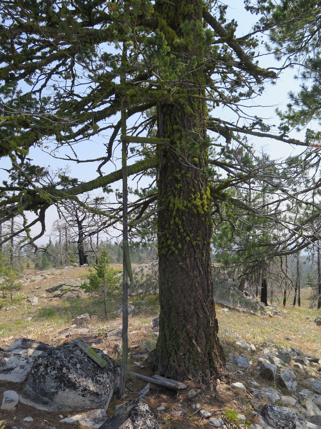
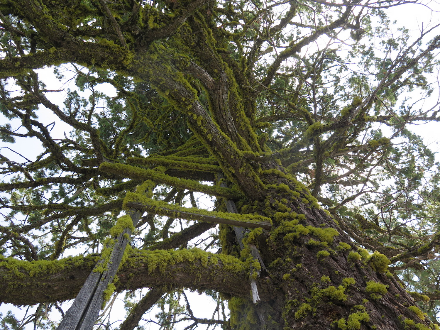
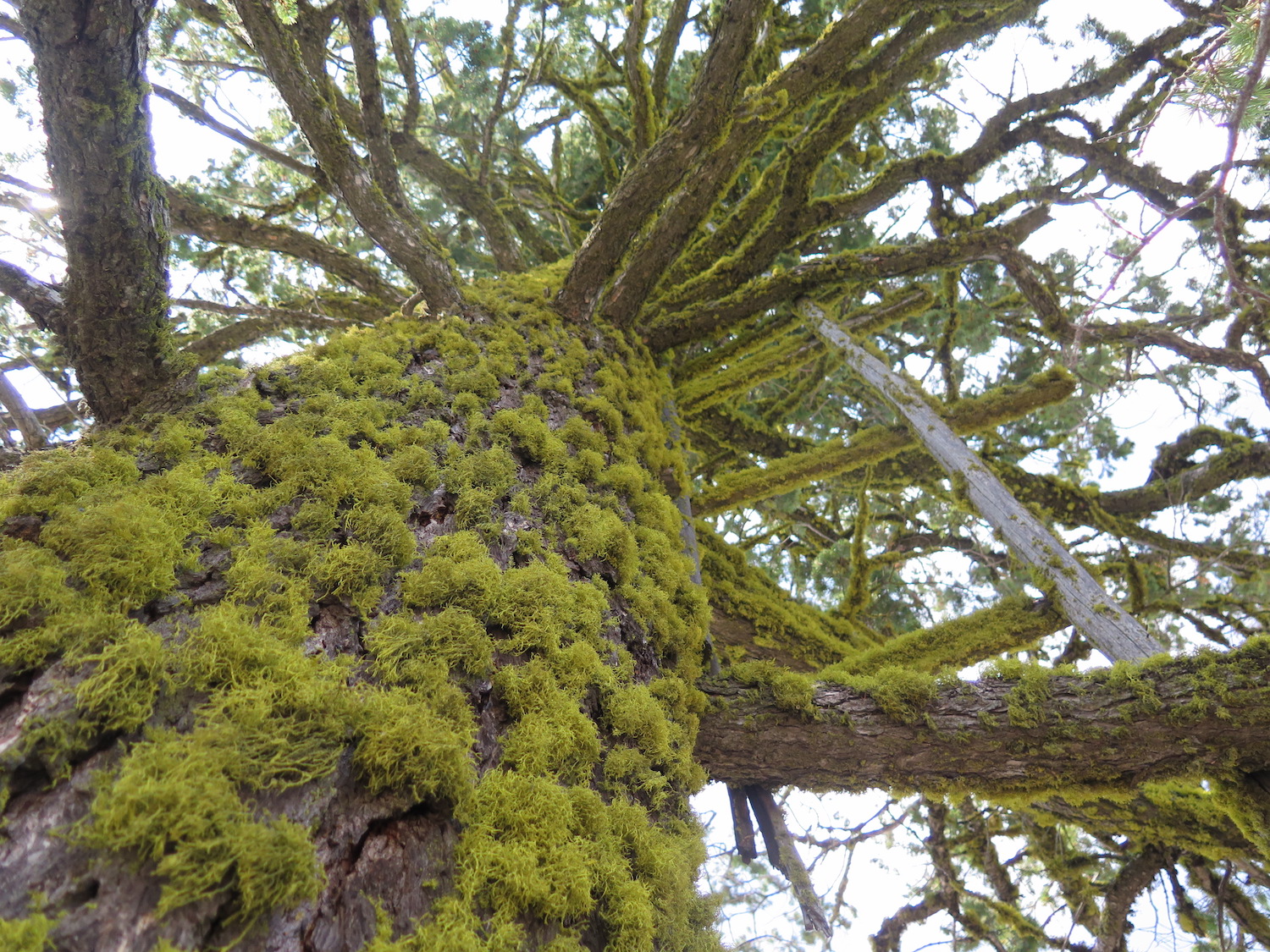
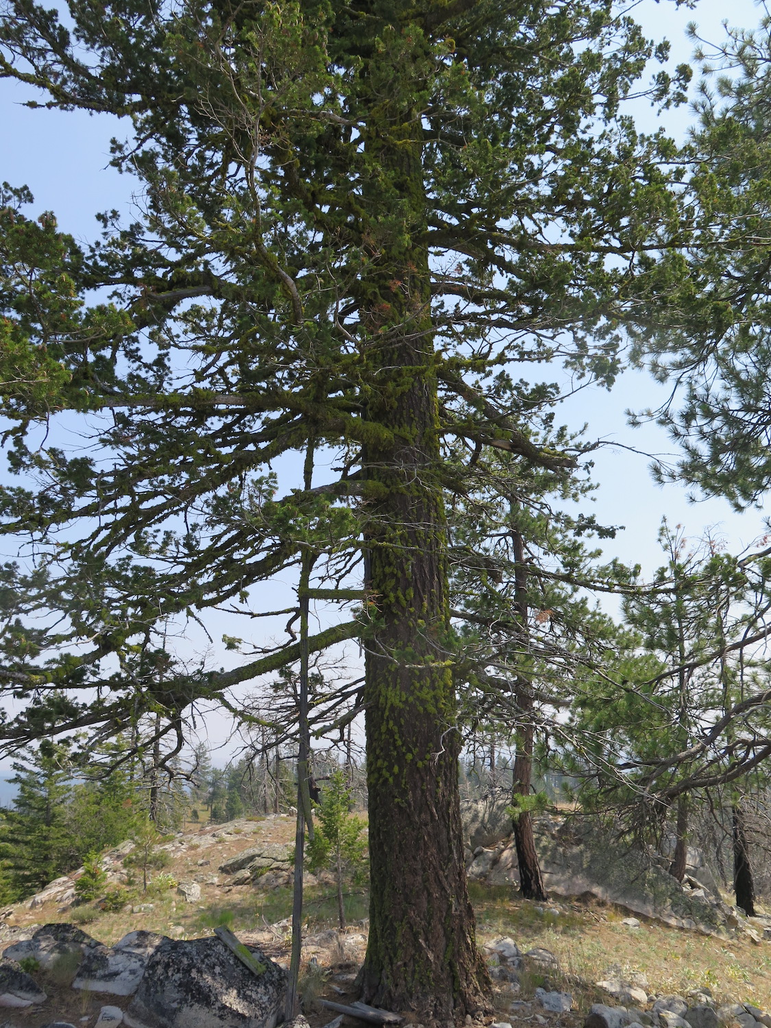
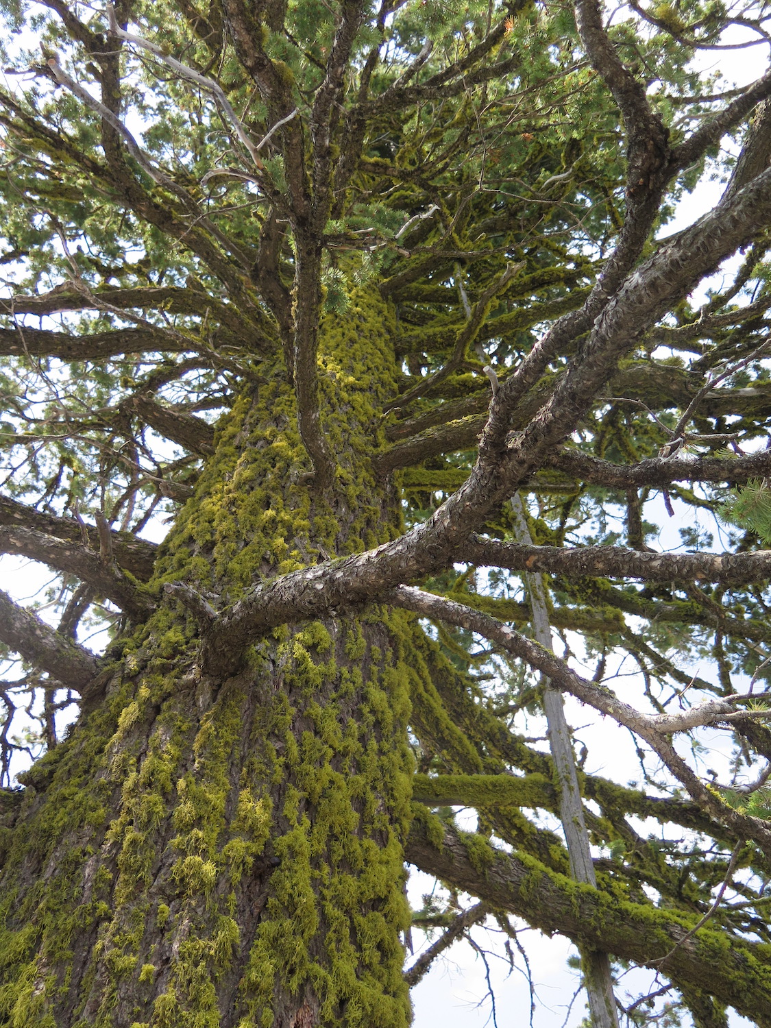
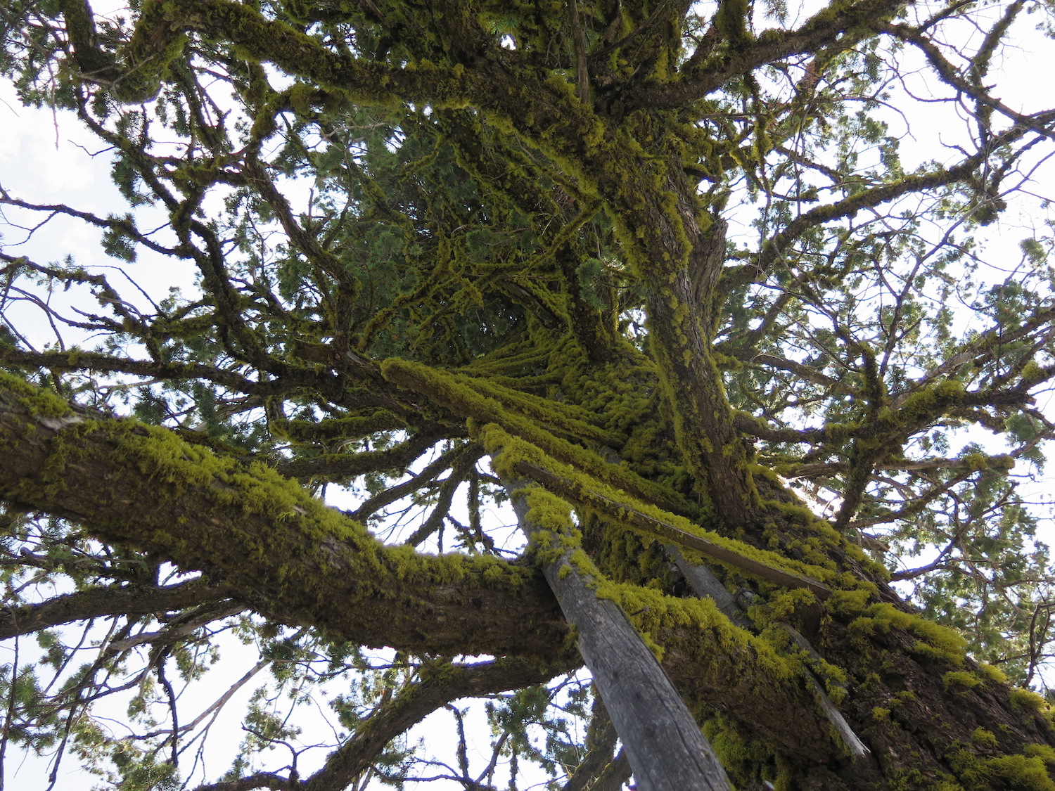
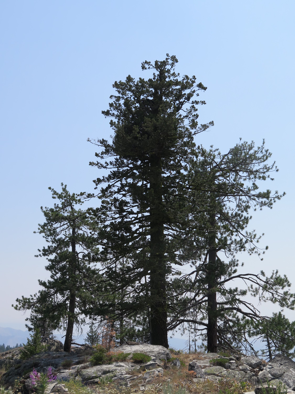
Mount Leecher is well known thanks to “Lightning Bill” Austin, who spent 19 seasons staffing Goat Peak before moving over to Leecher in 2014. What most people don’t know is that Leecher also has a 100+ year old tree top crows nest. Both the lookout and crows nest were nearly lost in the Carlton Complex fires of 2014.
Photos from 2018.
History.
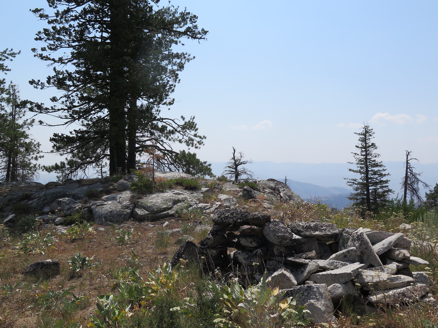
Leecher has had an active history involving many different structures on its summit. The site was first established with a tree top crow’s nest sometime around 1918, roughly 1,000′ south of the present tower. Because of its location further south on the summit, it’s considered a separately existing standing fire lookout. It surprisingly still stands today despite the Carlton Complex fire in 2014 burning neighboring trees.
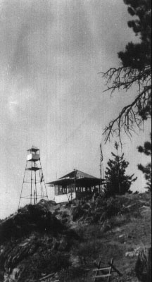
In 1921, a 45′ windmill tower with 6’x6′ cab was constructed on the summit by Coast Culvert & Flume. Then shortly after in 1922, a grand house 18’x22′ log cabin living quarters joined it. A road to the summit was built around 1930 and then in 1936, the log cabin was replaced by an L-4 ground house cab.
The steel tower was moved to the North Cascades Smokejumper Base in 1954 and the L-4 ground cab was sent to Slate Peak, replaced by a new 40′ timber tower with L-4 cab from Chiliwist Butte Lookout. This is the current structure remaining today on the summit, which was restored in 2009.
After staffing Goat Peak for 19 seasons, “Lightning Bill” Austin was sent to Leecher for 2014 and then evacuated that summer by helicopter when the Carlton Complex fire surrounded the lookout. Both the lookout and its crow’s nest amazingly escaped the flames.
The route.
Distance (RT): 2.4 miles*
Elevation Gain: 500′
*It used to be possible to drive to the summit if the gate was open, but as of 2019, Lightning Bill is keeping the gate closed, so be prepared for a short road walk.
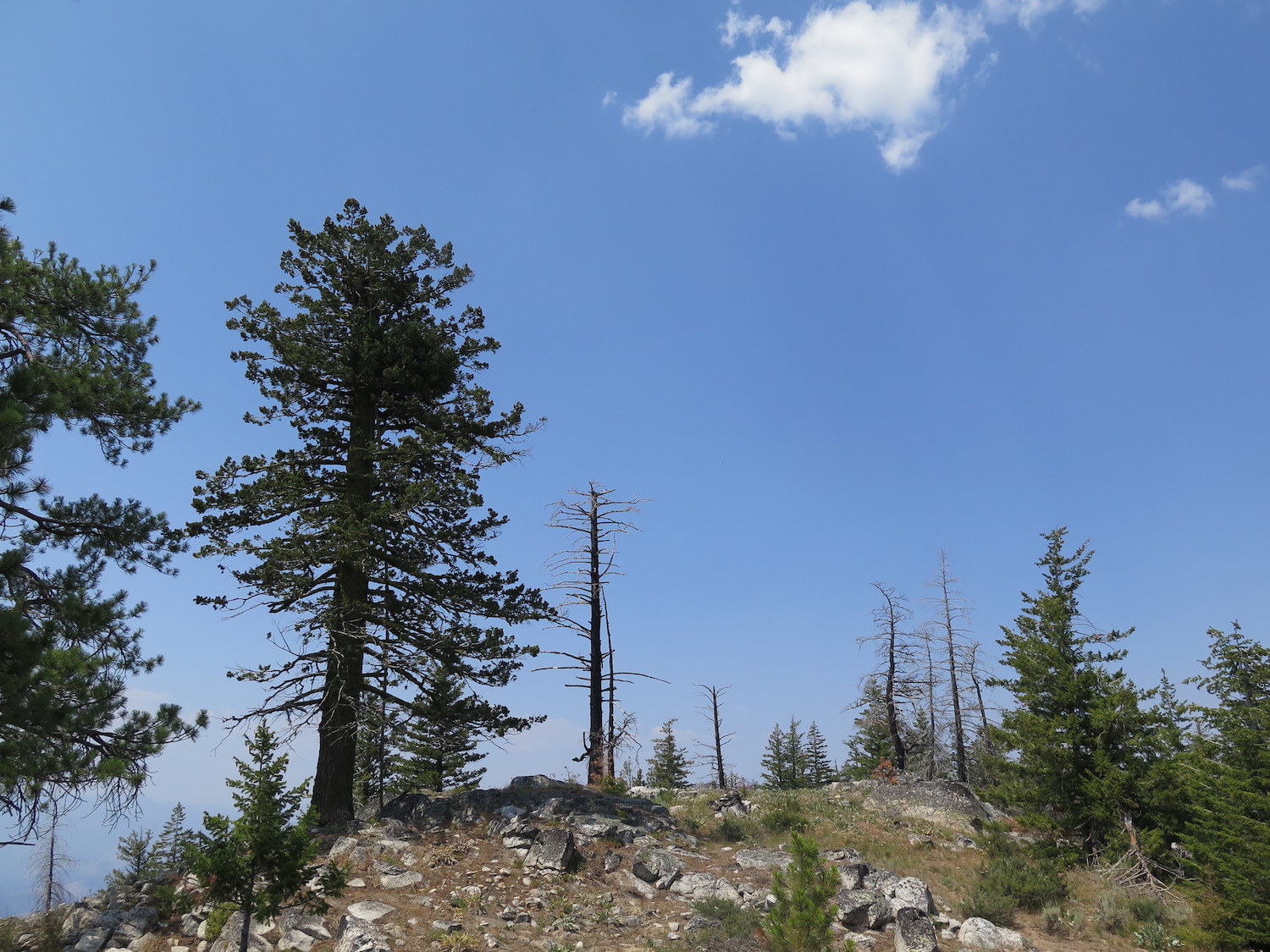
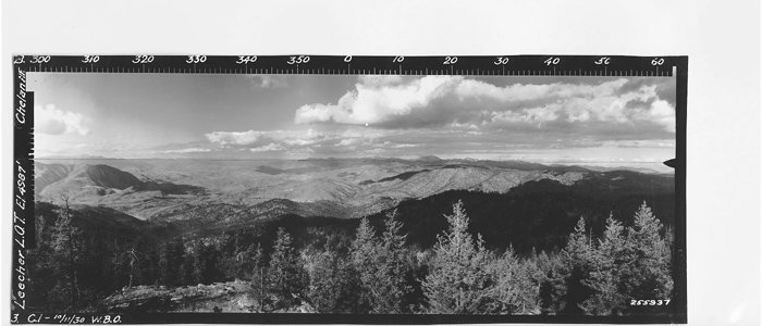
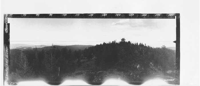
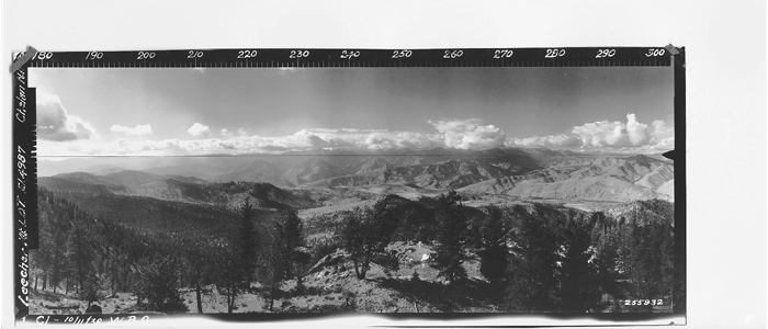
If the road is gated, it’s a little over a mile walk to the lookout. The road is a bit sandy in spots, but a pleasant, scenic hike without much elevation gain. When I visited in October of 2017 the fireweed was brilliantly colored, a stark contrast to some of the dark charred trees from the Carlton Complex fires. The walk to the summit is classic Okanogan, with big views, blue skies, ponderosa pine, douglas fir, and dry grass and shrub.
The Leecher Lookout is locked if not staffed, but you can climb the narrow steps and enjoy the sweeping views of the entire Okanogan Valley from just beneath the cab, or visit when “Lightning Bill” is on duty. I make a trip to this lookout every year to chat with Bill, he’s an incredibly friendly guy with a wealth of history and knowledge!
*The crows nest tree is located a short walk southeast of the fire lookout on a knob at approximately 5,000′.
Directions.
From Twisp, drive east on Highway 20 for 2 miles, then south on Highway 153 for 3.1 miles to a left turn onto Benson Creek Drive (Forest Road 4150). Follow the road 9.8 miles to a junction with French Creek Road. Turn right and keep right at the fork 0.6 miles later. Follow the road the remaining 3 miles to a small parking area at a locked gate, or 4.7 miles to the summit if the gate is open. The road is sandy and rough in places, so high clearance or 4×4 is strongly recommended!