North Cascades | Okanogan Range
Okanogan-Wenatchee National Forest
Location: 48.6313167,-120.7815098
Summit Elevation: 6,960′
Lookout Type: L-5
Site Established: 1930s
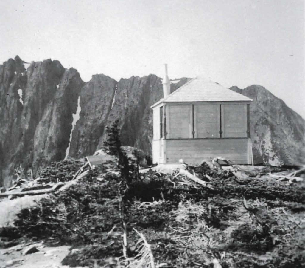
Current Structure Built: 1934
Date Visited: 10/14/18
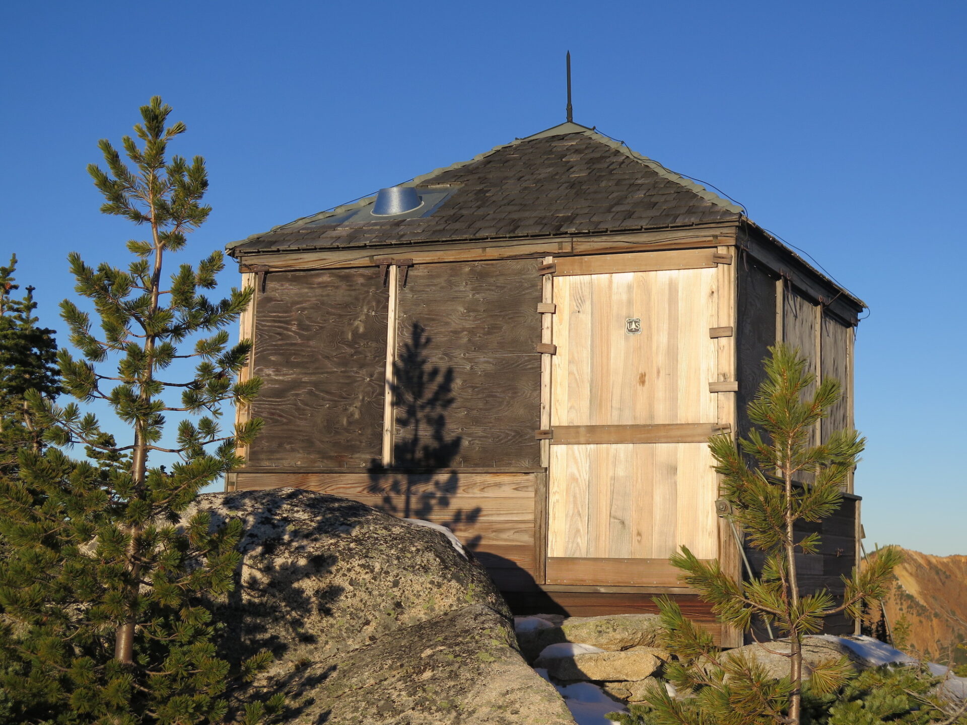
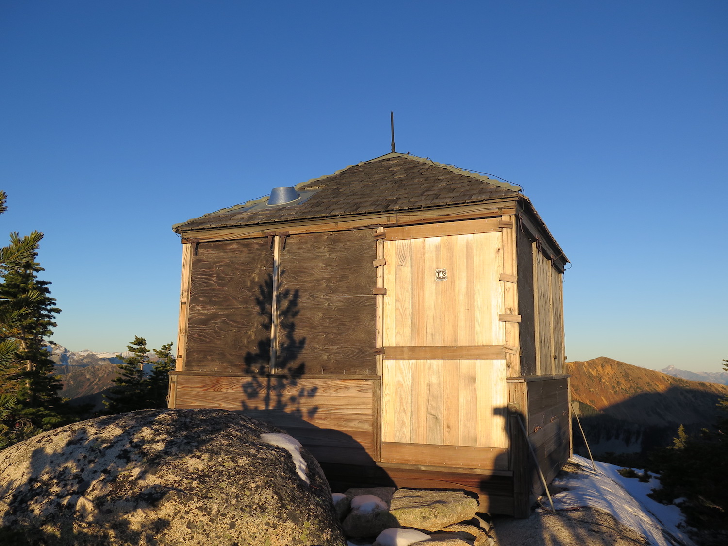
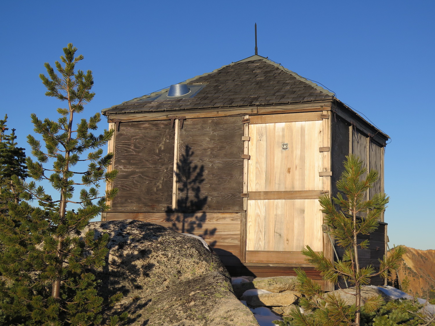
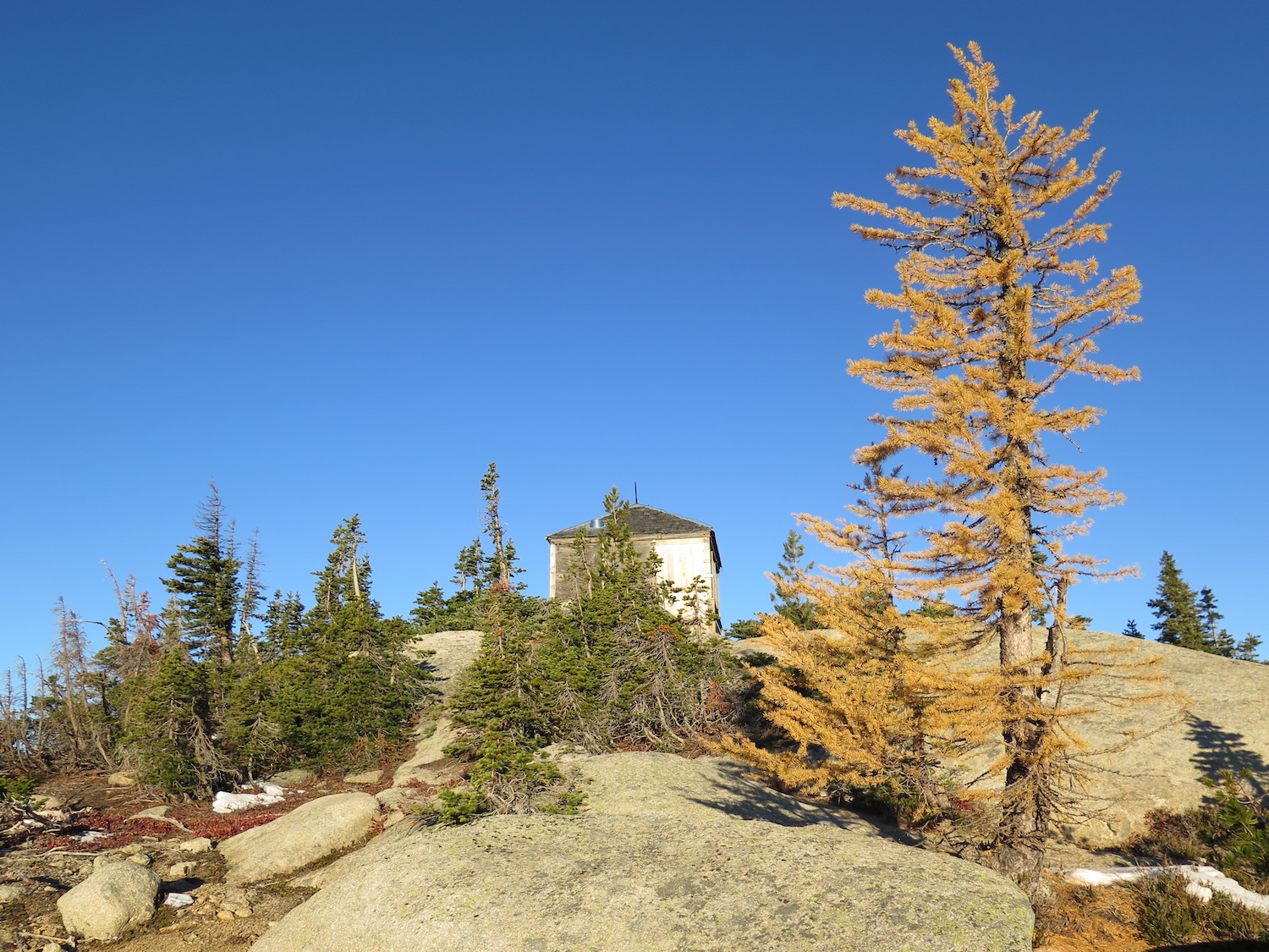
Ah, Mebee Pass! This tiny rare L-5 lookout is my absolute favorite fire lookout in Washington State. Not only is this lookout in an extraordinary location right in my own backyard but it’s an adventure to get to and it’s the last known standing L-5 of its kind. This truly is a historical gem!
Photos from October 2018.
History.
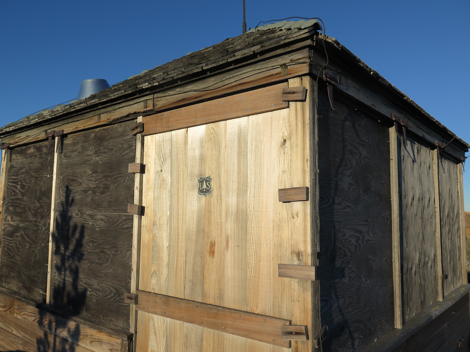
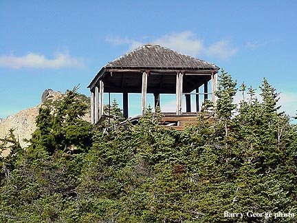
The Mebee Pass fire lookout is believed to be the last remaining L-5 of its kind. These tiny 10′ x 10′ structures were prefabricated and typically hauled into a secondary lookout site by horse or mule by the US Forest Service and temporarily staffed during times of high fire danger.
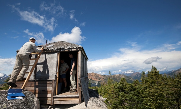
Two members of the Forest Fire Lookout Association hiked up to Mebee in 2002 and found the structure severely neglected and barely standing. A helicopter was used to bring in materials to do emergency repairs.
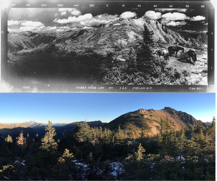
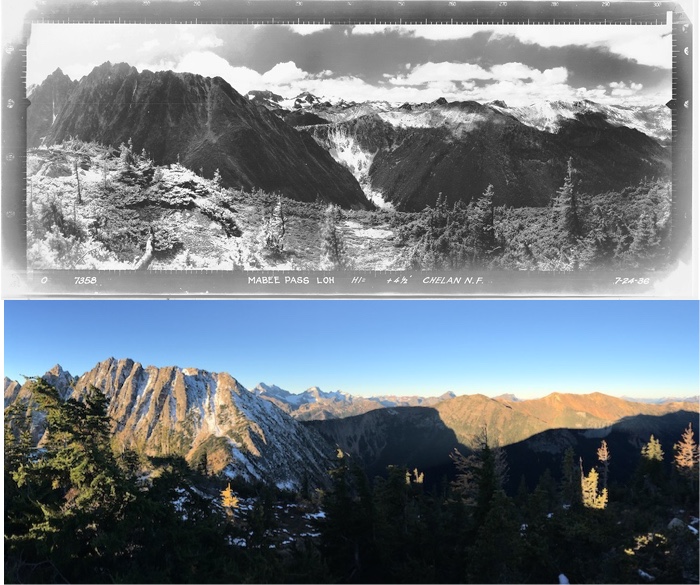
John Scurlock, a well-known talented aerial photographer based in the North Cascades, photographed Mebee on flights in 2006 and 2008. During a flight in 2013 he became concerned that the frail lookout wouldn’t last much longer and spearheaded a restoration effort as well as the creation of the “Friends of Mebee Pass Fire Lookout” organization.
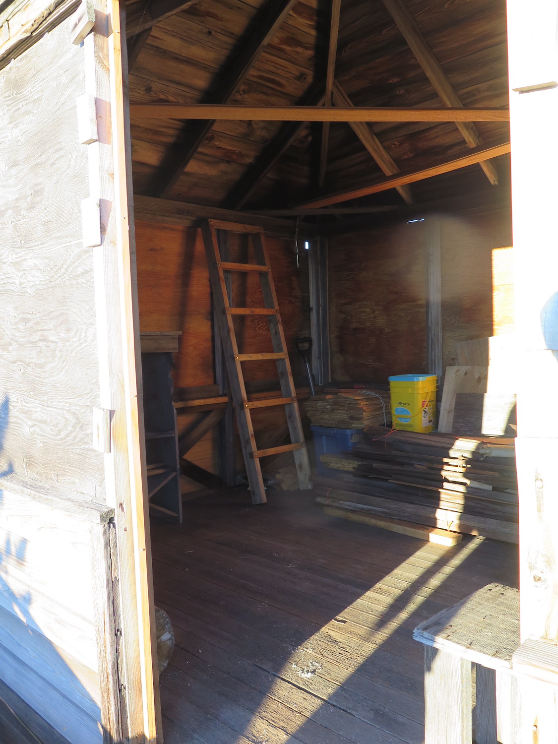
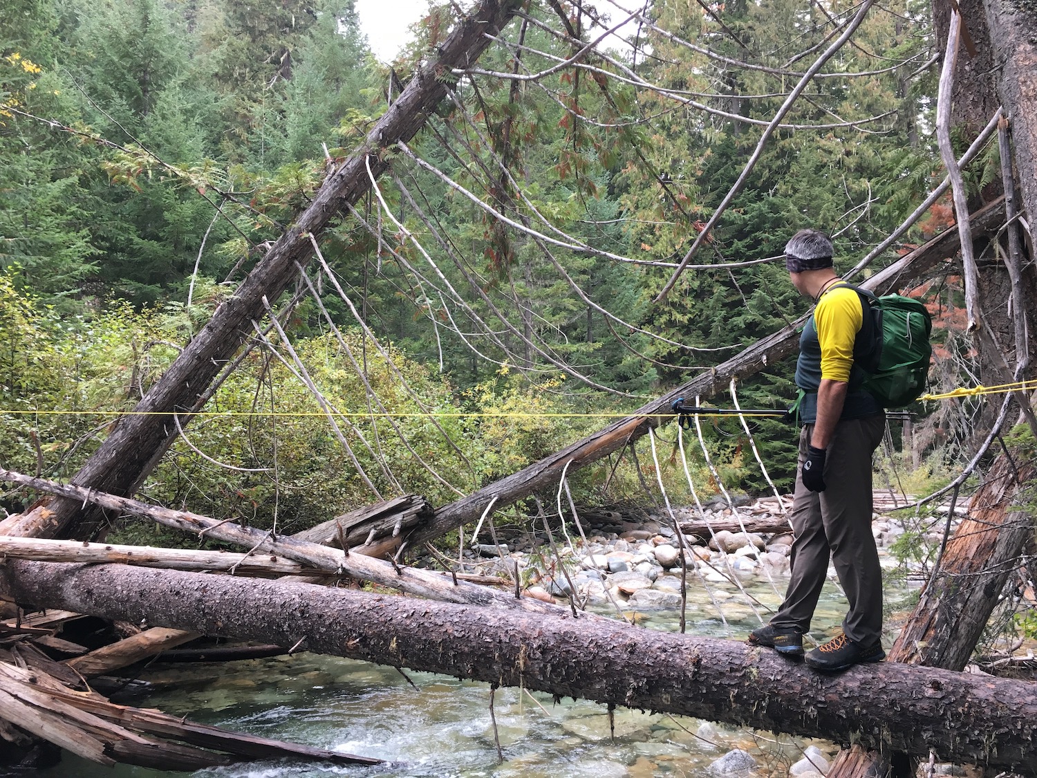
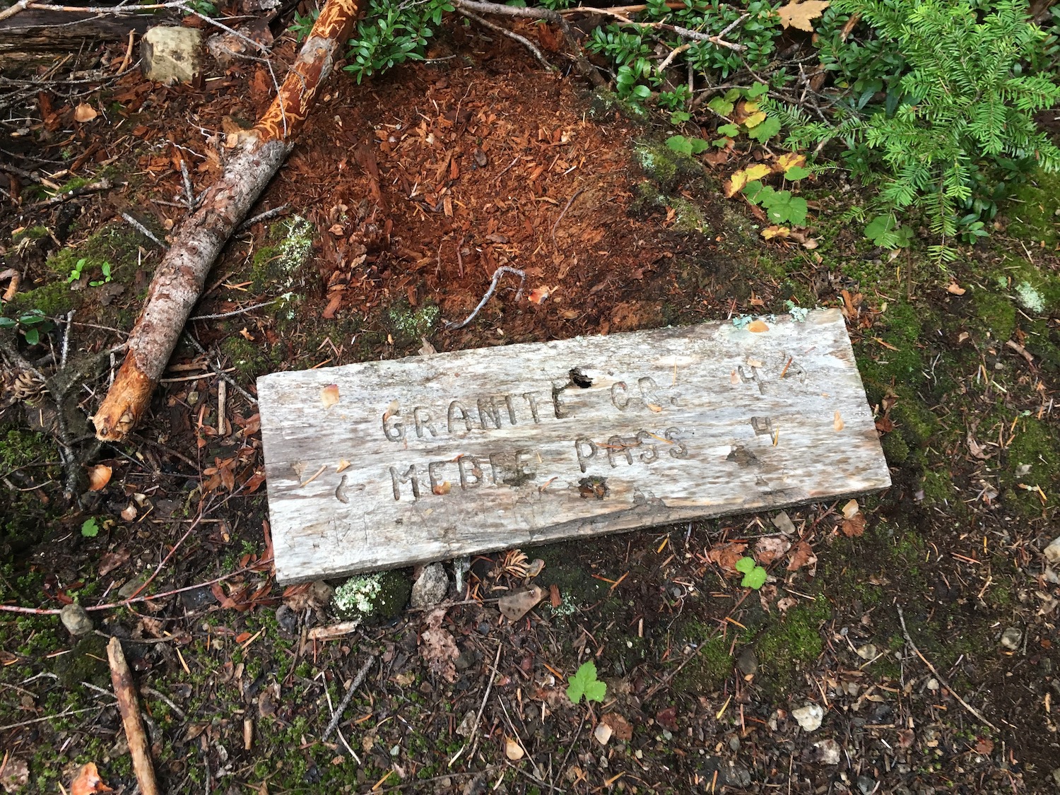
In 2013, Scurlock partnered with several volunteers and the Methow Valley District Ranger Mike Liu to clear the neglected trail to Mebee to begin restoration efforts. The crew sawed through hundreds of fallen trees and rigged a rather treacherous log crossing across Granite Creek, where a bridge has been out for years. It took them much of the summer of 2013 to clear the trail. With $3,000 of donations in the bank, the crew was able to repair the foundation, replace the roof, repair deteriorated walls, and install a lightning rod. Hi Line helicopters of Darrington assisted in flying in 1,100 pounds of equipment that included lumber, siding, posts, crew supplies, and specially ordered Alaskan yellow cedar shingles.
Scurlock and crew were attentive to historical detail to maintain the structure’s integrity. Their herculean efforts saved this wonderful historical structure for generations to come. Another round of work parties to install windows, shutters, and a proper door are in the early planning stages for possibly 2022. If you’d like to be involved or make a donation, contact the Friends of Mebee Pass Fire Lookout.

The Mebee Pass adventure.
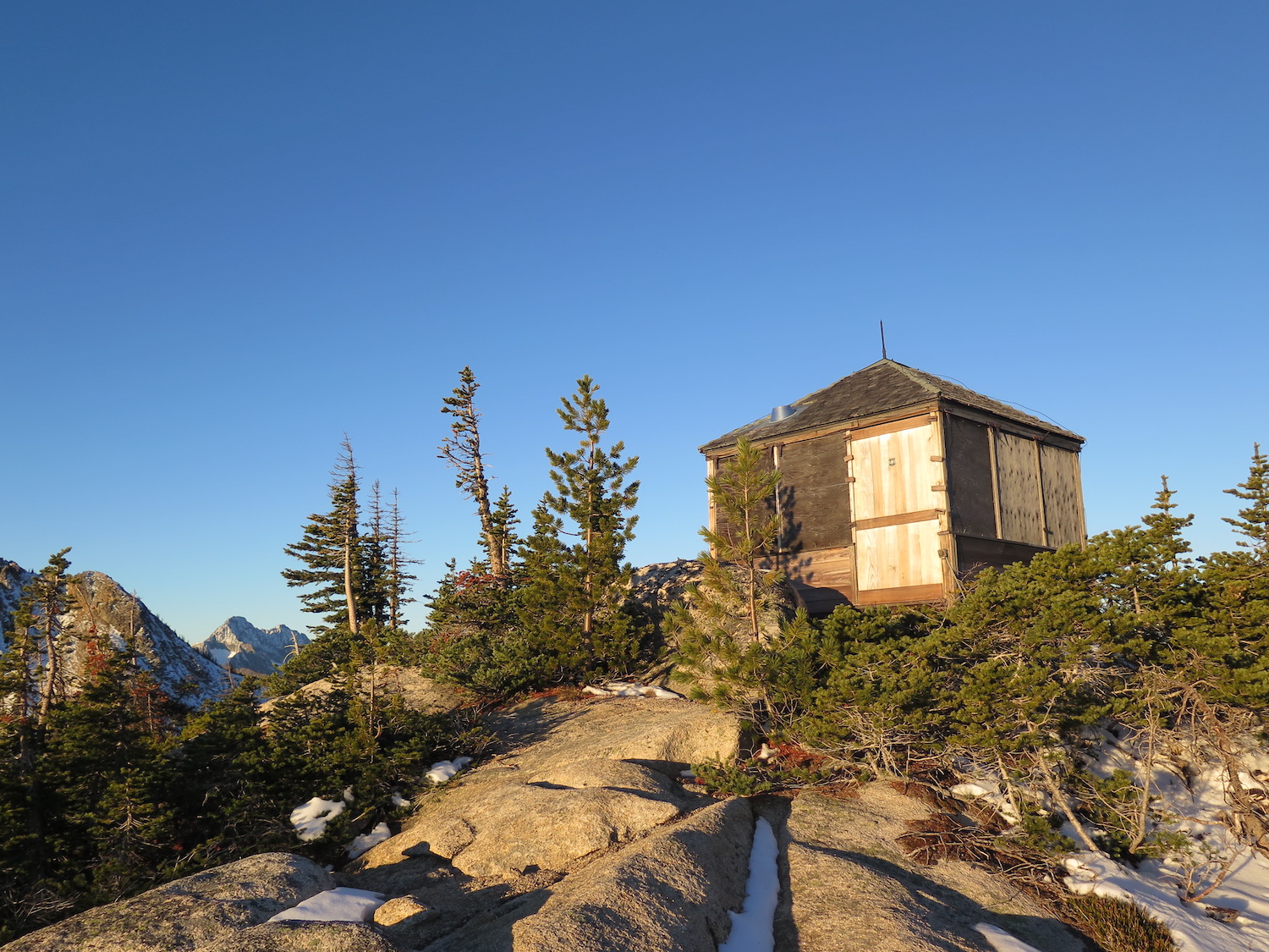
Mebee Pass is my absolute favorite fire lookout in Washington. The tiny little L-5 is not only unique among the last standing Washington fire lookouts but it’s also the last of its kind anywhere. I love the remote area of the North Cascades surrounding this lookout and I especially loved the adventure of getting there.
When I first visited Mebee in October 2018 there were no trip reports, no flagging, and very few had been up there recently besides Scurlock and volunteers. It was of course one of my very favorite adventures!
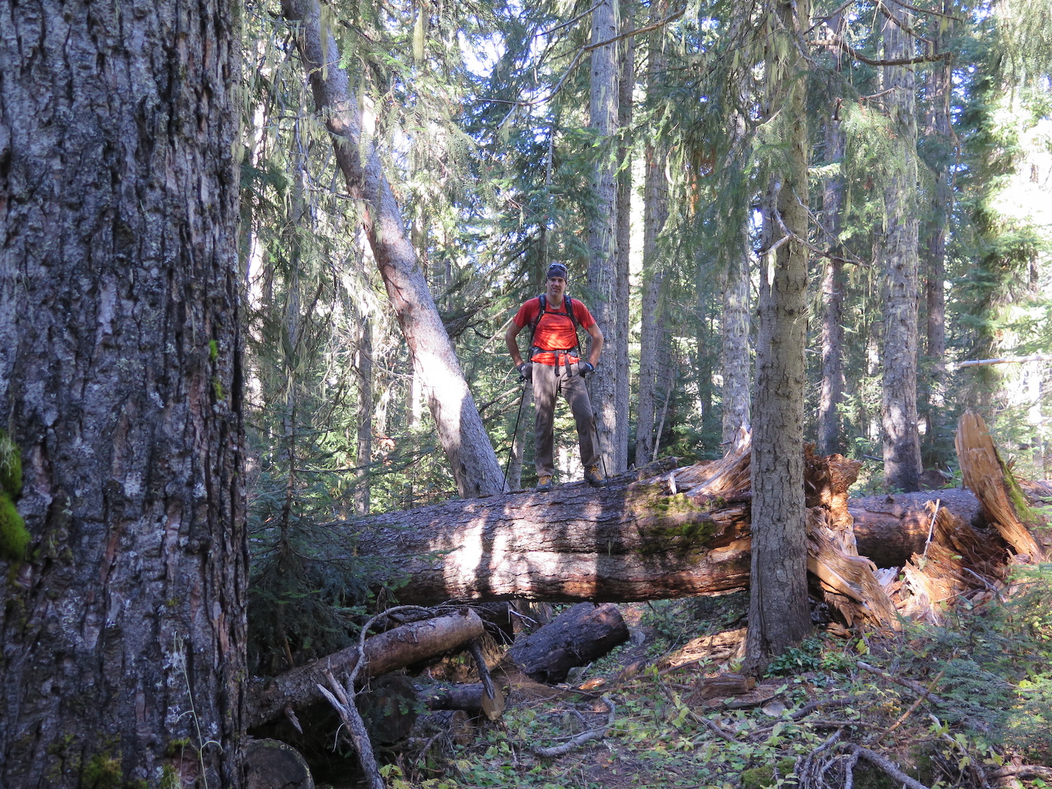
The day prior to visiting Mebee, I had day hiked 20 miles round trip to the Copper Mountain fire lookout in just under 5 hours. Thanks to over 200 downed trees and numerous route finding challenges, it would take me 6 hours to hike the 8 miles one way to Mebee. Talk about two very different experiences and one big weekend!
Mebee was one of the few lookouts I didn’t do solo. My partner at the time, Nick, who wasn’t fond of hiking trails, came along only because I told him I doubted there would be a trail. I was mostly right!
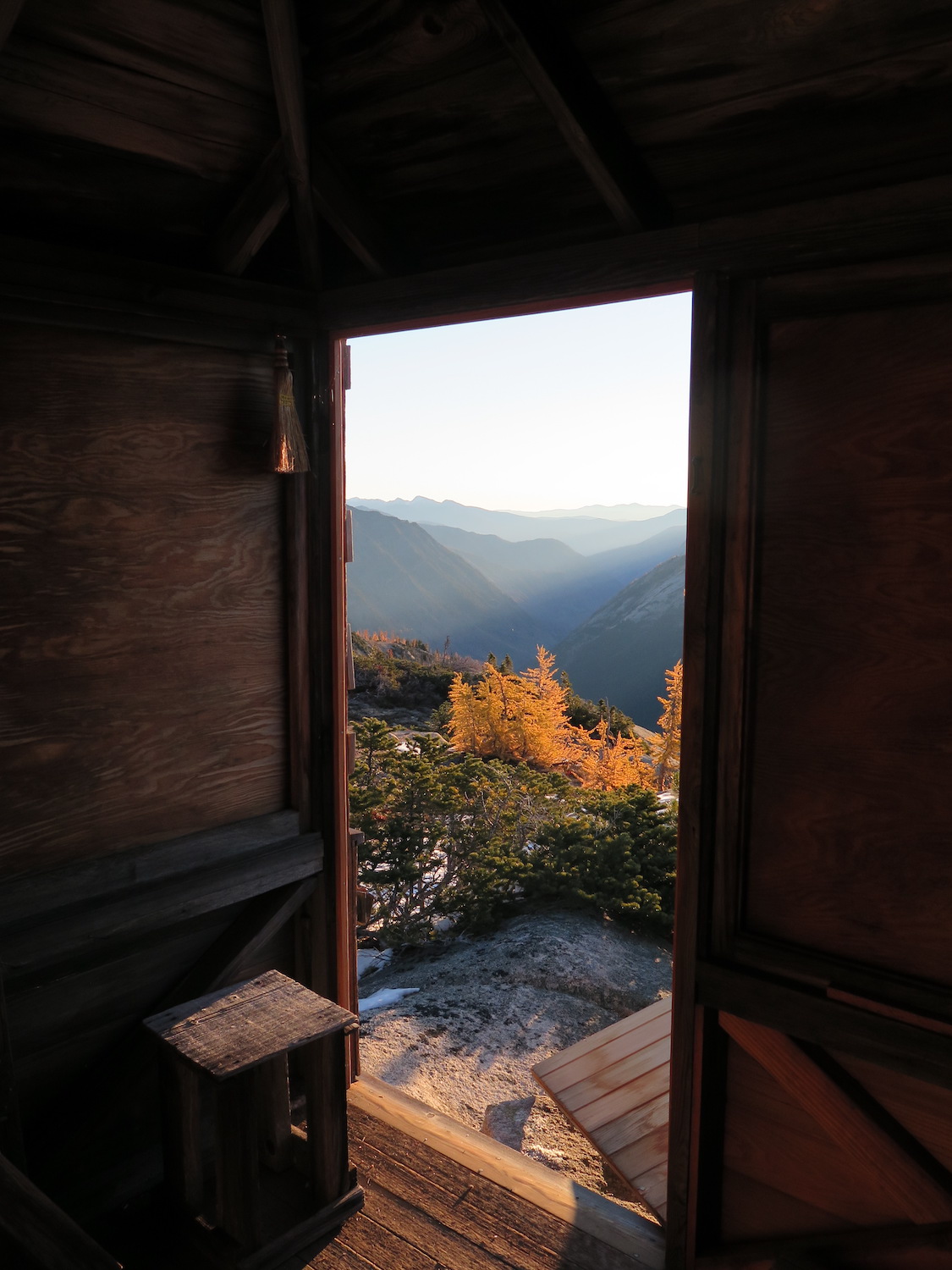
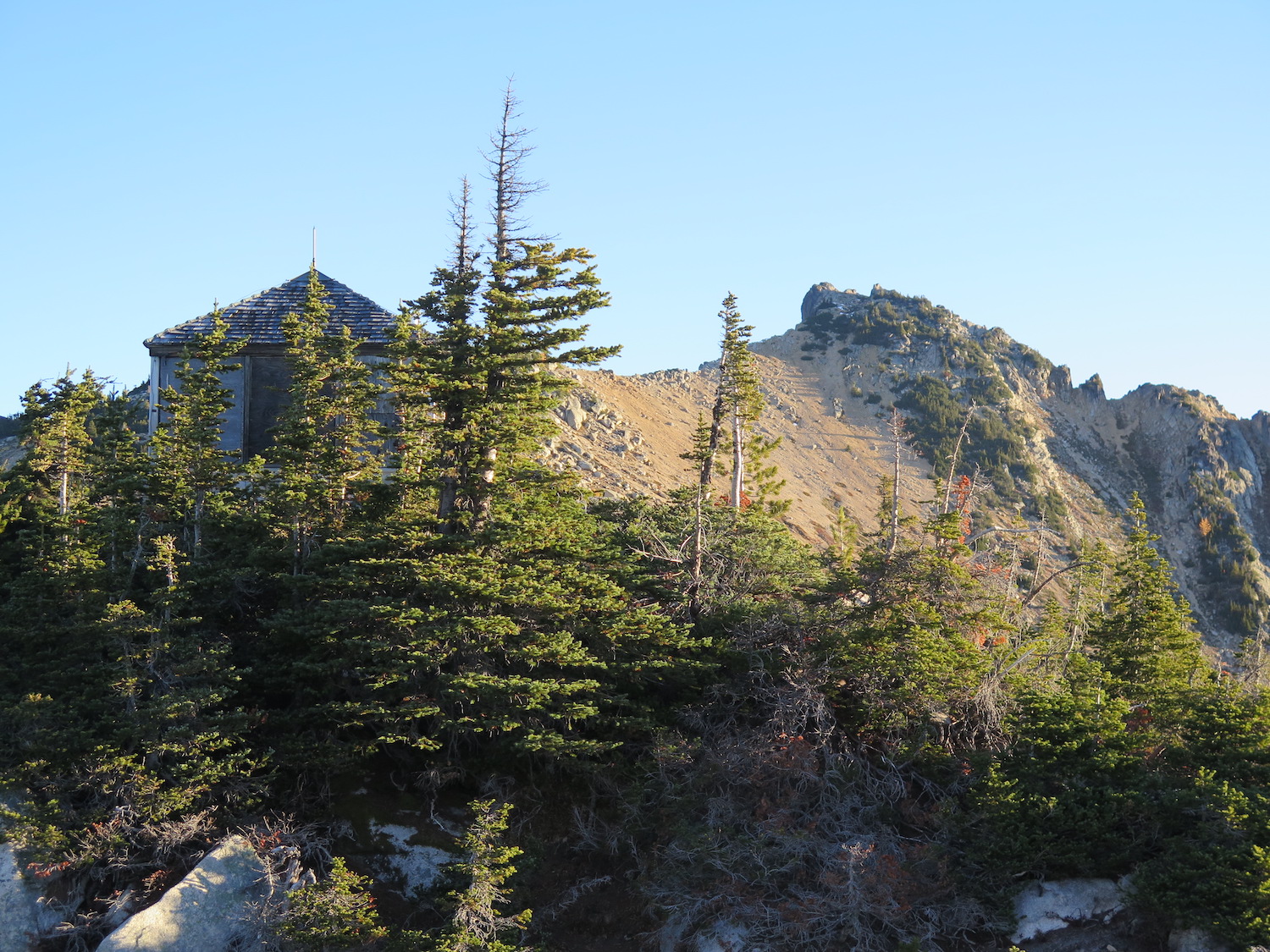
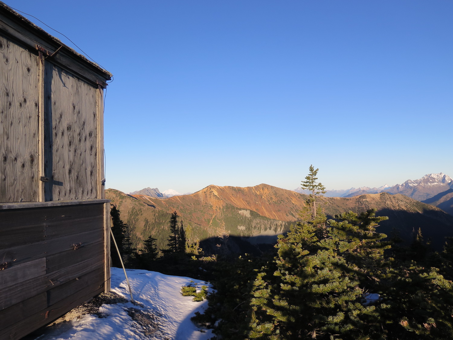
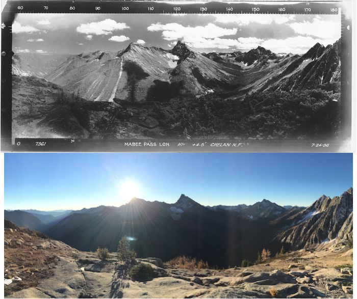
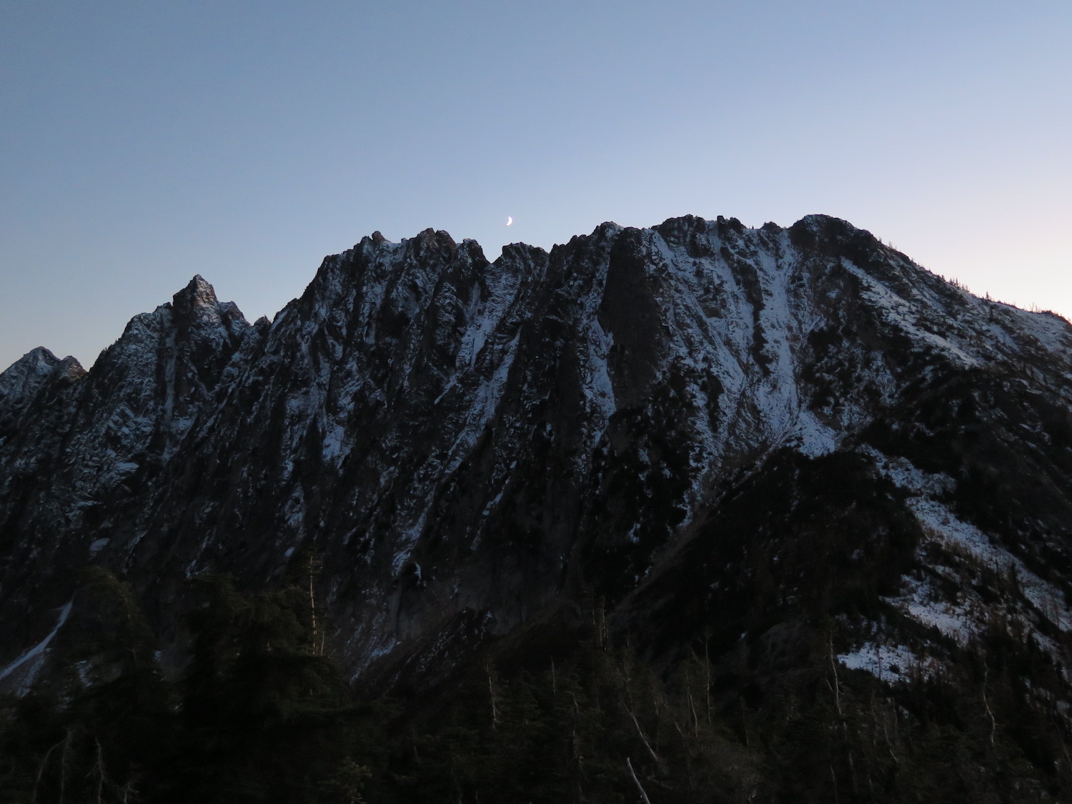
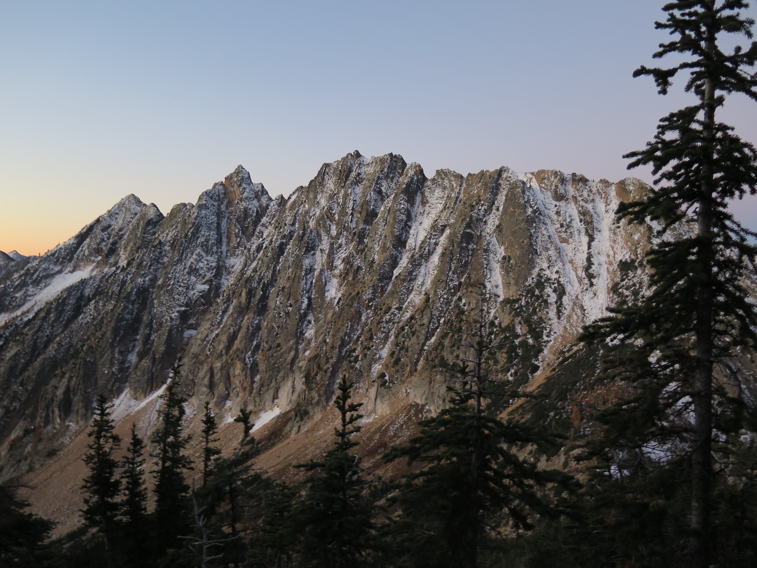
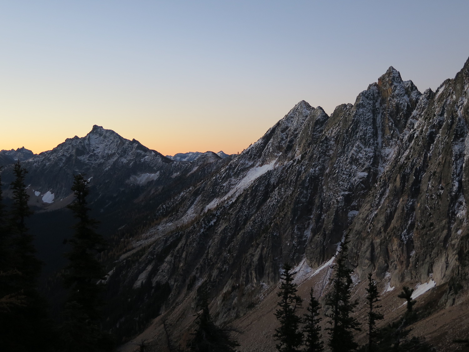
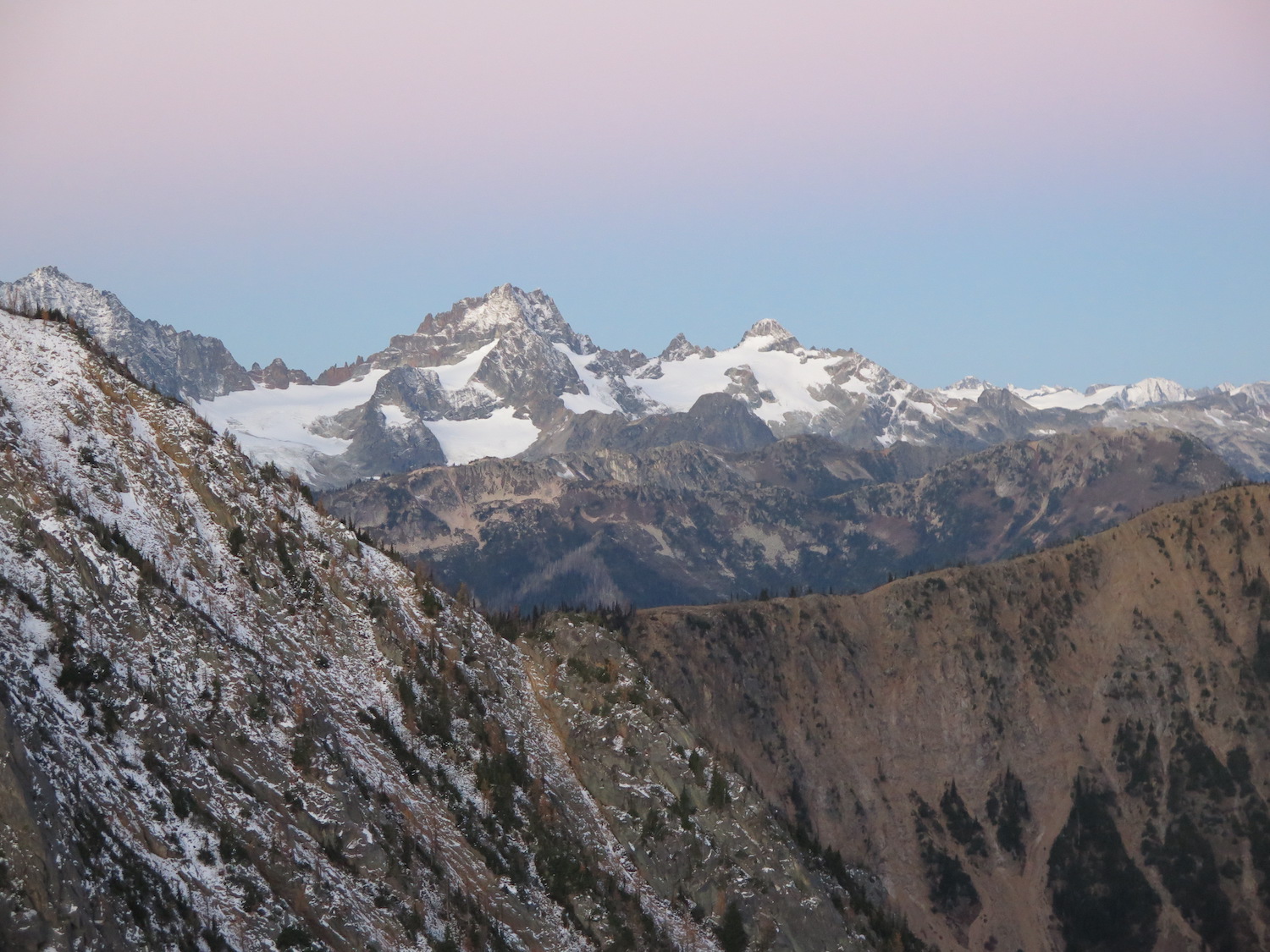
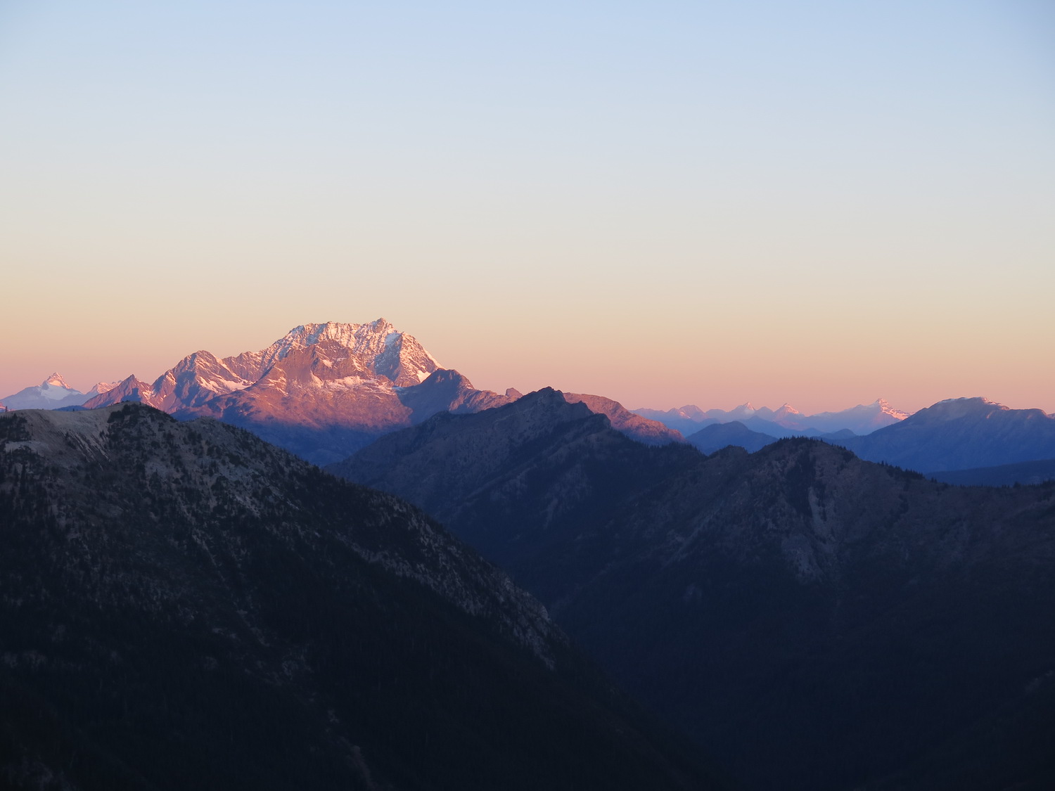
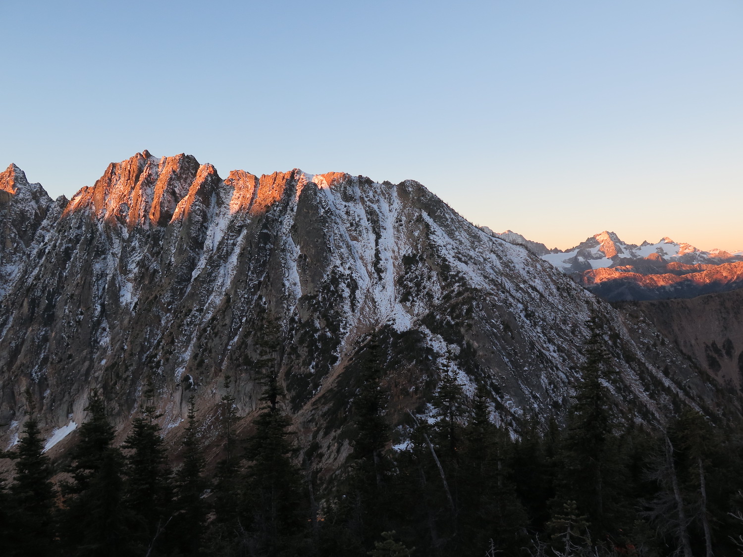
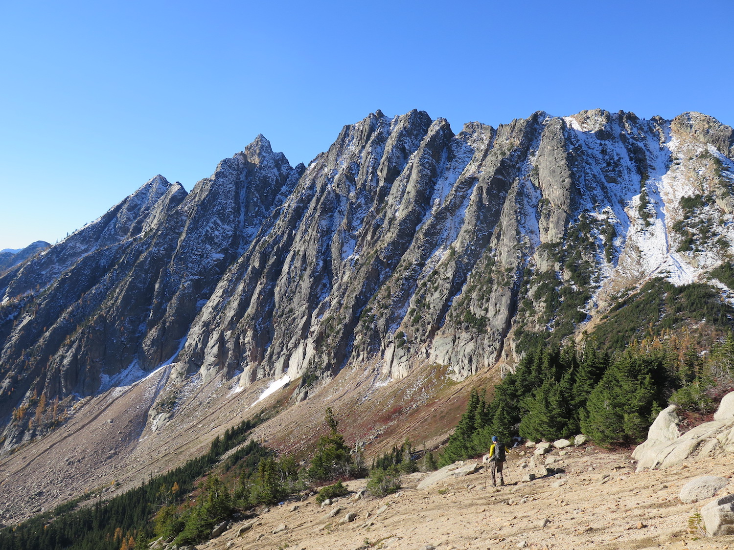
Our goal when visiting Mebee was to overnight on the summit but unfortunately it took much longer than expected to get there. With darkness fast approaching, we weren’t confident about safely routefinding up the last bit of steep terrain so we pitched my tent into the only tiny, somewhat flat spot we could find on the steep slopes below Mebee. That night the single digit temps were brutal but I’ve never seen a more glorious daybreak than in this remote area of the North Cascades. Pre-dawn with a fresh dusting of snow on the Methow Pinnacles was absolutely stunning!
These days more people seem to be visiting Mebee and I hear the route is full of flagging, which fills me with mixed emotions. I love that others are able to visit and the route has become more straight-forward. At the same time, it’s a little sad that some of the grand adventure of reaching this lookout has been removed. I’ve never been a huge fan of cairns and flags. At any rate, I hope that everyone visiting Mebee treats this structure with the highest respect. It truly is the last of its kind and an irreplaceable gem.
The route.
Distance (RT): 17 miles
Elevation Gain: 4,480′
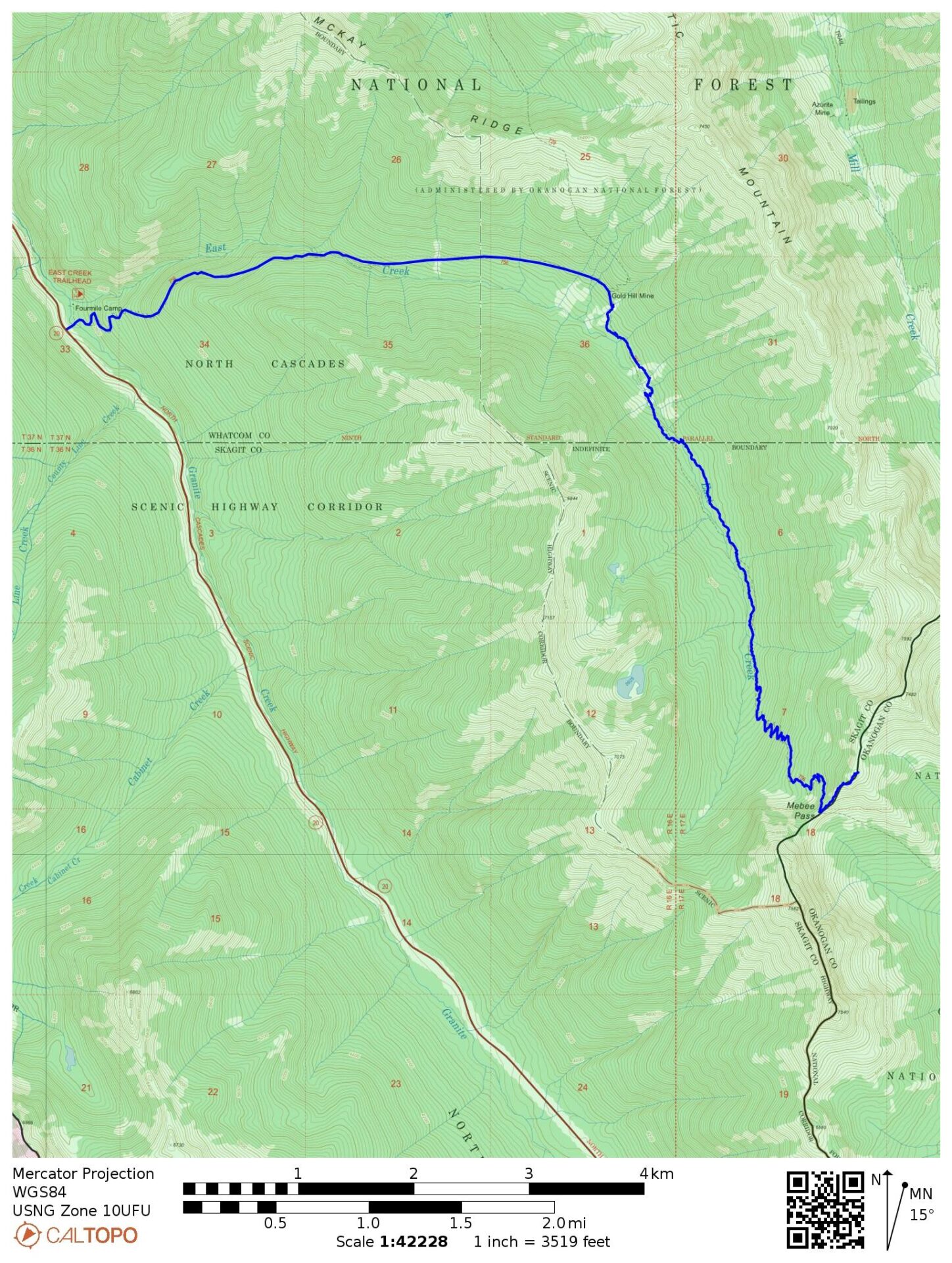
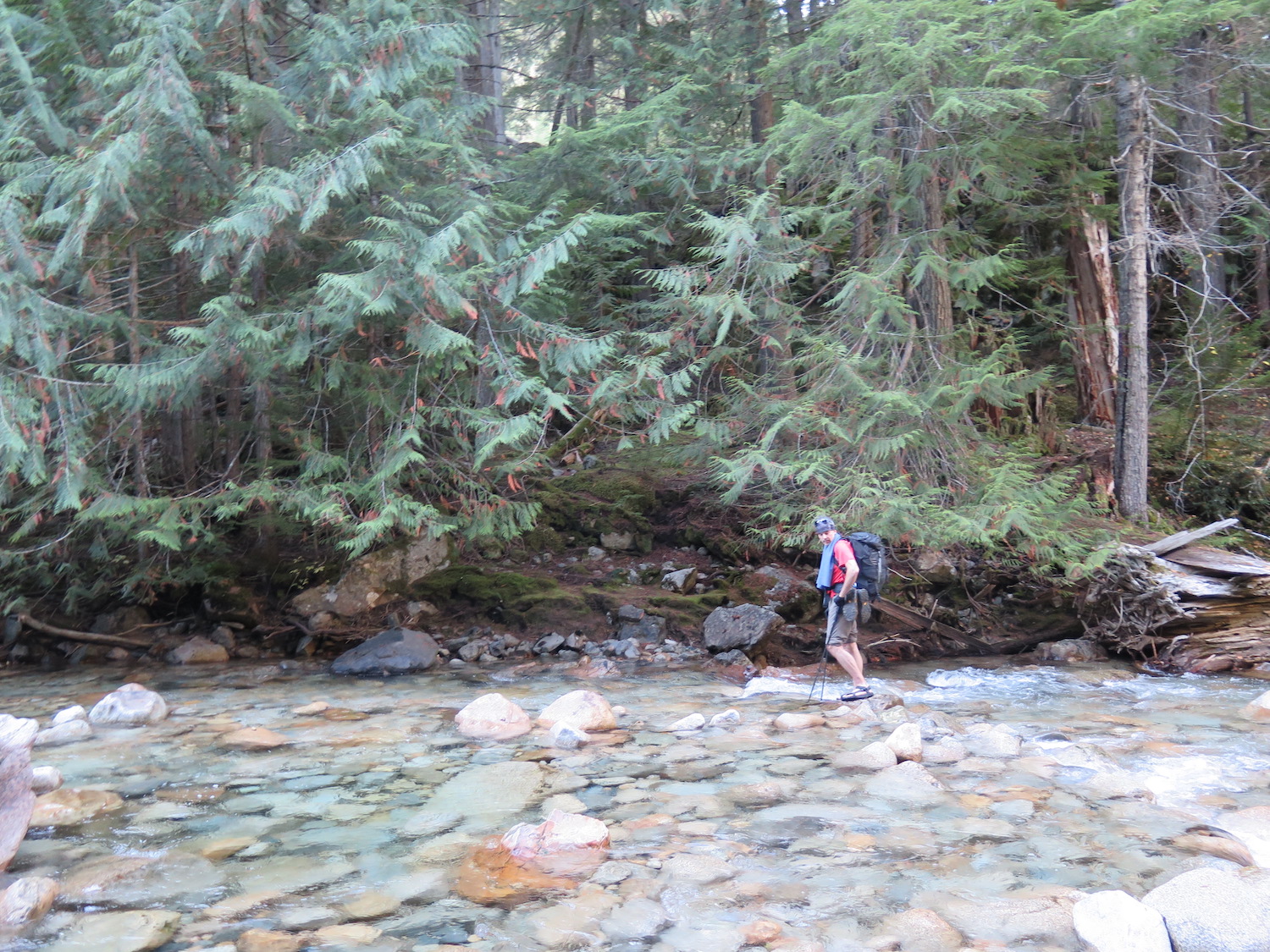
Getting to Mebee is half the adventure, though these days it sounds like the route is heavily flagged and much easier to traverse than on my trip in 2018. The first and biggest hurdle is only 500′ from the trailhead on East Creek, which is crossing the mighty and churning Granite Creek. The bridge washed out years ago and requires either a ford or treacherous log crossing. Late in summer or early fall, the ford is safe enough, though icy cold. When I visited, there was a super sketchy log crossing a bit upstream but the consequences were high. It sounds like the log crossing has had improvements but cross at your own risk.
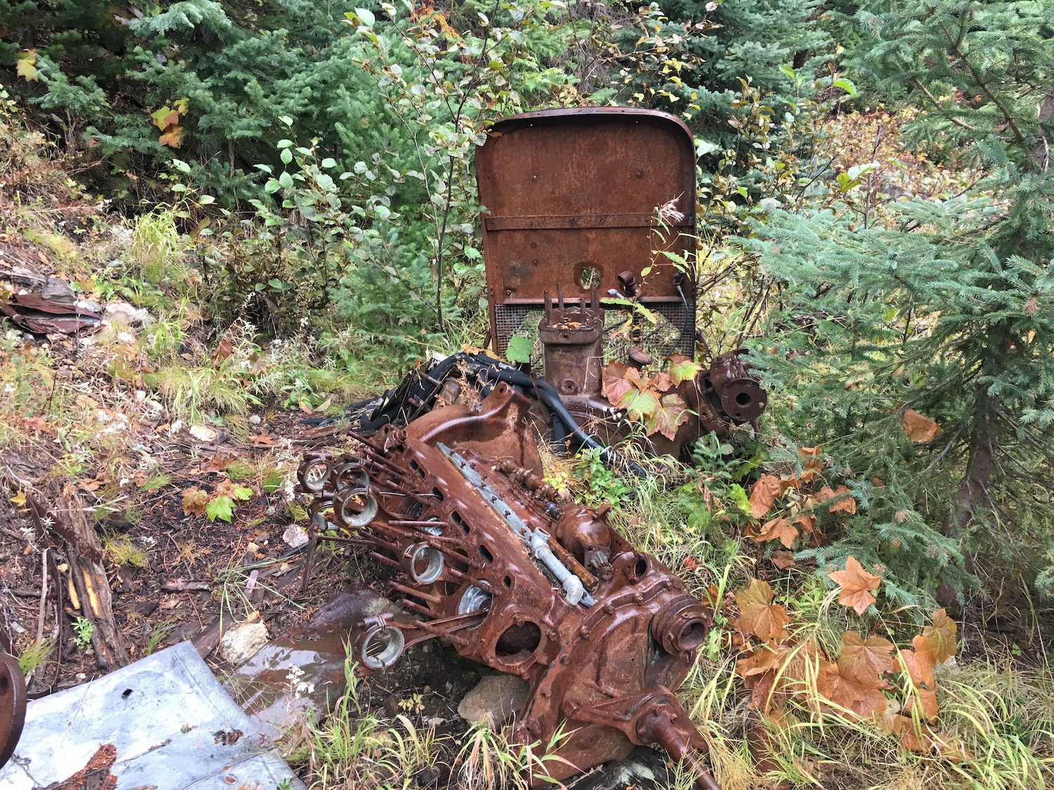
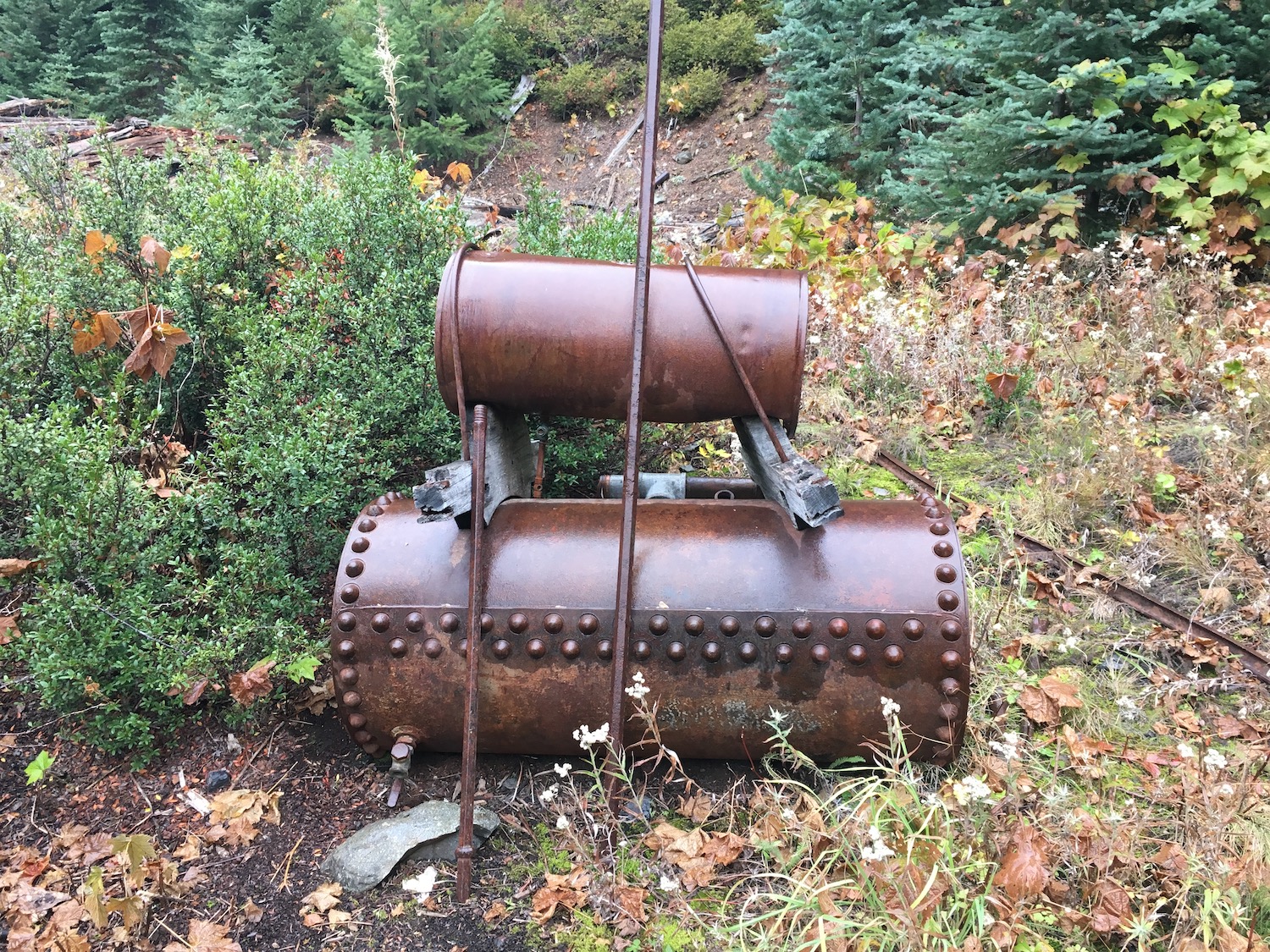
The trail on the other side of Granite Creek was in remarkably good shape for two or so miles, climbing steeply before turning easterly above East Creek. The trail crosses East Creek, then continues to the Gold Hill Mine junction, where there is a scattering of old mining equipment. This is a great spot for a break and it’s also possible to take a detour about 500′ uphill to an old mining bunkhouse. If you have good eyes, you’ll see the bunkhouse in the distance coming back down from Mebee.
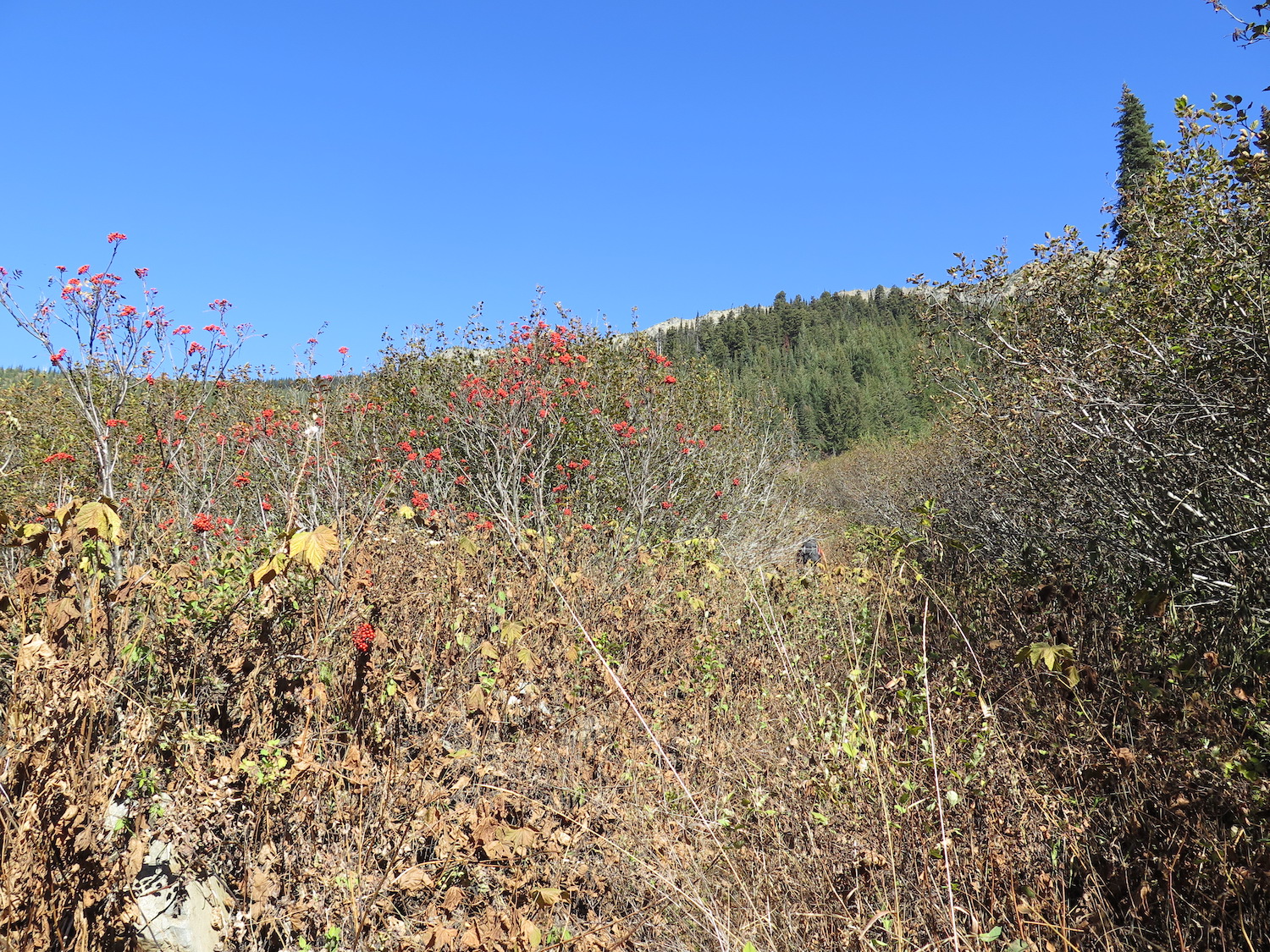
After the mine junction the trail gets a lot harder to follow and eventually disappears into a tangled mess of slide alder and avalanche and slide debris. Trail maps won’t help here since the trail has been obliterated. Some people have dropped down all the way to East Creek. I was able to head down slope maybe 50′ or so and find a faint trail across the slope that headed back into the forest. It sounds like this section is now heavily flagged so the route-finding may no longer be an issue.
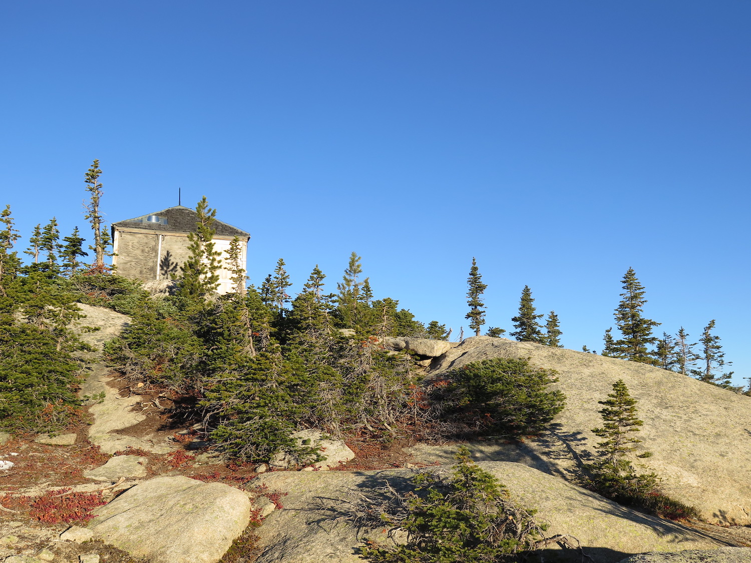
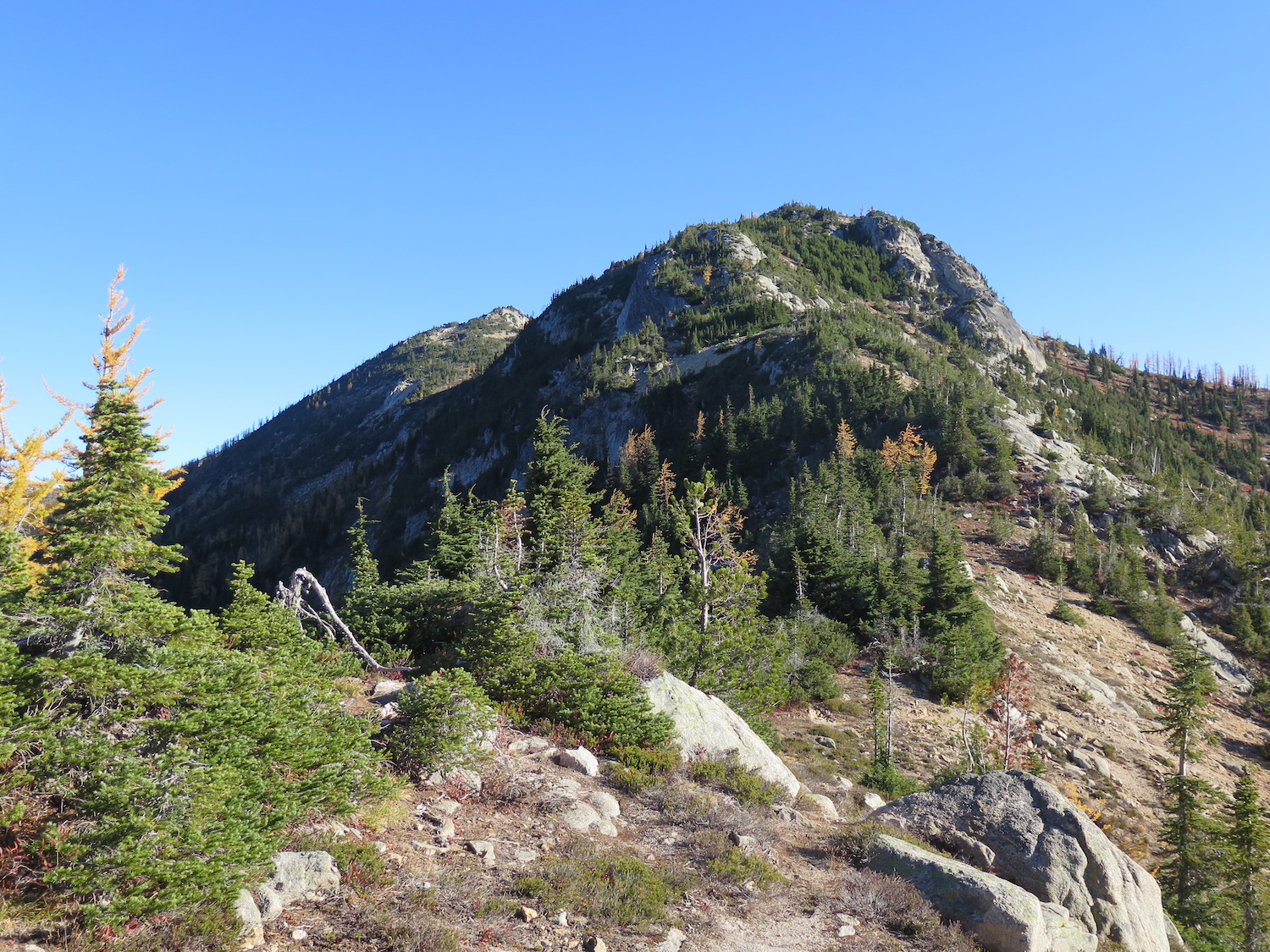
After a few slide paths, the trail makes its way down to East Creek and crosses the creek, traversing on the other side before continuing to a meadow. From the meadow, the trail is much easier to find in the forest and easy to follow all the way to Mebee Pass, but fallen trees make for slow going. In 2018, we hurdled over 200 trees, especially in this section of trail, many over a foot in diameter. Eventually the trail starts climbing up switchbacks to Mebee Pass, with breathtaking views of the spectacular Methow Pinnacles. The lookout is another 500′ up along a ridgeline to the northeast. There is no trail, but following the spine of the ridge on the path of least resistance mostly along the tree line will eventually get there.
The lookout stays hidden until nearly the last step onto the summit, then the tiny structure finally reveals itself!
It is also possible to reach Mebee Pass from the east along either the Pacific Crest Trail and/or Methow River Trail, though conditions on both the Methow River Trail and the East Creek Trail between the PCT and Mebee are likely very tough.
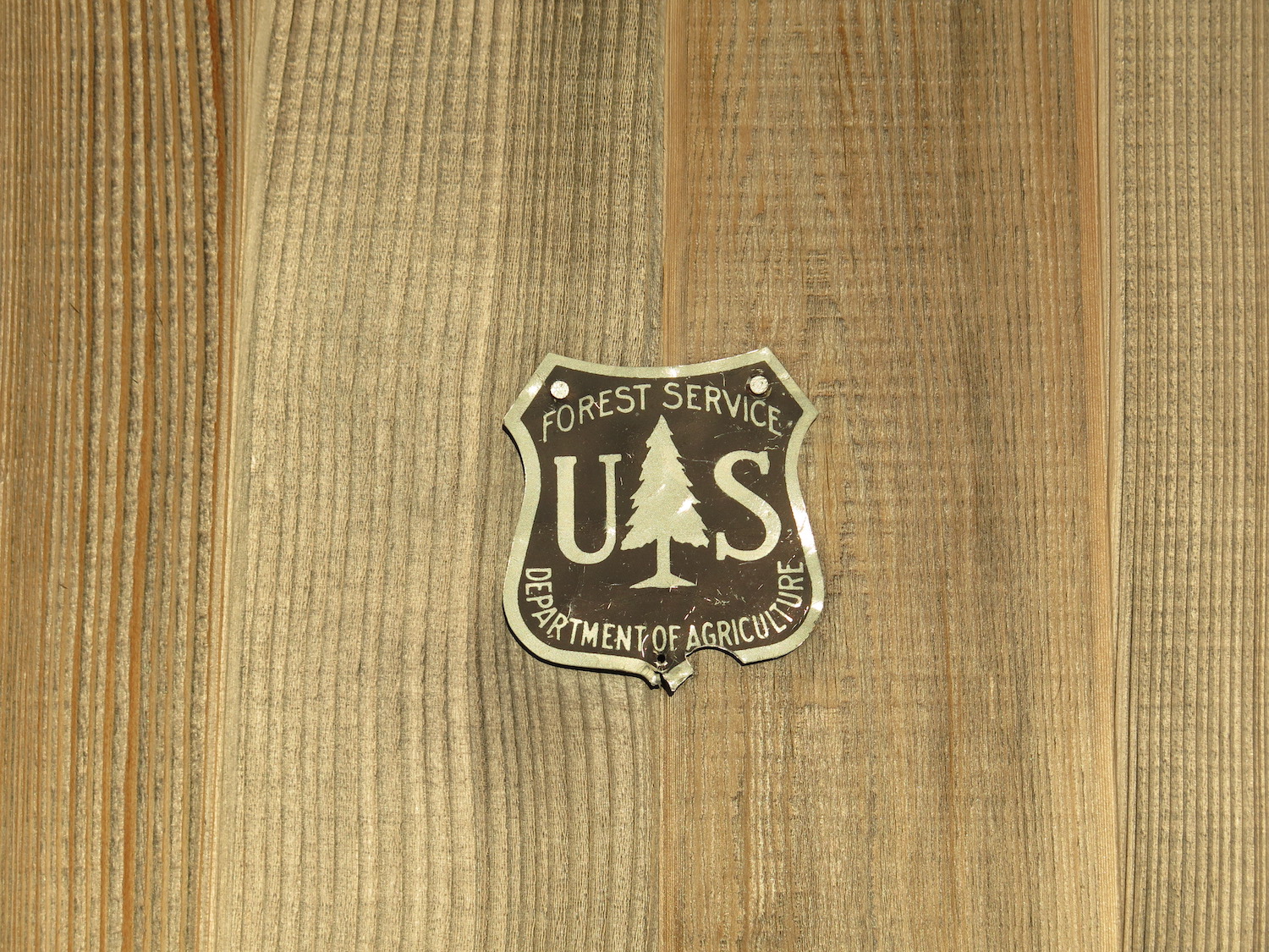
Please remember that if you visit this lookout, absolutely no candles, no incense, no stoves, and no open flames in or near this historic and vulnerable structure. An enormous and expensive effort was made to save and restore it and everyone’s help is needed to preserve this gem. Thank you!
Directions.
The primary route to Mebee Pass starts from the East Creek Trailhead roughly three miles to the east of the Canyon Creek Trailhead on Highway 20. The trailhead is 35 miles west of Mazama and about 24 miles east of Newhalem.