REI can thank me for contributing to their record breaking quarter as I just replaced all of my old backpacking gear with shiny new ultralight gear. I looked at my credit card statement and almost fainted. How did that happen!? Quick: I need gearaholics anonymous. That damn REI. They’re sneaky with all that gear.
This past Labor Day weekend I had too many options for great things to do and not enough conviction to choose one. Coming off a really busy work week I felt scattered. I needed some quiet time and didn’t have my shit together by Friday evening to leave town. So I spent my Friday night partying hard by playing Tetris with all my new gear. Yep, I’m a wild one!
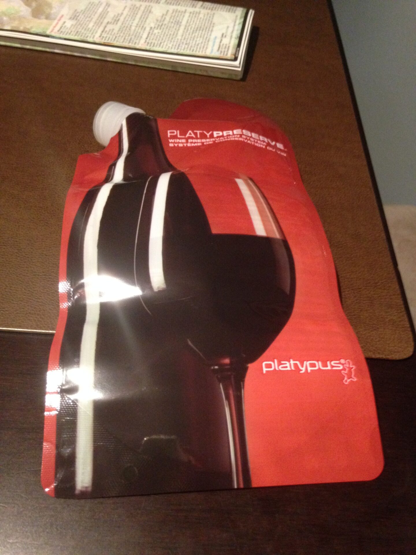
Even with ultralight stuff it was pretty hard to pack 2-3 nights into a 36L pack. So I ended up doing a Friday night REI run to swap my new 36 liter Osprey pack for the 3oz heavier 46 liter version. A bit more room so I could pack my Platypus wine flask. Hey, I have priorities in the wilderness!
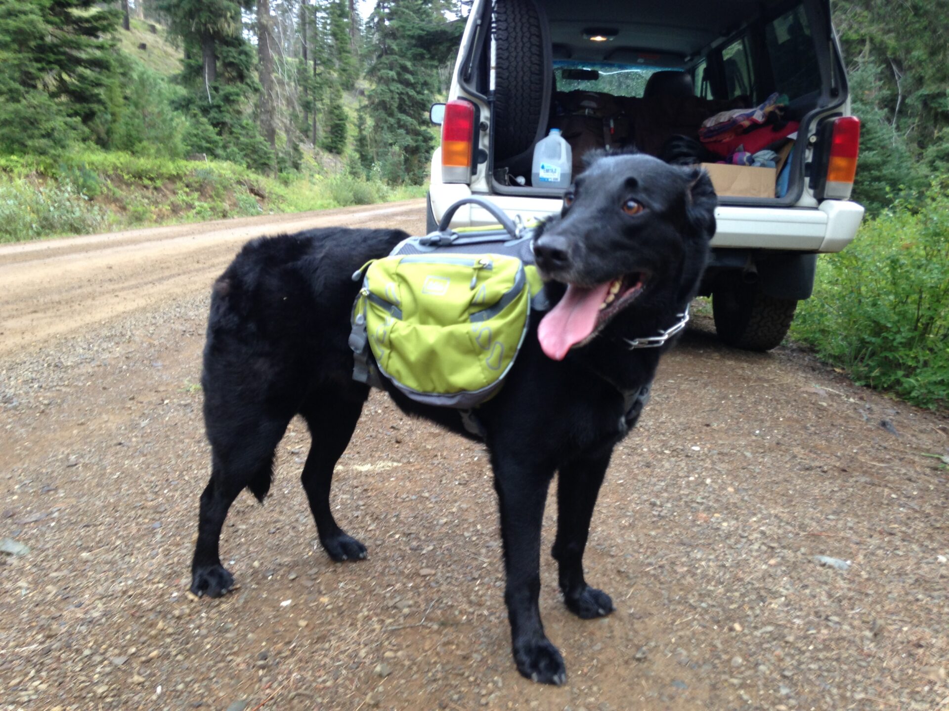
I was really eager to try out my new backpacking setup before an upcoming trip to Montana so I thought about venturing out on my own. I’ve never backpacked solo though and the idea made me a little nervous. Of course I wouldn’t be completely solo, my trusty partner in crime Jake dog would be coming along. I’ve never backpacked with him so I had no idea what to expect or what kind of potential disaster this would turn out to be. Was I crazy to just set out on a trail and backpack by myself with my dog? Probably.
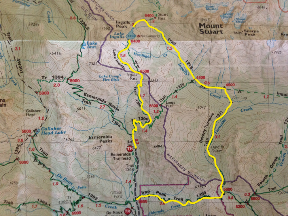
I hatched a plan to head to the Teanaway on Saturday and hike into the Esmeralda Basin. I’d set up camp somewhere Saturday night, then do a big hike that loops through the basin and comes up the saddle near Iron Peak where my friend Annette was hiking Sunday. Since I’ve already done Iron a few times I figured I could skip the summit and just meet up with her and hike back down. Meeting someone would assure that maybe I didn’t die out there somewhere.
Ok, I had a plan!
After getting stuck in ridiculous traffic Saturday and detouring through Ellensburg to see a friend, I rolled up to the Esmeralda Trailhead at 5:30pm – much later than planned. I had about 2 hours to hopefully bust it up to Lake Ingalls and find a camp spot before dark.
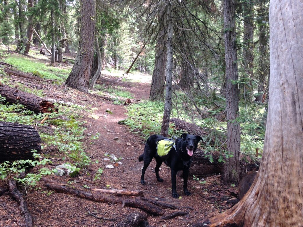
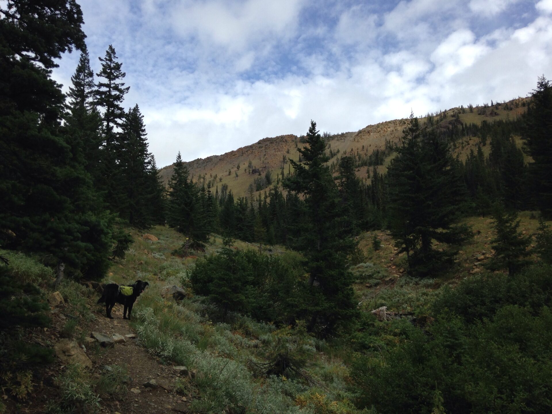
My REI shopping spree also included a new doggie pack for Jake. It’s been years since I’ve outfitted him, but if he’s going to backpack with me I figured I’d put him to work carrying his own food and treats. I put the pack on him and initially he wouldn’t move, looking at me as if to say “Nope, not doing it.” Then 5 minutes later he completely forgot, bounded up the trail, and promptly wedged himself and the pack into a tree. If this pack lasts at least one hike I’ll consider it a win.
We started our hike under blue skies and scattered clouds but a big wall of clouds not far in the distance was moving in. Hmmm, the forecast called for clearing conditions Saturday night into Sunday, not worsening conditions. I’m sure glad I bought the Osprey pack with a built-in rain cover because an hour later I was standing in a downpour in dismay. I had some rain gear but I was really NOT planning on crawling into my brand new tent with a wet and muddy 85-lb Jake who wouldn’t be tired out in the least with only a 3 mile hike. Maybe I’m not a true adventurer because everything in my head told me to turn around and that’s exactly what I did. And when I finally reached the trailhead again the rain stopped. Of course.
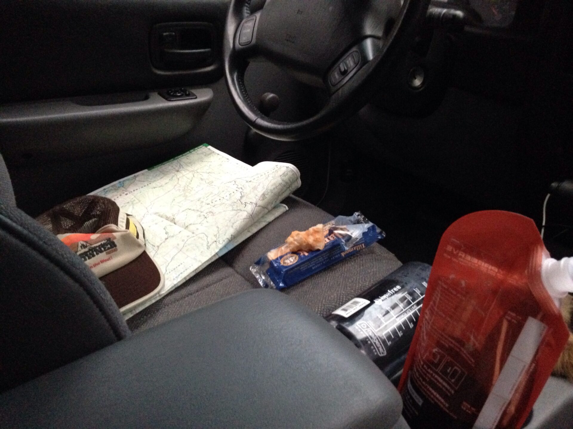
It was nearing dark and with the abundance of nice campgrounds along the Teanaway I decided to just camp here and make a plan B for tomorrow. I had just set up camp when the skies promptly opened again. With Jake still wet I retreated to the Jeep where we both spent the night despite my tent being barely 20 feet away. It’s ok though, I had a Platypus flask of wine, a brick of cheese, and a good book. And a big map. A good way to test your new tent’s rainproofness I suppose without actually getting wet!
Sometime around midnight I woke up and it was so cold I thought of abandoning Jake and climbing into my warm sleeping bag inside the tent. Instead I grabbed my down gear from the back of the Jeep and stayed with my dog like a good dog mom. Jake owes me big time.
There are only so many ways to attempt to sleep comfortably in a bucket seat so after a very long night I had to laugh when both Jake and I stumbled from the Jeep with stiff sore joints. Luckily the weather had mostly cleared so after a nice breakfast I tried to figure out a plan B. It would be tough to do the original loop hike and still meet Annette in a timely fashion. I had no cell service to let Annette know I wasn’t going to meet her on Iron and all I knew was that she was planning to head up from the trailhead around 10am.
I poured over my trail map and saw “Earl Peak” on the map, a lofty 7,036′ summit just to the east of Iron Peak that was about a 7-mi round trip trek. I’ve had cell service on the top of Iron Peak before so I guessed that I might have it on the top of Earl and could possibly connect with Annette, who would hopefully also be on the top of Iron with cell service. I laughed at how ridiculous this was. Yep, it’s so ridiculous it just might work!
I rattled off whatever was left of my poor Cherokee on the road to the Beverly Turnpike Trailhead. Deciding to test out the full backpack, Jake and I hit the trail for a 7-mi RT hike with about 3 days of gear strapped to us. The way to Earl starts up the Bean Creek trail and climbs steadily along the river. The few river crossings were low and easy though I’d imagine in early season they would be a little more tricky.
As the clouds cleared I could see Mount Stuart peeking through the background and I think I was looking straight over to Iron Peak. Annette should be on her way up there. I hope!
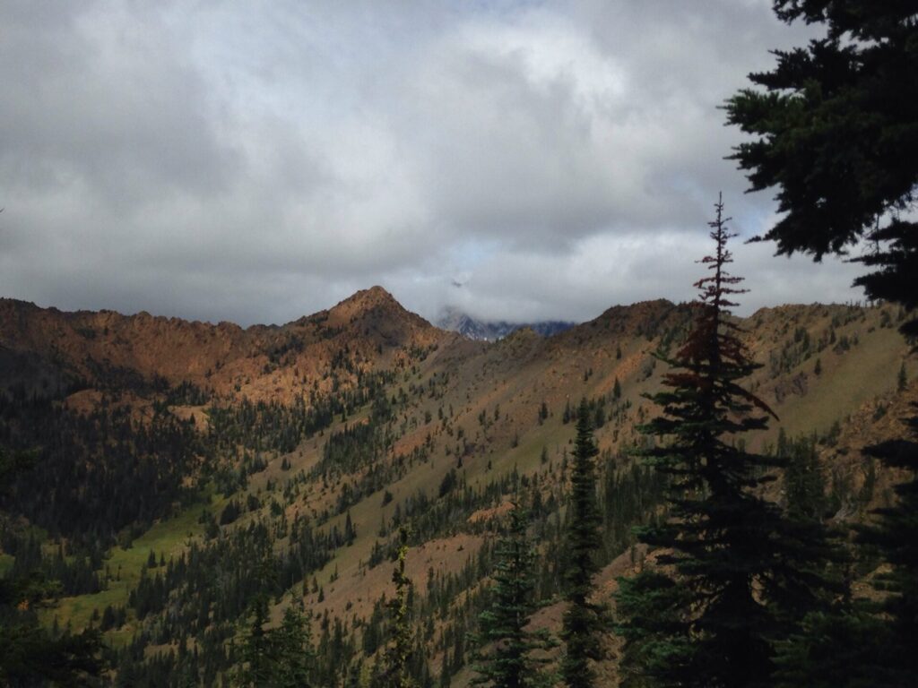
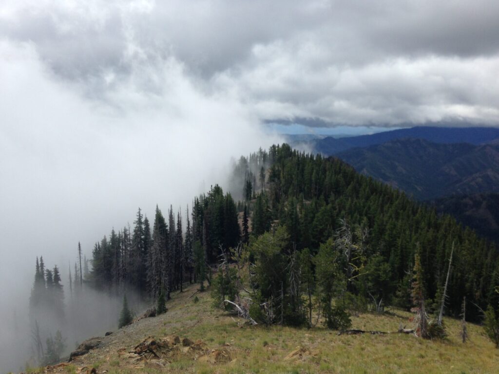
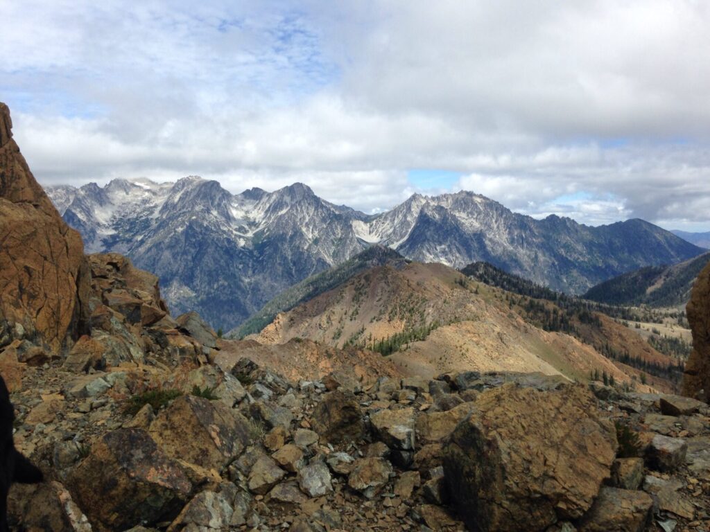
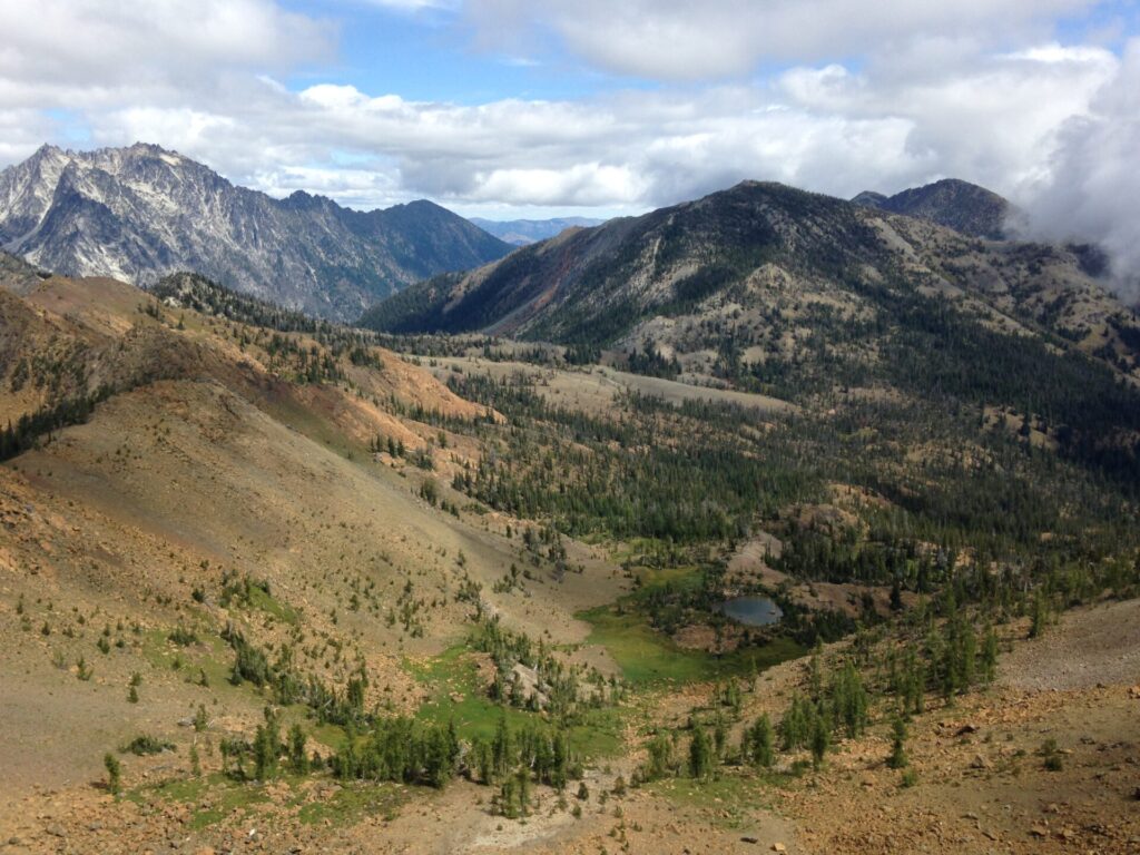
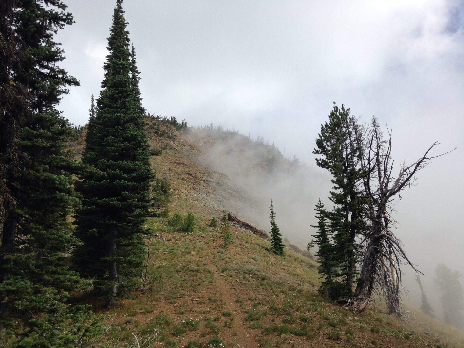
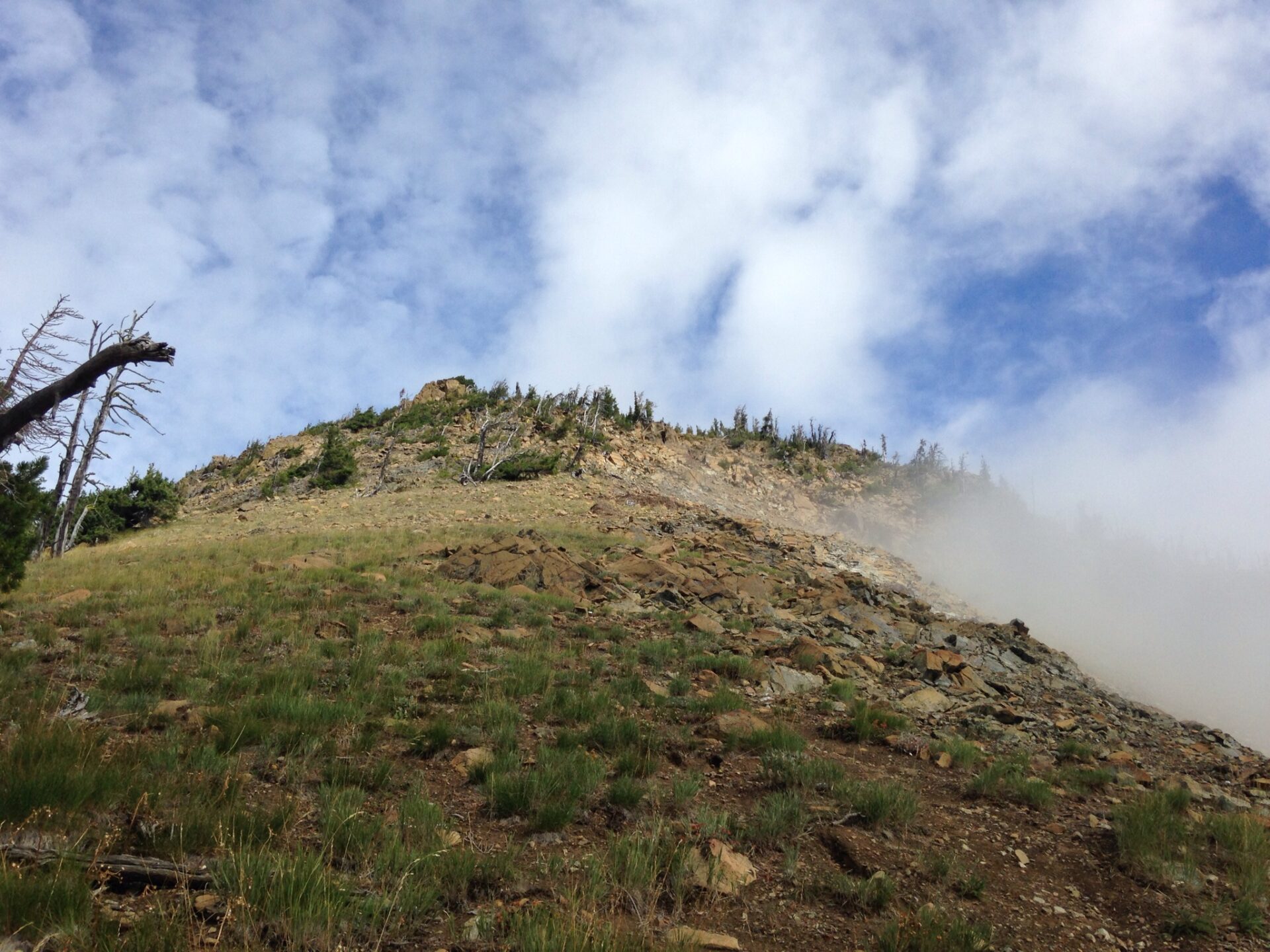
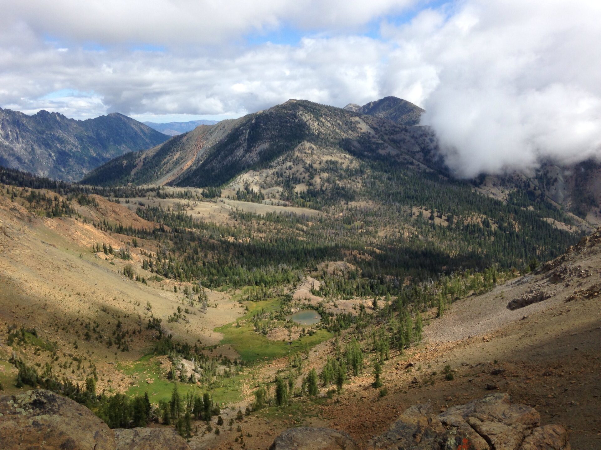
In about 2.5 miles the trail reaches Bean Creek meadows, which offers some great camping areas. The trail continues up to the right towards Earl Pass at 6100′. When I approached the pass I couldn’t believe all the clouds and fog in the basin on the other side of the mountain. It was really quite spectacular. I sat there for a few minutes watching the clouds roll off the side of Earl Peak. Incredible!
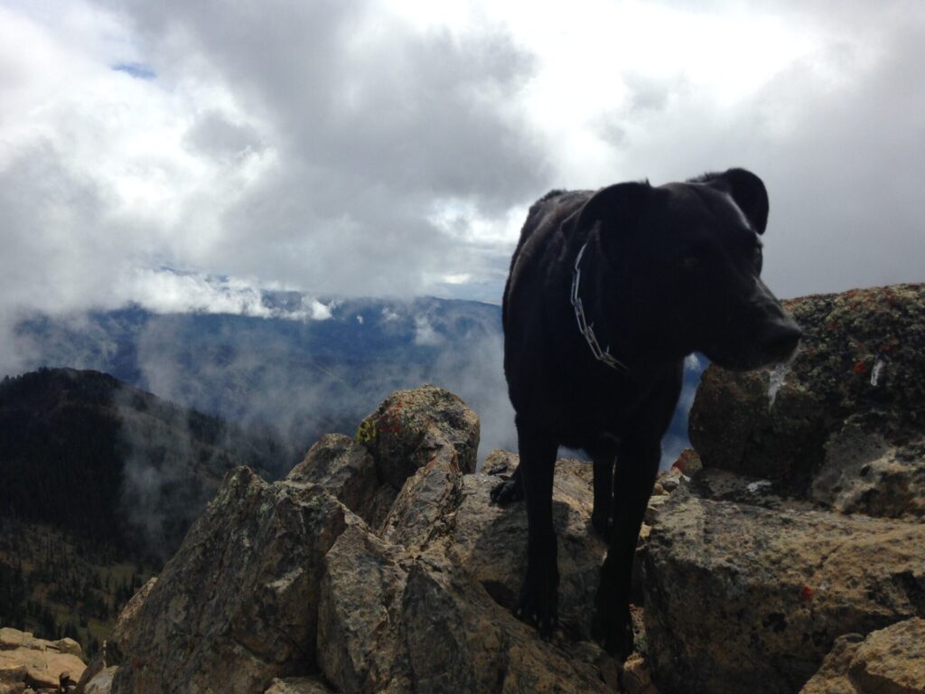
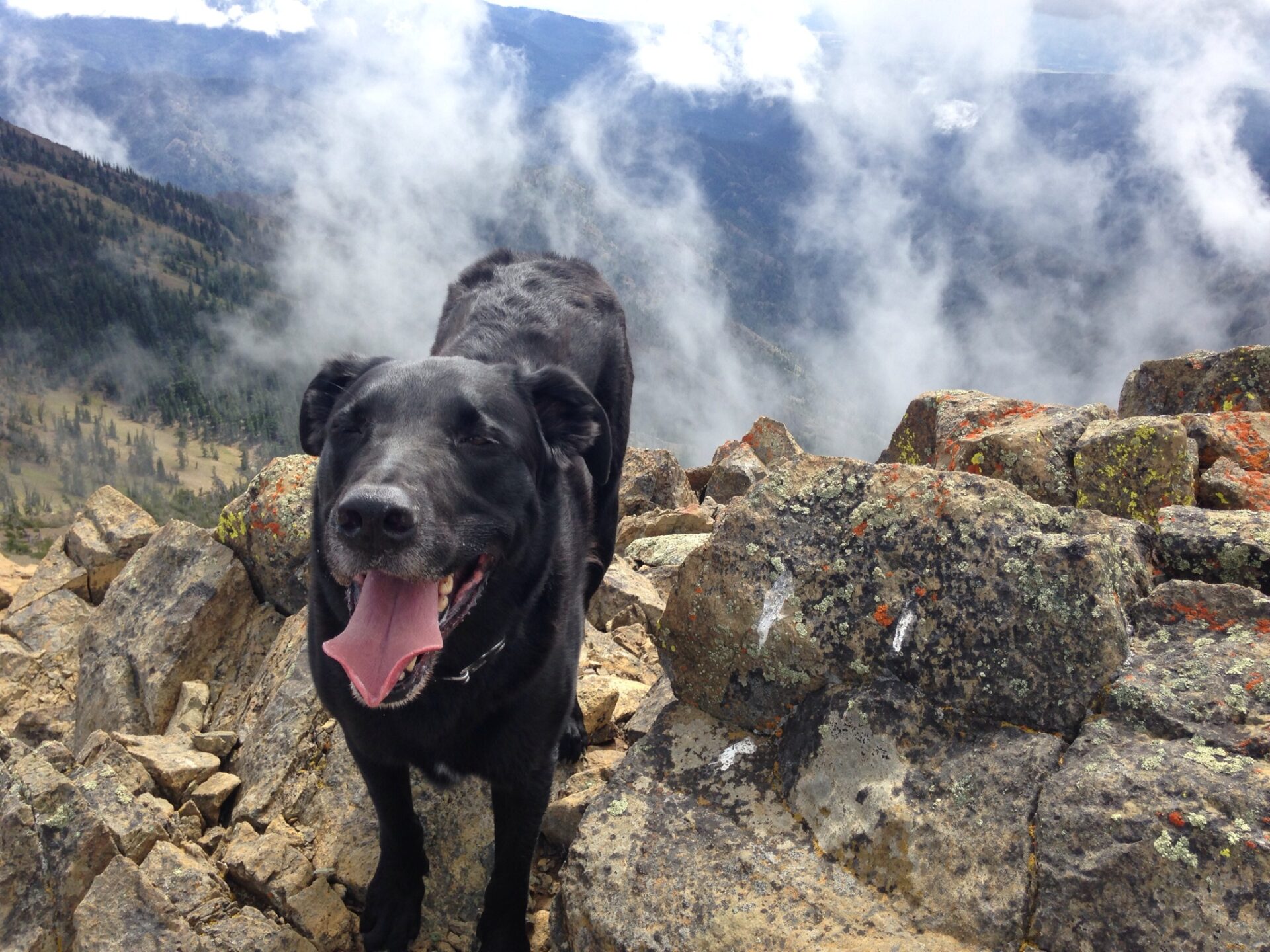
Once at the saddle I saw the boot track headed up the mountain to the left and stowed my pack below in some trees. Jake was already well on his way up the mountain, looking back at me as if to say “Are you coming? What’s taking so long?” My dog is awesome.
About halfway up to the peak I realized the stack of boulders I thought was the summit wasn’t the summit at all. My Green Trails GPS said I still had at least 500′ to go. The hike/scramble up to Earl’s ended up being about a 1000′ effort on scree over about a half mile with maybe two false summits. You gotta work for this one! I also became keenly aware that with my Plan A falling through and no cell service, no one really knew where I was. Annette knew I was in the Teanaway, likely around the Esmeralda Basin, but I wasn’t there. Instead I was scrambling up a 7,000′ peak roughly in the area, but still miles away. “Don’t fall” I told myself. “No one knew where I was” isn’t a good start to a story.
I almost stopped, a little nervous about the situation, but I can’t deny I was being pulled upward by the peak. I just had to bag it! So I kept moving, carefully. I checked my phone and suddenly had service, so I sent a quick message to Annette, letting her know where I was. At least if something happened she’d eventually get the message and I pushed upward with a little less hesitation.

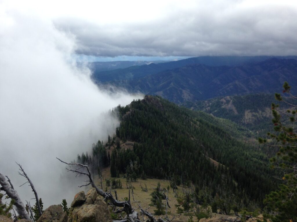
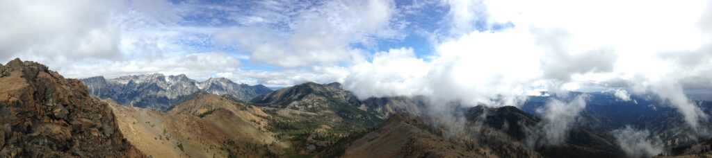
When I turned around I couldn’t believe how the clouds were just billowing off the side of the mountain – it was amazing! Blue sky days are great and all but clouds like this are so dramatic. It was stunning!
All of a sudden my phone buzzed and what do you know!? Annette had texted “Hey! We’re almost on the top of Iron!” I couldn’t believe it. We were both nearly on the top of peaks right next to each other. With both hikes being about 3.5 miles back down and knowing Annette was further up the Teanaway, I suggested we meet back at the end of the gravel road on the way out where it turns to pavement. Then I lost my service. I hoped she got the message. A long time ago we mentioned The Brick in Roslyn as a last ditch rendezvous, so if all else failed hopefully I’d see her there.

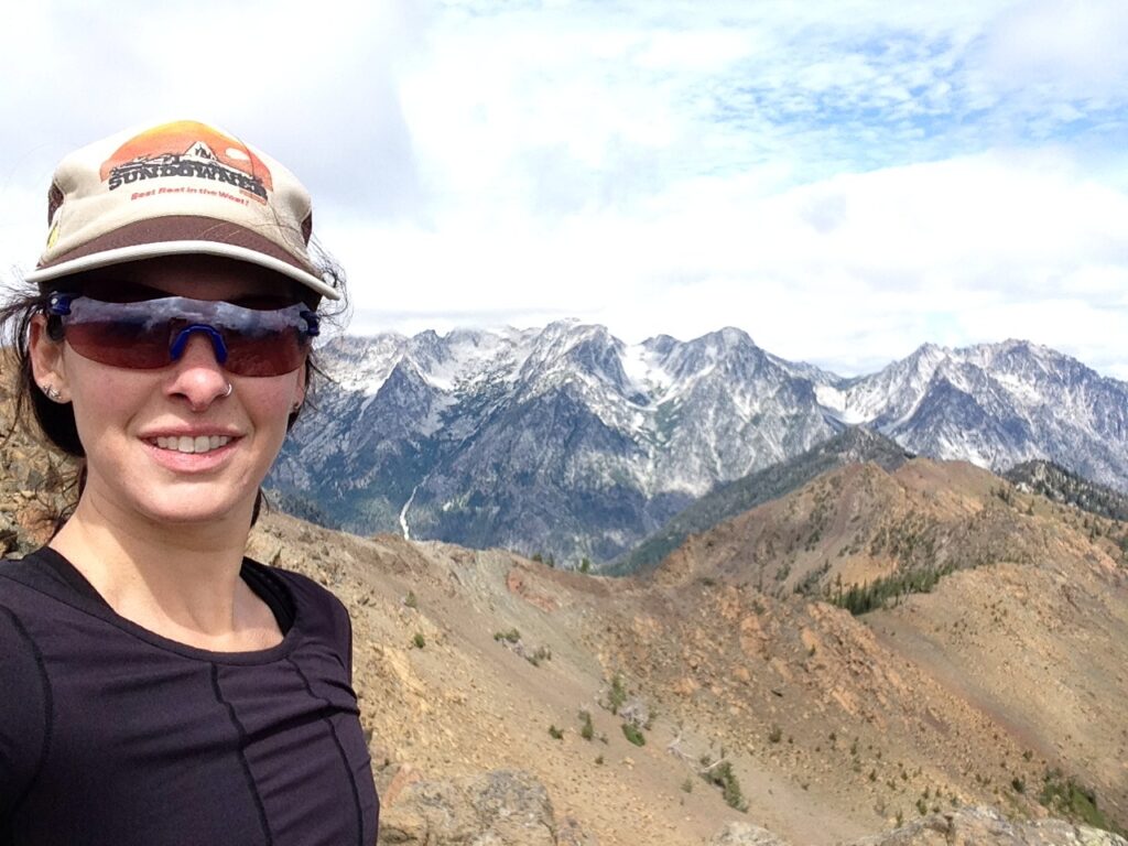
I finally pushed over the top of Earl and couldn’t believe my eyes. Up until now I had only gotten one peek-a-boo glimpse of Mount Stuart, but then there it was with the Enchantments, looming large in full glory. Ever one to find graceful words to describe a moment I could only loudly say “Holy shit. Look at that!” I had no idea a couple sat nearby, hidden by the rock. When I saw them I apologized for my Tourettes but the guy simply yelled back “F’n amazing!” Heck yes it was!

Jake and I enjoyed the summit views for a while, then carefully picked our way back down the scree slope. Why I packed 3 days of stuff with me and left my trekking poles in the car remains anyone’s guess but boy… I sure could have used them! Instead I slid down on my butt in places and used rocks for support. I ran into two other hikers on the way up and besides them and the couple at the top, they were the only people I saw all day.
The hike down went quickly and as I was nearing the trailhead I looked at my watch: 2:30pm. I figured if Annette made the summit of Iron around 12:30 like she said, they’d likely be down around 2-2:15, then would have roughly a 30 minute drive back down to the rendezvous I had suggested. I had maybe a 15-min drive… perhaps our timing would work?
I almost couldn’t believe my eyes when I drove down the Teanaway, popped out on pavement and saw her car! She jumped out “Hey! I can’t believe it! We haven’t even been here 5 minutes!” She started the hike about an hour late and I ended up hiking somewhere completely unplanned but yet here we were. Unbelievable. The only proper celebration was beer and grub at the Brick in Roslyn of course!
So after all that I didn’t get to have my first solo backpacking adventure but that’s ok. I did get to test out my new gear and I’m more than happy with it! Jake did great with his pack, the tent survived its first rain test, and I got to unexpectedly climb to 7,000′ and bag one of the higher peaks in the Wenatchee Mountains. All in all, a pretty fabulously unplanned weekend!
Stats
Round Trip: 7.5 miles
Elevation Gain: ~3600′
High Point: 7036′
Hiking Time: 4:00
GPS Tracks
Full Gallery