Okanogan Highlands | South Okanogan Highlands
Okanogan-Wenatchee National Forest
Location: 48.7852778,-119.12309
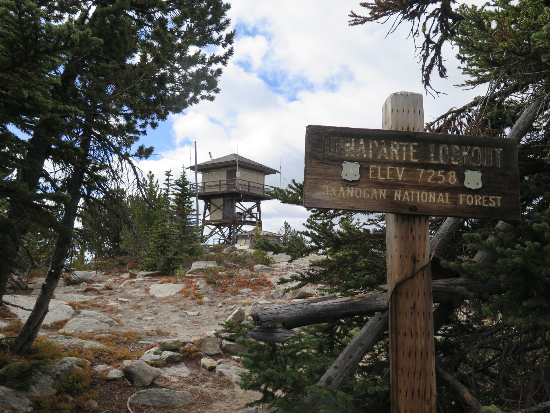
Summit Elevation: 7,258′
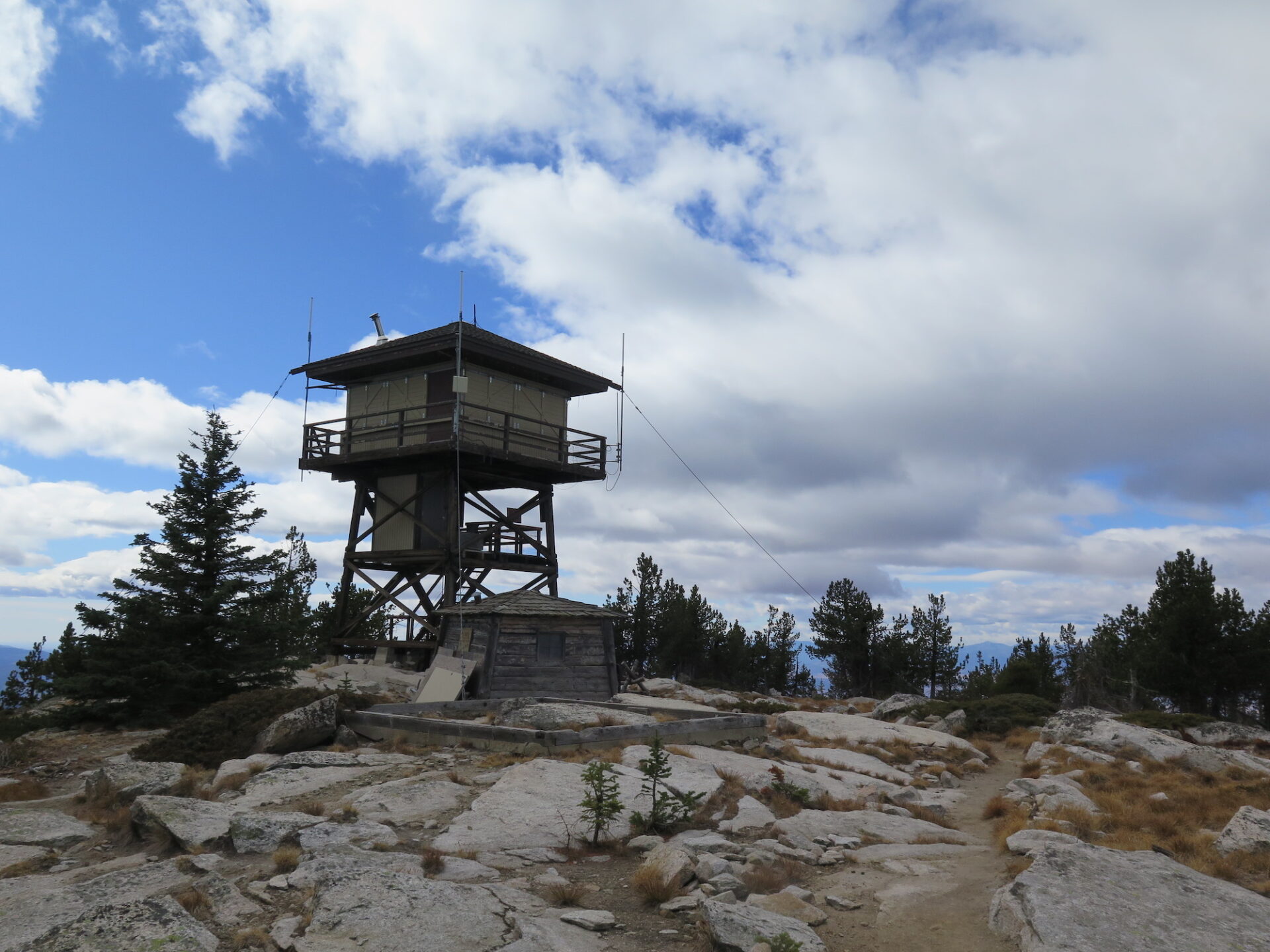
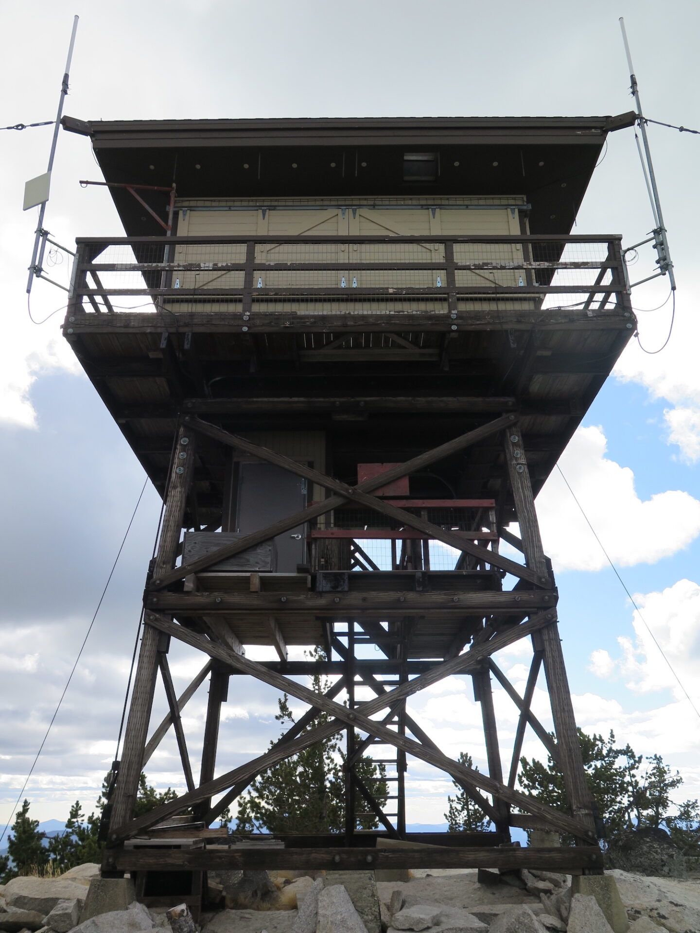
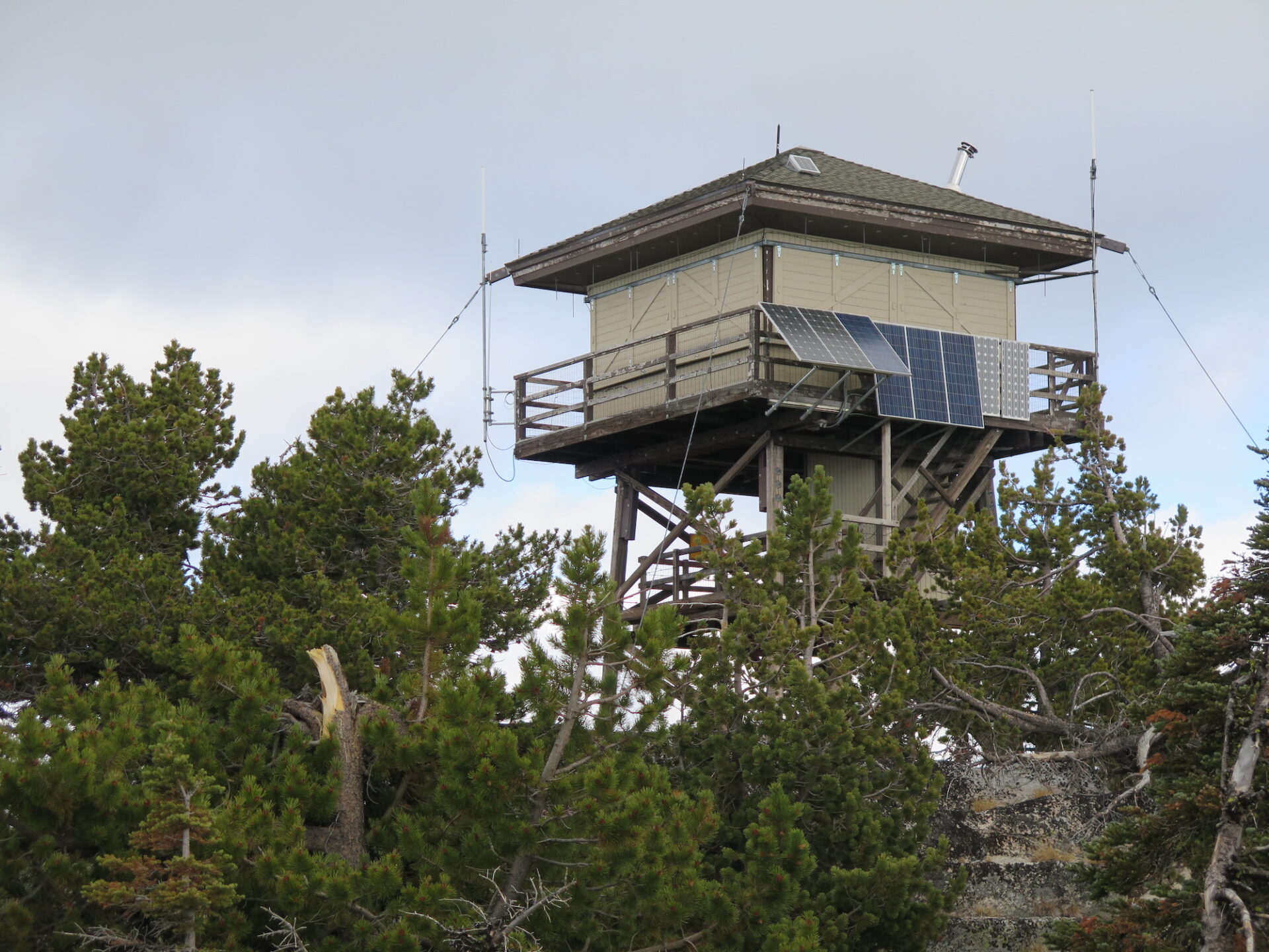
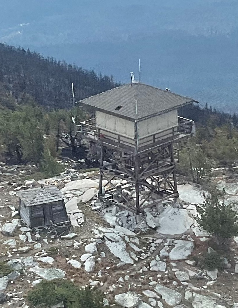
Lookout Type: R-6 flat cab
Site Established: 1906
Current Structure Built: 1963
Date Visited: 10/7/17
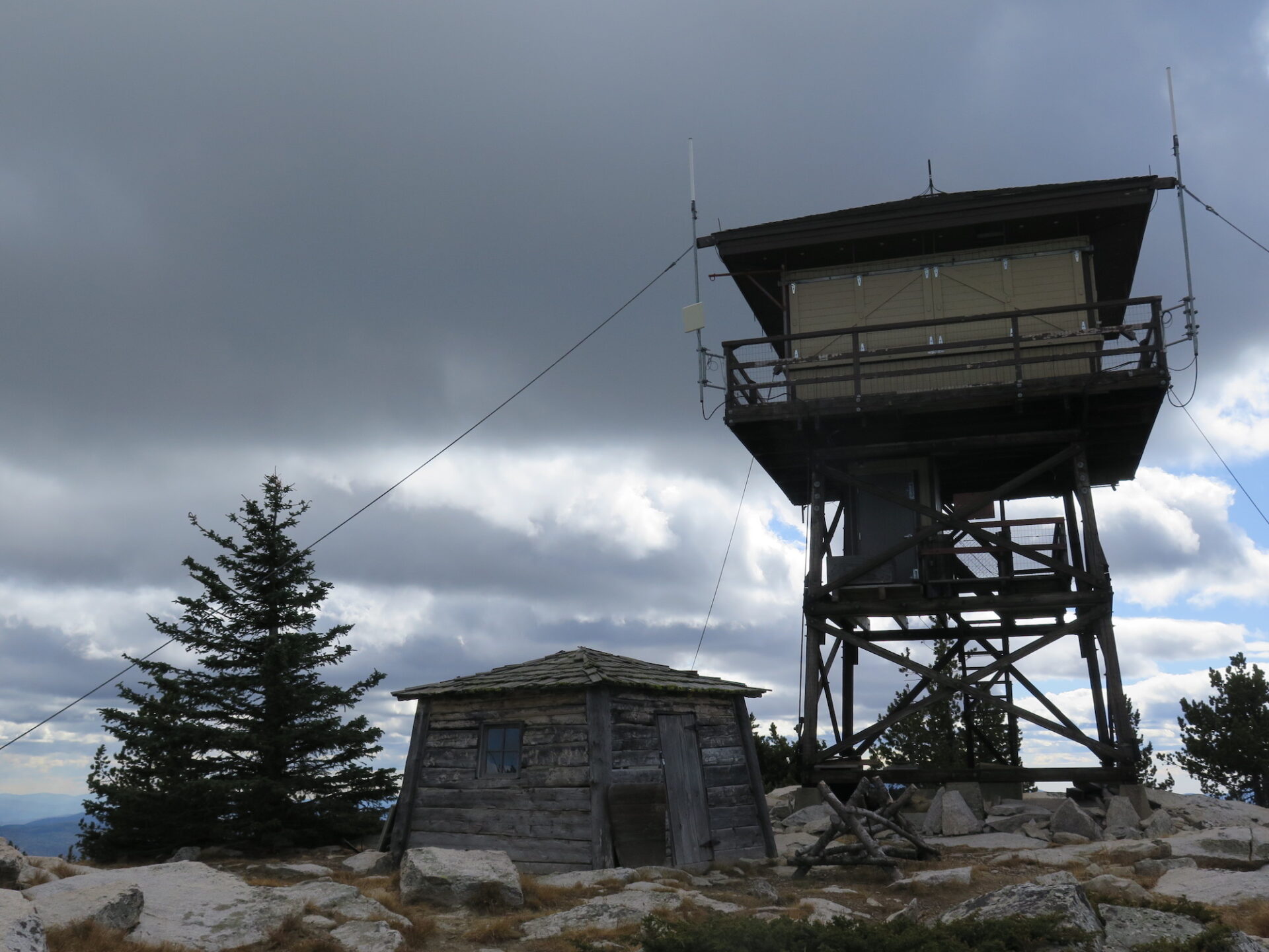
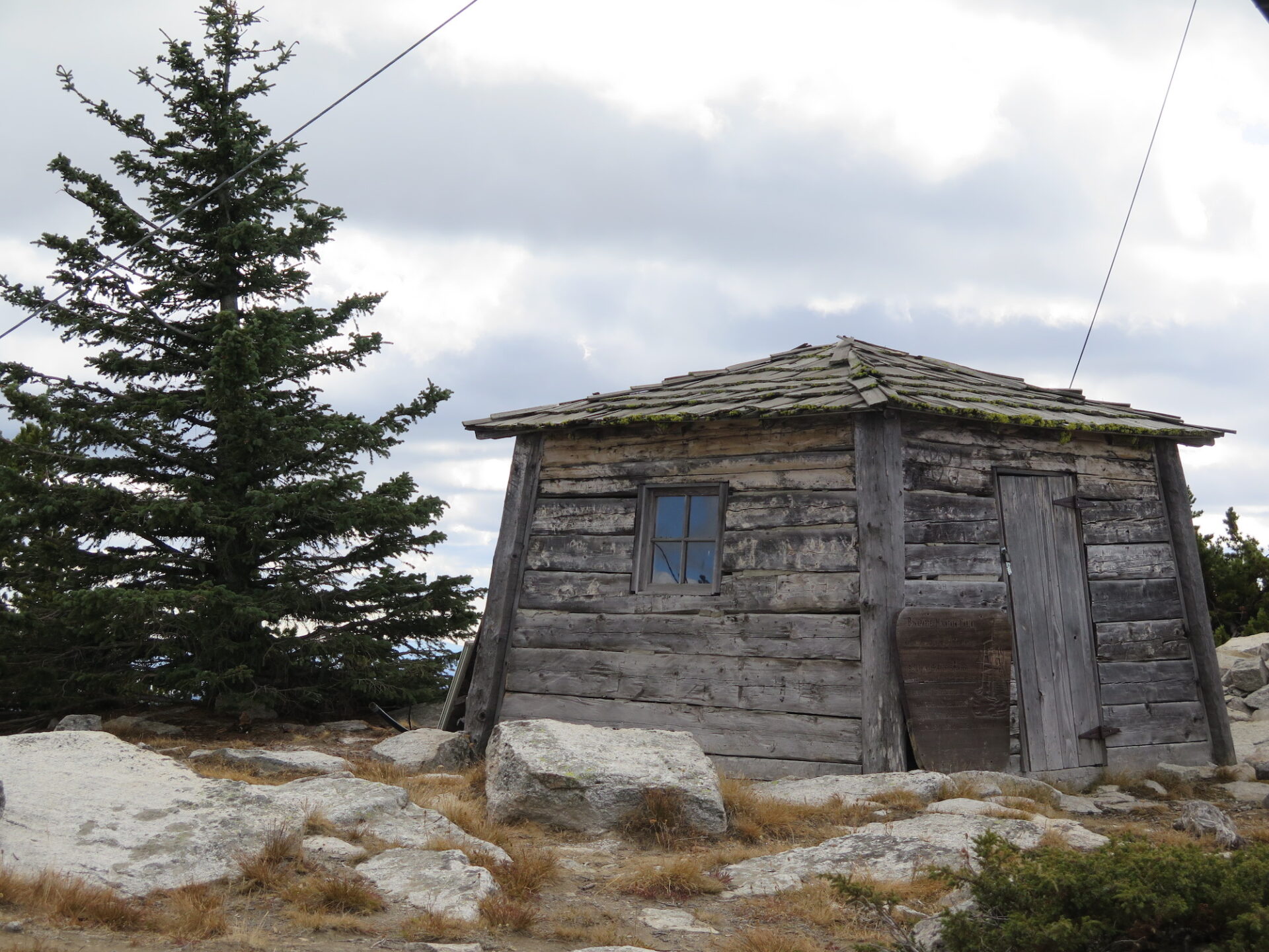
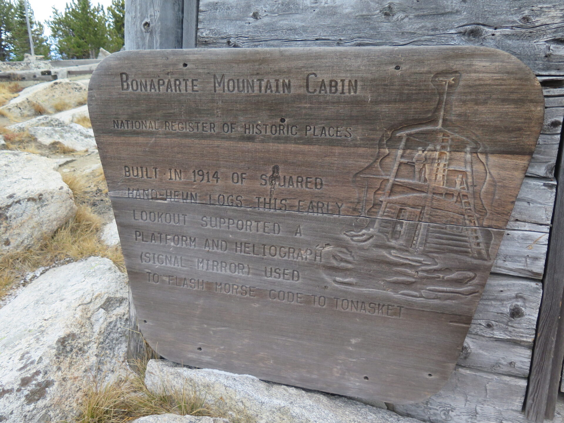
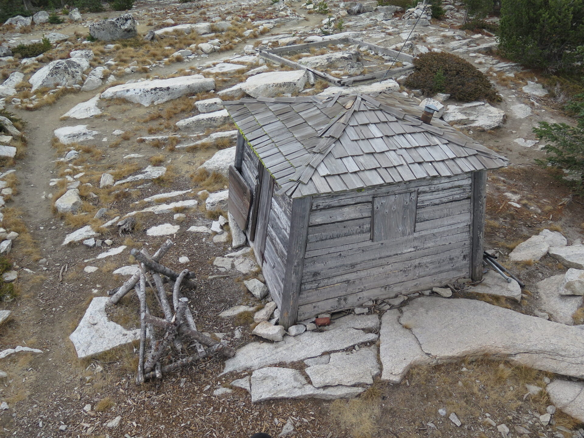
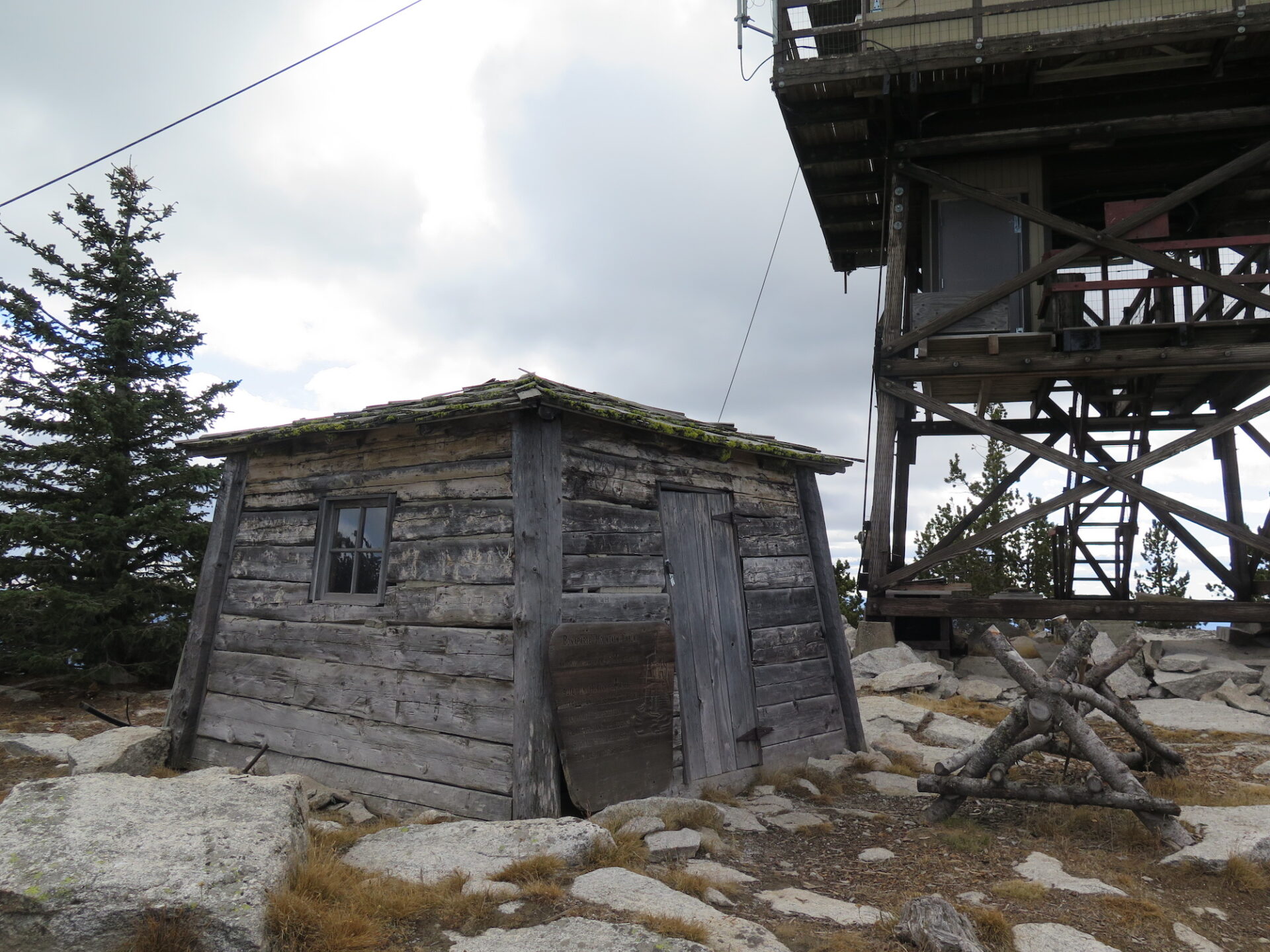
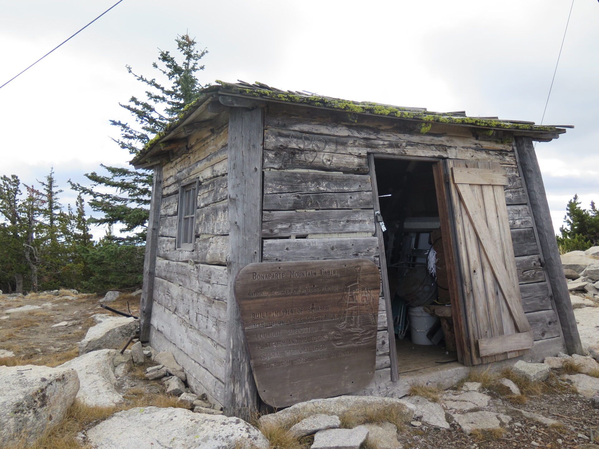
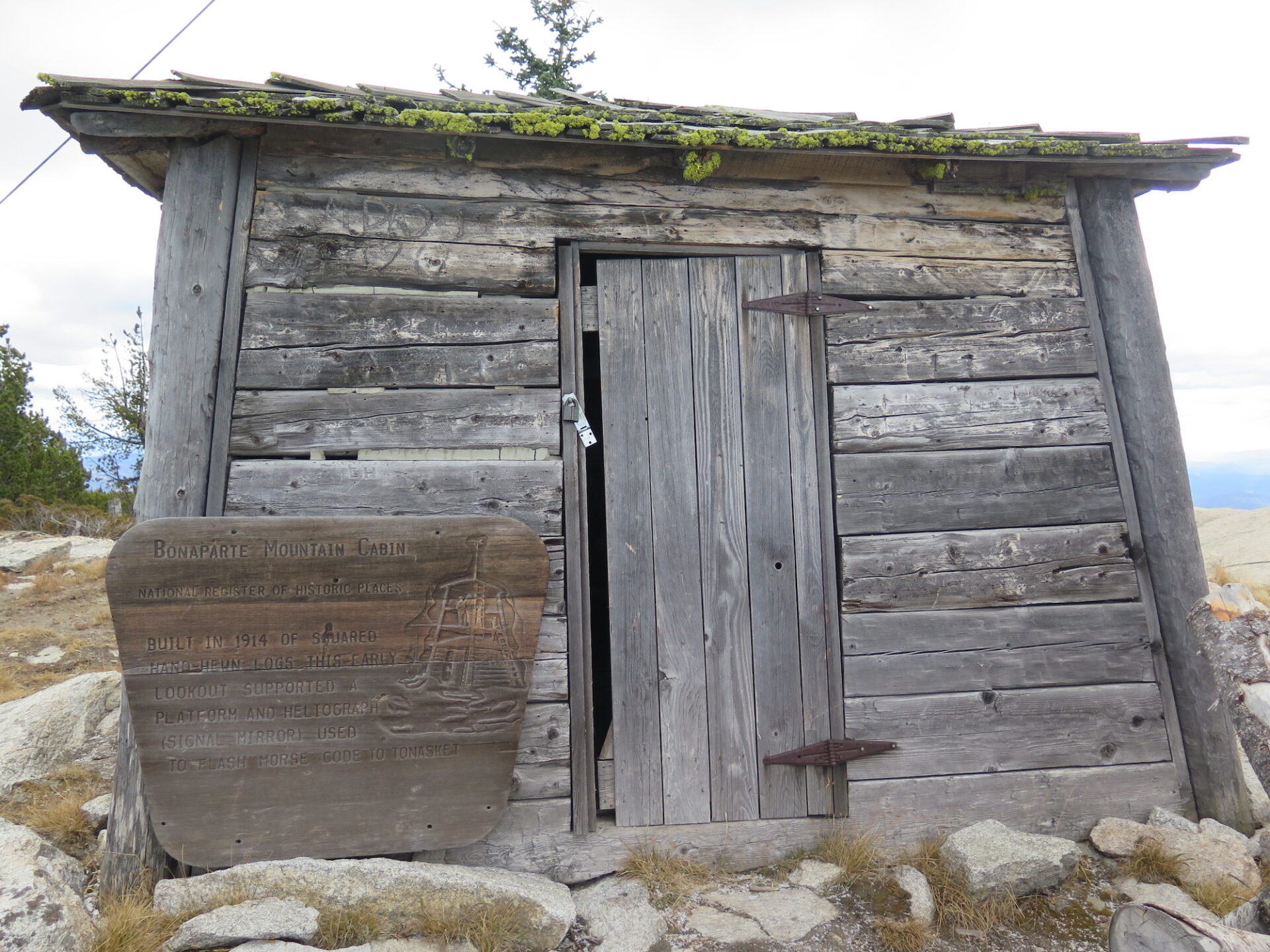
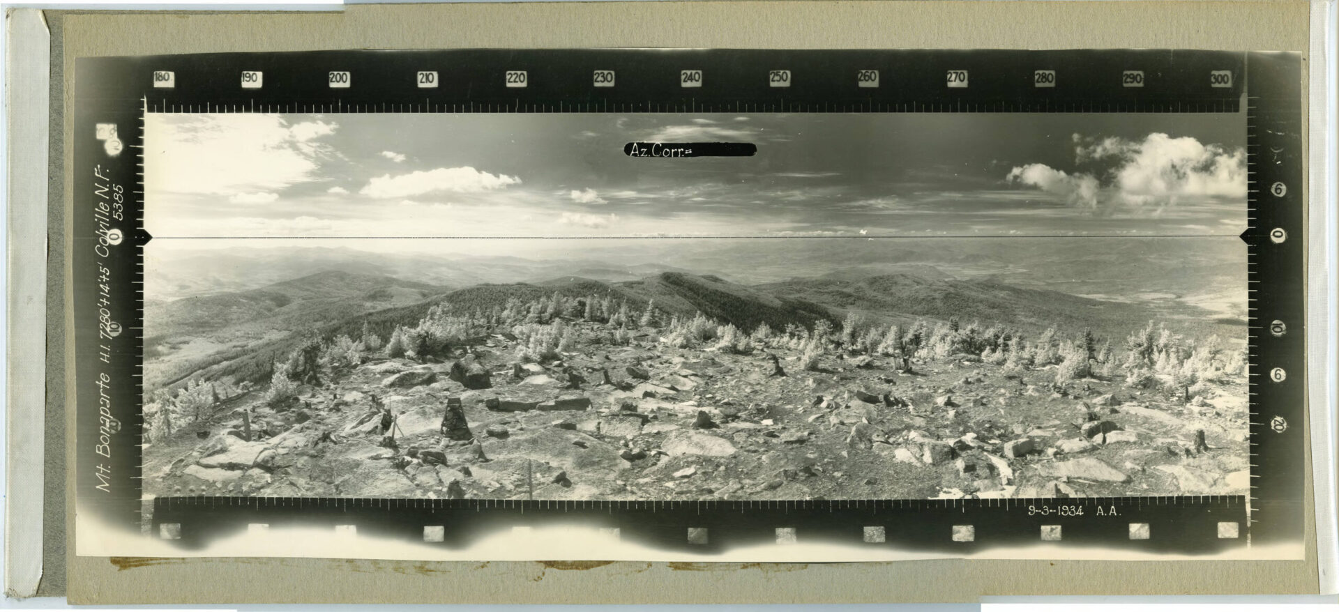
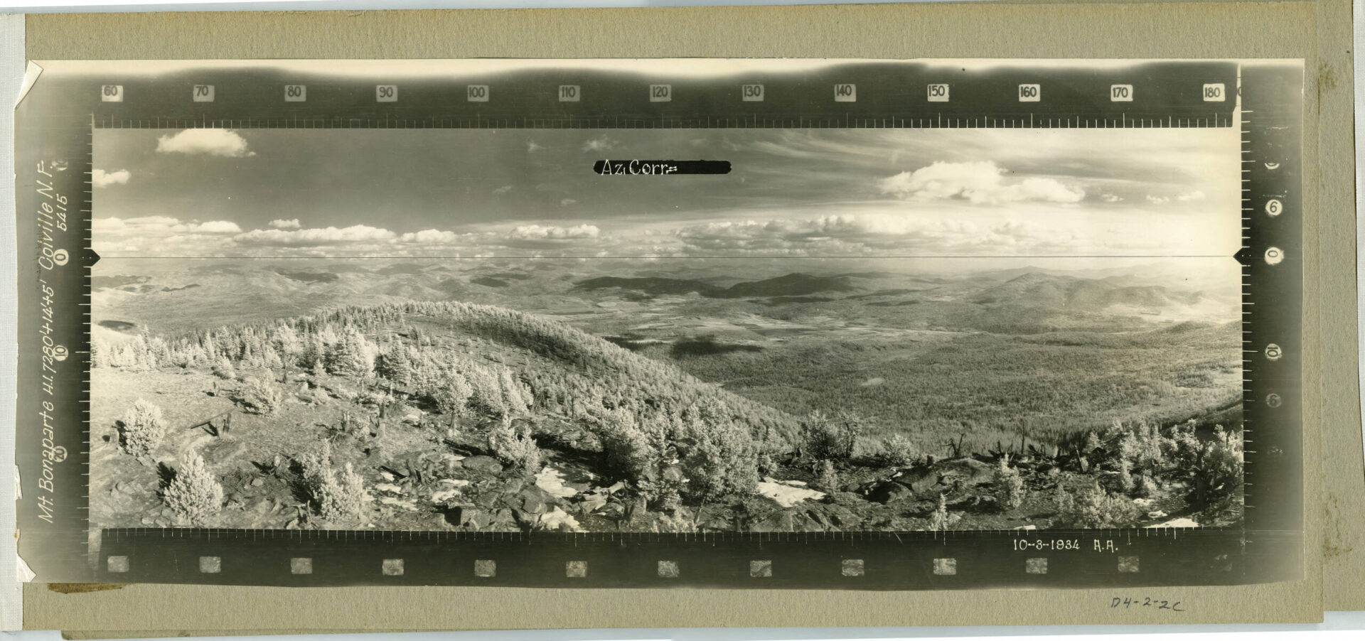
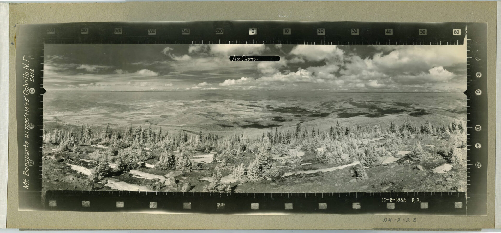
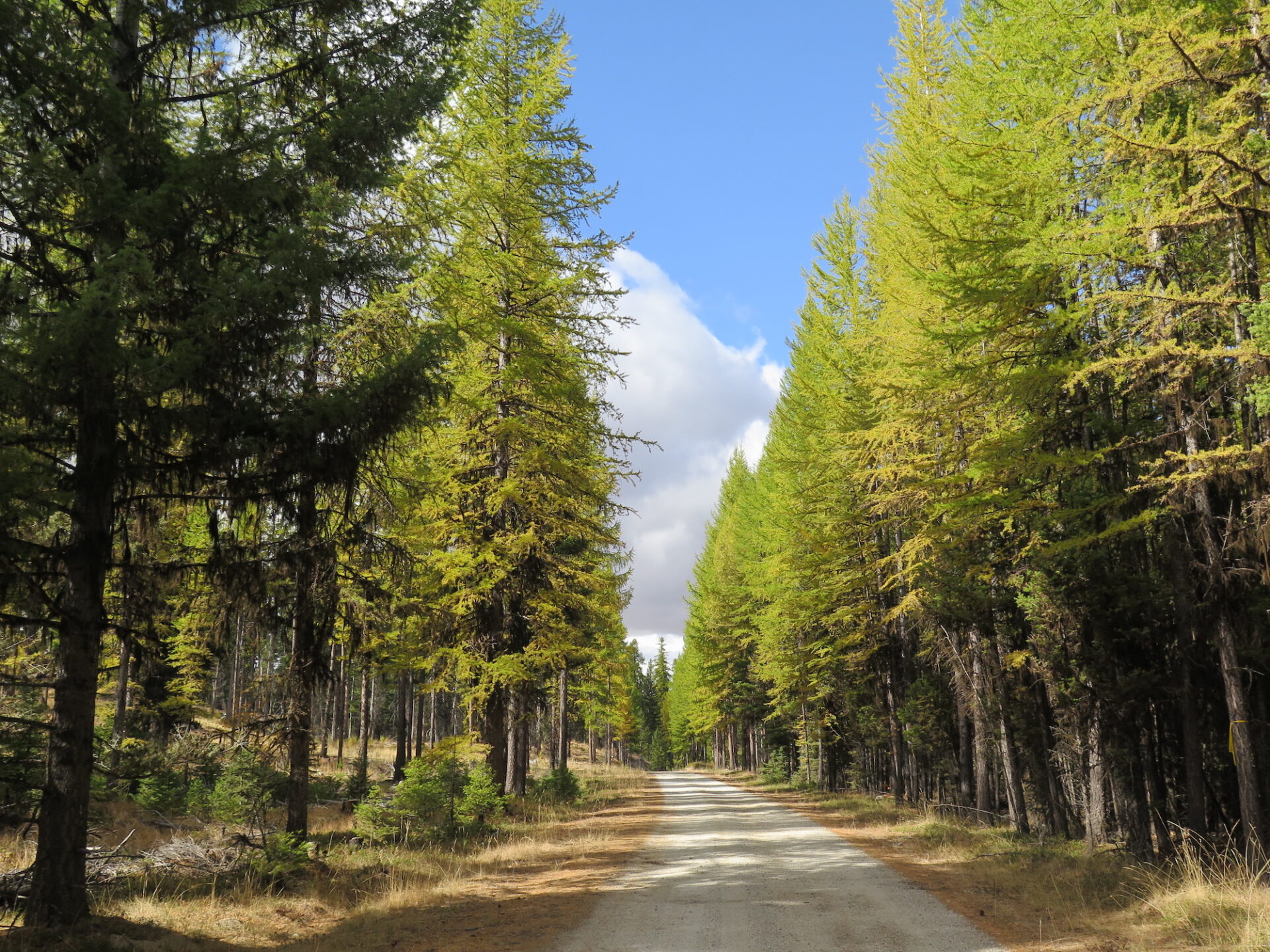
Mount Bonaparte’s impressive 3,537′ of prominence ranks it number 31 on Washington State’s list of top 200 most prominent mountains and it’s the 3rd highest peak in the state east of the Okanogan River. Bonaparte’s fire lookout is Washington’s 4th highest in altitude and it also has a cool historical cabin built in 1914. Definitely do this one in the fall when towering tamaracks put on a dazzling golden show.
Photos from October 2017.
History.
Mount Bonaparte is a bit of an anomaly in the area, often called a monadnock, which means high, solitary mountain. With 3,537′ of prominence, Bonaparte is Washington State’s 31st most prominent mountain. The fire lookout is the 4th highest in elevation (7,257′) and also the 4th most prominent.
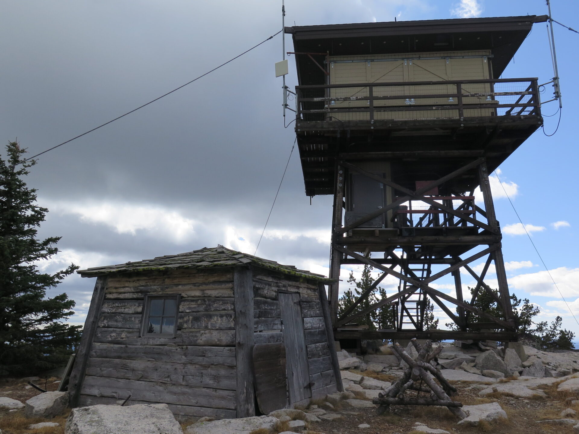
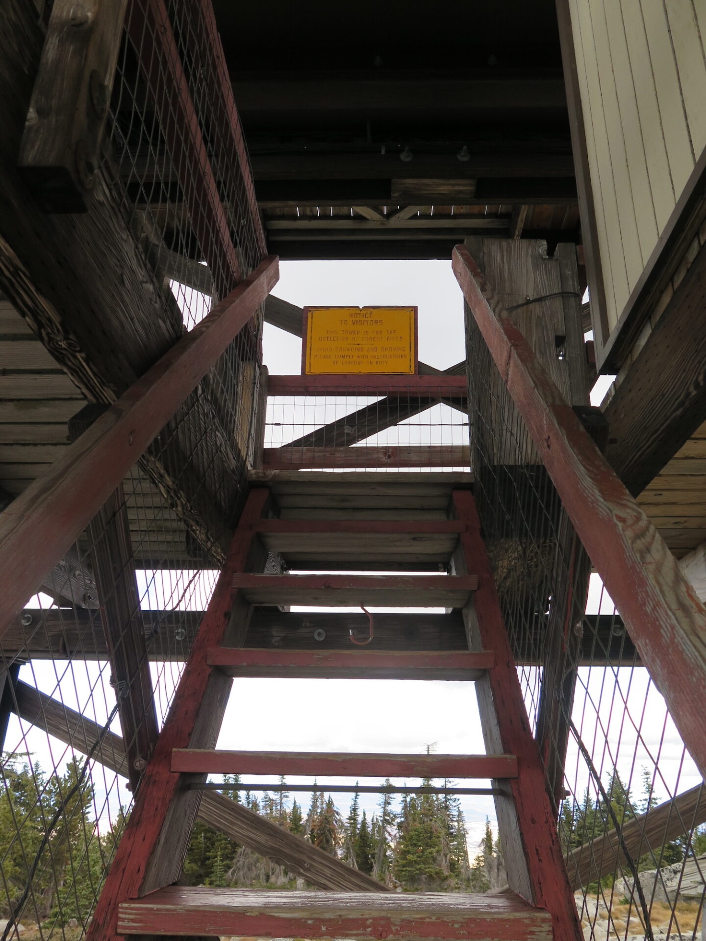
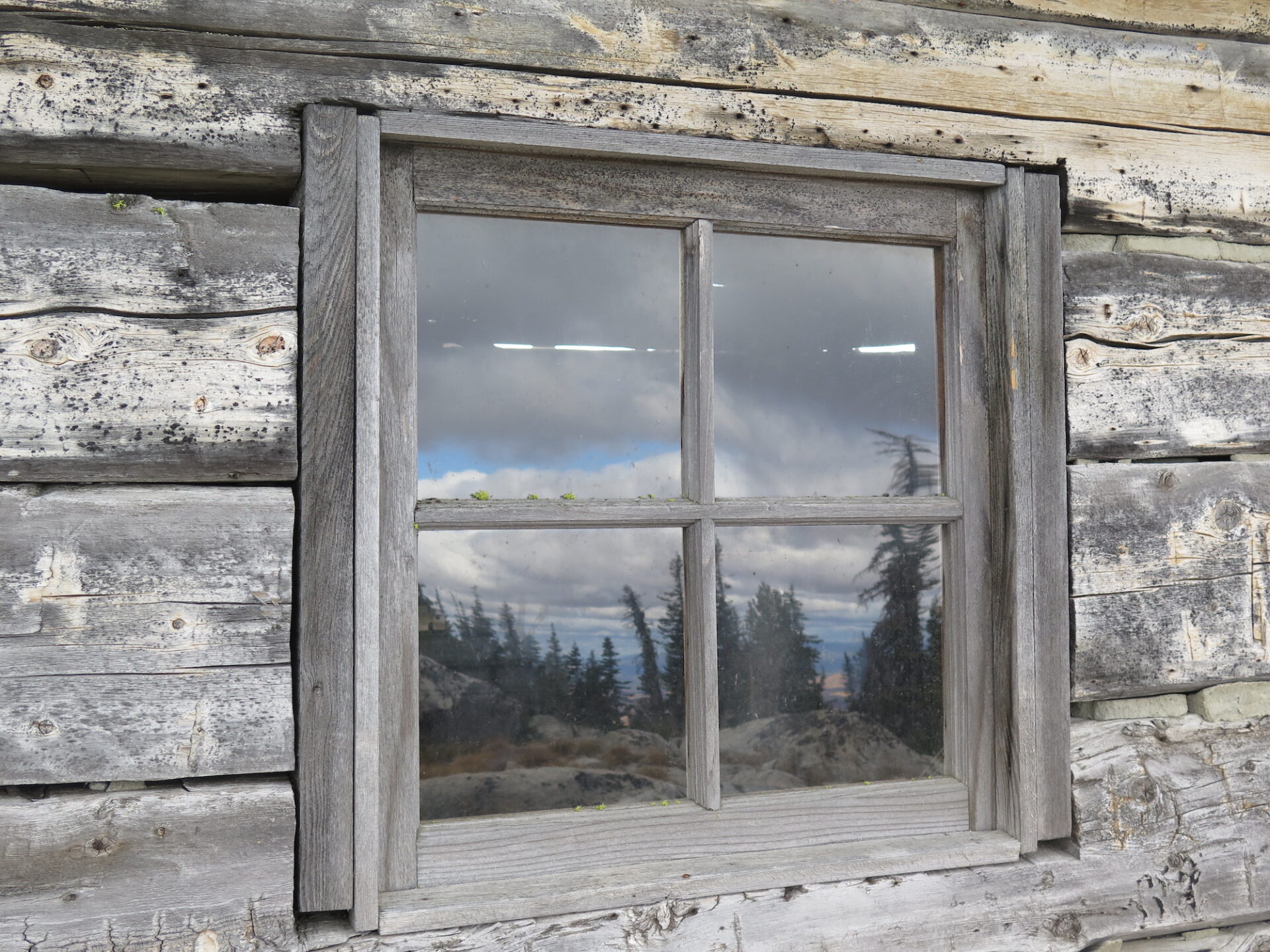
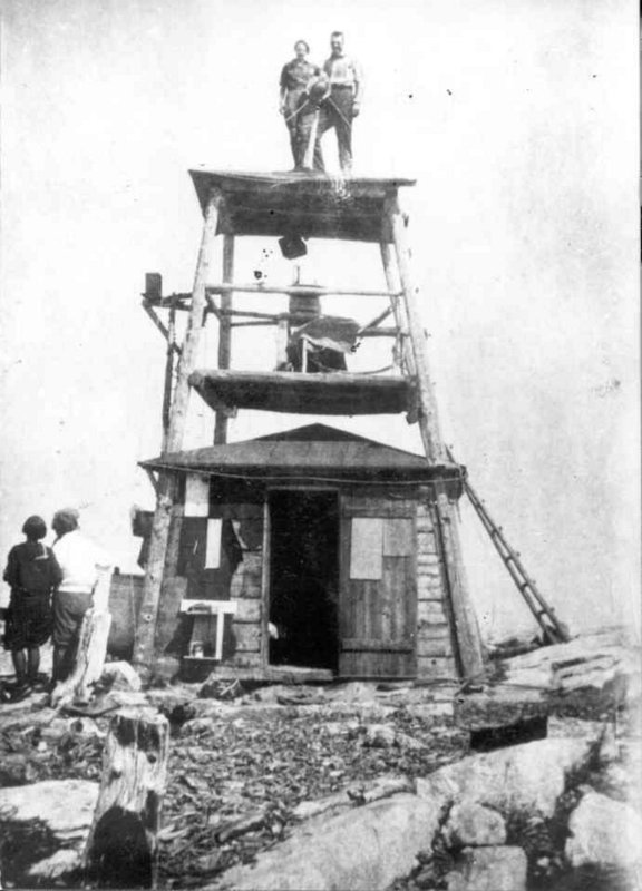
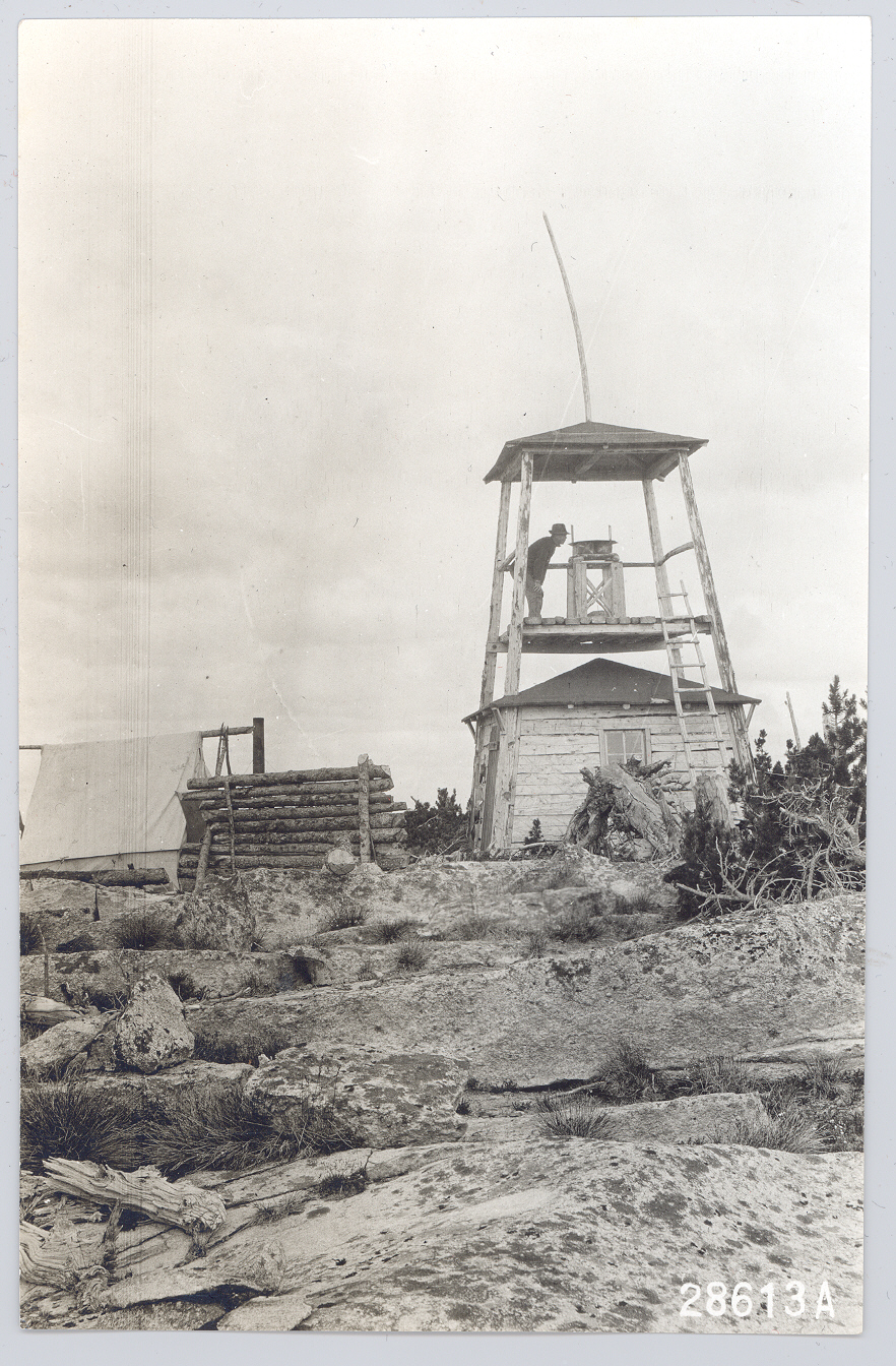
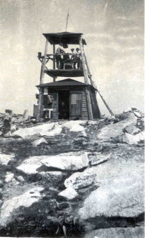
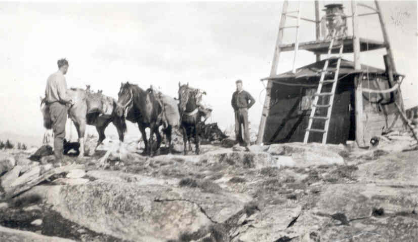
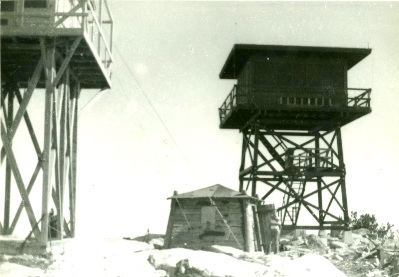
Mount Bonaparte may have been established as a tent camp lookout as early as 1906. A 12’x12′ flat-hewn slant-walled ground house with a 15′ covered platform tower was built in 1914 and the historical structure remains on the summit today. In 1930, a 16′ wooden tower with Region 5 cab was added to the summit. The present 20′ R-6 flat cab was built in 1961 and photos prove that for a time, all three structures were standing.
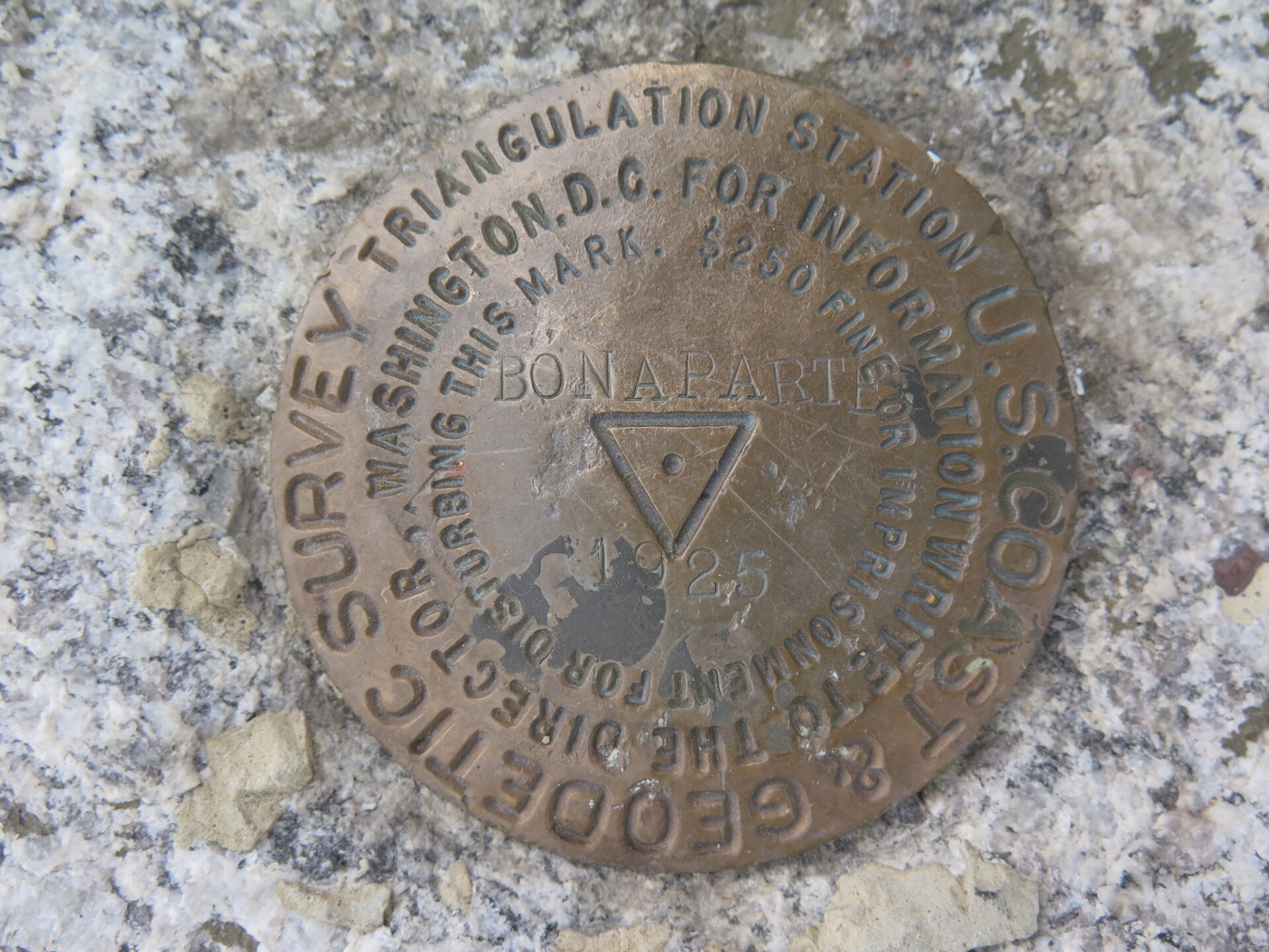
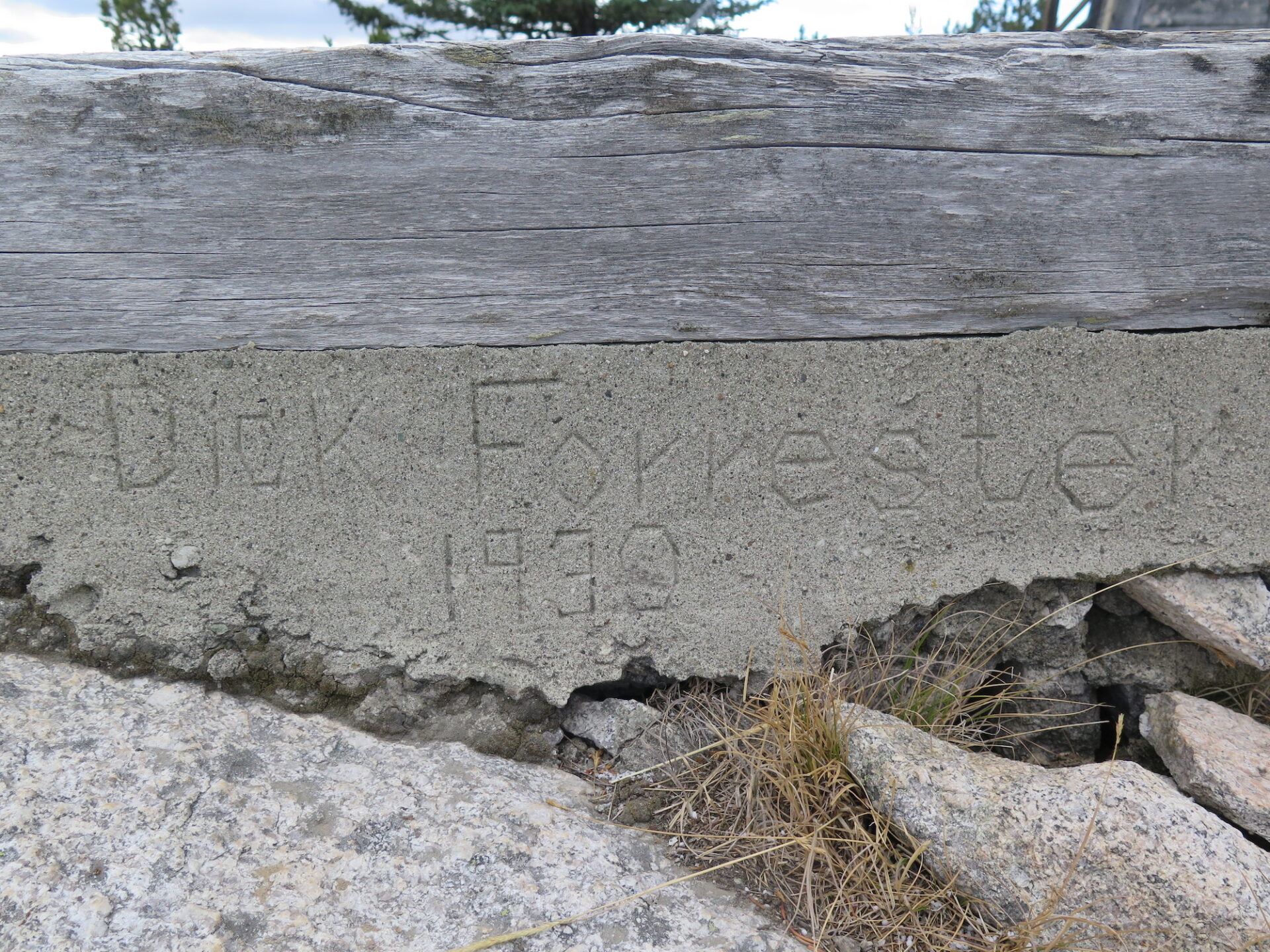
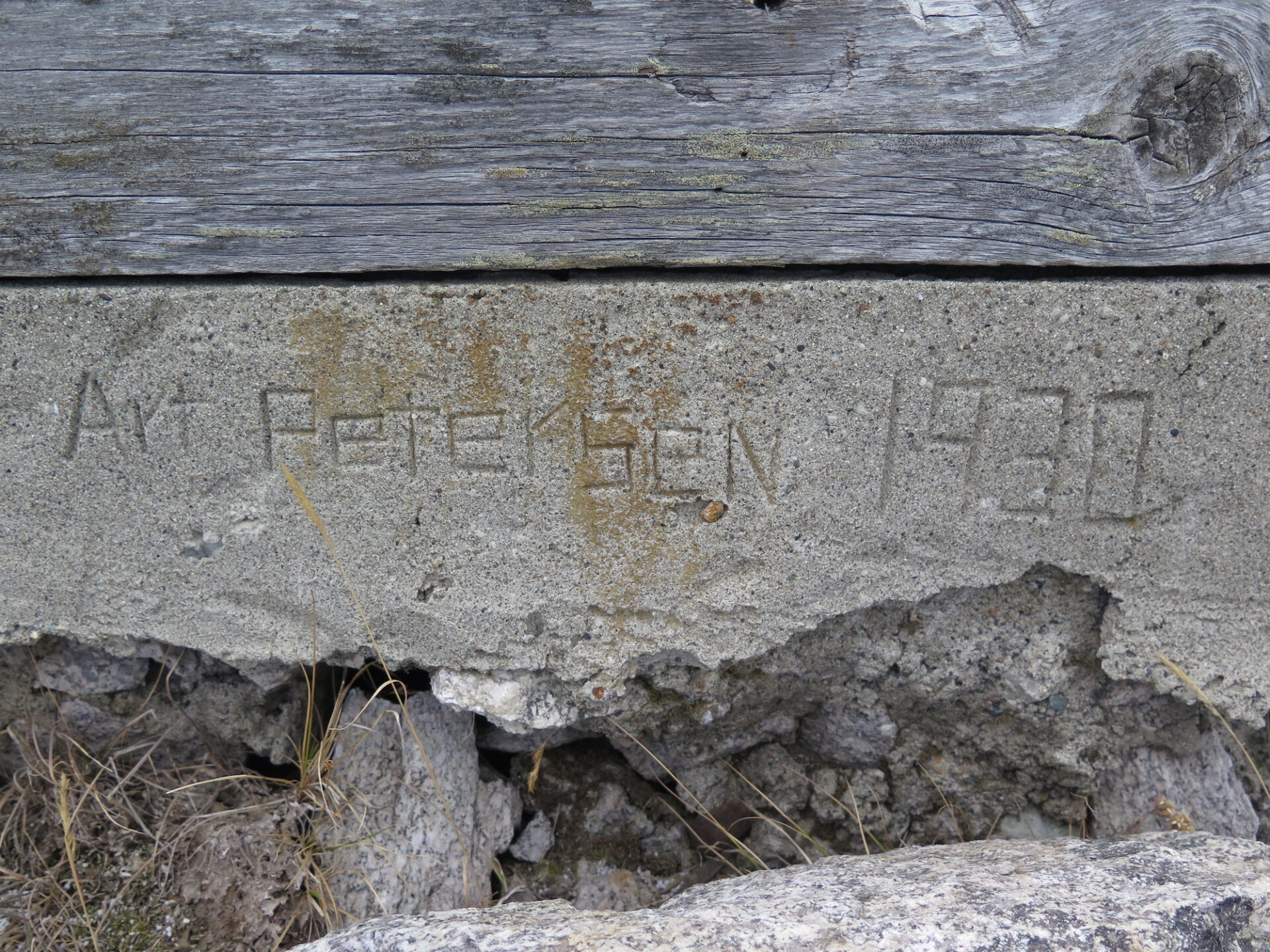
The 1930 Region 5 cab has since been removed but its foundation remains. If you look closely, you’ll find some names etched into the concrete. The 1914 cabin is listed on the National Register of Historic Places and both the cabin and present lookout are on the National Historic Lookout Register.
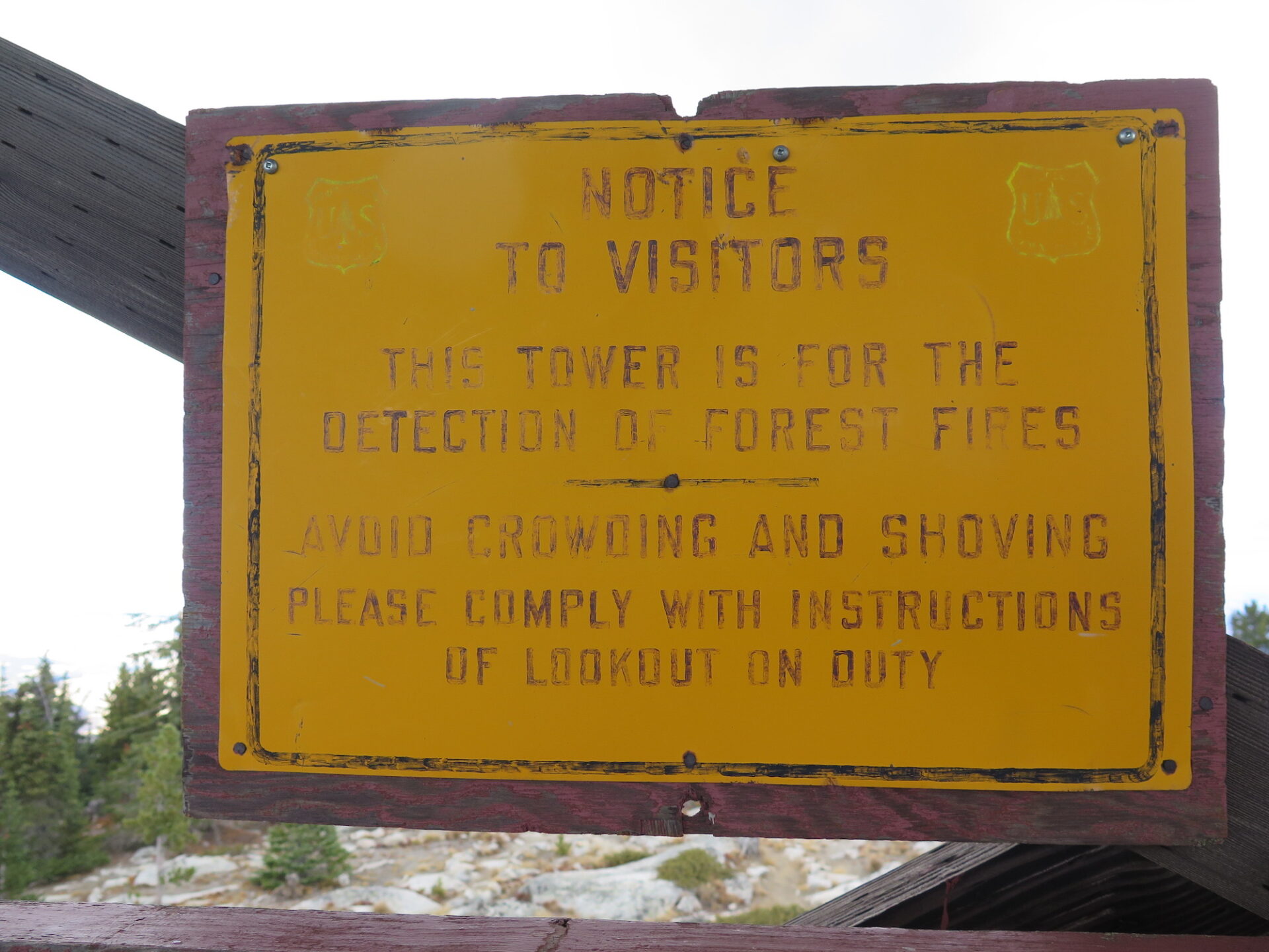
The lookout received extensive maintenance in 2000 and is actively staffed during the summer.
Bonaparte joined a handful of Washington State fire lookouts that came dangerously close to fires during 2021.
The route.
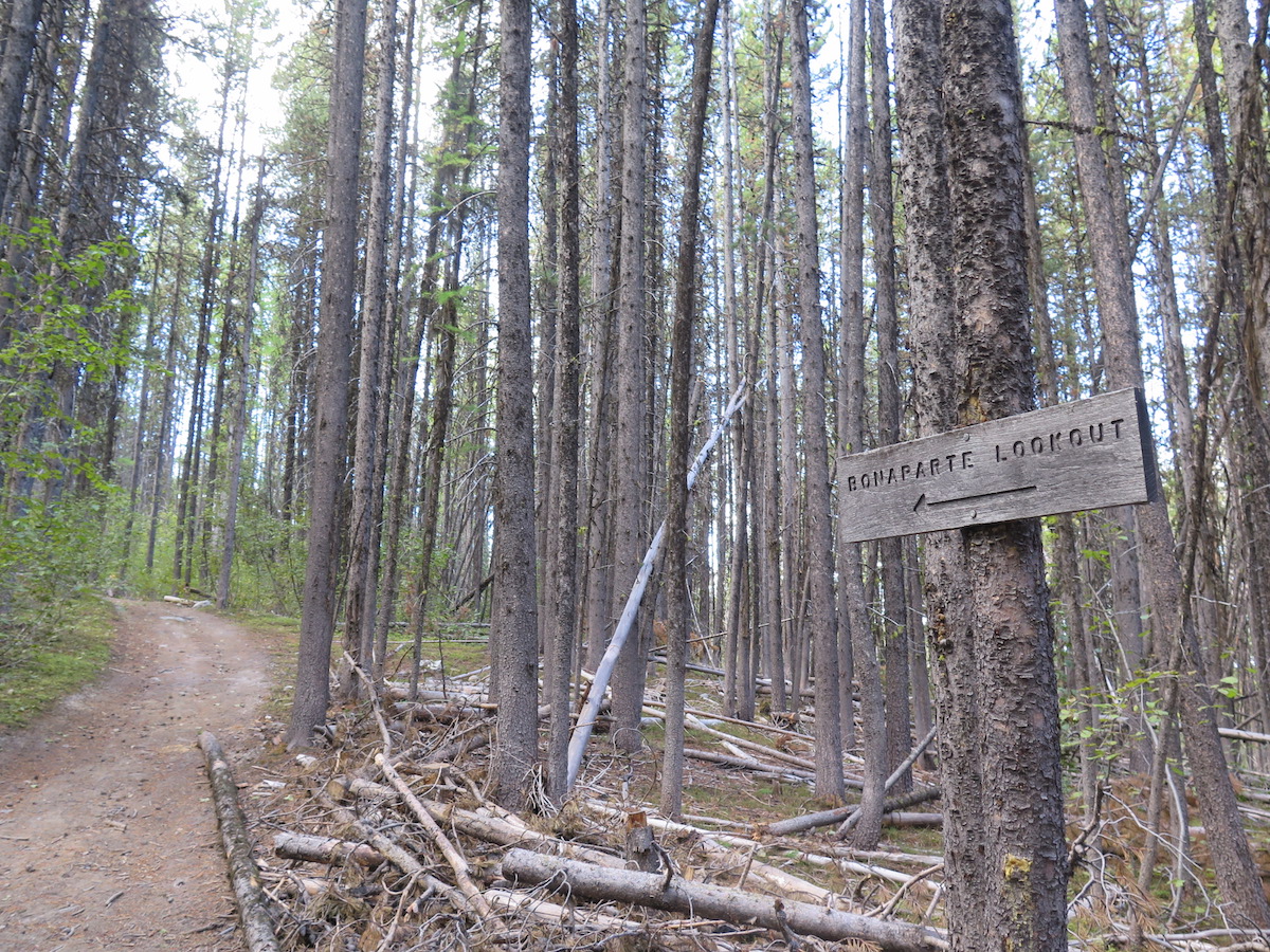
The most frequently used, shortest and most direct approach to Bonaparte is from the north side on the Bonaparte Trail. However, there are several other routes to the summit if you’re up for a make your own adventure type of outing. From the west side of Bonaparte Lake, it’s possible to summit Bonaparte by following the South Side Trail. There are also numerous trails on the west side of Bonaparte using the Antoine Creek approach.
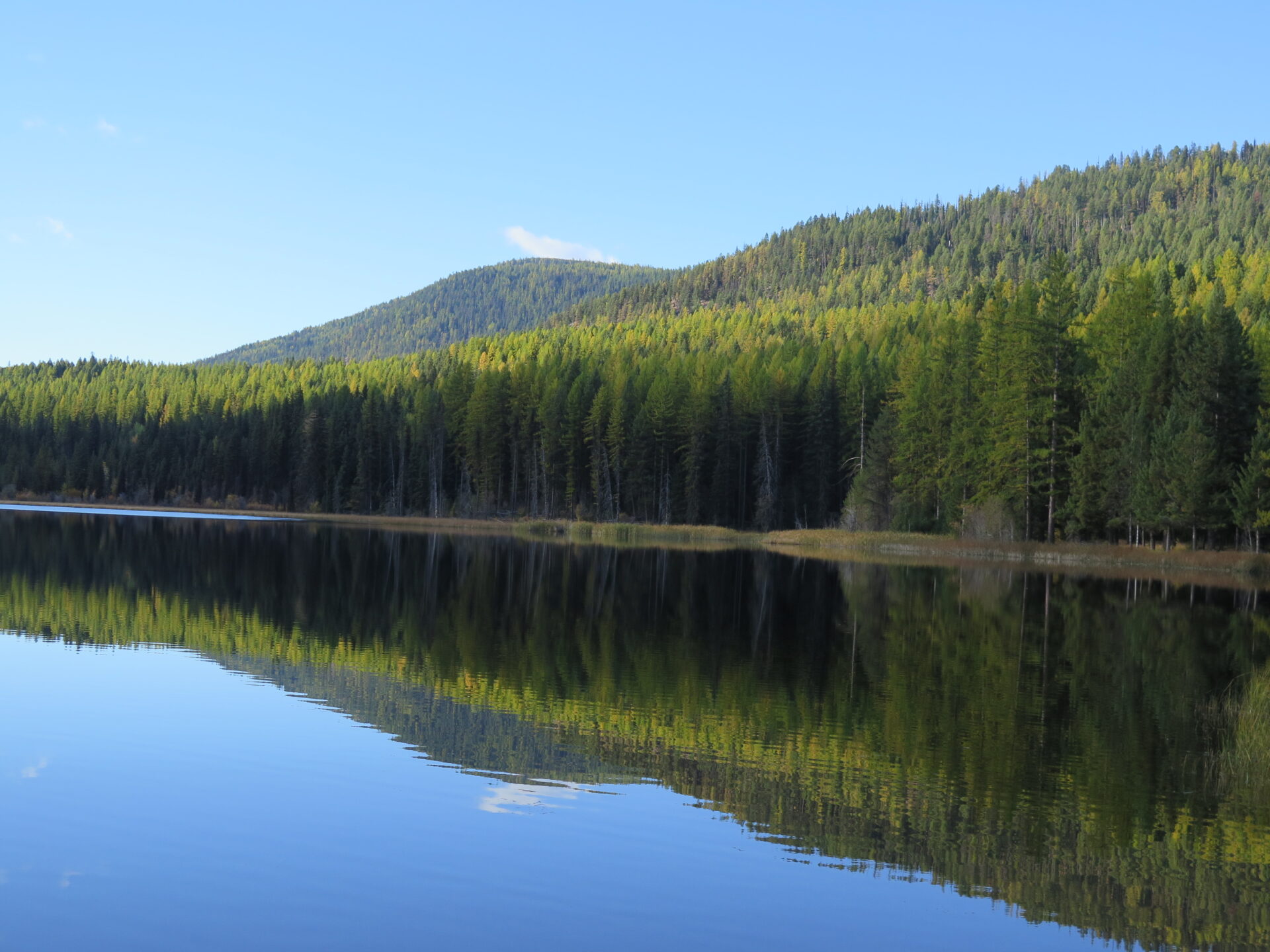
I hiked the north side approach on my trip in October 2017 and not only was it pleasant, but I had the entire trail and summit to myself! Even better? In fall, the larches (oftentimes called tamaracks in the east) put on a fabulous golden show and the ones in this area are huge!
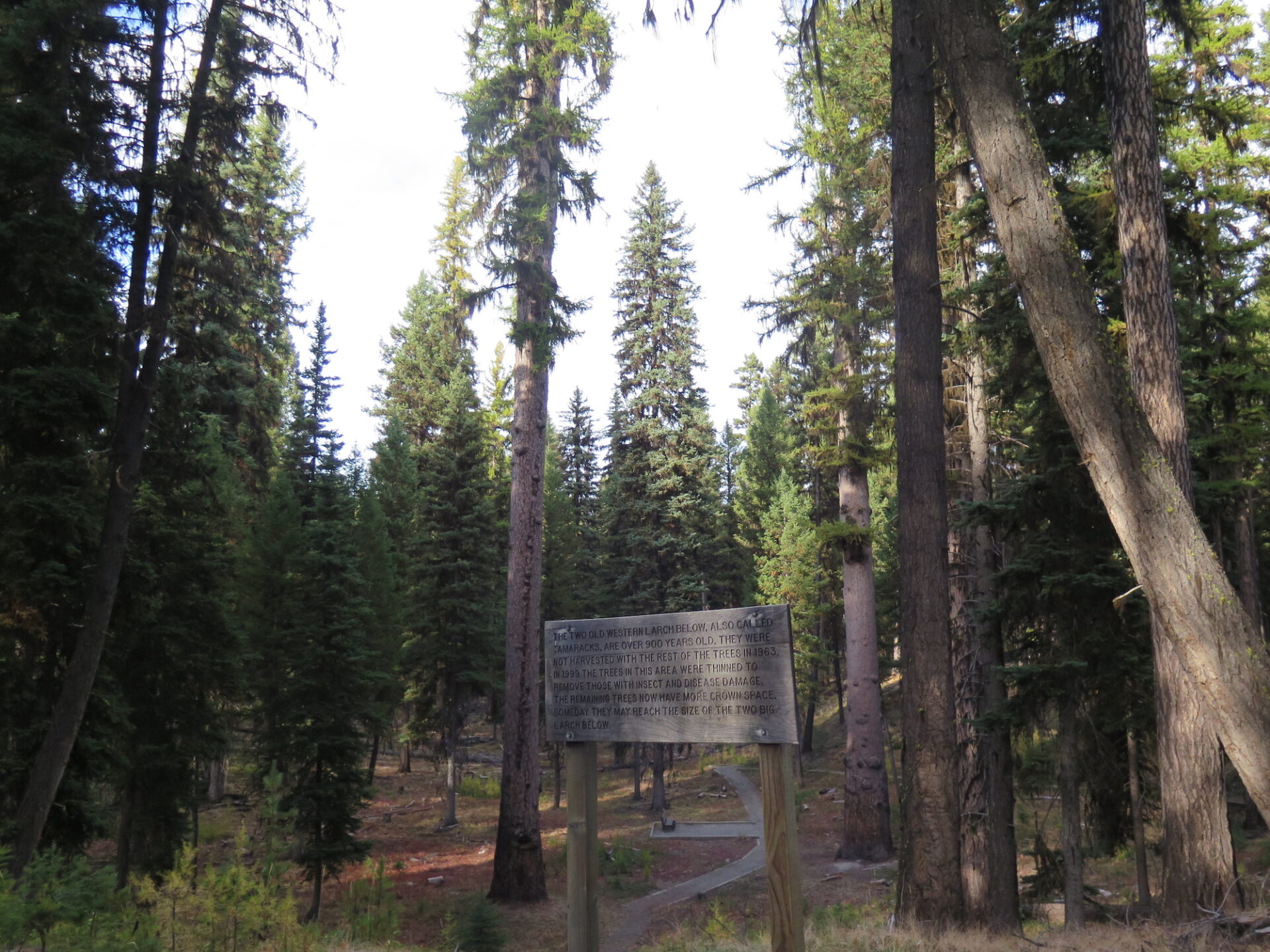
The nearby Lost Lake Campground makes a fabulous base camp and the Big Tree Botanical area is a must see. You’ll be delighted as you walk amongst towering tamaracks that are hundreds of years old!
Northside Bonaparte Trail.
Distance (RT): 5.8 miles
Elevation Gain: 2,210′
The trail climbs steeply at first through ponderosa forest before the grade lightens up in about a half mile. In one mile is a junction where the southside trail meets up from Bonaparte Lake. Shortly after is a spur trail to Lookout Spring. The trail switches back steadily upwards through forest all the way to the summit. It’s a good grade, but never too aggressive. The trail stays in the trees until nearly the very top of the summit where the lookout finally reveals itself.
South Side Trail from Bonaparte Lake.
Distance (RT): 10.6 miles
Elevation Gain: 3,130′
Although this is called the south side approach, it does in fact come up the east side of Bonaparte from the west side of Bonaparte Lake. It’s possible to start right from the lake by taking the Pipsissewa Trail up to the start of the South Side trail. After 2 miles, the South Side trail meets up with the Fourth of July trail. Though not completely intuitive, turn right at this junction and in approximately 3 miles it will join the Bonaparte Mountain trail. From there it’s a half mile up to the summit.
Directions.
Northside Upper Mount Bonaparte trailhead. From Havillah, turn east onto W. Lost Lake Road. Drive 0.8 miles and then turn right at the “T” intersection onto FS-33. Follow FS-33 for 3.3 miles, then turn right onto Road 300. There may or may not be a sign for the Mount Bonaparte Trail. Follow the road 2.5 miles to a trailhead. Parking is limited.
Southside Bonaparte Lake approach. Drive north from the Bonaparte Lake campground on Forest Road 32 for 5 miles. Turn left on Forest Road 33, then take Road 100 4 miles to the trailhead on the west side of the road.