Back in January 2015 I made my first long overdue visit to the beautiful Goldmyer Hot Springs, located 25 miles northeast of North Bend in the Upper Middle Fork Valley. I expected a tranquil evening hot spring soaking amongst old-growth forest. What I got was a full-on flood, raging creeks, a washed-out road and one of the wildest nights I’ve ever spent in the Cascades.
A rainy day and perfect rain on snow storm conditions would push the Snoqualmie River to its 8th highest flood stage on record, stranding me and two friends high up the Middle Fork Valley. The trip remains once of my most memorable adventures.
A friend had booked reservations for three, including me, for a Sunday evening visit on January 4, 2015. As our date approached, the weather forecast turned a bit dismal. My friend chose to postpone, offering her two reservations to me. Not to be deterred by rainy PNW weather, I convinced my friend Brian and his friend Mac to join me last minute.
At the time, a large federal highway project was underway to repave the Middle Fork, so while the drive to Goldmyer wasn’t as legendary as it once was, it still required driving five miles on a notoriously rough road between the Taylor Bridge and the Dingford trailhead. A high clearance vehicle and 4WD has always been highly recommended. If the road is impassable, Goldmyer can easily turn into a tough 20+ mile outing and there is no cell service beyond the lower Middle Fork Valley.
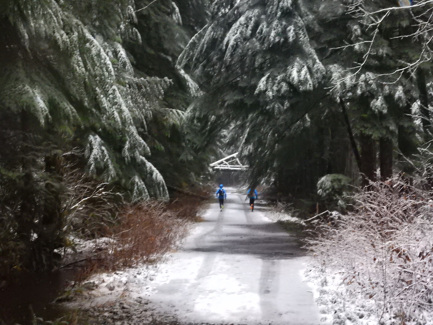
From the Dingford trailhead, the hot springs is a 4-5 mile hike or bike and reservations are required as the number of visitors is limited to 20 per day. Back then I was trail running a lot, so my friends and I planned to run into Goldmyer late in the afternoon for an evening soak, then run back out by headlamp. We left Seattle around 1:30pm, reaching the Dingford Creek Trailhead around 3:30pm. We ran the mostly flat 4.5 miles to Goldmyer in about an hour, arriving at dusk. On the way, a 1-2″ dusting of snow combined with slush and deep water made for a cold, wet run, but we were well prepared.

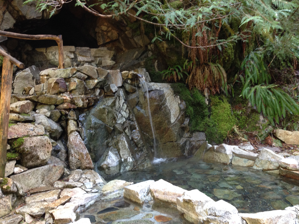
Arriving at Goldmyer is like stepping into a wonderland. The caretakers cabin is nestled into tall old growth trees like a magical gatekeeper. We rang the bell to check in and talked to the relief caretakers, who had just arrived that morning to manage the springs for the following week. Afterwards, we hiked straight up the hill about a half mile to the hot springs. I’m so glad we had just enough light to see the towering old growth trees on the property, many over 900 years old!
We had the place all to ourselves and spent the next several hours laughing, chatting, relaxing, and enjoying the special ambiance of this wonderfully energetic place. The rain had been falling steadily since our arrival, but wasn’t worryingly heavy. Around 9pm, we reluctantly packed up and started our trek back to the Dingford trailhead.

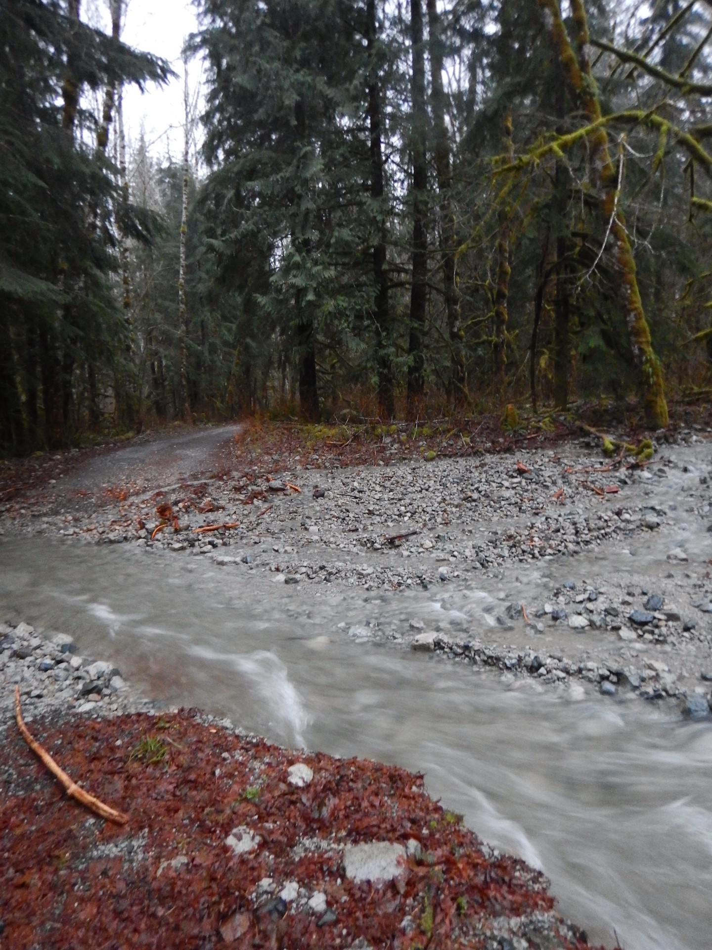
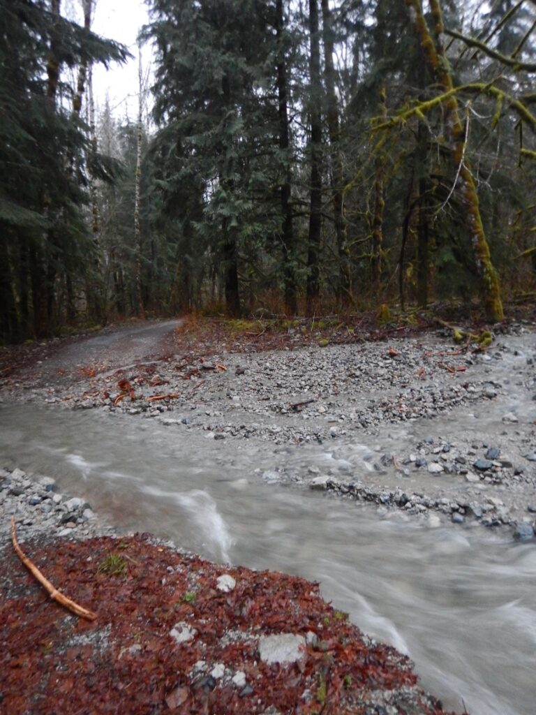
As we ran back on the road, we realized hours of steady rain combined with rising temperatures had melted a lot of snow. The road was a flooded, cold mess. I was so happy I was wearing neoprene Storm Socks over my wool running socks. Though far from 100% waterproof, they kept my feet from freezing completely.
We kept up a steady pace to get quickly back to the car and into dry clothes. As we neared the trailhead, we heard an incredible roar in the distance, finally realizing it was the Dingford waterfall raging like a freight train! There was a lot of water coming down from the higher elevations and as we began our drive out, we grew concerned. Water was moving swiftly across the road, leaving deep fast-moving water channels.
In only a few short miles driving out from Dingford, we stopped. There was a lot of water over the road. We got out, probed around with sticks, and made a collective decision that the water was low enough and safe enough to cross. I nudged my Jeep carefully across and we all breathed a small sigh of relief.
Unfortunately, only a few more feet down the road we encountered another overflowing creek, this one moving much swifter. A very deep narrow channel was cut into the road. While it looked crossable with my Jeep, I grew up off-roading and know that water is very easy to underestimate. We probed around again with a stick and found the channel to be deeper than expected with very soft silt and large rocks at the bottom.
I didn’t like it at all.
You know when people say to listen to that little voice inside your head? Yep, mine was yelling loudly that this was not a good situation.
As we stood there, trying to find a safe way across, the water suddenly surged and within barely a minute, the volume and current increased rapidly. If we tried to cross and got hung up in deep silt or debris, we’d be stuck right in the middle of rapidly rising water. Not a good idea.
We all agreed it wasn’t worth the risk and that our only safe option was to turn around, recross the first deep channel of water over the road, and camp at the Dingford trailhead for the night. From there we’d be in a better position to run back to Goldmyer if needed to let the caretakers know about road conditions. Happy with our plan, we turned around, only to find the first creek we had crossed just 20-30 minutes before had also exploded in volume and was no longer safely passable by car or by foot.
Shit.
We were trapped between two raging creeks that were both slowly washing out the road.
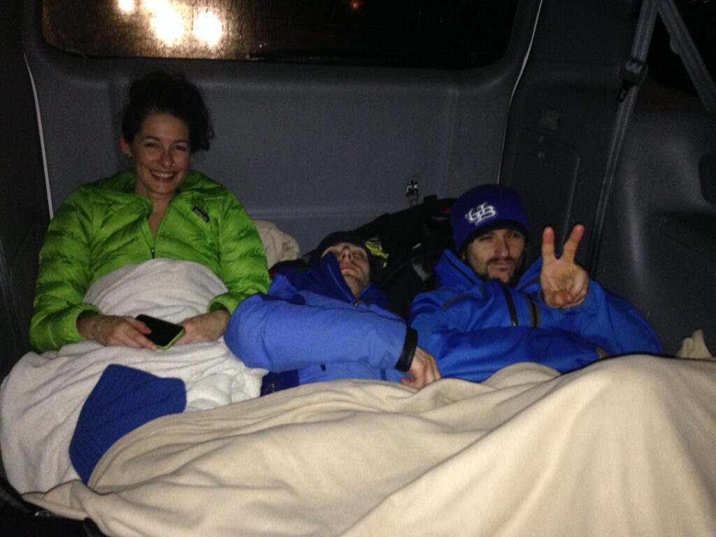
We found the safest high ground between the two and parked for the night, hoping by morning the visibility and conditions would be much improved. Again, there is no cell service this far up the Middle Fork and at the time (2015, afterall), I didn’t have any kind of satellite communication device, so we were on our own. Luckily, my Jeep was well stocked and I had plenty of extra food and supplies. Our biggest concern was getting out of wet clothes so we could stay warm and dry. Standing out in the pouring rain trying to assess the road and water crossings had soaked us to the bone.
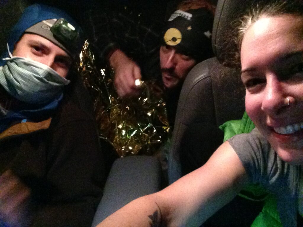
We all quickly went to work picking out the most essential clothing and drying it with the car heaters. I raided my Jeep emergency kit and found extra lights, batteries, two emergency blankets, and lots of extra food. Brian’s friend Mac was the most in need of dry clothing. Luckily for him I had a pair of shorts and a t-shirt in the back of the Jeep. We all got a good laugh as Mac squeezed himself into my tiny size 0 clothes, ha!
Once settled, we tried to get some sleep, but the rain continued steadily and it wasn’t very relaxing knowing that we were trapped between two raging creeks. We’d sometimes hear a noise, likely wind in the trees, and turn on the headlights to check out what was going on. Would we find ourselves suddenly floating in water? Would a tree crash down with the ground saturation? It wasn’t a relaxing evening.
At one point Mac moved around in the backseat and I awoke to the Jeep shaking, freaked out that we were being washed down the road. Every hour or so we’d turn on the ignition to get heat, dry more clothes, and then try to get back to sleep. Sometime around 3am we all got a little slap happy and found ourselves raiding the emergency kit, laughing at the absurdity of it all.
We made a plan to wait until first light. If we couldn’t continue down the road, we’d leave the Jeep where it was and head back to Goldmyer on foot. Though the rain continued all night, surprisingly, by daybreak the water had crested and receded. With the light of day we could see much easier and were able to safely cross the previous creek that had stopped us the night before.
It was now Monday morning and we were all going to be shortly overdue for work. Both my friend Brian and I had told family and friends about our plans and we knew if we weren’t able to check in soon there would be cause for concern. We continued driving down the road, assuming that shortly we’d be back into cell service and could call family and friends to let them know we were ok. I was also incredibly worried about my dog, who had been home alone all night.
I thought our adventure was soon to be over.
I was wrong.
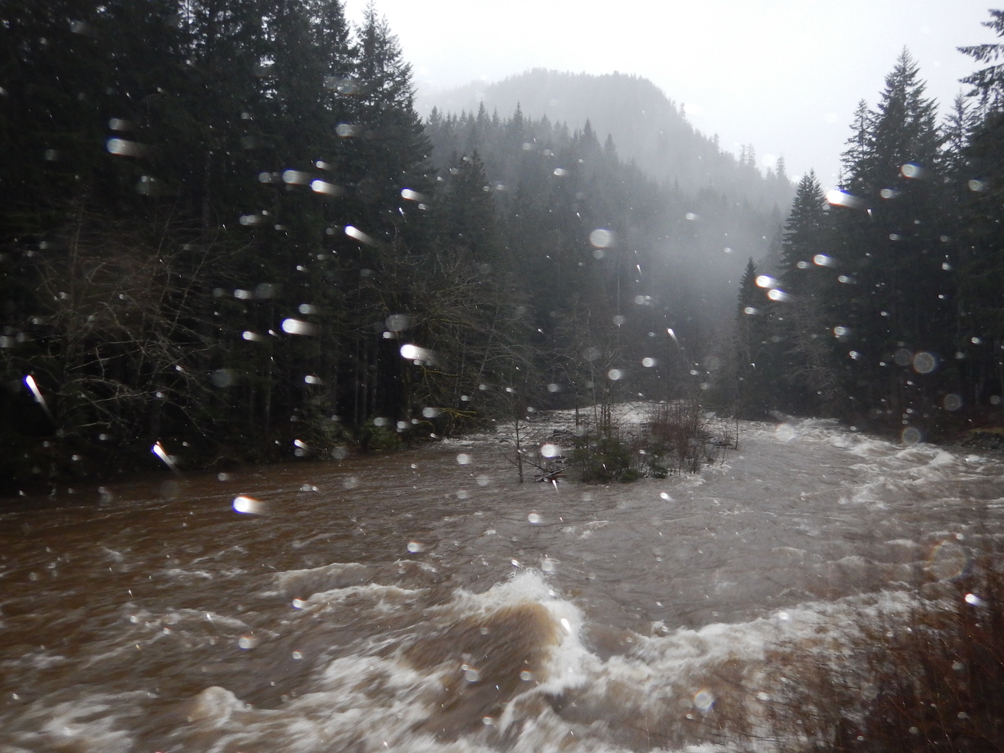
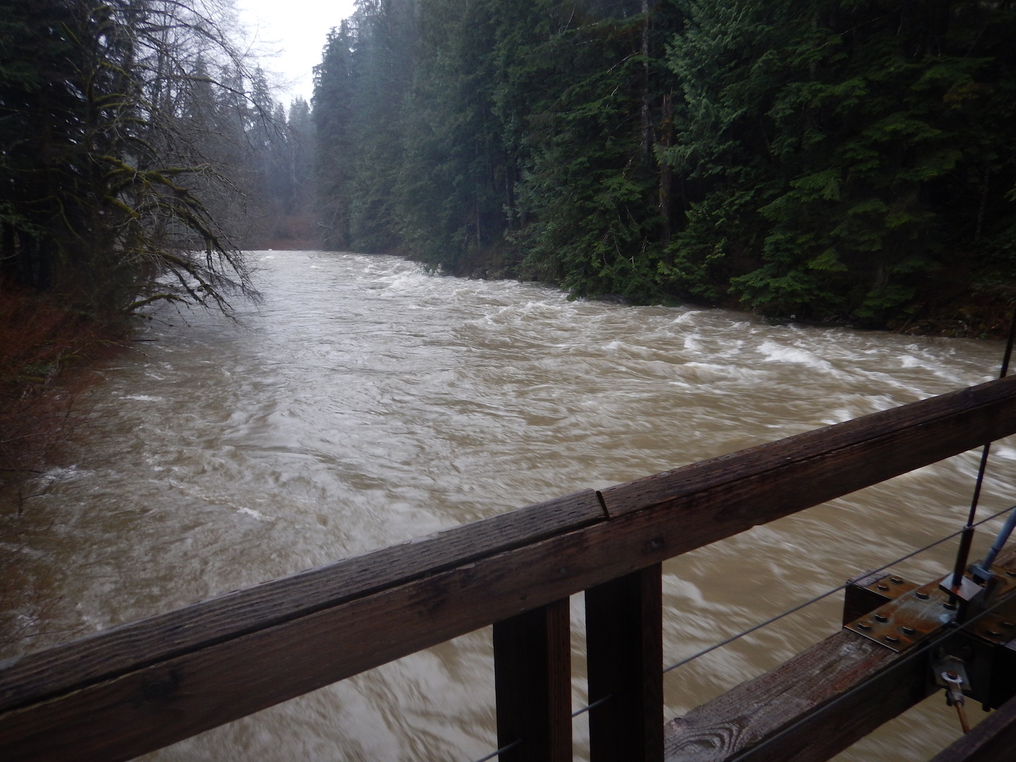
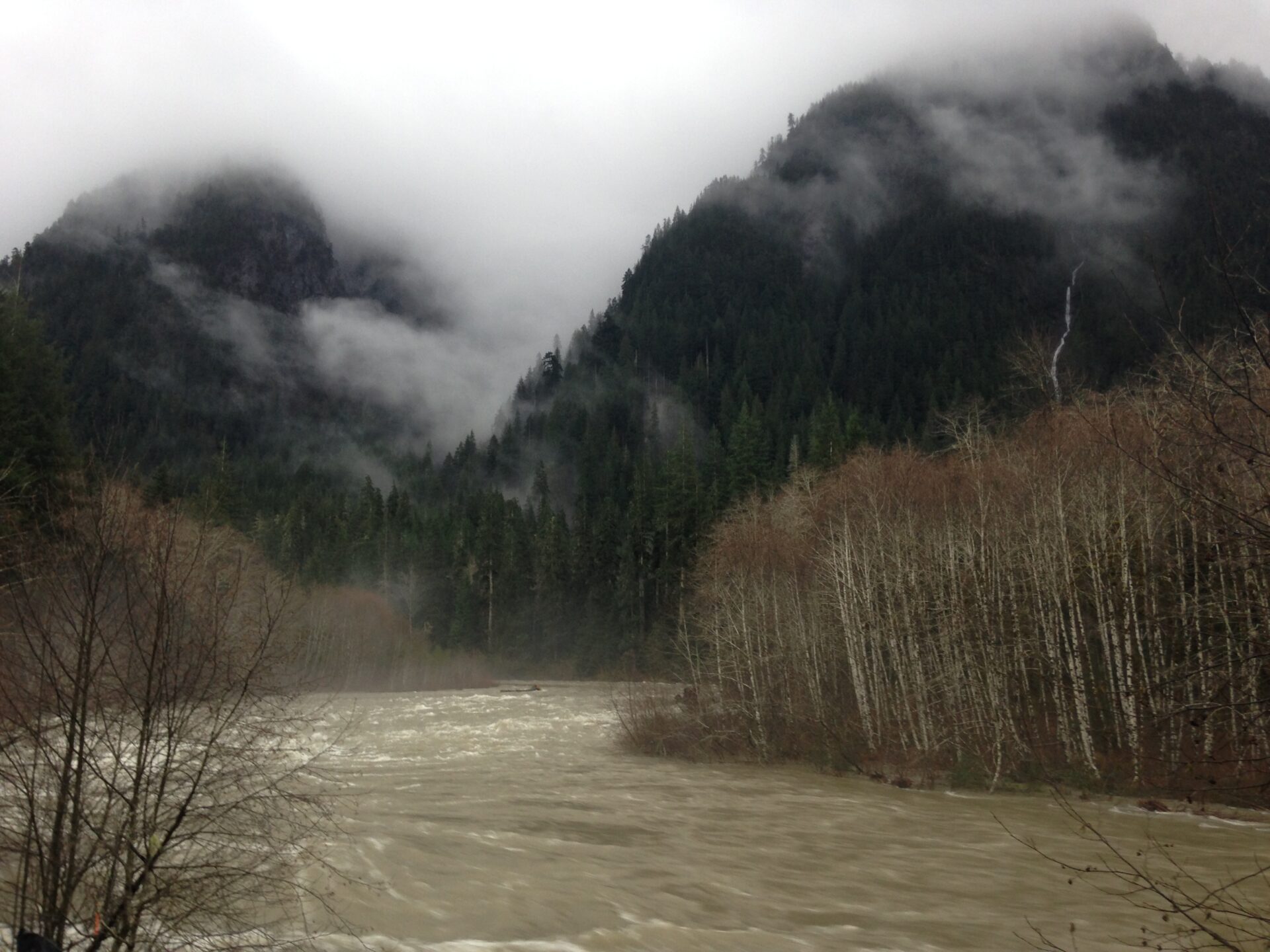
There was still a lot of water running down the road and a lot of massive rock and log debris. We took it very slow. When we finally reached the Taylor River bridge at the bottom of the Middle Fork, we couldn’t believe our eyes. The Snoqualmie River was absolutely raging! It was running so high in fact, that there was barely any space between the top of the river and the bottom of the Taylor River bridge. Knowing the bridge had been replaced in 2009 after it was compromised in flooding made us gulp. It was a rather anxious crossing.
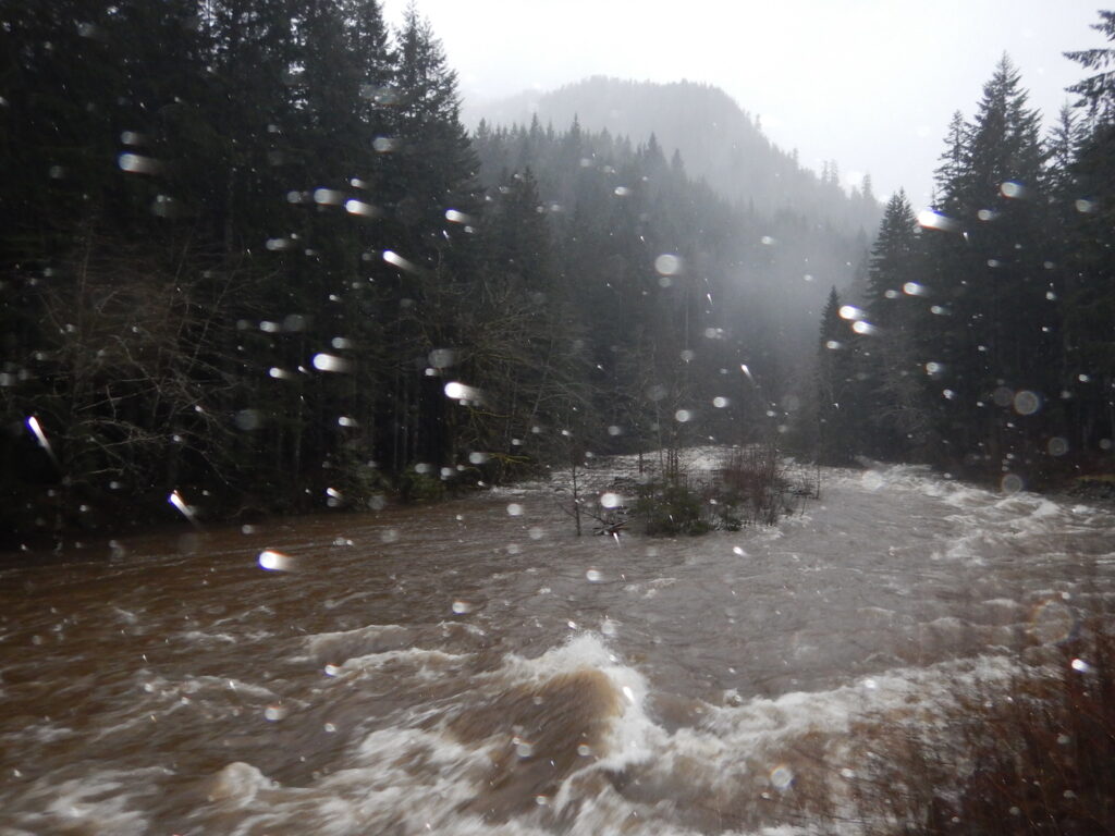
We all breathed a huge sigh of relief when we made it across the Taylor Bridge. It was quite the experience driving across, with the Snoqualmie River literally lapping at the bridge deck. It was disconcerting how high the water was.
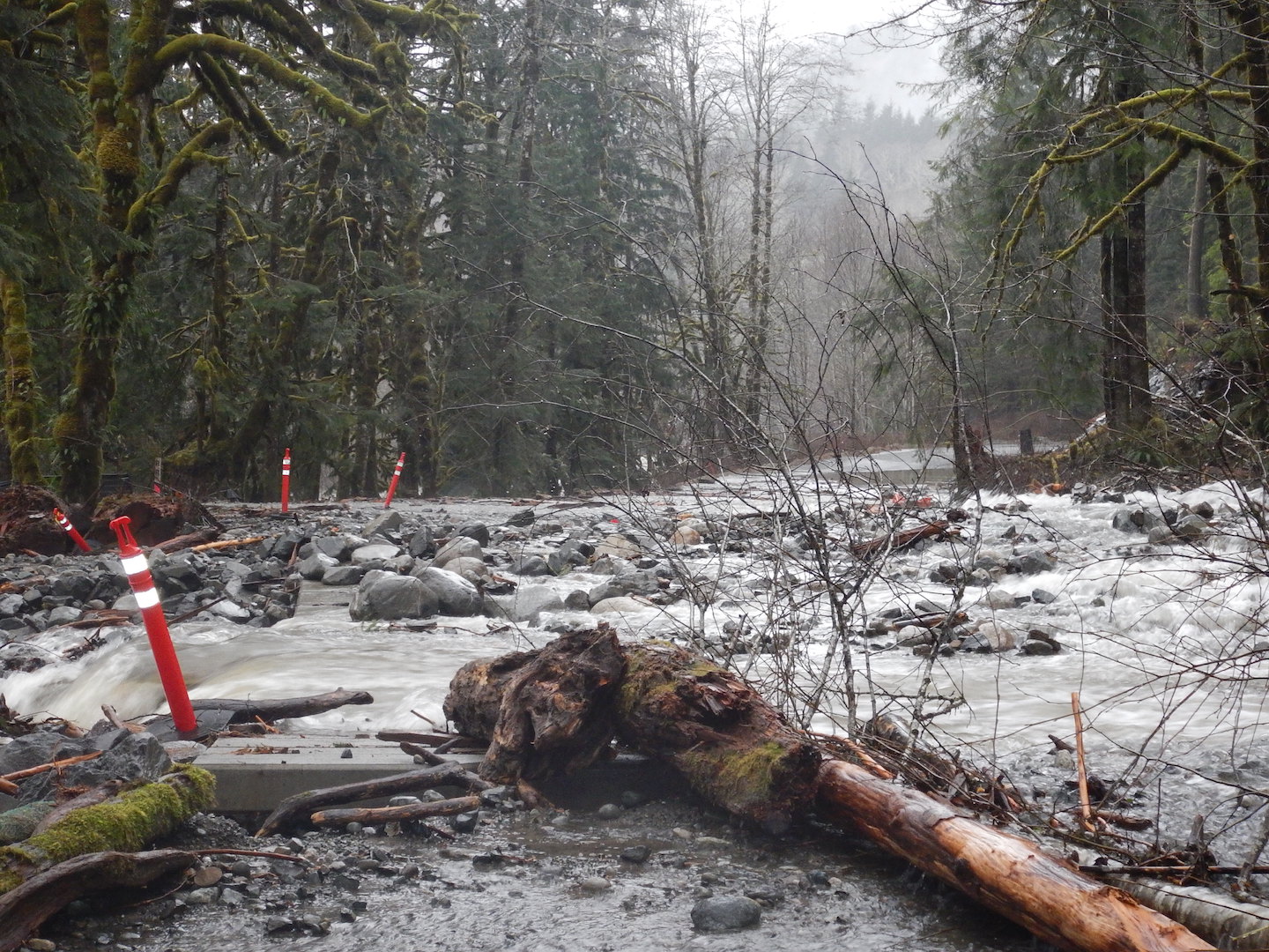
We were now almost certain we had crossed the last of our obstacles and were home free. We even started planning a stop at the North Bend Bar & Grill for a celebratory breakfast feast before returning home. Our lighthearted attitudes; however, quickly changed when we reached the newly installed box culverts over Bessequartz Creek.
“Holy ****. Is that all water?” I asked in disbelief.
All we could see in the distance was a wall of water flowing over the road. We were so screwed.
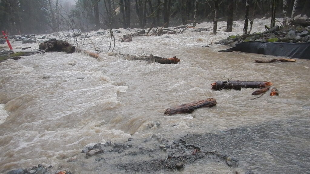
These newly installed box culverts were plugged with large logs, trees, and debris. The water was flowing so fast and high over the road there was absolutely no way across. Our elation went to deflation pretty quickly.
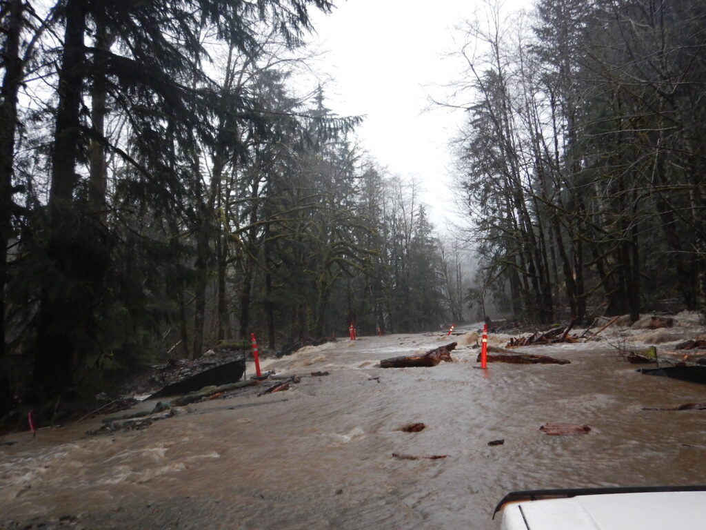
We sat there a while, trying to imagine a way through but knew there was none. We had no idea if the planks of the culvert bridges were even still intact under all that debris and able to even handle vehicle traffic. Would be drive across and fall into a hole? Everything said no, do not even try it.
I checked my phone and somehow, miraculously, had one tiny bar of service. We couldn’t believe it!
Though it may sound silly, we talked about what to do next. Do we call 911? It wasn’t life threatening. We were safe and still had enough food and supplies to get us through one more day if needed, but seeing how fast the water was flowing and how much debris was being left in its wake made us uncertain of our ability to get out. Should we call the county sheriff? Would we need help even when the water eventually receded? How long would we be here? How would I get my Jeep out?
Unsure who to contact and worried about losing cell reception while trying to make a 911 emergency call, I decided to call my friend and hiking partner Scott, who lived in North Bend and was aware that we had gone to Goldmyer that previous evening. I figured if he knew we were still up there and we lost our ability to communicate, he would likely know exactly what to do.
As I dialed his number, we all collectively held our breath. The call connected. I quickly told him our predicament, where we were stuck, and that we had supplies and were safe. He couldn’t believe we were still up there and had been worried about our situation since he heard about the flooding.
He ended up making the 911 call, which was routed to King County Search & Rescue, and relayed our situation to them. Shortly after, the King County Sheriff’s department called me back to clarify details and check on our condition. They told me there were several major washouts on the road and that the Middle Fork had been closed way down at Valley Camp. Brian and Mac took turns using my phone to let work and friends know they were ok. I called a friend to check on my dog, who at this point, had been home alone for almost 24 hours.
With sporadic unreliable cell service, Scott acted as our liaison between Search and Rescue. Their plan was to assemble a swift water rescue team but by midday, the road was still impassable. We had plenty of supplies and food, so the risk simply wasn’t necessary and they told us to stay put one more night. At one point, the Sheriff asked if we had enough water and Brian quipped “Yep, about 20,000 cubic feet of it. I’m trying to drink it so we can get out of here.” We all had a good laugh.
We sorted out what was left of our food and backtracked up the road to find a safe, dry place where we could sleep a little sounder for the night. We pulled into the Middle Fork Trailhead and made use of the bathroom shelter to get out of the rain for a while and take a breather.

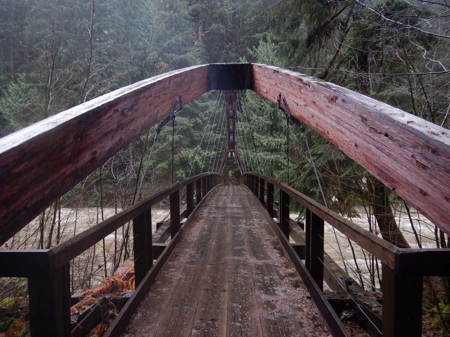
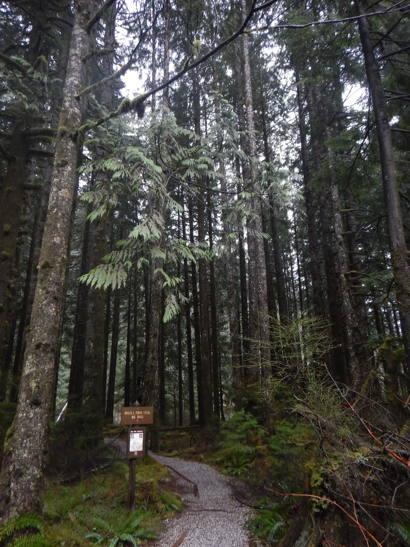
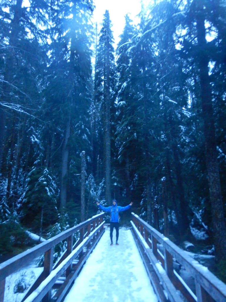
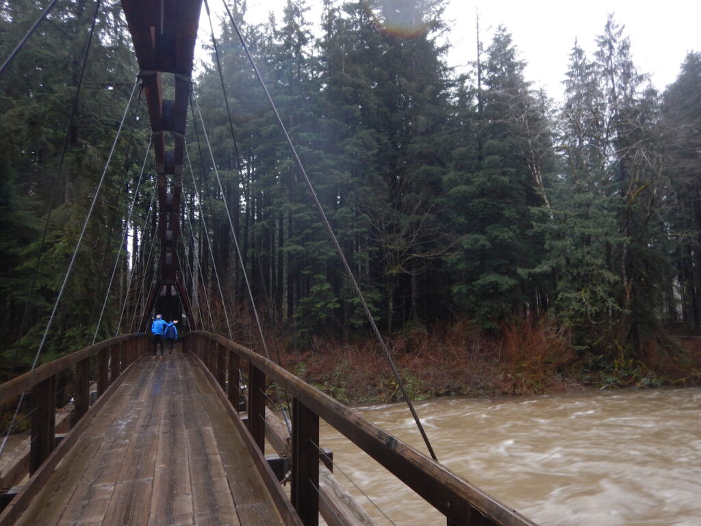
The realization that we were likely the only people between here and Goldmyer was surreal. What a fantastic place to have all to ourselves despite the circumstances! The rain stopped long enough for us to get out and stretch our legs, and we found an amazing bridge across the Snoqualmie River. Afterwards we got back to work organizing the car and drying out more clothes. We were fully prepared to spend another night up the Middle Fork.
Funny enough, I still had some mini champagne bottles left in the back of the Jeep from a recent New Year’s Day climb of Mount St. Helens. We fired up my Pocket Rocket stove, heated up some Lipton chicken soup, and shared a little champagne. We couldn’t help but laugh at the situation. Here we were, stranded far up the Middle Fork, enjoying champagne and soup. We sure hoped Search and Rescue wouldn’t find us this way!
Unfortunately, we had no cell service here so we decided to return to Bessequartz Creek where we had at least intermittent service. This was around 9:45am January 5th, 2015. As we reached the creek, we could hear the loud roar of water in the distance and were shocked to find both the current and volume of water had exploded dramatically. Both culverts were now completely buried under a flood of water and we could hear the loud crashing and banging of logs, huge boulders, and all sorts of debris being carried down the mountain. Boulders several feet in diameter were being pushed around like pebbles. We simply stood there in awe.
Somehow we had returned to the Bessequartz Creek box culverts right at the peak flow at 10am on January 5th, 2015. This was also the same time Snoqualmie River gauges recorded a peak flow of about 27,300 cfps at the nearby Tanner station before equipment malfunctioned.
I will never forget the sound and power of the water moving boulders, rocks, and trees. It was truly amazing to watch.
Fully awed by the force of mother nature, we stuck around, because there was nothing else to do. At some point we realized the rain had finally stopped. We had been trying so hard to stay warm and dry for the last 24 hours, that we had mostly been confined to the Jeep. It was refreshing to get out and stretch! We walked up and down the eerily deserted Middle Fork Road and took our time marveling at the beauty.

We checked the crossing again around 1:30pm and the water had receded nearly as fast as it had crested. A trail of disaster was left behind.

There was so much debris it was clear there was no way we were driving out of there, even with a Jeep. We still had no idea if the planks on the culverts were intact or popped off. Brian, Mac, and I discussed gathering our gear and possibly running/hiking out by foot. The only problem was that it was already 2:30pm, we had 6-8 miles to cover, and we weren’t certain what sort of conditions we’d find further down the road.
With only two hours of daylight left, we unanimously decided the safest plan was to stay put one more night and wait until morning, then make a break for it on foot. We communicated our plan to Scott, who relayed to Search and Rescue teams, and we divided what was left of our food into a dinner and breakfast pile.

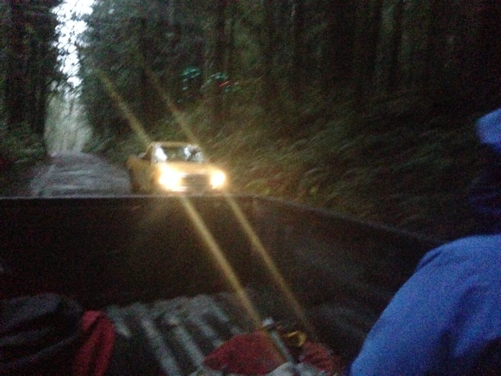
Once organized, we set off again to walk, run, and stretch our legs. We figured we might as well enjoy being stranded way up the Middle Fork! Brian was running out in front of us, then Mac and I came around a corner and saw him stopped, talking with three guys. “Whoah!” we thought. “Where’d they come from?” They didn’t look like Search and Rescue. Were they also stranded?
We quickly walked up the road to meet them and find out they were from ACI, the road construction company responsible for the Middle Fork paving project. They had driven up the road to check out conditions and were stopped on the other side of the flooded Bessequartz washout. They looked about as surprised to see us as we did to see them!
Also with them was Monty VanderBilt, a Snoqualmie Valley historian and connoisseur who had hiked in 6 miles from Valley Camp to survey the damage. He manages a website called Mid Fork Rocks with Middle Fork Valley history, chronology, and all sorts of great information including a report of this storm. He excitedly asked to see all of our pictures and videos and couldn’t believe we had witnessed the entire event firsthand. He said the prior night’s predicted storm levels weren’t remarkable, when he awoke in the morning and heard the Snoqualmie River was pushing 20,000 cubic feet per second he came out to take a look.
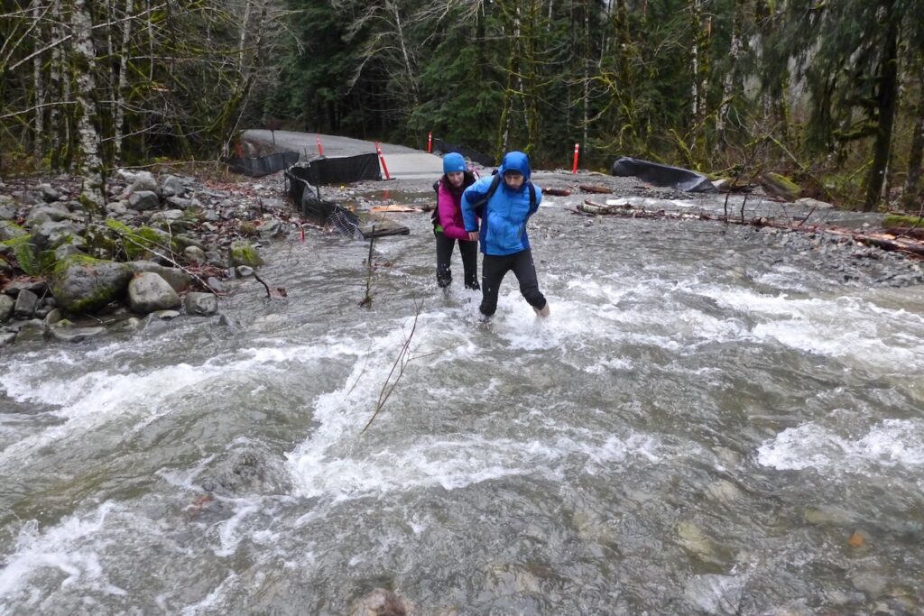
The ACI team had a truck on the other side of the washout, so we quickly grabbed our gear, parked the Jeep in a safe place ,and forded Bessequartz creek through the debris to catch a ride back to Valley Camp. Even with lower water levels, the current was frighteningly strong. The construction team told us we made the right call not trying to drive across the box culverts. They said the surface planks were most certainly undermined and chances were high they had been popped off by the water flow. A vehicle crossing would have been incredibly dangerous.
As we drove out, the crew pointed out several areas of the road that had been under a few feet of water only hours prior. Once back at Valley Camp, we talked to a King County crew on site, letting them know we were safely out and wouldn’t need assistance from Search and Rescue. The ACI Project Manager took my phone number to keep me updated on when I could safely retrieve my Jeep, and Monty gave us all a lift to the North Bend Bar and Grill, the only place we eagerly wanted to go for food and drink!
My good friends Annette and Jed battled horrific evening commute traffic to meet us in North Bend and drove us back to Seattle. They had their van stocked with warm blankets and pillows. They’re the best!
We couldn’t have imagined our quick trip to Goldmyer would turn into such an adventure. Once we were safely back, I realized that seeing this historical event firsthand was an incredibly lucky and memorable experience I won’t ever forget. Mother Nature is truly humbling.
I also couldn’t have picked better friends to be stuck with! We were able to think through our actions and make collective decisions that kept our situation from becoming dangerous. I also can’t overstate how important it was that we had so much extra gear and supplies. Without the extra food, clothing, water, and safety gear I always carried in my Jeep, this trip would have been a completely different story. By being prepared, we were able to sit tight, take care of ourselves, and not force search and rescue into a dangerous rescue mission.
Monty posted a NWHikers thread about the event, updated his website, and also uploaded a Flickr set of photos.
The January 2015 Snoqualmie Flooding Event.
The storm from January 4-5, 2015 was pretty epic even for Northwest standards. Rising temps, melting snow, and steady rain all contributed to this being the largest flood the Valley had seen since 2009. The Snoqualmie River had a peak flow of 27,300 cfps at 11:15am on Monday, January 5th, 2015 before recording equipment malfunctioned, making it the 7th highest flow in recorded history. In a 24-hour period, North Bend reported 4.5″ of rain and stream flow at Snoqualmie Falls was recorded at 50,000 cfps! Flooding and washouts were reported all over western Washington and the Middle Fork didn’t fully reopen until later in May.
We were very thankful to the ACI construction crew for giving us a lift out of there and to Monty for dropping us at the North Bend Bar & Grill. We also owe many thanks to Scott for coordinating and communicating with Search and Rescue on our behalf, and for my friends Annette and Jed for the ride home. I’m glad we didn’t end up needing SAR help but I’m always thankful for the amazing service they provide. What a day we picked to visit Goldmyer and a fantastic memory we’ll always have!
Part 2: We returned a week later with caretakers from Goldmyer Hot Springs and spent several hours moving debris and boulders from the road to finally retrieve my Jeep and enjoy an exclusive Hot Springs soak!
I hope you enjoyed this story and use it as a reminder to always carry the 10 essentials and extra safety gear in your vehicle, especially when visiting remote areas with no cell service. It’s also so important to let someone know your itinerary. If we hadn’t been able to call out, we know that friends and family would have called the authorities and given them our location. In fact, my dad and stepmom said they were getting increasingly concerned I hadn’t checked in and wasn’t answering my phone and they were about 30-60 minutes away from calling the local police. These days I now carry a small Garmin InReach.