Okanogan Highlands | South Okanogan Highlands
Okanogan-Wenatchee National Forest
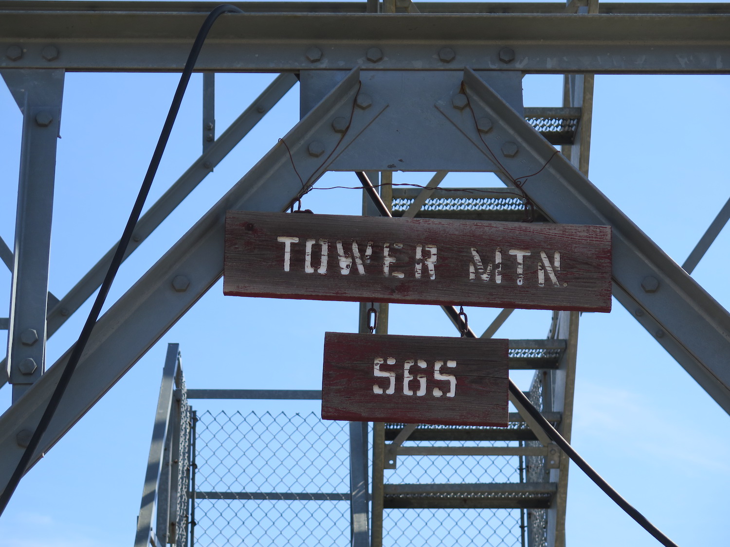
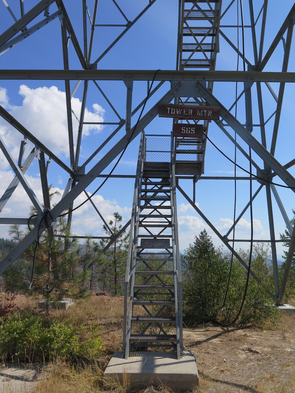
Location: 48.545425, -119.236424
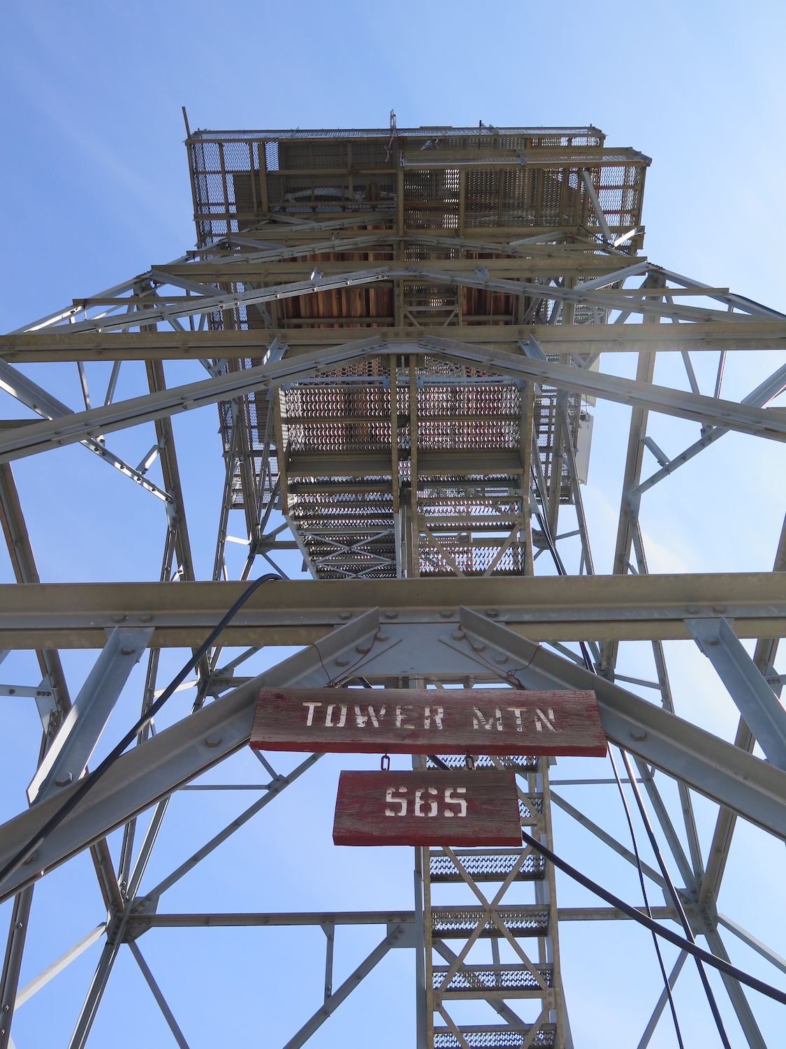
Summit Elevation: 6,058′
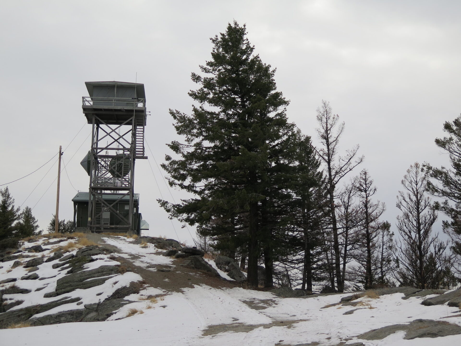
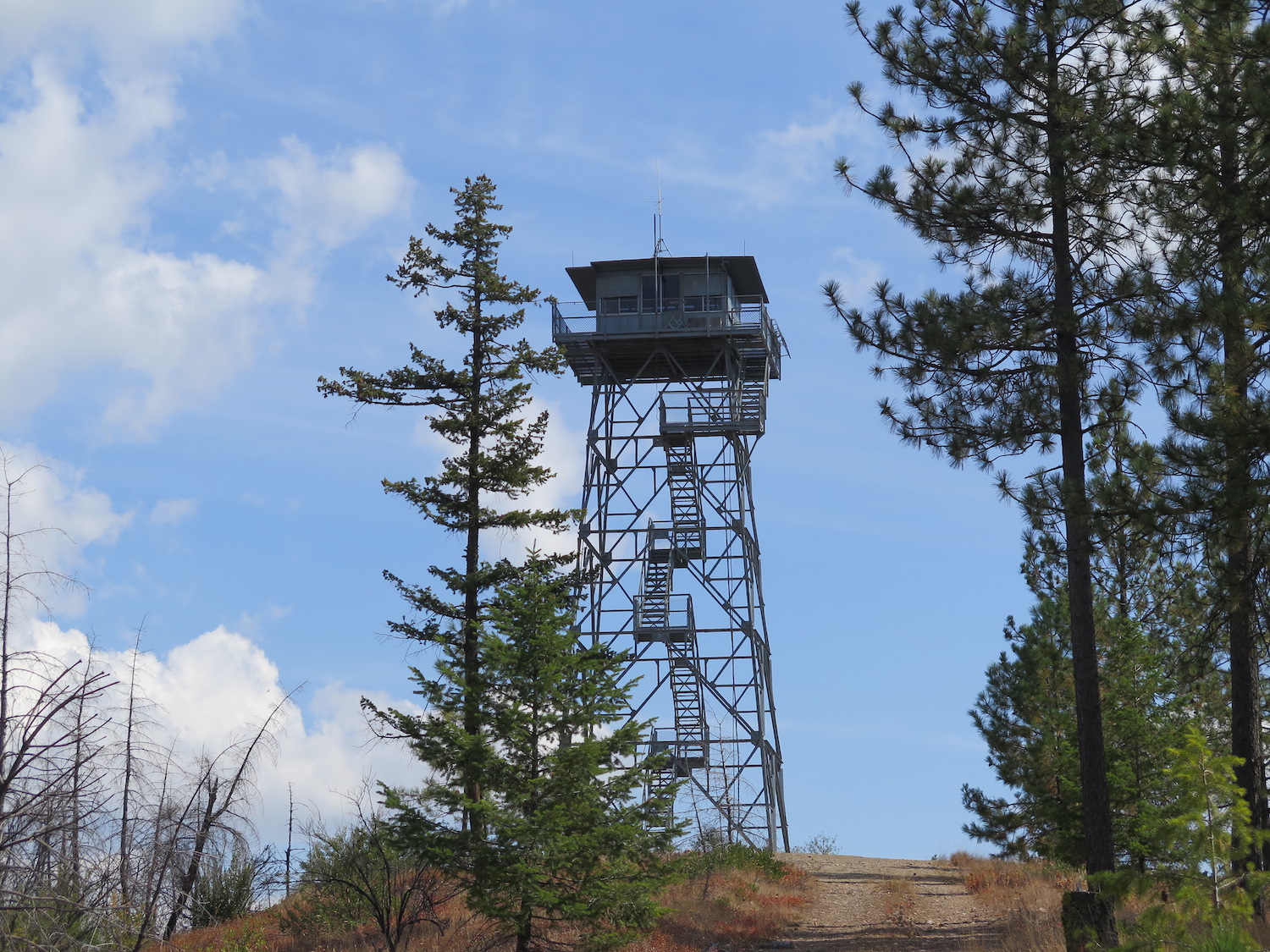
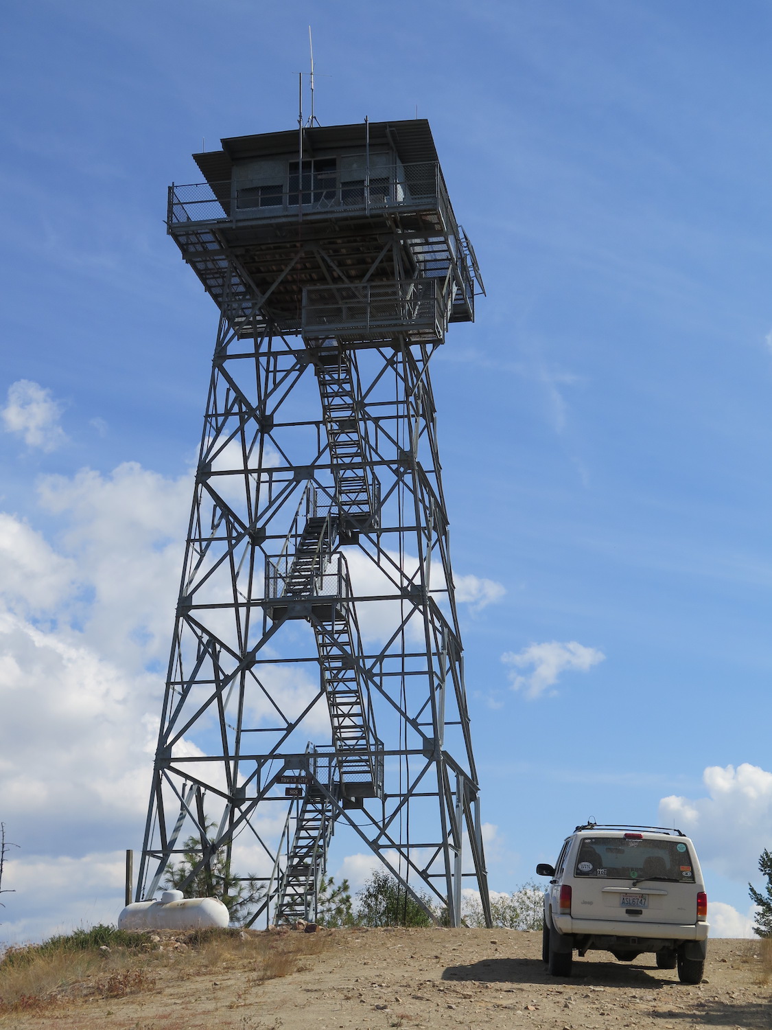
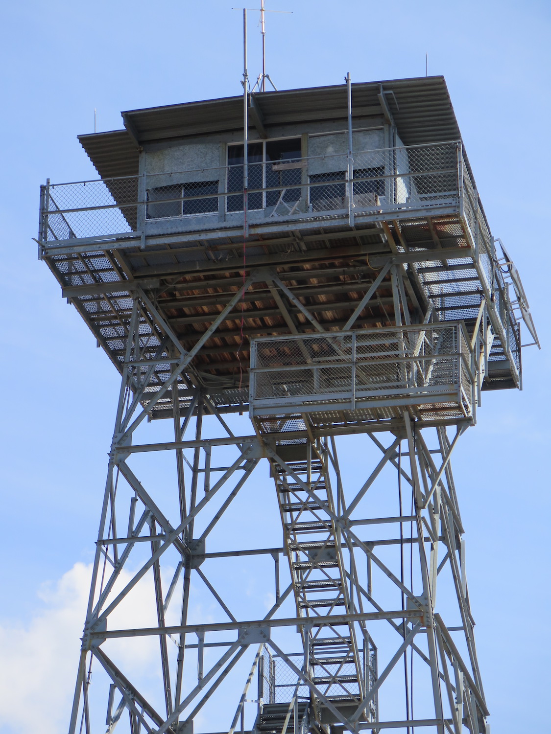
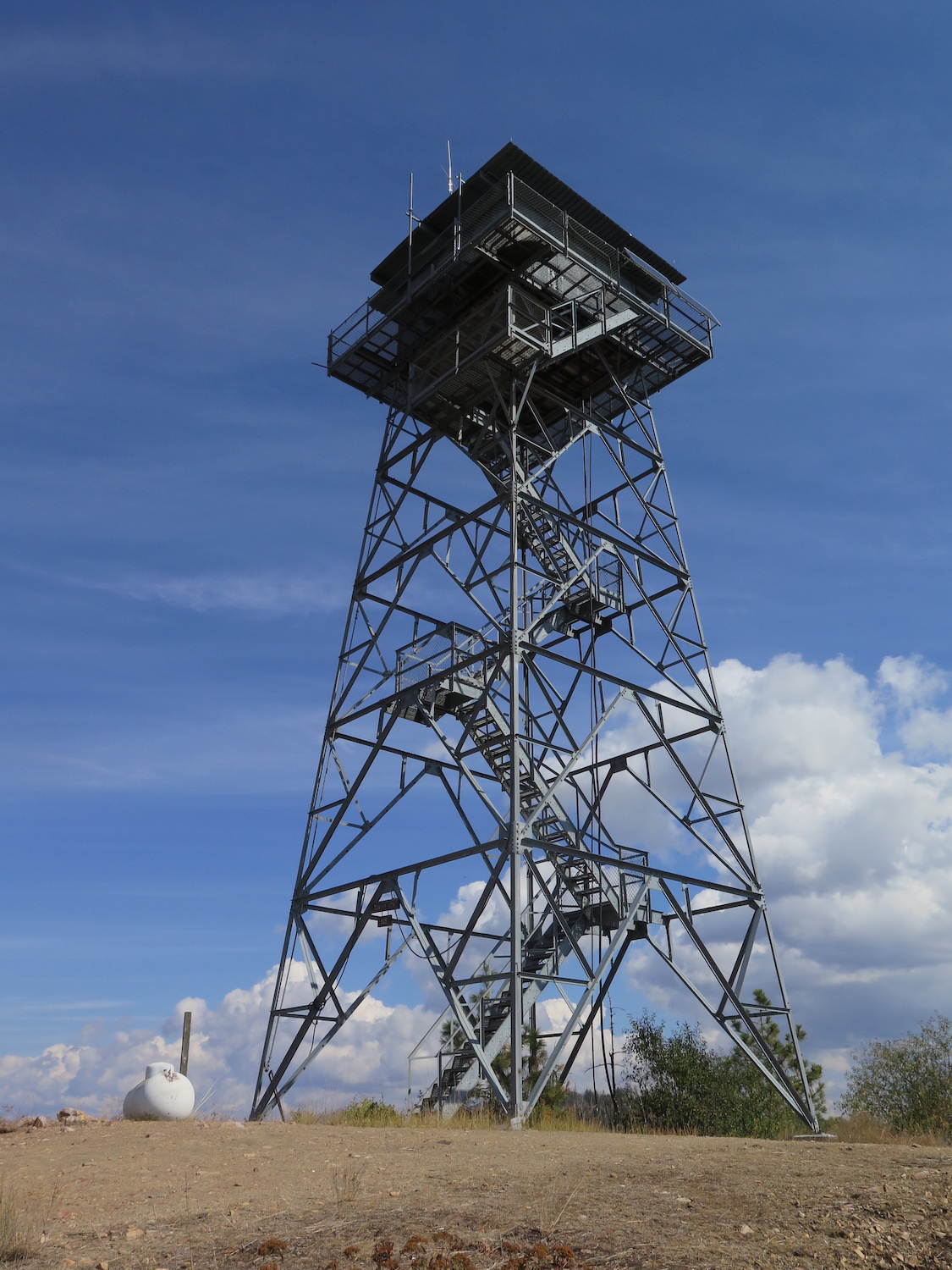
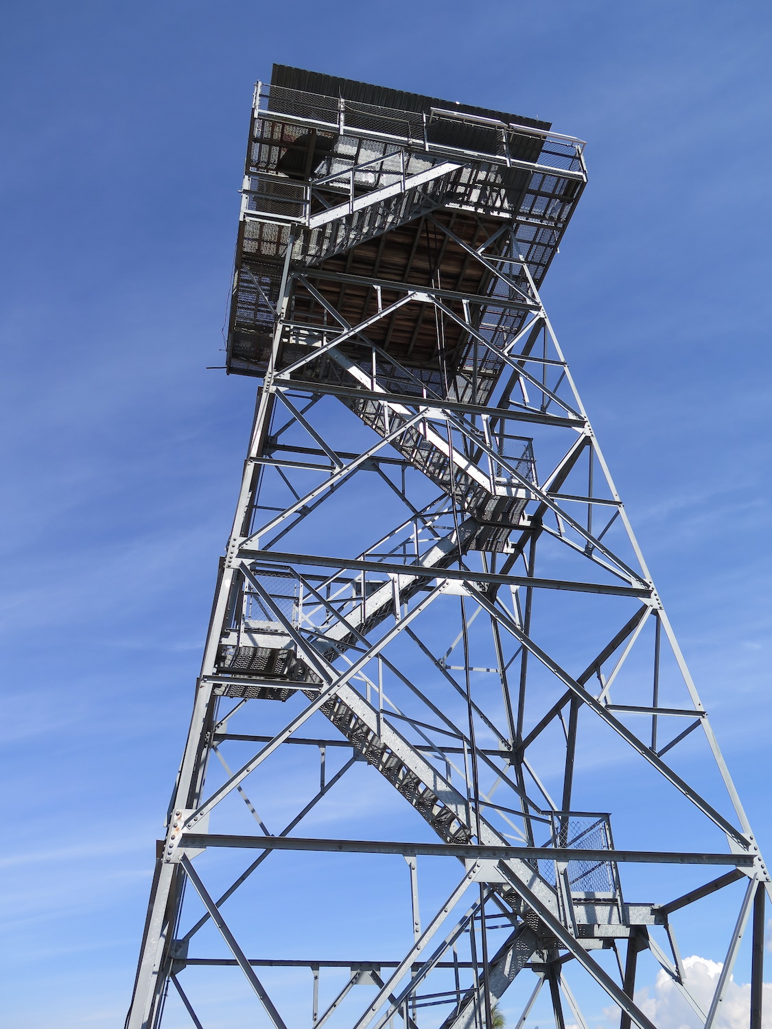
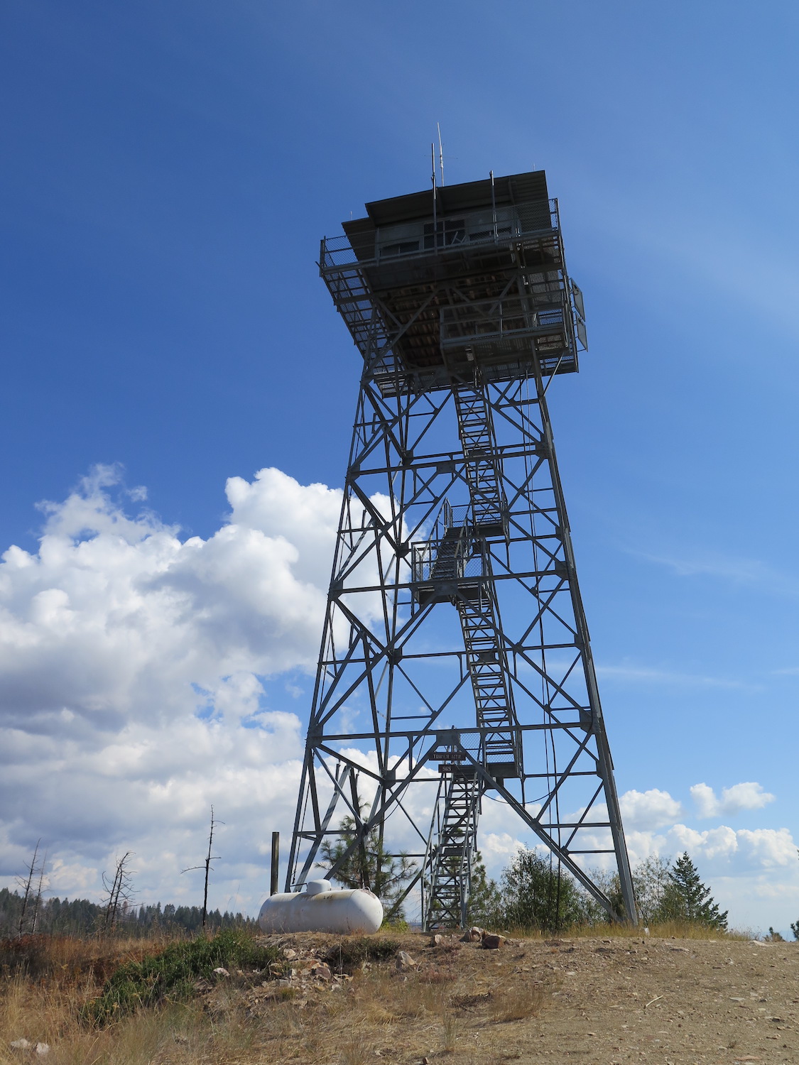
Lookout Type: 40′ tower with DNR cab
Site Established: 1933
Current Structure Built: 1966
Date Visited: 11/24/17
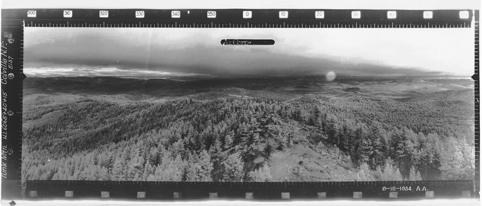
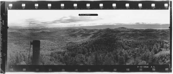
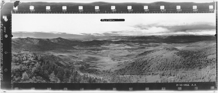
Tunk has over 2,000′ of prominence with big views of the Okanogan Highlands and surrounding peaks like Moses and Bonaparte. Though Tunk is privately owned, it was recently staffed in 2021 during a period of high fire activity.

Photos from 2017.
History.
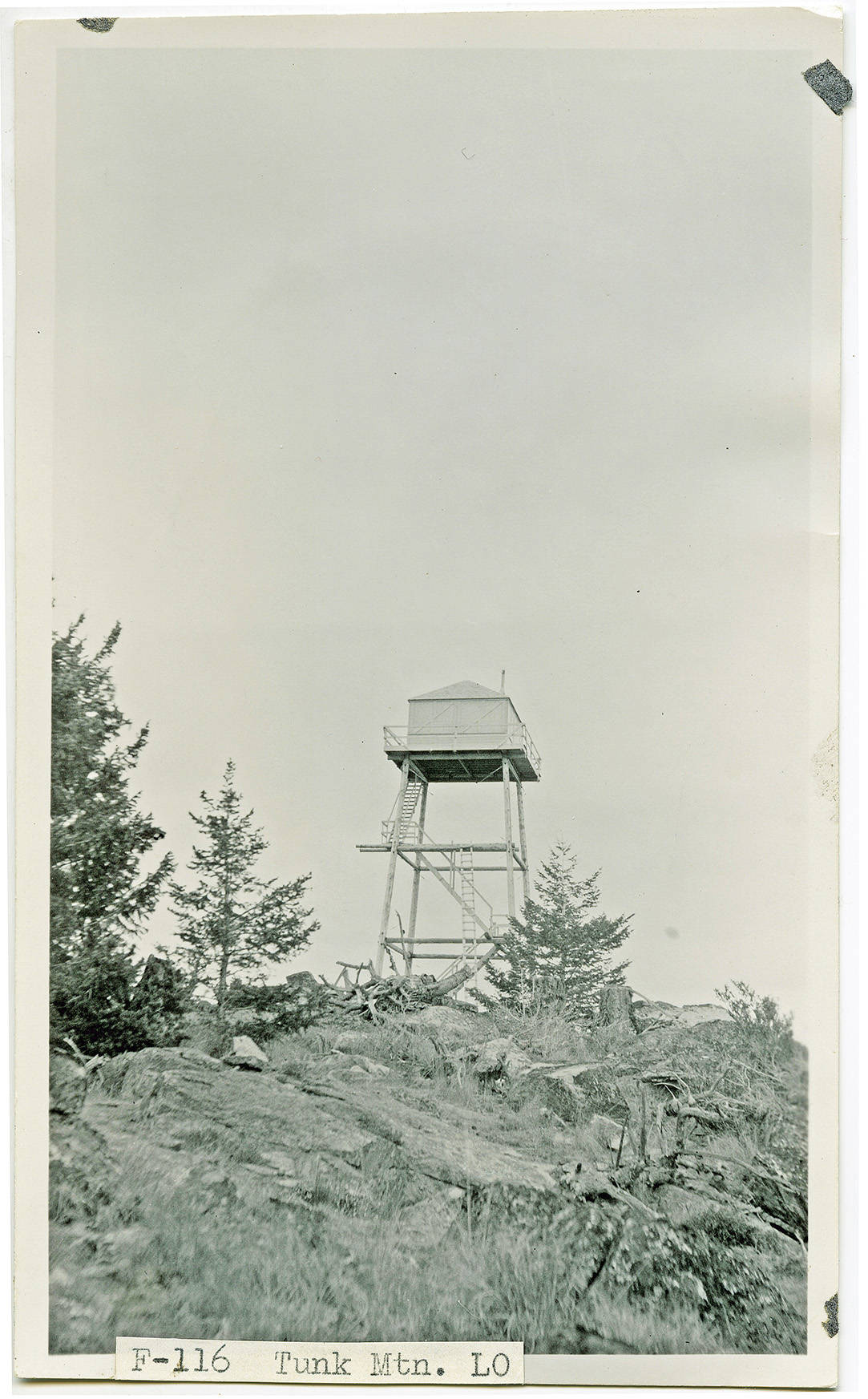
The U.S. Forest Service built the original Tunk Mountain Lookout as a detection point in 1933 with an L-4 cab on a 40′ pole tower. In the 1950s, the Washington Department of Natural Resources took over the tower and replaced it in 1966 with the current 40′ timber tower with 14’x14′ DNR cab and cat walk. It stood abandoned for several years and was declared as surplus in the 1990s. A private party, W.R. Morrison, purchased the lookout and kept it on site through a special use permit. It seems the lookout was taken over by another private party, American Resources, and staffed for a month in 2005 during the reconstruction of nearby Bonaparte Lookout.
The lookout is currently privately owned and locked up but the summit area is still accessible to the public. It is currently maintained by volunteers and listed on the National Historic Lookout Register. Due to its prominence, the summit is host to numerous communications towers.
In 2021 Tunk was temporarily staffed by the fire lookout at Bonaparte was forced to evacuate due to the growing Spur/Walker Creek Fire started by lightning on August 3, 2021.
Directions.
From Highway 97/20 in Omak, drive 7.5 miles north towards Riverside and take a right onto Kendall St. Kendall turns left and becomes N Main St. Turn right onto Tunk Valley Road, then in 0.25 miles turn left onto Tunk Creek Road. Follow the road for 6.9 miles, then turn left onto Chewiliken Valley Road. Follow Chewiliken Valley Road for 12.2 miles, then make a slight left as Chewiliken becomes NF-3015 and then right as it becomes NF-200. Follow this 1.8 miles, then make a slight right as the road turns to the summit of Tunk Mountain.
When I visited in November 2017 the road was relatively well maintained and it’s possible to drive all the way to the summit but snow stopped me about a mile below the lookout.