Southern Cascades | Mount Rainier Area
Gifford Pinchot National Forest
Location: 46.68449, -121.90303
Summit Elevation: 5,685′
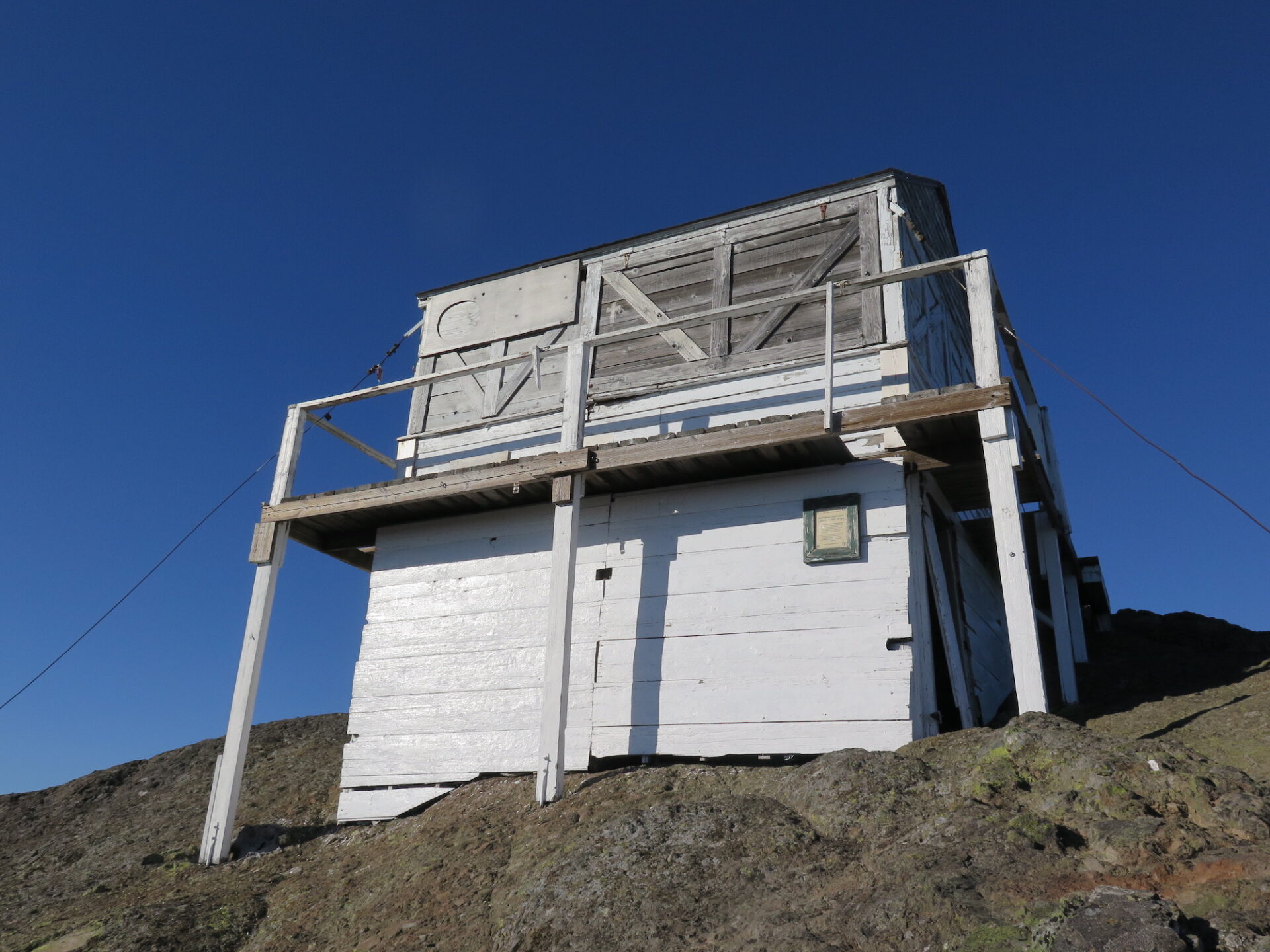
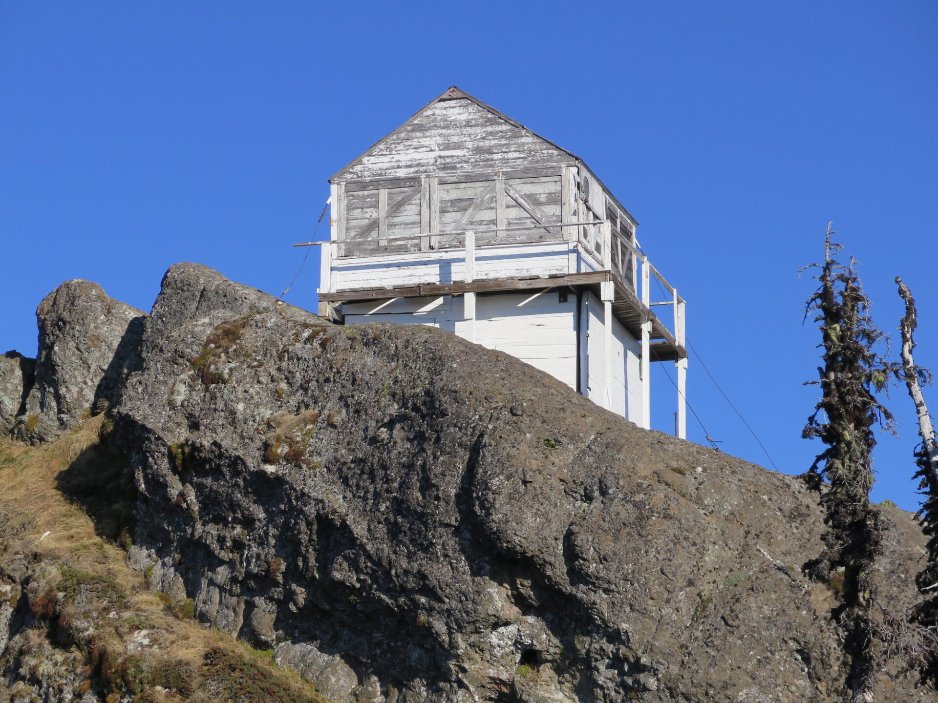
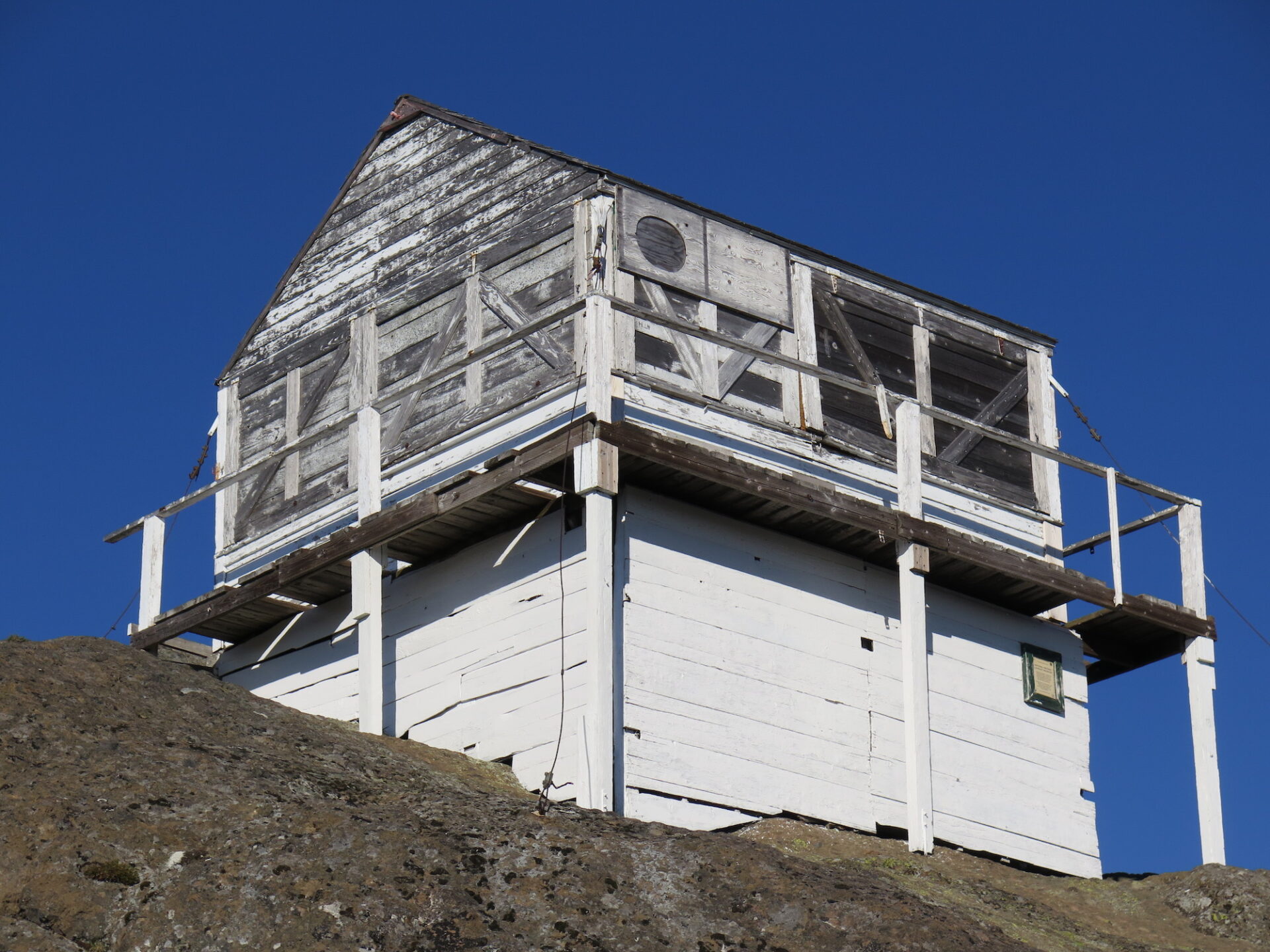
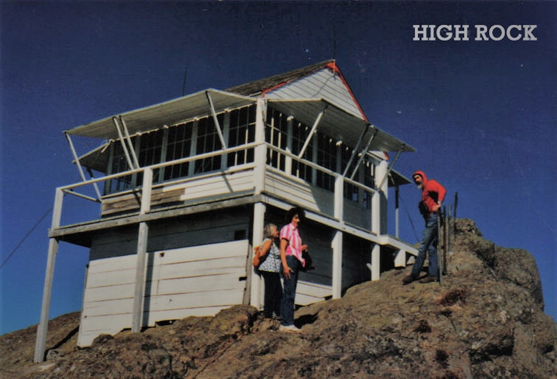
Lookout Type: 14’x14′ gable roof L-4 ground house
Site Established: 1929
Current Structure Built: 1929
Dates Visited: 7/1/01, 9/28/17
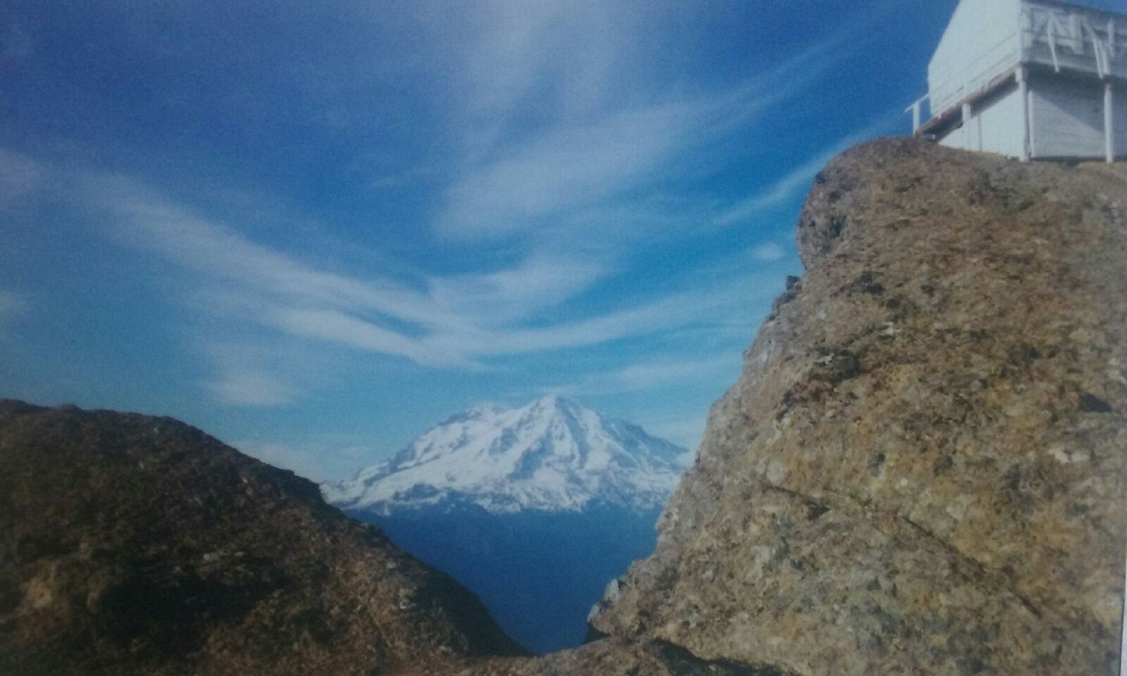
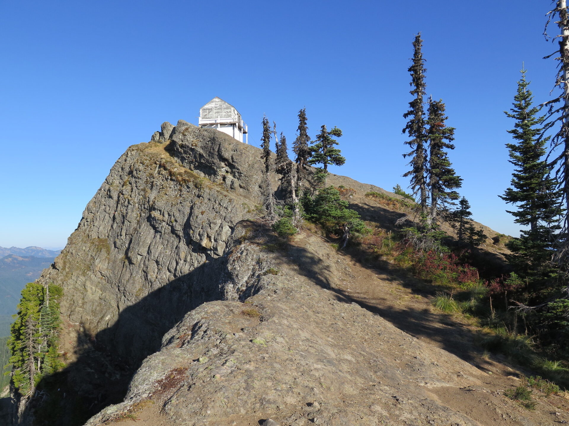
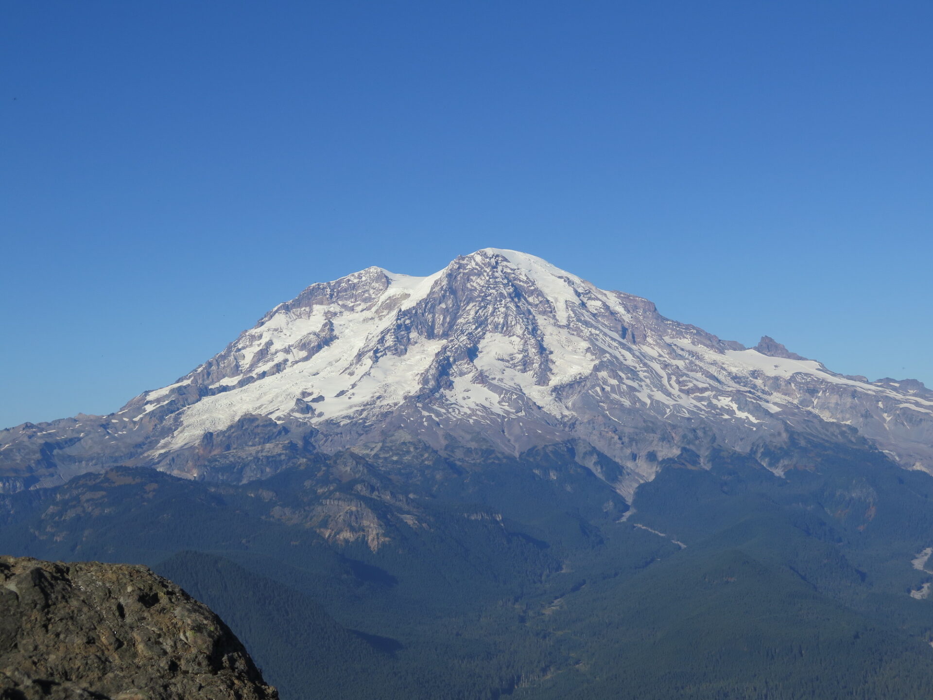
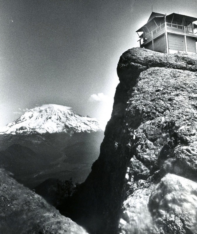
High Rock is not only the highest and loftiest point on the Sawtooth Ridge of Gifford Pinchot National Forest, but it’s also #45 on Washington’s list of peaks with 2,000′ of prominence. It’s short approach makes it popular, especially amongst families, but use caution at the top. The summit is a sheer cliff and vertigo-inducing.
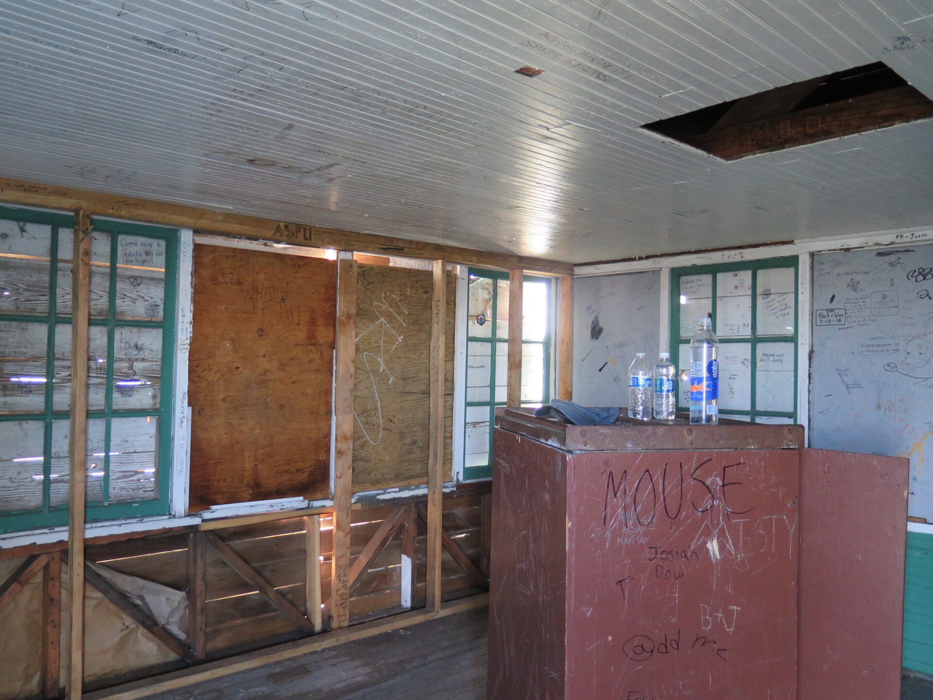
After many years of neglect, High Rock finally received emergency repairs in 2018 and the Forest Service and White Pass Historical Museum are currently managing a restoration effort. Consider donating through the White Pass Historical Museum below to help support the restoration!
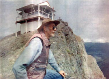
Photos above are mostly from a visit in 2017 with the exception of one very grainy photo taken by my dad in 2001.
History.
The original structure was built in 1929, taking 31 days to assemble with materials brought in by pack mule from Mineral, WA. Along the trail is a plaque dedicated to Johnnie T. Peters, who managed this pack team and also helped construct 10 other lookouts in the Mineral, Packwood, and Randle districts.
High Rock was used as active lookout for much of its life and staffed by the well-known Packwood local Bud Panco for 17 years. He was employed by the Forest Service his first 10 years, then remained as a volunteer after budget cuts. In 2004, vandals broke the door and tossed his bed from the lookout. He retired shortly after and passed away in 2014.
In 2001, High Rock was placed on the National Historic Lookout Register but with Bud’s absence in 2004, the structure fell into disrepair, mostly at the hands of vandals.
High Rock’s restoration is slated to take several years and I can’t wait to return and see this beautiful lookout restored to its former glory.
The route.
Distance (RT): 3.2 miles
Elevation Gain: 1,365′
Summit Elevation: 5,685′
Though this is a short hike, there is no water on the trail or nearby so bring your own. From the trailhead below at Towhead Gap you can see the lookout perched precariously high on the sheer rock above. It’s an unbelievable sight!
The trail starts out narrow, entering forest and providing nice shade for most of the climb. The way is short, but also steep with few switchbacks. Wooden benches along the trail provide nice resting spots if needed.
Take a minute to look around the base of the summit block for the dilapidated remains of a cabin, then take a breath before continuing up the sheer rock to the summit. It’s plenty safe but the airy cliff drops over 600′ and can trigger some vertigo, so be careful! The old steel guide cables that used to be there are long gone thanks to vandals.
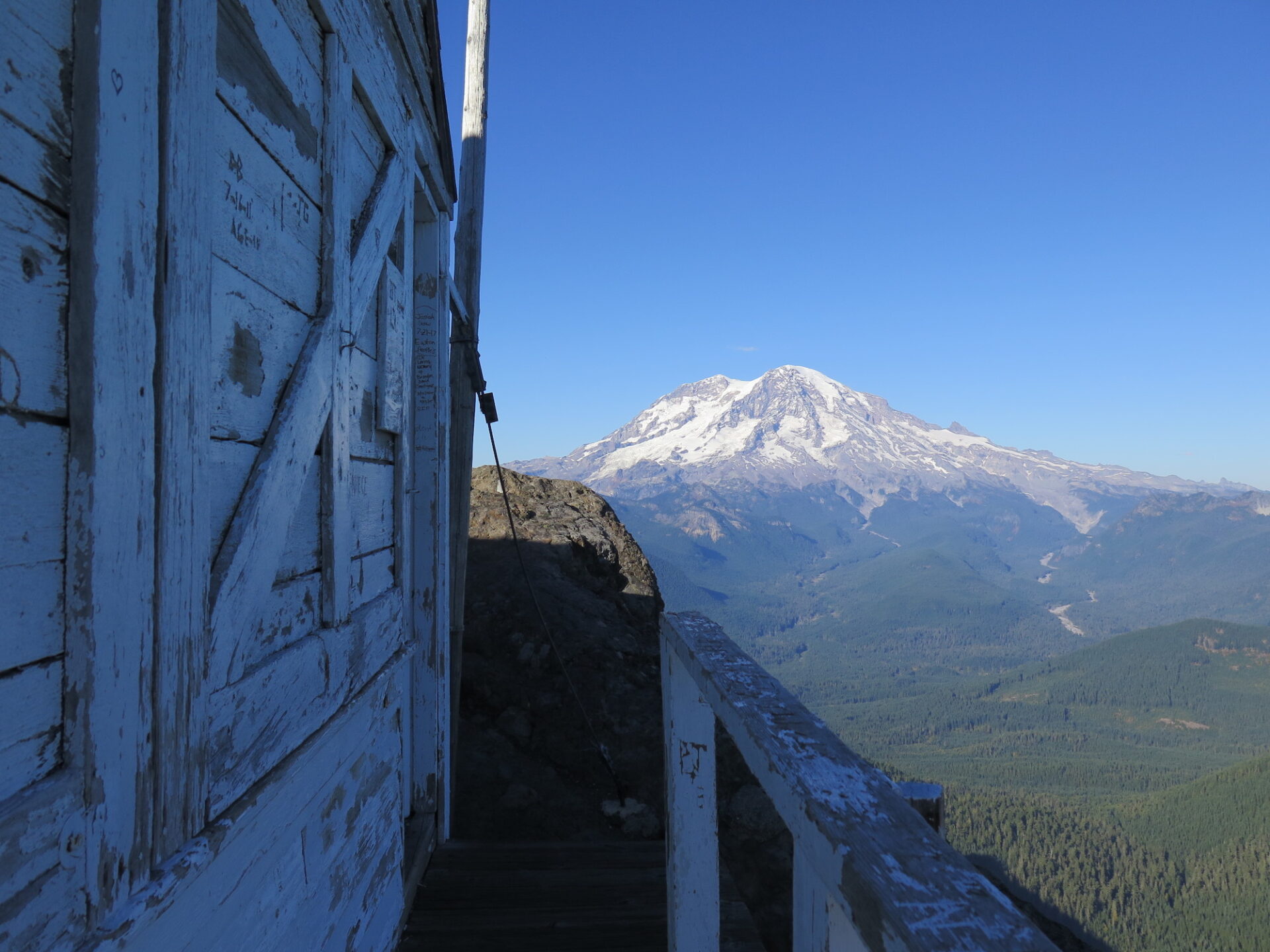
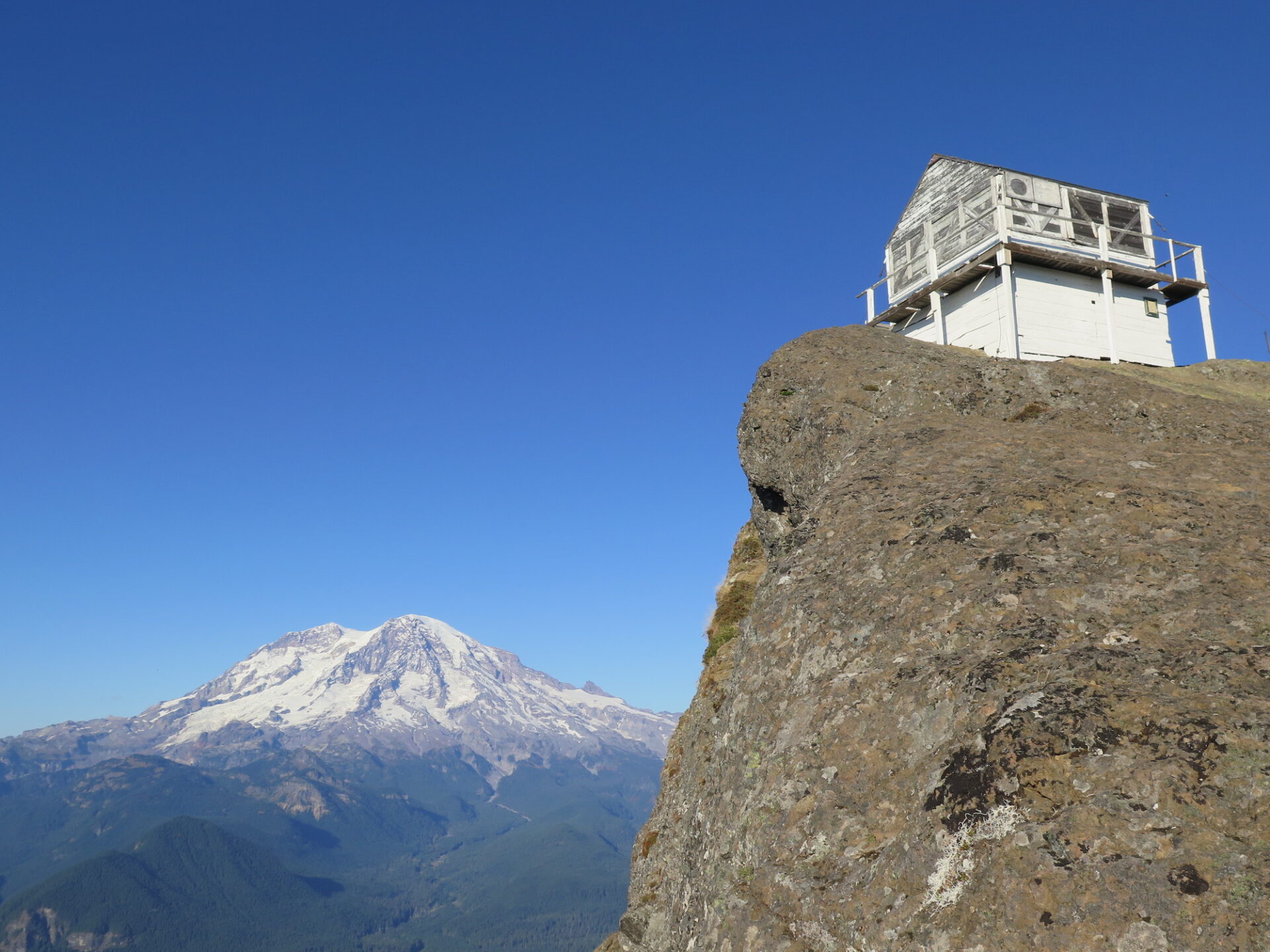
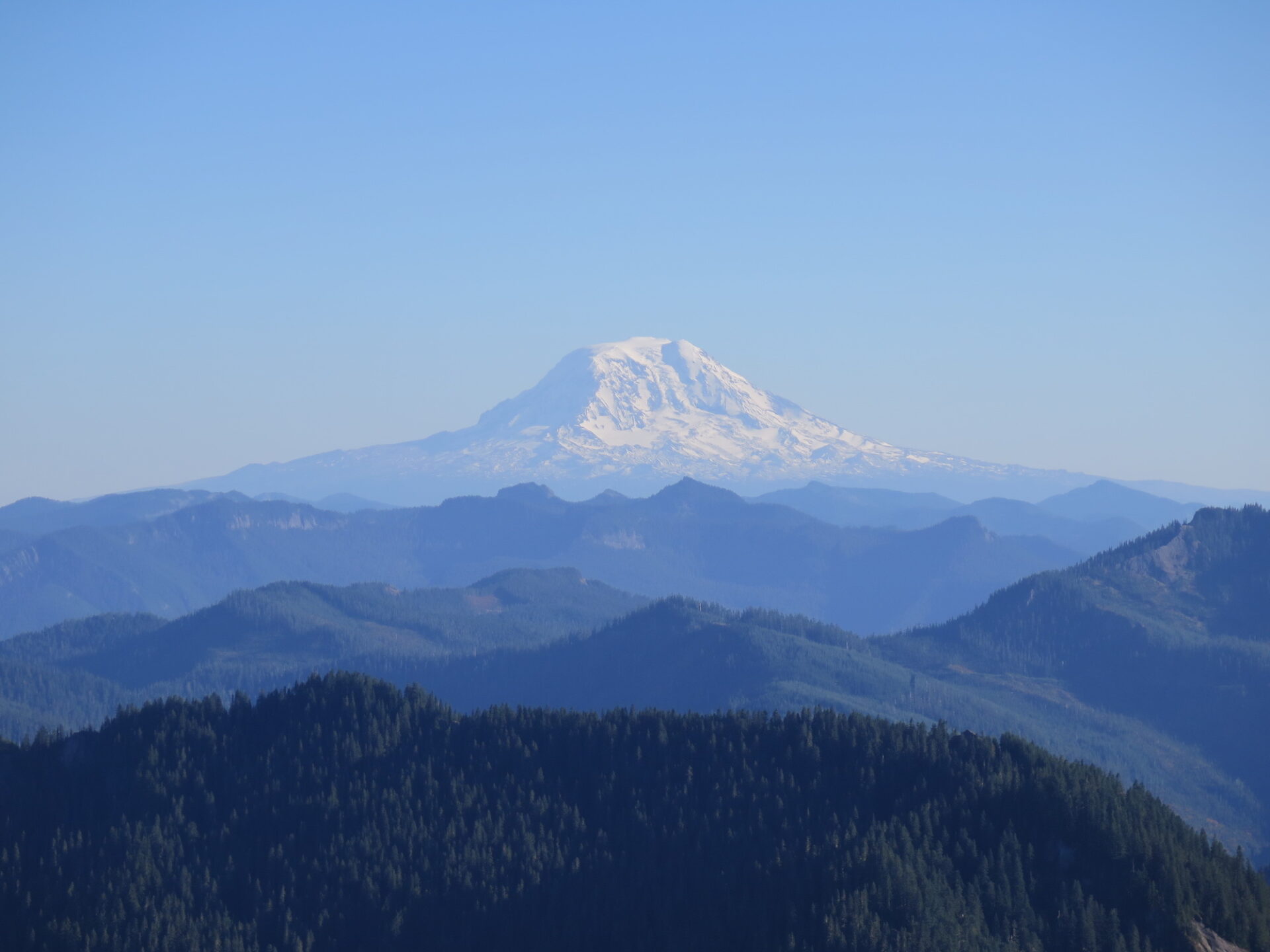
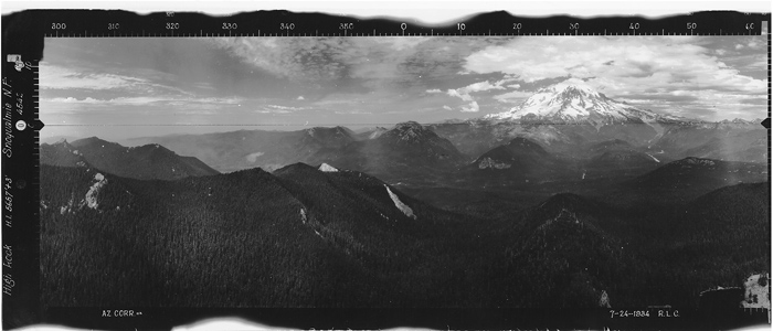
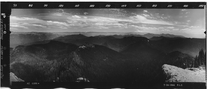
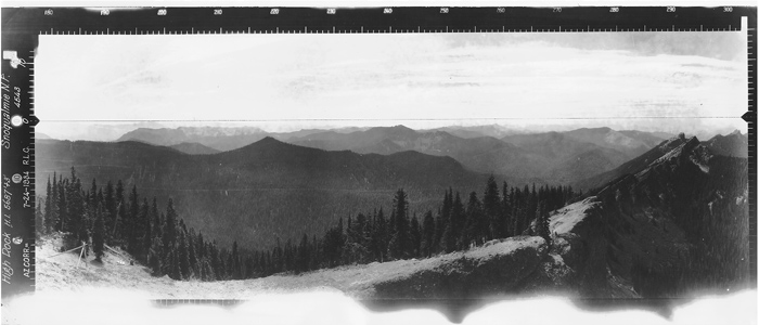
Enjoy the jaw-dropping view of Rainier as well as Adams and Mount St. Helens on the horizon with Cora Lake sparkling a dizzying 1,500′ below.
And remember, pack out garbage and be kind to this structure to others can enjoy it for generations to come!
An early 2001 visit to High Rock.
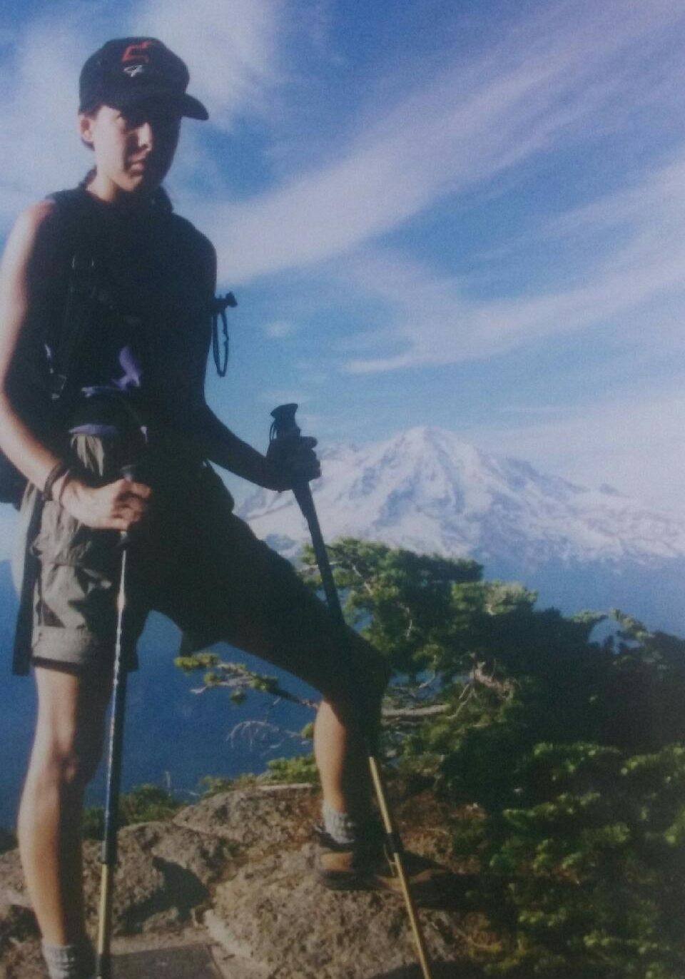
In 2001, I was pretty new with hiking and back then you found hikes by reading guidebooks from the Mountaineers. The internet was nothing like today and the Washington Trails Association website looked nothing like it does now! I first found High Rock in my old trusty Ira Spring/Harvey Manning 100 Classic Hikes in Washington book and the photo captivated me.
When my dad came up to Seattle in July of 2001, we both visited this stunning location but sadly missed meeting Bud Panco, who would have still been maintaining the lookout then. Even though the photo my dad took in 2001 is quite grainy, it’s clear High Rock was in very good condition.
I returned a few more times over the years, most recently in 2017, and couldn’t believe how badly the lookout had deteriorated over the years. I’m so glad to see it getting the love it deserves. This is one truly spectacular location and I would urge you to consider donating a small amount to the restoration effort through the PayPal link above, or contact the White Pass Historical Museum directly.
Directions.
The trailhead can be accessed from both the north and south side, though the south side approach on Forest Road 85 is in considerably worse condition and requires a high clearance 4×4. The best approach is from Elbe.
Head east on State Route 706 for 10.1 miles, passing through Ashford. Turn right on Kernahan Road and in 1.4 miles the road will curve to the left and become Skate Creek Road. Follow this for 3.3 miles, then turn right on Forest Road 84. Drive 6.8 miles, then stay right at the fork onto Forest Road 8440. Continue another 2.7 miles to the trailhead at Towhead Gap (4,330′).