Lake Chelan is the largest natural lake in Washington state and the 3rd deepest in the country. It travels a length of 50 miles with a maximum depth of 1,486′. Only Lake Tahoe and Crater Lake are deeper. A pretty amazing lake to have right here in our own backyard!
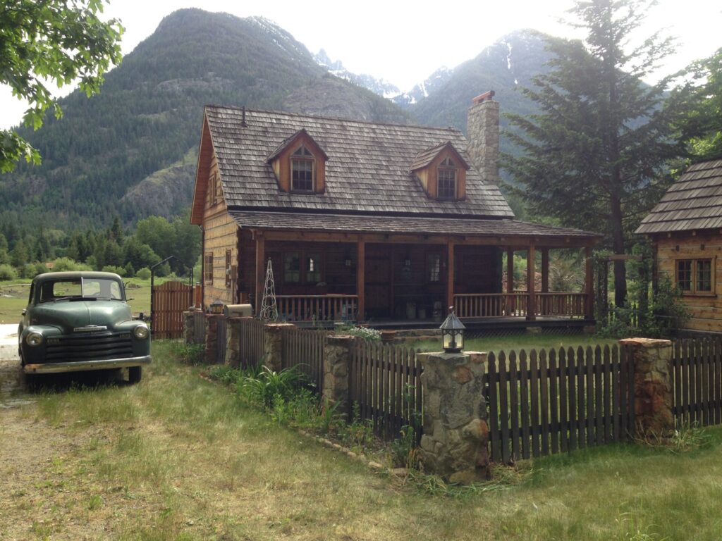
At its northwest corner lies Stehekin, a tiny isolated mountain community of about 80 year-round residents. The only way in or out is by foot, float plane, ferry, or private boat. The 17 mile Lakeshore Trail winds along Lake Chelan’s eastern shore and connects Stehekin to the boat-accessible Prince Creek trailhead. Visiting Stehekin has been high on my list for a while. Back in May my friend Brian suggested running the Lakeshore Trail to Stehekin and camping there over Memorial Day weekend. I jumped at the idea.
Most people backpack the Lakeshore Trail. Since Brian had visited Stehekin before and was familiar with the trail, he had a novel idea: what if we could talk to the ferry operator and leave our bags onboard while we disembarked at Prince Creek? Then we could run the 17 miles into town with only our hydration packs. We’d just need to talk someone into offloading our bags in Stehekin. Brilliant plan!
We kicked off the weekend by driving to Leavenworth late Friday night to miss holiday traffic. Hoping to catch a meteor shower that unfortunately turned dud, we stayed up much too late and slept outside in a field at a friend’s farm. We woke Saturday morning with the roosters, hurting from both the ground and the lack of sleep. Great prep for a big run day!
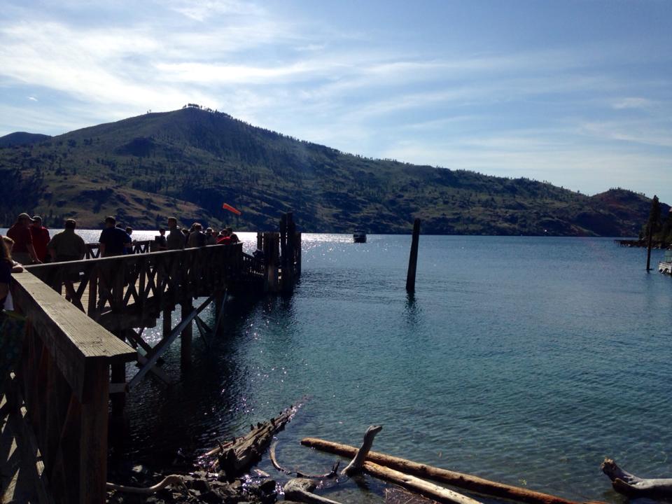
Brian’s friends kindly served us an amazing farmer’s breakfast and then we hit the road to Chelan, boarding the Lady of the Lake ferry from Field’s Point Landing, 17 miles northwest of town. If you’re going straight to Stehekin and book ahead, you can ride the express ferry that gets you there in about 2 hours. Since we were stopping at Prince Creek we were stuck with the slow boat: 2 hours to Prince Creek and 3 to Stehekin.

We talked to the loading worker and ferry captain about our plan to send our baggage onward while we ran from Prince Creek. Both looked at us a bit incredulously but were incredibly nice and wanted to be sure they were familiar with our bags. The ferry would reach Stehekin before us and if our gear was simply pushed out onto the dock, it might end up being loaded back onto the return ferry to Chelan. That would be bad.
They assured us they would move our bags off the dock and to a holding area. We could only cross our fingers this plan would work and that our stuff would be there waiting when we eventually arrived. We thanked them and boarded the ferry, eager for a nap. We arrived at Prince Creek 2 hours later in disbelief over how many backpackers were exiting! Easily 50-60 people were getting off the ferry and we wondered how everyone would find camping spots along the trail.
Since we had gotten little sleep the night before we made a game time decision to skip Prince Creek and the crowds and instead disembark at the next stop at Moore Point, shortening our day to a 7 mile run instead of 17. That gave us an easier day so we could relax in Stehekin, get some sleep, and plan something big for Sunday. Maybe, we convinced ourselves, we could trail race the ferry the 7 miles to Stehekin!
We couldn’t help but laugh as the ferry pulled away from Prince Creek and we watched a few guys hoist their huge backpacks. It was a scene straight from Bill Bryson’s A Walk in the Woods. One had so much gear tied to the outside of his pack that everything swung in a huge arc and hit him in the head. Another had a Costco-sized A1 bottle stuffed into the side pocket of his pack and a huge shopping bag of meat hanging from the back of his pack. If the sun didn’t bake it I was convinced a black bear would take a swipe at it. It was unbelievable entertainment!
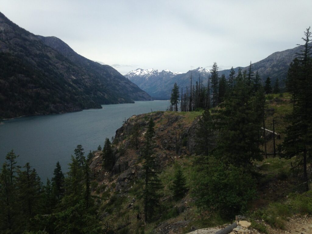
When we finally reached Moore Point and only a few others grabbed their gear to hop off, we were immediately happy with our decision. Lots of folks looked at us curiously in only our running gear with our hydration packs and wondered what the hell we were doing.
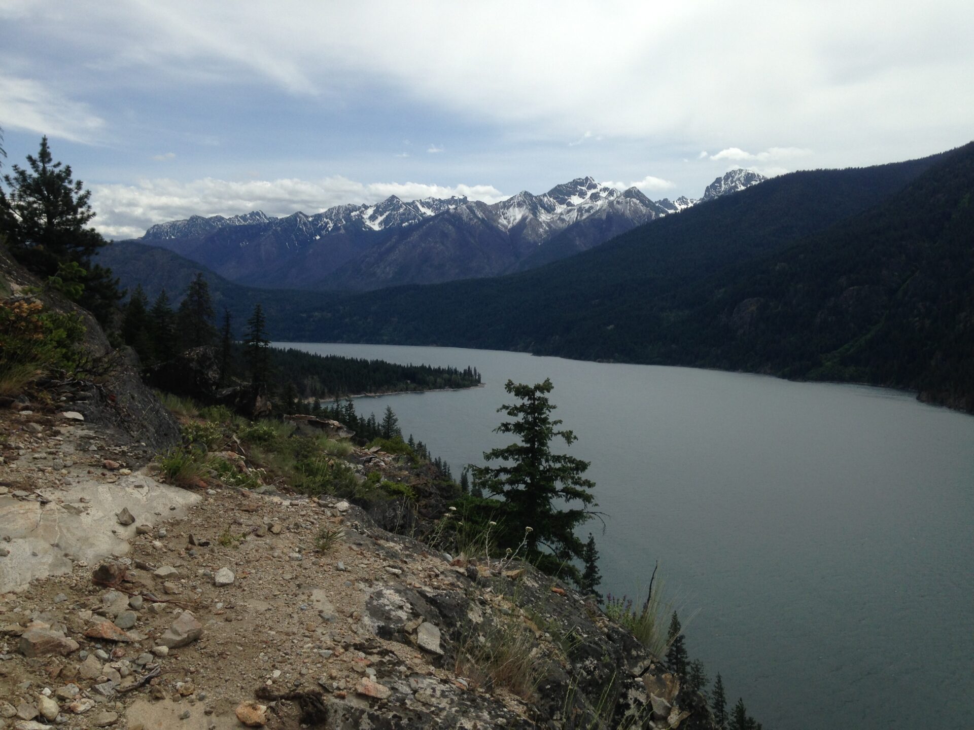
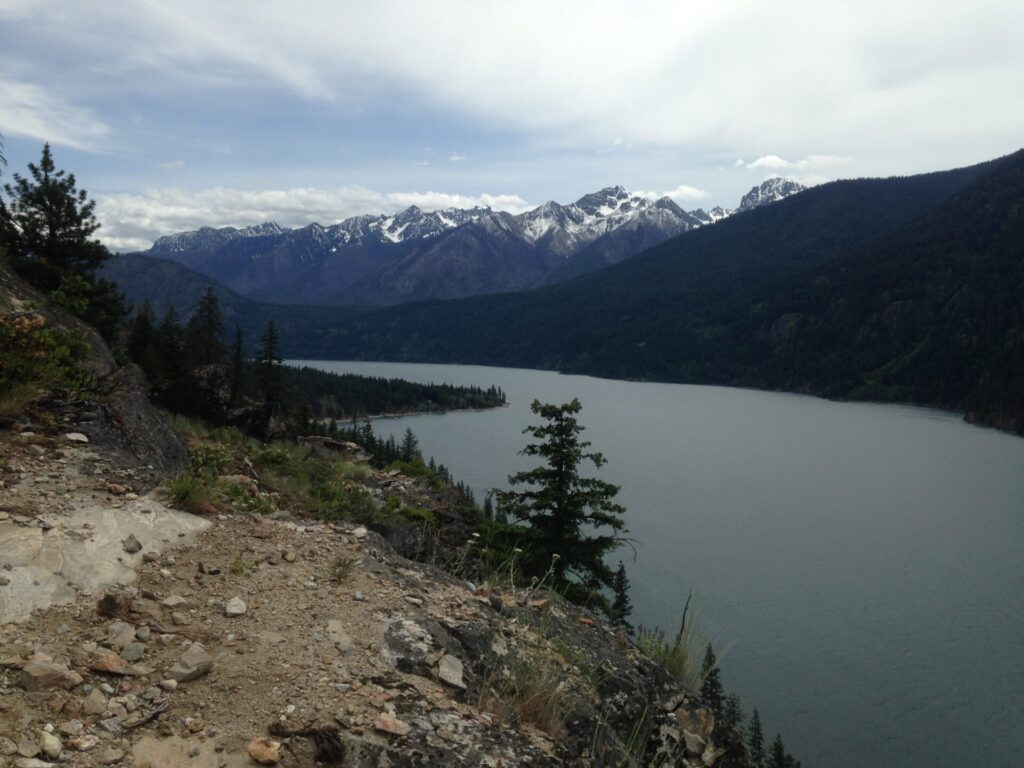
The Lakeshore trail turned out to be trail running bliss! The mostly flat, gently rolling terrain really let us hit the gas and go. We had a blast running along, whooping it up, and trying not to trip while taking in the gorgeous views. We saw only 2 other people the entire way. Stopping off and on to enjoy the scenery it took us a bit under 2 hours to reach Stehekin and we definitely did not beat the ferry. I simply wasn’t in a hurry to let these beautiful views go by!
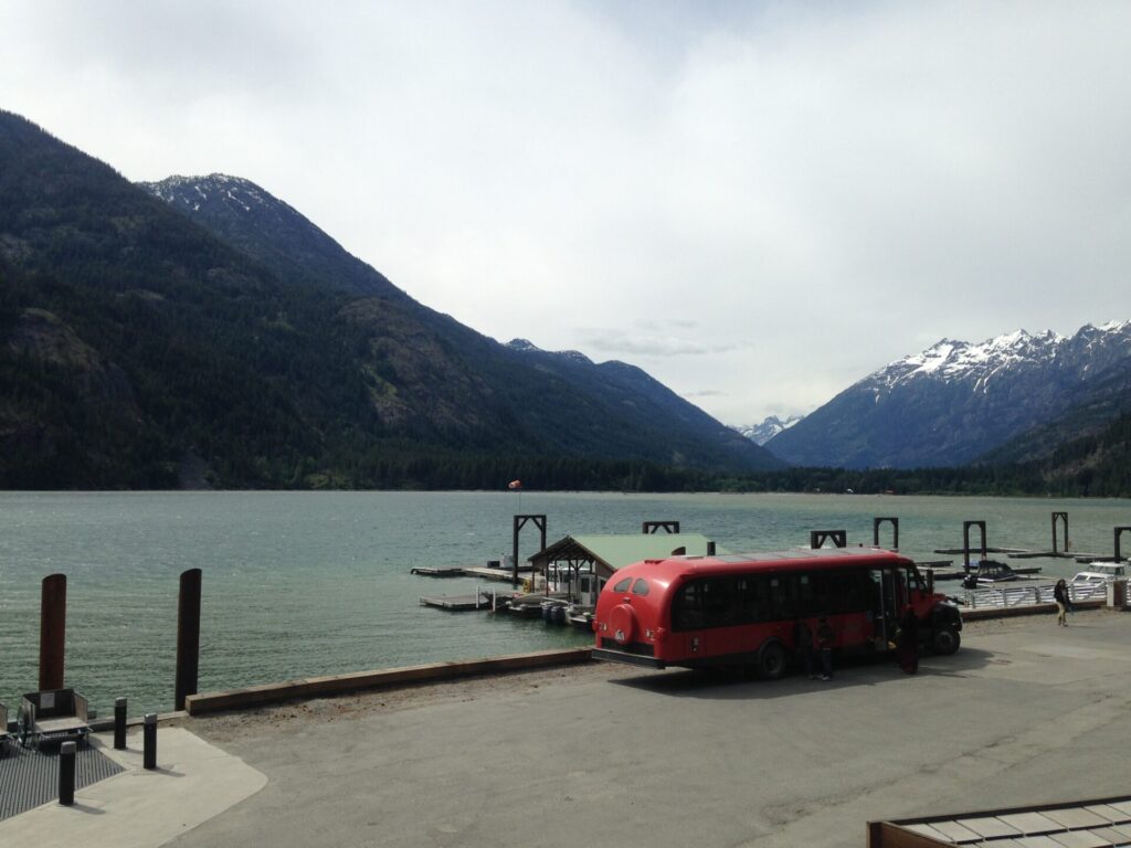
Once in town we were immediately elated to see our bags sitting there by the dock just as the captain had promised. Yippee!! Another bonus to our plan was arriving in Stehekin before most of the day hikers and backpackers. Camp sites require a backcountry permit from the Golden West Visitor Center at the landing but are free. It’s first come, first serve and they don’t turn people away, even on a busy holiday weekend, so you just squeeze in wherever you can go. We scored a great spot at Purple Point, right on the lakeshore near the landing.
The rangers gave us information about trail conditions and once we set up camp we took a mile walk to the famous town bakery to make a plan for Sunday. We thought it would be fun to see how far up the valley we could get. Could we actually make it to Horseshoe Basin 27 miles away? Due to flooding in 2003 the shuttle no longer runs the full road to Cottonwood Camp, so we could only ride it 11 miles up to High Bridge. From there it would be 12 miles to Cottonwood, another 2.2 to the Horseshoe Basin spur, then a final 1.5 miles to the actual Basin. And that’s if we didn’t get stopped by snow. It would be a 30 mile roundtrip hike/run, my most ambitious outing yet, but on mostly flat terrain. Could we do it? It sure would be fun to try!
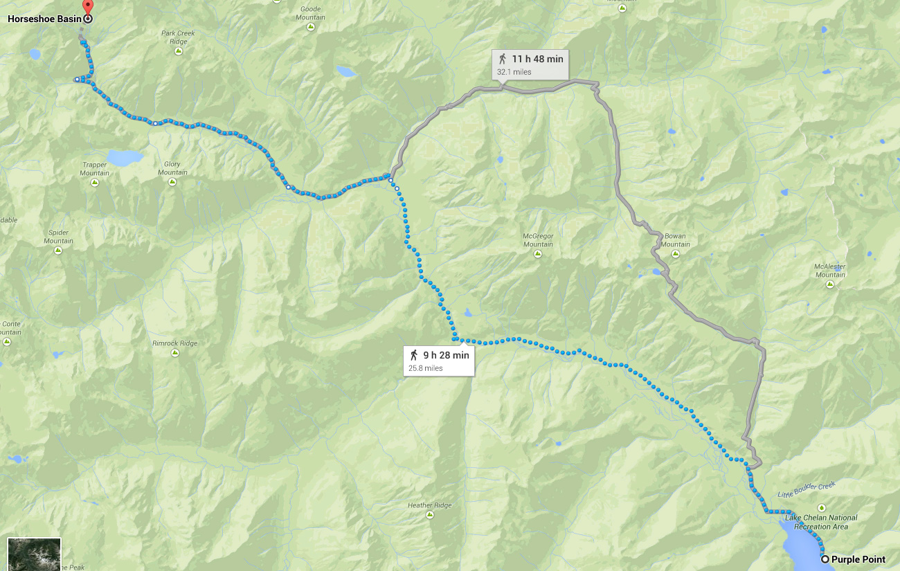
The big hitch was logistics. The earliest Sunday shuttle wouldn’t get us to High Bridge until almost 10am. We’d have to catch the 4pm return shuttle from there or else run the 11 miles back to town. 41 miles wasn’t really in my realm of possibilities and 6 hours for a 30 mile round trip was way too tight. As we walked along I saw a little 4×4 ATV-like vehicle with a sign that said “Rent me”. We laughed about how fun that would be. “Hmmm, could we rent that and get an earlier start?”
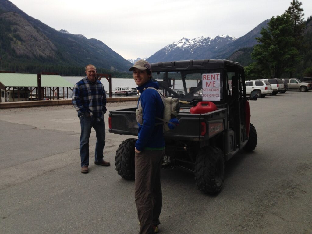
As we stopped and brainstormed ideas a local resident who owned the little ATV came over to say hi. Brian told him about our idea of running up valley to Horseshoe Basin. He doubted we’d make it due to snow but quickly countered “If you need a lift I could pick you up at 6am at the landing and get you 2 miles further past the High Bridge shuttle stop. That’ll get you an early start so you can catch the return shuttle.” Not even taking a second to think about it we both replied “YES!!!!” and agreed to meet him at the landing bright and early for a very reasonable shuttle fee.
Excited about our upcoming 4×4 trail running party, we lounged at the bakery for a bit enjoying delicious pie and chatting up some other backpackers. It seemed we were already a bit famous. “Oh, you guys are the trail runners?” we kept getting asked. It’s funny how after a few hours in Stehekin you start seeing familiar faces and being remembered. News travels fast in a small town!
Brian’s plan of sending our bags ahead while we ran the Lakeshore Trail was genius. The ferries don’t officially offer baggage service and I can’t guarantee that everyone could get away with it, but if you’re thinking of running or fastpacking the Lakeshore Trail I’d suggest politely talking with the ferry boat captain about handling your bags for you. It worked for us!
I’ll have up another post later for part 2 of this adventure: our run to Horseshoe Basin.
Lakeshore Trail from Moore Point
One Way: 6.9 miles
Elevation Gain: ~1,480
High Point: 1,735
Running Time: 1:43